Quantico Creek

Last updated

Coordinates: 38°32′38″N77°17′32″W / 38.54389°N 77.29222°W / 38.54389; -77.29222

Geographic coordinate system Coordinate system

A geographic coordinate system is a coordinate system that enables every location on Earth to be specified by a set of numbers, letters or symbols. The coordinates are often chosen such that one of the numbers represents a vertical position and two or three of the numbers represent a horizontal position; alternatively, a geographic position may be expressed in a combined three-dimensional Cartesian vector. A common choice of coordinates is latitude, longitude and elevation. To specify a location on a plane requires a map projection.

Contents

Quantico Creek

Quantico creek.JPG

Quantico Creek in Prince William Forest Park
Country United States
State Virginia
County Prince William County
Physical characteristics
River mouth Potomac River
0 feet (0 m)
Length 13.7 miles (22.0 km)
Quantico Falls in Prince William Forest Park Quantico falls.JPG
Quantico Falls in Prince William Forest Park

Quantico Creek is a 13.7-mile-long (22.0 km) [1] partially tidal tributary of the Potomac River in eastern Prince William County, Virginia. Quantico Creek rises southeast of Independent Hill, flows through Prince William Forest Park and Dumfries and empties into the Potomac at Possum Point.

Tributary stream or river that flows into a main stem river or lake

A tributary or affluent is a stream or river that flows into a larger stream or main stem river or a lake. A tributary does not flow directly into a sea or ocean. Tributaries and the main stem river drain the surrounding drainage basin of its surface water and groundwater, leading the water out into an ocean.

Potomac River river in the mid-Atlantic United States

The Potomac River is located within the Mid-Atlantic region of the United States and flows from the Potomac Highlands into the Chesapeake Bay. The river is approximately 405 miles (652 km) long, with a drainage area of about 14,700 square miles (38,000 km2). In terms of area, this makes the Potomac River the fourth largest river along the Atlantic coast of the United States and the 21st largest in the United States. Over 5 million people live within the Potomac watershed.

Prince William County, Virginia County in the United States

Prince William County is a county on the Potomac River in the Commonwealth of Virginia in the United States. As of the 2010 census, the population was 402,002, on July 1, 2015, the population was estimated to be 451,721, making it Virginia's second-most populous county. Its county seat is the independent city of Manassas.

History

John Smith in 1608 reported the existence of a Doeg community called Pamacocack on the banks of this creek, as well as on the directly opposite (Maryland) side of the Potomac. This is thought to be a likely candidate for the place Henry Spelman was found living among the natives, which he reported was named "Nacottawtanke, but by our english cald [sic] Camocacocke". Early land patents spell the name of the creek variously as Quancico (1654), Quanticotte (1654, 1658), Quantecot (1657), Quanticoke (1664), Quonticutt (1665), and Quanticutt (1665). [2]

John Smith (explorer) English soldier, explorer and writer

John Smith was an English soldier, explorer, colonial governor, Admiral of New England, and author. He played an important role in the establishment of the Jamestown colony, the first permanent English settlement in North America, in the early 17th century. Smith was a leader of the Virginia Colony based at Jamestown between September 1608 and August 1609, and led an exploration along the rivers of Virginia and the Chesapeake Bay, during which he became the first English explorer to map the Chesapeake Bay area. Later, he explored and mapped the coast of New England. He was knighted for his services to Sigismund Báthory, Prince of Transylvania, and his friend Mózes Székely.

Maryland State of the United States of America

Maryland is a state in the Mid-Atlantic region of the United States, bordering Virginia, West Virginia, and the District of Columbia to its south and west; Pennsylvania to its north; and Delaware to its east. The state's largest city is Baltimore, and its capital is Annapolis. Among its occasional nicknames are Old Line State, the Free State, and the Chesapeake Bay State. It is named after the English queen Henrietta Maria, known in England as Queen Mary.

Henry Spelman (1595–1623) was an English adventurer, soldier, and author, the son of Erasmus Spelman and nephew to Sir Henry Spelman of Congham (1562–1641). The younger Henry Spelman was born in 1595 and left his home in Norfolk, England at age 14 to sail to Virginia Colony aboard the ship Unity, as a part of the Third Supply to the Jamestown Colony in 1609. He is remembered for being an early interpreter for the people of Jamestown as well as writing the Relation of Virginia, documenting the first permanent English settlement in North America at Jamestown, Virginia, and particularly the lifestyles of the Native Americans of the Powhatan Confederacy led by Chief Powhatan.

In 1690, settler Richard Gibson erected a gristmill on Quantico Creek near what is now the town of Dumfries. Scottish settlers then established a settlement and port on the estuary of Quantico Creek downstream after the bars to Virginia's profitable tobacco trade were lifted by the Navigation Law of 1707. West of that port, the land was quickly cleared of its timber and was planted with crops such as cotton and tobacco. These cash crops were harvested and shipped out through the port of Dumfries at the head of the Quantico harbor. A customhouse and warehouse followed in 1731, and many others cropped up along the estuary by 1732. The growth of tobacco caused the area around the creek to erode, and the creek was filled with silt.

Gristmill mill; grinds grain into flour

A gristmill grinds cereal grain into flour and middlings. The term can refer to both the grinding mechanism and the building that holds it.

Dumfries, Virginia Town in Virginia

Dumfries, officially the Town of Dumfries, is a town in Prince William County, Virginia. The population was 4,961 at the 2010 United States Census.

Scotland Country in Europe, part of the United Kingdom

Scotland is a country that is part of the United Kingdom. Sharing a border with England to the southeast, Scotland is otherwise surrounded by the Atlantic Ocean to the north and west, by the North Sea to the northeast and by the Irish Sea to the south. In addition to the mainland, situated on the northern third of the island of Great Britain, Scotland has over 790 islands, including the Northern Isles and the Hebrides.

The mid-19th century saw the development of some mining operations along the creek, consisting of the Greenwood Gold Mine, located at the headwaters of the North Branch near Independent Hill, and the Cabin Branch Pyrite Mine, located about 1 mile west of Dumfries and now within the Park.

The Greenwood gold mine operated in Prince William County, Virginia, United States, near the town of Independent Hill for a few years before closing in 1885. It was one of two known gold mines in Prince William County, the other being the Crawford placer prospect on Neabsco Creek, near I-95, though small amounts of gold were occasionally found at the Cabin Branch Pyrite Mine in nearby Dumfries.

Independent Hill, Virginia Unincorporated town in Virginia, United States

Independent Hill is an unincorporated town in Prince William County, Virginia. It is located along State Route 234 at the intersection with Joplin Road. The only visible remaining businesses seem to be Samsky's Market and Crosby's Crab Company. In early 2006, a realignment of 234 bypassed the town, leaving it on a side road. The greater Independent Hill area is defined by the Census Bureau as a census-designated place (CDP), with a population of 7,419 as of 2010.

Both mines were significant sources of pollution on the creek. The pyrite mine was a source of sulfuric acid, formed from the natural breakdown of pyrite, while mercury was used extensively in the gold extraction process. At one point, the water in the creek was nearly as acidic as vinegar. Both mines have since undergone significant reclamation to restore the creek and its surroundings to an acceptable state of health, especially within the park.

Pyrite sulfide mineral

The mineral pyrite (/ˈpaɪraɪt/), or iron pyrite, also known as fool's gold, is an iron sulfide with the chemical formula FeS2 (iron(II) disulfide). Pyrite is considered the most common of the sulfide minerals.

Sulfuric acid chemical compound

Sulfuric acid (alternative spelling sulphuric acid), also known as vitriol, is a mineral acid composed of the elements sulfur, oxygen and hydrogen, with molecular formula H2SO4. It is a colorless, odorless, and syrupy liquid that is soluble in water and is synthesized in reactions that are highly exothermic.

Mercury (element) Chemical element with atomic number 80

Mercury is a chemical element with symbol Hg and atomic number 80. It is commonly known as quicksilver and was formerly named hydrargyrum. A heavy, silvery d-block element, mercury is the only metallic element that is liquid at standard conditions for temperature and pressure; the only other element that is liquid under these conditions is the halogen bromine, though metals such as caesium, gallium, and rubidium melt just above room temperature.

Today, the creek is not navigable because of silting in. Most of its watershed lies in Prince William Forest Park and the town of Dumfries. The mines are no longer in operation. A power plant on Possum Point uses the water from the creek to cool itself.

Communities

Several communities, some extinct, lie near Quantico Creek. Communities are listed from the Quantico's source to its mouth on the Potomac.

Watershed organizations

See also

Related Research Articles

Quantico, Virginia Town in Virginia, United States

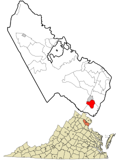
Quantico is a town in Prince William County, Virginia, United States. The population was 480 at the 2010 census.

Triangle, Virginia Census-designated place in Virginia, United States

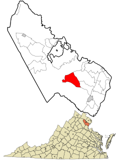
Triangle is a census-designated place (CDP) in Prince William County, Virginia, United States. The population was 8,188 at the 2010 census. It is bounded to the south by the Marine Corps Base Quantico, which surrounds the town of Quantico.

Marine Corps Base Quantico CDP in Virginia, United States

Marine Corps Base Quantico is a United States Marine Corps installation located near Triangle, Virginia, covering nearly 55,148 acres (86.169 sq mi) of southern Prince William County, Virginia, northern Stafford County, and southeastern Fauquier County. Used primarily for training purposes, MCB Quantico is known as the "Crossroads of the Marine Corps".

Battle of Cockpit Point battle

The Battle of Cockpit Point, the Battle of Freestone Point, or the Battle of Shipping Point, took place on January 3, 1862, in Prince William County, Virginia, as part of the blockade of the Potomac River during the American Civil War.

Prince William Forest Park

Prince William Forest Park was established as Chopawamsic Recreational Demonstration Area in 1936. Its location is in Triangle, Virginia, adjacent to the Marine Corps Base Quantico. The park is the largest protected natural area in the Washington, D.C. metropolitan region at over 16,000 acres (6,500 ha). Today, the park is a window into the past and serves as an example of what much of the East Coast once looked like centuries ago.

Piscataway, Maryland Unincorporated community in Maryland

Piscataway is an unincorporated community in Prince George's County, Maryland, United States. It is one of the oldest European-colonized communities in the state. The Piscataway Creek provided sea transportation for export of tobacco. It is located near the prior Piscataway tribe village of Kittamaqundi.

Southbridge, Virginia Unincorporated community in Virginia, United States

Southbridge is an unincorporated master-planned community of over 1,500 homes with more than 5,000 residents located in Prince William County, Virginia. It is situated on over 600 acres (2.4 km2) near the Potomac River on the Cherry Hill Peninsula just north of the Town of Dumfries.

Joplin, Virginia Ghost town in Virginia

Joplin is an uninhabited unincorporated community in Prince William County, Virginia. The town was located on land taken to form Chopawamsic Recreational Demonstration Area and is now part of Prince William Forest Park, a National Park Service property located adjacent to Marine Corps Base Quantico. The remains of the town, now just a collection of homes, lies on a stretch of Va. 619, Joplin Road, about 3 miles west of Dumfries.

Hickory Ridge, Virginia Extinct unincorporated town in Virginia

Hickory Ridge is an extinct unincorporated town in Prince William County, Virginia. The town was located on land that is now part of Prince William Forest Park, a National Park Service property located adjacent to Marine Corps Base Quantico. The town was established shortly after the opening of the now defunct Cabin Branch Pyrite Mine in 1889 and was home to many of the mine employees.

Batestown is an extinct unincorporated community in Prince William County, Virginia. The town was located along the farthest terminus of Mine Road in what is now a western neighborhood of Dumfries along the banks of Quantico Creek. It was an enclave for freed slaves named for Mary Bates, the matriarch of the community.

Breckenridge Reservoir

Breckenridge Reservoir is a small reservoir on Chopawamsic Creek in Prince William and Stafford counties, Virginia. The reservoir's western shore is the Marine Corps Base Quantico and the eastern shore is a part of Prince William Forest Park, which is a unit of the National Park Service. The reservoir is open to fishing along with a Virginia fishing license and Marine Corps Base Quantico permit. Primitive campsites and a hiking trail are on the Prince William Forest Park side of the reservoir. Reservoir storage volume is approximately 22,500,000 cubic feet with a surface area of about 1,820,000 square feet.

Chopawamsic Creek stream in Virginia, United States of America

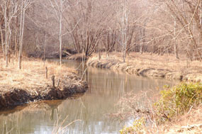
Chopawamsic Creek is a 6.8-mile-long (10.9 km) tributary of the Potomac River in Prince William and Stafford counties, Virginia. Chopawamsic Creek is formed by the confluence of the North and South Branches of Chopawamsic Creek and empties into the Potomac River south of Quantico at the Marine Corps Base Quantico's Air Station. Breckenridge Reservoir lies at the stream's confluence with the North and South Branches. Along with its North Branch, Chopawamsic Creek forms part of the boundary between Prince William and Stafford counties. The North Branch flows through part of the Chopawamsic Backcountry Area in Prince William Forest Park.

Possum Point is a small peninsula in Northern Virginia that juts out into Quantico Creek and separates it from the Potomac River. It lies in a suburban area of Washington D.C.

USS Rescue (1861) was a small (111-ton) steamer commissioned by the United States Navy during the American Civil War.

Chopawamsic was an 18th-century plantation on Chopawamsic Creek in Stafford County, Virginia. Chopawamsic was a seat of the Mason family.

Occoquan River tributary of the Potomac River in Virginia, United States

The Occoquan River is a tributary of the Potomac River in Northern Virginia, where it serves as part of the boundary between Fairfax and Prince William counties. The river is 24.7 miles (39.8 km) long, and its watershed covers about 590 square miles (1,528 km2). It is formed by the confluence of Broad Run and Cedar Run in Prince William County; Bull Run, which forms Prince William County's boundary with Loudoun and the northerly part of Fairfax counties, enters it east-southeast of Manassas, as the Occoquan turns to the southeast. It reaches the Potomac at Belmont Bay. The Occoquan River is part of the Chesapeake Bay watershed. The name Occoquan is derived from a Doeg Algonquian word translated as "at the end of the water".

Glymont is an unincorporated community in Charles County, Maryland, United States.

References

  1. U.S. Geological Survey. National Hydrography Dataset high-resolution flowline data. The National Map, accessed August 15, 2011
  2. Nugent, Cavaliers and Pioneers: Abstracts of Virginia Land Patents.