Dumfries, Virginia

Last updated

Dumfries, Virginia
Town of Dumfries
Henderson House (Dumfries, Virginia) 003.jpg
Seal of Dumfries, Virginia.png
Prince William County Virginia incorporated and unincorporated areas Dumfries highlighted.svg
Location in Prince William County and the state of Virginia
Coordinates: 38°34′4″N77°19′29″W / 38.56778°N 77.32472°W / 38.56778; -77.32472
CountryFlag of the United States.svg  United States
State Flag of Virginia.svg  Virginia
County Prince William
Founded1749
Government
   Mayor Derrick R. Wood
Area
[1]
  Total1.55 sq mi (4.02 km2)
  Land1.53 sq mi (3.98 km2)
  Water0.02 sq mi (0.05 km2)
Elevation
36 ft (11 m)
Population
 (2010)
  Total4,961
  Estimate 
(2019) [2]
5,922
  Density3,857.98/sq mi (1,489.58/km2)
Time zone UTC−5 (Eastern (EST))
  Summer (DST) UTC−4 (EDT)
ZIP Code
22026
Area code(s) 571, 703
FIPS code 51-23760 [3]
GNIS feature ID1499362 [4]
Website www.DumfriesVA.gov

Dumfries, officially the Town of Dumfries, is a town in Prince William County, Virginia. The population was 4,961 at the 2010 United States Census.

Contents

Geography

Dumfries is located at 38°34′4″N77°19′29″W / 38.56778°N 77.32472°W / 38.56778; -77.32472 (38.567853, 77.324591). [5]

According to the United States Census Bureau, the town has a total area of 1.6 square miles (4.1 km2), all of it land. The town is situated 70 miles north of the state capital, Richmond. It is 30 miles south of central Washington, D.C. [6]

History

Dumfries Cemetery Dumfries Cemetery (Dumfries, Virginia) 002.jpg
Dumfries Cemetery

The history of Dumfries began as early as 1690 when Richard Gibson erected a gristmill on Quantico Creek. A customhouse and warehouse followed in 1731, and many others cropped up along the estuary by 1732. The Town of Dumfries was formally established on 60 acres (240,000 m2) of land at the head of the harbor of Quantico Creek, provided by John Graham. He named the town after his birthplace, Dumfries, Scotland. [7]

After much political maneuvering, the General Assembly established Dumfries as the first of seven townships in the county. Dumfries received its charter on May 11, 1749, making it the oldest continuously chartered town in Virginia.

The Ceremonial Seal of the Town of Dumfries embodies elements of its heritage, from the period of 1651, when the first patents were issued to colonists, who following the Potomac recognized the value of a snug harbor in Quantico Creek. Thus the foundations for the establishment of a town, which in 1749 received its charter from the Colonial government in Williamsburg, Virginia.

The elements of the seal are contained within the pattern formed by the outer frame of a hawser rope or cable, and the inner frame of an anchor chain, of a type employed in ships of the Colonial era.

Within these frames are found items which are consistent with a town of maritime background. They are overlaid on a chart of the Chesapeake Bay and the Potomac River, with Dumfries indicated at the head of Quantico Creek. The navigational aids of the sextant and compass rose complete the maritime motif.

The two water fowl relate to the wetlands of Quantico Creek. The dock with fishnet, pilings, ships block and line further the theme of a mercantile port of call. The thistle indicates the Scottish founders of the town, with the name of Dumfries, taken by John Graham, the founder, in honor of his home in Scotland. The supporters of the shield are, on the left, a Piscataway brave, of the Powhatan Confederacy, the predominant tribe along the Potomac, in this area. On the right, a Colonial militiaman of 1775, when Colonel Henry Lee was company Commander. The shield in its upper quadrant, displays a sailing vessel of the period, and below the tobacco leaf, the first commodity, overlaid with shafts of wheat, the later commodity that supported the town.

When Dumfries became the second leading port in Colonial America receiving tobacco from the upland, it rivaled New York, Philadelphia and Boston. Dumfries peaked in size and importance in 1763. For about 15 years Dumfries was a thriving port when several factors brought about its demise: the Revolutionary War, erosion and siltation, and the shift in the main shipping commodity (from tobacco to wheat and sugar).

The Dumfries Cemetery contains burials of some of the Dumfries pioneers.

Alexander Henderson built a house known as the Henderson House which still stands on a hill in Dumfries, as well as owning various land in Prince William Forest Park. Alexander was a merchant when the ports were booming in Dumfries. Alexander is famous for his son, United States Marine Corps commandant Archibald Henderson.

The Leesylvania Archeological Site (44PW7), Old Hotel, and Weems-Botts Museum are listed on the National Register of Historic Places. [8]

Dumfries was combined with the community of Triangle, Virginia, to form Dumfries-Triangle in the 1950 United States Census. However, the two communities were separated again by the time of the 1960 census.

Demographics

Historical population
CensusPop.Note
1860 171
1870 167−2.3%
1880 132−21.0%
1900 160
1910 158−1.2%
1920 18215.2%
1930 157−13.7%
1940 480205.7%
1960 1,368
1970 1,89038.2%
1980 3,21470.1%
1990 4,28233.2%
2000 4,93715.3%
2010 4,9610.5%
2019 (est.)5,922 [2] 19.4%
U.S. Decennial Census [9]

As of the census [3] of 2000, there were 4,937 people, 1,573 households, and 1,198 families residing in the town. The population density was 3,085.6 inhabitants per square mile (1,191.4/km2). There were 1,699 housing units at an average density of 1,061.9 per square mile (410.0/km2). The racial makeup of the town was 48.91% White, 35.26% Black, 0.63% Native American, 1.07% Asian, 3.73% from other races, and 8.40% from two or more races. Hispanic or Latino of any race were 15.06% of the population.

There were 1,573 households, out of which 46.5% had children under the age of 18 living with them, 48.8% were married couples living together, 19.7% had a female householder with no husband present, and 23.8% were non-families. Of all households, 16.5% were made up of individuals, and 3.7% had someone living alone who was 65 years of age or older. The average household size was 3.13 and the average family size was 3.51.

In the town, the population was spread out, with 35.0% under the age of 18, 9.7% from 18 to 24, 33.6% from 25 to 44, 17.1% from 45 to 64, and 4.7% who were 65 years of age or older. The median age was 29 years. For every 100 females, there were 98.8 males. For every 100 females age 18 and over, there were 93.0 males.

The median income for a household in the town was $43,672, and the median income for a family was $46,927. Males had a median income of $35,247 versus $24,451 for females. The per capita income for the town was $17,652. About 10.4% of families and 12.5% of the population were below the poverty line, including 16.0% of those under age 18 and 7.1% of those age 65 or over.

View north along US 1 just south of SR 234 in Dumfries 2018-10-10 10 23 35 View north along U.S. Route 1 (Jefferson Davis Highway) just south of Virginia State Route 234 (Dumfries Road) in Dumfries, Prince William County, Virginia.jpg
View north along US 1 just south of SR 234 in Dumfries

Transportation

Primary road transportation to Dumfries is provided by U.S. Route 1. Virginia State Route 234 and Interstate 95 are also directly adjacent to Dumfries.

Notable people

Related Research Articles

<span class="mw-page-title-main">Quantico, Virginia</span> Town in Virginia, United States

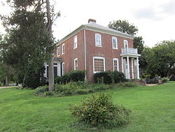
Quantico is a town in Prince William County, Virginia, United States. The population was 480 at the 2010 census. Quantico is approximately 35 miles southwest of Washington, D.C., bordered by the Potomac River to the east and the Quantico Creek to the north. The word Quantico is a corruption of the name of a Doeg village recorded by English colonists as Pamacocack.

<span class="mw-page-title-main">King George County, Virginia</span> County in Virginia, United States

King George County is a county located in the Commonwealth of Virginia. As of the 2020 census, the population sits at 26,723. Its county seat is the town of King George.

<span class="mw-page-title-main">Granville County, North Carolina</span> County in North Carolina, United States

Granville County is a county located on the northern border of the U.S. state of North Carolina. As of the 2020 census, the population was 60,992. Its county seat is Oxford.

<span class="mw-page-title-main">Henderson County, Kentucky</span> County in Kentucky, United States

Henderson County is a county in the U.S. state of Kentucky. The county is located in western Kentucky on the Ohio River across from Evansville, Indiana. As of the 2020 census, the population was 44,793. Its county seat is Henderson.

<span class="mw-page-title-main">Mesquite Creek, Arizona</span> CDP in Mohave County, Arizona

Mesquite Creek is an unincorporated community and census-designated place (CDP) in Mohave County, Arizona, United States. The population was 403 at the 2020 census.

<span class="mw-page-title-main">Westernport, Maryland</span> Town in Maryland, United States

Westernport is a town in Allegany County, Maryland, United States, along the Georges Creek Valley. It is part of the Cumberland, MD-WV Metropolitan Statistical Area. The population was 1,888 at the 2010 census.

<span class="mw-page-title-main">Port Tobacco Village, Maryland</span> Town in Maryland, United States

Port Tobacco, officially Port Tobacco Village, is a town in Charles County, in southern Maryland, United States. The population was 13 at the 2010 census, making Port Tobacco the smallest incorporated town in Maryland.

<span class="mw-page-title-main">Sharpsburg, Maryland</span> Town in Maryland, United States

Sharpsburg is a town in Washington County, Maryland. The town is approximately 13 miles (21 km) south of Hagerstown. Its population was 705 at the 2010 census.

<span class="mw-page-title-main">Darrouzett, Texas</span> Town in Texas, United States

Darrouzett is a town in Lipscomb County, Texas, United States. The population was 350 at the 2010 census, up from 303 at the 2000 census. The town is named for John Louis Darrouzet, a Texas state legislator who served as an attorney for the Santa Fe Railroad.

<span class="mw-page-title-main">Port Royal, Virginia</span> Town in Virginia, United States

Port Royal is an incorporated town in Caroline County, Virginia, United States. The population was 126 at the 2010 census.

<span class="mw-page-title-main">Mount Vernon, Virginia</span> Census-designated place in Virginia, United States

Mount Vernon is a census-designated place (CDP) and unincorporated community in Fairfax County, Virginia, United States. The population was 12,416 at the 2010 census. Primarily due to its historical significance and natural recreation and beauty, the Mount Vernon area receives over one million tourists each year.

<span class="mw-page-title-main">Smithfield, Virginia</span> Town in Virginia, United States

Smithfield is a town in Isle of Wight County, in the South Hampton Roads subregion of the Hampton Roads region of Virginia in the United States. The population was 8,533 at the 2020 census.

<span class="mw-page-title-main">Triangle, Virginia</span> Census-designated place in Virginia, United States

Triangle is a census-designated place (CDP) in Prince William County, Virginia, United States. The population was 8,188 at the 2010 census. It is bounded to the south by the Marine Corps Base Quantico, which surrounds the town of Quantico.

<span class="mw-page-title-main">Falmouth, Virginia</span> Census-designated place in Virginia, United States

Falmouth is a census-designated place (CDP) in Stafford County, Virginia, United States. Situated on the north bank of the Rappahannock River at the falls, the community is north of and opposite the city of Fredericksburg. Recognized by the U.S. Census Bureau as a census-designated place (CDP), Falmouth's population was 4,274 as of the 2010 census.

<span class="mw-page-title-main">Colonial Beach, Virginia</span> Town in Virginia, United States

Colonial Beach, Virginia (CBVA) is a river and beach town located in the northwestern part of Westmoreland County on Virginia's Northern Neck peninsula. It is bounded by the Potomac River, Monroe Bay and Monroe Creek. It is located 65 mi (105 km) from Washington, D.C.; 70 mi (110 km) from the state capital of Richmond; and 35 nautical miles from the Chesapeake Bay.

<span class="mw-page-title-main">Montross, Virginia</span> Town in Virginia, United States

Montross is a town in Westmoreland County, Virginia, United States. The population was 553 at the 2020 census. It is the county seat of Westmoreland County. Located in the historic Northern Neck of Virginia, Montross is near the George Washington Birthplace National Monument and the Stratford Hall Plantation. The town's slogan is return to the village.

<span class="mw-page-title-main">Berkeley Springs, West Virginia</span> Town in West Virginia, United States

Berkeley Springs is a town in, and the county seat of, Morgan County, West Virginia, United States, in the state's Eastern Panhandle. Berkeley Springs is also commonly used to refer to the area in and around the Town of Bath. In 1776, the Virginia Legislature incorporated a town around the springs and named it Bath. Since 1802, it has been referred to by the name of its original post office, Berkeley Springs. The population was 758 at the 2020 census. It is part of the Hagerstown–Martinsburg metropolitan area.

<span class="mw-page-title-main">Mill Creek, West Virginia</span> Town in West Virginia, United States

Mill Creek is a town in Randolph County, West Virginia, United States, along the Tygart Valley River. The population was 563 at the 2020 census.

<span class="mw-page-title-main">Marine Corps Base Quantico</span> CDP in Virginia, United States

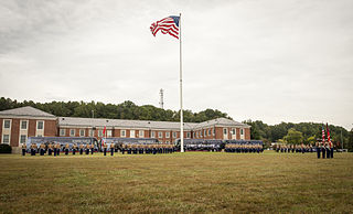
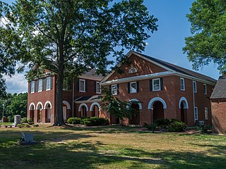
Marine Corps Base Quantico is a United States Marine Corps installation located near Triangle, Virginia, covering nearly 55,148 acres of southern Prince William County, Virginia, northern Stafford County, and southeastern Fauquier County. Used primarily for training purposes, MCB Quantico is known as the "Crossroads of the Marine Corps".

<span class="mw-page-title-main">Cherry Hill, Prince William County, Virginia</span> Census-designated place in Virginia, United States

Cherry Hill is a census-designated place (CDP) in Prince William County, Virginia, United States. The population was 16,000 according to the 2010 Census. As of the 2020 census, it was estimated to be 23,683. The CDP is made up of the Cherry Hill peninsula, to the northeast of the town of Dumfries.

References

  1. "2019 U.S. Gazetteer Files". United States Census Bureau. Retrieved August 7, 2020.
  2. 1 2 "Population and Housing Unit Estimates". United States Census Bureau. May 24, 2020. Retrieved May 27, 2020.
  3. 1 2 "U.S. Census website". United States Census Bureau . Retrieved January 31, 2008.
  4. "US Board on Geographic Names". United States Geological Survey. October 25, 2007. Retrieved January 31, 2008.
  5. "US Gazetteer files: 2010, 2000, and 1990". United States Census Bureau. February 12, 2011. Retrieved April 23, 2011.
  6. "Google Maps". Google Maps. January 1, 1970. Retrieved July 20, 2012.
  7. Gannett, Henry (1905). The Origin of Certain Place Names in the United States. Govt. Print. Off. p. 109.
  8. "National Register Information System". National Register of Historic Places . National Park Service. July 9, 2010.
  9. "Census of Population and Housing". Census.gov. Retrieved June 4, 2015.
  10. Sibley, Marilyn McAdams (June 15, 2010). "Graham, George". Handbook of Texas Online. Texas State Historical Association. Retrieved July 2, 2018.