Gate City, Virginia

Last updated

Gate City
GateCity1-MarkLindamood.jpg
Gate City in 2007
VAMap-doton-GateCity.PNG
Location of Gate City, Virginia
Coordinates: 36°38′18″N82°34′50″W / 36.63833°N 82.58056°W / 36.63833; -82.58056
CountryUnited States
State Virginia
County Scott
Area
[1]
  Total4.02 sq mi (10.41 km2)
  Land3.98 sq mi (10.31 km2)
  Water0.04 sq mi (0.10 km2)
Elevation
1,339 ft (408 m)
Population
 (2010)
  Total2,034
  Estimate 
(2019) [2]
1,869
  Density469.48/sq mi (181.28/km2)
Time zone UTC−5 (Eastern (EST))
  Summer (DST) UTC−4 (EDT)
ZIP code
24251
Area code 276
FIPS code 51-30496 [3]
GNIS feature ID1498481 [4]
Website Official website

Gate City is a town in Scott County, Virginia, United States. The population was 2,034 at the 2010 census. It is the seat of Scott County. [5]

Contents

Gate City is part of the Kingsport Bristol (TN) Bristol (VA) Metropolitan Statistical Area, which is a component of the Johnson City KingsportBristol, TN-VA Combined Statistical Area commonly known as the "Tri-Cities" region.

Some scenes from The River were shot here.

History

In 1771, Silas Engart received a land grant of 200 acres that included the location of the future town. By the time of Scott County's formation in 1815, landowner James Davidson, Sr. donated approximately 13 acres of his plantation for establishing the county seat. The location of the town was such that it would emerge as an important commercial center for people and goods traveling through Big Moccasin Gap and the North Fork of the Holston River. [6]

When the county seat was established in 1815, it was named Winfield in honor of War of 1812 hero Gen. Winfield Scott. The main street of the new town honored war hero and future president Andrew Jackson. [6]

In 1817, the town was renamed Estillville in honor of Benjamin Estill, a local judge instrumental in the formation of the new county. As a result of the county seat's location near Big Moccasin Gap and the North Fork of the Holston River, the town grew into a commercial center for people passing through on their way westward, for farmers hoping to sell goods, and businessmen in town for legal affairs. A regular wagon train and coach line service conveying people, mail, and commercial goods between Bedford and Estilville. [6]

Gate City received its present name in 1886, when Attorney General Rufus A. Ayers pointed out that proximity to Big Moccasin Gap marked the town as the "Gate Way to the West." The town was incorporated in 1892.
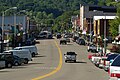
 [6]

By the beginning of the twentieth-century, Gate City was one of several "boom towns" located in southwestern Virginia. Although the streets were little more than dirt byways in the town, the area was a vibrant commercial and transportation center. Up to six daily passenger trains passed through Gate City. The town also had a railroad log yard where logs from all over the county were stored and then loaded to be later transported by train. Iron ore from the Snowflake and Nickelsville areas as well as glass sand from the south of Clinch Mountain were manufactured and shipped from Gate City. In addition, the town had a thriving manufacturing center in the area of Water Street where wood pumps, staves, sleds, and harnesses were built. By 1915, the town supported two livery stables on Willow Street and a blacksmith shop on Jackson Street, as well as a dentist's office, an ice plant, a casket shop, and a furniture manufacturing business. By the 1930s, Gate City had three movie theaters, banks, and a hotel. The town also had two businesses that dealt with auto sales and repairs. [6]

By the 1950s and 1960s, the town's momentum was slowing. As industry in Kingsport, Tennessee (6 miles to the south) attracted Gate City residents, several local businesses and small manufacturing companies shut down. By 2010, many former commercial buildings stood vacant, [6] but the Gate City Historic District was newly listed on the National Register of Historic Places. [7]

Pilot Flying J, the largest network of service station/travel centers in North America operating in 44 states and 6 Canadian provinces, and headquartered in Knoxville, TN, was started in Gate City in 1958.

Geography

Gate City is located at 36°38′18″N82°34′50″W / 36.63833°N 82.58056°W / 36.63833; -82.58056 (36.638325, 82.580659). [8]

According to the United States Census Bureau, the town has a total area of 2.1 square miles (5.4 km2), of which 2.0 square miles (5.2 km2) is land and 0.04 square miles (0.10 km2), or 0.97%, is water. The town has expanded its boundaries since the 2000 census via a boundary adjustment agreement with the county.

Bordered by a mountain, Gate City is a small city relative to its neighbors and located on U.S. Routes 23 and 421 near the Tennessee state line. The Virginia Department of Transportation (VDOT) plans for a large portion of the mountain at Moccasin Gap to be shorn away. [9]

Demographics

Historical population
CensusPop.Note
1900 521
1910 59915.0%
1920 68414.2%
1930 1,21677.8%
1940 1,56528.7%
1950 2,12635.8%
1960 2,1420.8%
1970 1,914−10.6%
1980 2,49430.3%
1990 2,214−11.2%
2000 2,159−2.5%
2010 2,034−5.8%
2020 2,0430.4%
U.S. Decennial Census [10]

As of the census [3] of 2000, there were 2,159 people, 984 households, and 604 families residing in the town. The population density was 1,058.8 inhabitants per square mile (408.8/km2). There were 1,119 housing units at an average density of 548.8 per square mile (211.9/km2). The racial makeup of the town was 95.69% White, 3.80% African American, 0.09% Native American, and 0.42% from two or more races. Hispanic or Latino of any race were 0.42% of the population.

There were 984 households, out of which 23.7% had children under the age of 18 living with them, 47.9% were married couples living together, 11.0% had a female householder with no husband present, and 38.6% were non-families. 36.2% of all households were made up of individuals, and 19.7% had someone living alone who was 65 years of age or older. The average household size was 2.16 and the average family size was 2.81.

In the town, 20.0% of the population was under the age of 18, 7.3% was from 18 to 24, 25.7% from 25 to 44, 24.8% from 45 to 64, and 22.2% was 65 years of age or older. The median age was 43 years. For every 100 females, there were 87.7 males. For every 100 females age 18 and over, there were 81.0 males.

The median income for a household in the town was $31,875, and the median income for a family was $48,068. Males had a median income of $35,875 versus $22,292 for females. The per capita income for the town was $19,268. About 4.1% of families and 13.5% of the population were below the poverty line, including 15.9% of those under age 18 and 22.9% of those age 65 or over.

Notable people

Footnotes

  1. "2019 U.S. Gazetteer Files". United States Census Bureau. Retrieved August 7, 2020.
  2. 1 2 "U.S. Census website". United States Census Bureau . Retrieved January 31, 2008.
  3. "US Board on Geographic Names". United States Geological Survey. October 25, 2007. Retrieved January 31, 2008.
  4. "Find a County". National Association of Counties. Archived from the original on May 31, 2011. Retrieved June 7, 2011.
  5. 1 2 3 4 5 6 Malvasi 2010.
  6. "National Register of Historic Places Listings". Weekly List of Actions Taken on Properties: 9/07/10 through 9/10/10. National Park Service. September 17, 2010. Archived from the original on September 8, 2014. Retrieved February 13, 2014.
  7. "US Gazetteer files: 2010, 2000, and 1990". United States Census Bureau. February 12, 2011. Retrieved April 23, 2011.
  8. "VDOT Moccasin Gap Bypass". Archived from the original on March 1, 2012. Retrieved March 16, 2012.
  9. "Census of Population and Housing". Census.gov. Retrieved June 4, 2015.
  10. "McMULLEN, Fayette, (1805 - 1880)". Biographical Directory of the United States Congress. Retrieved October 9, 2012.

Related Research Articles

<span class="mw-page-title-main">Webster County, West Virginia</span> County in West Virginia, United States

Webster County is a county in the U.S. state of West Virginia. As of the 2020 census, the population was 8,378. Its county seat is Webster Springs. The county was founded in 1860 and named for Daniel Webster.

<span class="mw-page-title-main">Washington County, Virginia</span> County in Virginia, United States

Washington County is a county located in the Commonwealth of Virginia. As of the 2020 census, the population was 53,935. Its county seat is Abingdon.

<span class="mw-page-title-main">Scott County, Virginia</span> County in Virginia, United States

Scott County is a county located in the far southwestern part of the U.S. state of Virginia, on the border with Tennessee. As of the 2020 census, the population was 21,576. Its county seat is Gate City. Scott County was formed by an act of the General Assembly on November 24, 1814, from parts of Washington, Lee, and Russell counties and was named for Virginia -born General Winfield Scott. Scott County is part of the Kingsport–Bristol–Bristol, TN-VA Metropolitan Statistical Area, which is a component of the Johnson City–Kingsport–Bristol, TN-VA Combined Statistical Area, commonly known as the "Tri-Cities" region. The County Administrator is Freda Russell Starnes.

<span class="mw-page-title-main">Bulls Gap, Tennessee</span> Town in Tennessee, United States

Bulls Gap is a town in Hawkins County, Tennessee, United States. The population was 756 at the 2020 census. It is part of the Metropolitan Statistical Area, which is a component of the Johnson City-Kingsport-Bristol, TN-VA Combined Statistical Area – commonly known as the "Tri-Cities" region.

<span class="mw-page-title-main">Mount Carmel, Tennessee</span> City in Hawkins County, Tennessee, United States

Mount Carmel is a city in Hawkins County, Tennessee, United States. As of the 2010 census, the population was 5,429, an increase of 634 since the 2000 census. It is part of the Kingsport-Bristol-Bristol, TN-VA Metropolitan Statistical Area, which is a component of the "Tri-Cities" region.

<span class="mw-page-title-main">Surgoinsville, Tennessee</span> Town in Tennessee, United States

Surgoinsville is a town in Hawkins County, Tennessee, United States. The 2020 census showed a population of 1,882, an increase over the figure of 1,801 tabulated in 2010. It is part of the Kingsport–Bristol (TN)–Bristol (VA) Metropolitan Statistical Area, which is a component of the Johnson City–Kingsport–Bristol, TN-VA Combined Statistical Area – commonly known as the "Tri-Cities" region.

<span class="mw-page-title-main">Blountville, Tennessee</span> CDP in Tennessee, United States

Blountville is a census-designated place (CDP) in and the county seat of Sullivan County, Tennessee. The population was 3,074 at the 2010 census and 3,120 at the 2020 census. It is the only Tennessee county seat not to be an incorporated city or town.

<span class="mw-page-title-main">Monterey, Virginia</span> Town in Virginia, United States

Monterey is a town in Highland County, Virginia, United States. The population was 165 at the 2020 census. It is the county seat of Highland County.

<span class="mw-page-title-main">Clinchport, Virginia</span> Town in Virginia, United States

Clinchport is a town in Scott County, Virginia, United States. The population was 64 at the 2020 census. Clinchport is the least-populated municipality in Virginia. It is part of the Kingsport-Bristol-Bristol, TN-VA Metropolitan Statistical Area, which is a component of the Johnson City-Kingsport-Bristol, TN-VA Combined Statistical Area – commonly known as the "Tri-Cities" region.

<span class="mw-page-title-main">Duffield, Virginia</span> Town in Virginia, United States

Duffield is a town in Scott County, Virginia, United States. The population was 73 at the 2020 census. It is part of the Kingsport-Bristol-Bristol, TN-VA Metropolitan Statistical Area, which is a component of the Johnson City-Kingsport-Bristol, TN-VA Combined Statistical Area – commonly known as the "Tri-Cities" region.

<span class="mw-page-title-main">Dungannon, Virginia</span> Town in Virginia, United States

Dungannon is a town in Scott County, Virginia. The population was 257 at the 2020 census. It was named after the town of Dungannon in County Tyrone, Northern Ireland.

<span class="mw-page-title-main">Nickelsville, Virginia</span> Town in Virginia, United States

Nickelsville is a town in Scott County, Virginia. The population was 378 at the 2020 census. It is part of the Metropolitan Statistical Area, which is a component of the Johnson City-Kingsport-Bristol, TN-VA Combined Statistical Area – commonly known as the "Tri-Cities" region.

<span class="mw-page-title-main">Weber City, Virginia</span> Town in Virginia, United States

Weber City is an incorporated town in Scott County, Virginia, United States. The population was 1,327 at the 2010 census. It is part of the Kingsport–Bristol (TN)–Bristol (VA) Metropolitan Statistical Area, which is a component of the Johnson City–Kingsport–Bristol, TN-VA Combined Statistical Area – commonly known as the "Tri-Cities" region.

<span class="mw-page-title-main">Damascus, Virginia</span> Town in Virginia, United States

Damascus is a small town in Washington County, Virginia. The population was 814 at the 2010 census. It is part of the Kingsport–Bristol (TN)–Bristol (VA) Metropolitan Statistical Area, which is a component of the Johnson City–Kingsport–Bristol, TN-VA Combined Statistical Area.

<span class="mw-page-title-main">Glade Spring, Virginia</span> Town in Virginia, United States

Glade Spring is a town in Washington County, Virginia, United States. The population was 1,456 at the 2010 census. It is part of the Kingsport–Bristol (TN)–Bristol (VA) Metropolitan Statistical Area, which is a component of the Johnson City–Kingsport–Bristol, TN-VA Combined Statistical Area – commonly known as the "Tri-Cities" region. I-81 runs through Glade Spring. It is located at exit 29.

<span class="mw-page-title-main">Kingsport, Tennessee</span> City in Tennessee, United States

Kingsport is a city in Sullivan and Hawkins counties in the U.S. state of Tennessee. As of the 2020 census, its population was 55,442. Lying along the Holston River, Kingsport is commonly included in what is known as the Mountain Empire, which spans a portion of southwest Virginia and the mountainous counties in northeastern Tennessee. It is the largest city in the Kingsport–Bristol metropolitan area, which had a population of 307,614 in 2020. The metro area is a component of the larger Tri-Cities region of Tennessee and Virginia, with a population of 508,260 in 2020.

<span class="mw-page-title-main">St. Paul, Virginia</span> Town in Virginia, United States

St. Paul is a town in Russell and Wise counties in the U.S. state of Virginia. The population was 970 at the 2010 census. Virginia City Hybrid Energy Center, which powers 150,000 homes, is located in St. Paul.

<span class="mw-page-title-main">Saltville, Virginia</span> Town in Virginia, United States

Saltville is a town in Smyth and Washington counties in the U.S. state of Virginia. The population was 1,824 at the 2020 census. It is part of the Kingsport–Bristol (TN)–Bristol (VA) Metropolitan Statistical Area, which is a component of the Johnson City–Kingsport–Bristol, TN-VA Combined Statistical Area – commonly known as the "Tri-Cities" region.

Nunda is a village in the town of Nunda, Livingston County, New York, United States. The population of the village was 1,377 at the 2010 census, out of 3,064 in the entire town.

<span class="mw-page-title-main">Kingsport–Bristol–Bristol metropolitan area</span> Metropolitan area in Tennessee and Virginia, United States

The Kingsport–Bristol–Bristol metropolitan area is a metropolitan statistical area (MSA) in Northeast Tennessee and Southwest Virginia, United States, as defined by the Office of Management and Budget (OMB). It was formed in December 2003 by the merger of the Bristol, VA MSA and Kingsport–Bristol, TN–VA MSA.

References

Attribution