Henry County, Virginia

Last updated

Henry County
Beaver Creek Plantation house.jpg
Flag of Henry County, Virginia.png
Henry County, Virginia seal.png
Logo of Henry County, Virginia.svg
Map of Virginia highlighting Henry County.svg
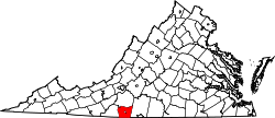
Location within the U.S. state of Virginia
Virginia in United States.svg
Virginia's location within the U.S.
Coordinates: 36°40′N79°53′W / 36.67°N 79.88°W / 36.67; -79.88
CountryFlag of the United States.svg United States
StateFlag of Virginia.svg  Virginia
Founded1777
Named for Patrick Henry
Seat Martinsville
Largest town Ridgeway
Area
  Total384 sq mi (990 km2)
  Land382 sq mi (990 km2)
  Water2 sq mi (5 km2)  0.5%
Population
 (2020)
  Total50,948
  Density130/sq mi (51/km2)
Time zone UTC−5 (Eastern)
  Summer (DST) UTC−4 (EDT)
Congressional district 9th
Website www.henrycountyva.gov
Virginia state historical marker for Henry County Virginia state historical marker Henry County Virginia.JPG
Virginia state historical marker for Henry County

Henry County is a county located in the U.S. state of Virginia. As of the 2020 census, the population was 50,948. [1] The county seat is usually identified as Martinsville; [2] however, the administration building (where county offices are located and where the board of supervisors holds meetings), county courthouse, and Henry County Sheriff's Office are located on Kings Mountain Road (SR 174) in Collinsville.The Henry County Adult Detention Center is located on DuPont Road in Martinsville.

Contents

Henry County is part of the Martinsville Micropolitan Statistical Area.

History

Major John Redd, Continental Army, pioneer settler of Henry County Major John Redd.jpg
Major John Redd, Continental Army, pioneer settler of Henry County

The county was established in 1777 when it was carved from Pittsylvania County. The new county was initially named Patrick Henry County in honor of Patrick Henry, who was then serving as the first Governor of Virginia, and some of whose relatives had settled in the area. Governor Henry also had a 10,000-acre (40 km2) plantation called "Leatherwood plantation" (for Leatherwood Creek) in the newly named county (where he ended up spending 5 years between his third and fourth gubernatorial terms). [3] [4] [5] [6]

In 1785 the northern part of Patrick Henry County was combined with part of Bedford County to form Franklin County. In 1790, Patrick Henry County was split again: the western part became Patrick County and the rest remained Henry County.

Other notable early settlers included: George Waller, [7] Captain George Hairston and Major John Redd, [8] all of whom were present at the surrender of General Cornwallis at Yorktown; Col. Abram Penn, a native of Amherst County, Virginia, who led his Henry County militia troops with the intention of joining General Nathanael Greene at the Battle of Guilford Courthouse during the Revolutionary War; [9] and Brigadier General Joseph Martin, for whom Martinsville is named. [10] Also prominent were Mordecai Hord, a native of Louisa County and explorer, who lived on his plantation called Hordsville; [11] and Col. John Dillard, born in Amherst County, Virginia in 1751, wounded at the Battle of Princeton during the Revolution, and later a member of the Committee of Safety. Captain Robert Hairston, a noted politician in the Colony of Virginia, owned Marrowbone plantation, commanded a militia company and served as Henry County's first high sheriff.

During the War of 1812, the 64th Virginia Militia, under Captain Graves, was formed in 1815 from Henry County. Benjamin Dyer was a lieutenant, then later a captain, of the 5th company of the 64th Virginia Militia. Private Alexander Hunter Bassett would later work large tobacco plantations in the county, and Wyatt Jarrett. Tavner Hailey (b.1793) of Martinsville became an early pioneer in Tennessee and served in the War of 1812. He was 1st Cpl. in Captain Brice Edward's Company, 64th Regiment, Virginia Militia." [12]

During the American Civil War, the 42nd Virginia Infantry was formed in part from Henry County volunteers. Its state senator, Christopher Y. Thomas, owned Henry's former Leatherwood plantation and would later briefly serve in the U.S. House of Representatives after the war. He was succeeded by George Cabell, a Confederate army veteran (38th Virginia Infantry) born in nearby Danville and from a family long prominent in the area. [13]

In 1902, the Henry County Historical Society was incorporated at Martinsville with its first officers being John W. Carter, J. Harrison Spencer and C. B. Bryant. [14]

Geography

Greenwood, built by Col. Joseph Martin, son of General Joseph Martin, namesake of Martinsville, at Axton, Henry County, 1808-1810 Colonel Joseph Martin Greenwood.jpeg
Greenwood, built by Col. Joseph Martin, son of General Joseph Martin, namesake of Martinsville, at Axton, Henry County, 1808–1810

According to the U.S. Census Bureau, the county has a total area of 384 square miles (990 km2), of which 382 square miles (990 km2) is land and 2 square miles (5.2 km2) (0.5%) is water. [15]

Districts

The county's six districts are as follows, in alphabetical order: Axton, Bassett, Collinsville, Horsepasture, Reed Creek, and Ridgeway.

Adjacent counties

Major highways

Demographics

Historical population
CensusPop.Note
1790 8,479
1800 5,259−38.0%
1810 5,6116.7%
1820 5,6240.2%
1830 7,10026.2%
1840 7,3353.3%
1850 8,87221.0%
1860 12,10536.4%
1870 12,3031.6%
1880 16,00930.1%
1890 18,20813.7%
1900 19,2655.8%
1910 18,459−4.2%
1920 20,2389.6%
1930 20,088−0.7%
1940 26,48131.8%
1950 31,21917.9%
1960 40,33529.2%
1970 50,90126.2%
1980 57,65413.3%
1990 56,942−1.2%
2000 57,9301.7%
2010 54,151−6.5%
2020 50,948−5.9%
U.S. Decennial Census [16]
1790-1960 [17] 1900-1990 [18]
1990-2000 [19] 2010 [20] 2020 [21]

2020 census

Henry County, Virginia – Racial and ethnic composition
Note: the US Census treats Hispanic/Latino as an ethnic category. This table excludes Latinos from the racial categories and assigns them to a separate category. Hispanics/Latinos may be of any race.
Race / Ethnicity (NH = Non-Hispanic)Pop 2010 [20] Pop 2020 [21] % 2010% 2020
White alone (NH)38,73734,30771.54%67.34%
Black or African American alone (NH)11,78611,06221.77%21.71%
Native American or Alaska Native alone (NH)78680.14%0.13%
Asian alone (NH)2362840.44%0.56%
Pacific Islander alone (NH)260.00%0.01%
Some Other Race alone (NH)431530.08%0.30%
Mixed Race or Multi-Racial (NH)7241,7671.34%3.47%
Hispanic or Latino (any race)2,5453,3014.70%6.48%
Total54,15150,948100.00%100.00%

2000 Census

As of the census [22] of 2000, there were 57,930 people, 23,910 households, and 16,952 families residing in the county. The population density was 152 people per square mile (59 people/km2). There were 25,921 housing units at an average density of 68 units per square mile (26 units/km2). The racial makeup of the county was 89.47% White, 10% Black or African American, 0.16% Native American, 0.41% Asian, 0.03% Pacific Islander, 1.39% from other races, and 0.92% from two or more races. 3.46% of the population were Hispanic or Latino of any race.

There were 23,910 households, out of which 28.60% had children under the age of 18 living with them, 54.30% were married couples living together, 12.20% had a female householder with no husband present, and 29.10% were non-families. 25.80% of all households were made up of individuals, and 10.30% had someone living alone who was 65 years of age or older. The average household size was 2.40 and the average family size was 2.87.

In the county, the population was spread out, with 22.30% under the age of 18, 7.50% from 18 to 24, 29.00% from 25 to 44, 26.10% from 45 to 64, and 15.00% who were 65 years of age or older. The median age was 39 years. For every 100 females, there were 95.10 males. For every 100 females age 18 and over, there were 93.00 males.

The median income for a household in the county was $31,816, and the median income for a family was $38,649. Males had a median income of $26,660 versus $20,766 for females. The per capita income for the county was $17,110. About 8.80% of families and 11.70% of the population were below the poverty line, including 15.20% of those under age 18 and 12.60% of those age 65 or over.

Government

View of the Smith River from bridge at Fieldale, Henry County View Smith River Fieldale Virginia.JPG
View of the Smith River from bridge at Fieldale, Henry County

Board of supervisors

Constitutional officers

Henry County is represented by Republican William M. "Bill" Stanley in the Virginia Senate, Republicans Wren Williams, D.W. "Danny" Marshall III, and Les R. Adams in the Virginia House of Delegates, and Republicans Bob Good and H. Morgan Griffith in the U.S. House of Representatives.

Law enforcement

The Henry County Sheriff's Office (HCSO) is the primary law enforcement agency in Henry County.

Robert Hairston was appointed the first "High sheriff" by Governor Thomas Nelson Jr. when Henry County was formed in 1777. Alexander Hunter also served as sheriff of Henry County for one year in 1803.

In 2006, a federal Grand Jury charged 20 defendants for their roles in a racketeering conspiracy that included the distribution of illegal drugs, theft of drugs and firearms under the custody of the Henry County Sheriff's Office, money laundering, and obstruction of justice. Thirteen of the twenty defendants were current or former employees of the Sheriff's Office. Eighteen of the defendants, including sheriff Frank Cassell, were convicted of felony offenses. This case, United States v. Frank Cassell, was prosecuted by US Attorney John L. Brownlee. [23] [24]

Politics

United States presidential election results for Henry County, Virginia [25]
Year Republican Democratic Third party
No.%No.%No.%
2020 16,72564.07%9,12734.96%2530.97%
2016 15,20863.13%8,19834.03%6852.84%
2012 13,98456.02%10,31741.33%6622.65%
2008 13,75854.56%11,11844.09%3391.34%
2004 13,35856.94%9,85141.99%2491.06%
2000 11,87055.30%8,89841.46%6953.24%
1996 9,11043.64%9,06143.41%2,70312.95%
1992 9,00541.26%9,29642.59%3,52416.15%
1988 10,87158.04%7,53640.24%3221.72%
1984 12,69363.76%6,97635.04%2371.19%
1980 8,25846.44%8,80049.49%7254.08%
1976 5,61235.02%9,68060.41%7324.57%
1972 7,55662.84%4,04233.62%4263.54%
1968 3,94625.92%4,17527.42%7,10346.66%
1964 2,84434.75%5,29564.70%450.55%
1960 2,32341.17%3,30658.59%140.25%
1956 2,43647.75%2,58250.61%841.65%
1952 1,87144.34%2,32355.05%260.62%
1948 73028.77%1,31851.95%48919.27%
1944 72732.03%1,53867.75%50.22%
1940 47420.79%1,79578.73%110.48%
1936 45820.34%1,79079.48%40.18%
1932 34222.75%1,14676.25%151.00%
1928 1,13947.34%1,26752.66%00.00%
1924 56533.29%1,09764.64%352.06%
1920 69844.04%87154.95%161.01%
1916 56739.68%85159.55%110.77%
1912 21616.58%70754.26%38029.16%

Communities

Virginia state historic marker for plantation of Patrick Henry, county's namesake, Leatherwood, Henry County Patrick Henry's Leatherwood Home Henry County Virginia.JPG
Virginia state historic marker for plantation of Patrick Henry, county's namesake, Leatherwood, Henry County

As an independent city since 1928, Martinsville is not part of Henry County, but exists as an enclave, surrounded by the county.

Town

Census-designated places

Other unincorporated communities

Notable people

See also

Related Research Articles

<span class="mw-page-title-main">Pittsylvania County, Virginia</span> County in Virginia, United States

Pittsylvania County is a county located in the Commonwealth of Virginia. As of the 2020 United States Census, the population was 60,501. Chatham is the county seat.

<span class="mw-page-title-main">Patrick County, Virginia</span> County in Virginia, United States

Patrick County is a county located on the central southern border of the Commonwealth of Virginia. As of the 2020 census, the county's population was 17,608. Its county seat is Stuart. It is located within both the rolling hills and valleys of the Piedmont Region and the more mountainous regions of Southwest Virginia.

<span class="mw-page-title-main">Mecklenburg County, Virginia</span> County in Virginia, United States

Mecklenburg County is a county in the Commonwealth of Virginia. As of the 2020 census, the population was 30,319. Its county seat is Boydton.

<span class="mw-page-title-main">Martinsville, Virginia</span> Independent city in Virginia, United States

Martinsville is an independent city in the Commonwealth of Virginia in the United States. As of the 2020 census, the population was 13,485. A community of both Southside and Southwest Virginia, it is the county seat of Henry County, although the two are separate jurisdictions. The Bureau of Economic Analysis combines the city of Martinsville with Henry County for statistical purposes.

<span class="mw-page-title-main">Lunenburg County, Virginia</span> County in Virginia, United States

Lunenburg County is a county located in the Commonwealth of Virginia. As of the 2020 census, the population was 11,936. Its county seat is Lunenburg.

<span class="mw-page-title-main">King and Queen County, Virginia</span> County in Virginia, United States

King and Queen County is a county in the U.S. state of Virginia, located in the state's Middle Peninsula on the eastern edge of the Richmond, VA, metropolitan area. As of the 2020 census, the population was 6,608. Its county seat is King and Queen Court House.

<span class="mw-page-title-main">Hanover County, Virginia</span> County in Virginia, United States

Hanover County is a county in the Commonwealth of Virginia. As of the 2020 census, the population was 109,979. Its county seat is Hanover Courthouse.

<span class="mw-page-title-main">Charlotte County, Virginia</span> County in Virginia, United States

Charlotte County is a United States county located in the south central part of the Commonwealth of Virginia. Its county seat is the town of Charlotte Court House. As of the 2020 census, the county population was 11,529. Charlotte County is predominantly rural with a population density of only 26.5 persons per square mile.

<span class="mw-page-title-main">Augusta County, Virginia</span> County in Virginia, United States

Augusta County is a county in the Shenandoah Valley on the western edge of the Commonwealth of Virginia in the United States. The second-largest county of Virginia by total area, it completely surrounds the independent cities of Staunton and Waynesboro. Its county seat is Staunton, but most of the administrative services have offices in neighboring Verona.

<span class="mw-page-title-main">Amelia County, Virginia</span> County in Virginia, United States

Amelia County is a county located just southwest of Richmond in the Commonwealth of Virginia, United States. The county is located in Central Virginia and is included in the Greater Richmond Region. Its county seat is Amelia Court House.

<span class="mw-page-title-main">Bassett, Virginia</span> CDP in Virginia, United States

Bassett is a census-designated place (CDP) in Henry County, Virginia, United States. The population was 1,100 at the 2010 census. It is part of the Martinsville Micropolitan Statistical Area. The town was founded along a rail line by the same family that later started Bassett Furniture. Bassett Furniture's headquarters have remained in Bassett since it began in 1902.

<span class="mw-page-title-main">Chatmoss, Virginia</span> CDP in Virginia, United States

Chatmoss is a census-designated place (CDP) in Henry County, Virginia, United States. The population was 1,698 at the 2010 census, down slightly from the 1,742 reported in 2000. It is part of the Martinsville Micropolitan Statistical Area.

<span class="mw-page-title-main">Collinsville, Virginia</span> CDP in Virginia, United States

Collinsville is a census-designated place (CDP) in Henry County, Virginia, United States. The population was 7,335 at the 2010 census, which was down from the 7,777 reported in 2000. It is part of the Martinsville Micropolitan Statistical Area. Collinsville is also where the administration building and county courthouse of Henry County are located.

<span class="mw-page-title-main">Fieldale, Virginia</span> CDP in Virginia, United States

Fieldale is a census-designated place (CDP) in Henry County, Virginia, United States. The population was 879 at the 2010 census. It is part of the Martinsville Micropolitan Statistical Area.

<span class="mw-page-title-main">Tazewell County, Virginia</span> County in Virginia, United States

Tazewell County is a county located in the southwestern portion of the U.S. state of Virginia. As of the 2020 census, the population was 40,429. Its county seat is Tazewell.

<span class="mw-page-title-main">Joseph Martin (general)</span> American politician

Joseph Martin, Jr. (1740–1808) was a brigadier general in the Virginia militia during the American Revolutionary War, in which Martin's frontier diplomacy with the Cherokee people is credited with not only averting Indian attacks on the Scotch-Irish American and English American settlers who helped win the battles of Kings Mountain and Cowpens, but with also helping to keep the Indians' position neutral and from siding with the British troops during those crucial battles. Historians agree that the settlers' success at these two battles signaled the turning of the tide of the Revolutionary War—in favor of the Americans.

<span class="mw-page-title-main">Martinsville, Virginia micropolitan area</span>

The Martinsville Micropolitan Statistical Area is a United States Micropolitan Statistical Area (USA) in Virginia, as defined by the Office of Management and Budget (OMB) as of June, 2003. As of the 2000 census, the μSA had a population of 73,346.

Leatherwood Plantation of 10,000 acres was located in Henry County, Virginia, where American Founding Father Patrick Henry lived from 1779 until 1784. The plantation is probably named after Leatherwood Creek, a tributary to the Smith River (Virginia), which ran through the property.

George Hairston was a Virginia planter, patriot and politician in Virginia who served one term in the Virginia House of Delegates representing Henry County after serving as a Colonel in the American Revolutionary War and later served as a Brigadier General in the War of 1812. The first of three men of the same name to serve in the Virginia General Assembly, unlike the two other men, he did not serve in the Virginia Senate, although this Hairston may be better known for building Beaver Creek Plantation, which remained his home and which he farmed using enslaved labor, or for helping to found Martinsburg.

George Waller was landowner, patriot and early settler in Henry County, Virginia.

References

  1. "Henry County, Virginia". United States Census Bureau . Retrieved January 30, 2022.
  2. "Find a County". National Association of Counties. Archived from the original on May 31, 2011. Retrieved June 7, 2011.
  3. "Patrick Henry Leatherwood Plantation".
  4. Places Associated with Patrick Henry, virginiaplaces.org
  5. National Register of Historic Places Form, dhr.virginia.gov
  6. History, Martinsville and Henry County, Virginia, martinsville.com
  7. born in Stafford County, Virginia, George Waller lived on his plantation at what was once known as Waller's Ford, today's Fieldale. He married Ann Winston (Carr) Waller, Patrick Henry's first cousin. Col. Waller's wife's sister was married to Col. Mordecai Hord. Col. George Waller's daughter, Mary Winston Carr Waller, married Major John Redd of the Continental Army.
  8. General Joseph Martin, by John Redd, Publications of the Southern History Association, Vol. VII, No. 1, January 1903, Washington, D.C.
  9. Lord Dunmore's Little War of 1774, Warren Skidmore, Donna Kaminsky, Heritage Books, 2002
  10. Henry County, The Carolina Road, virginia.org Archived 2009-08-13 at the Wayback Machine
  11. Thomas Hord, Gentleman, Arnold Harris Hord, Thomas Hord, Philadelphia, 1903
  12. Hailey Family
  13. Brock, Robert Alonzo (1888). Virginia and Virginians: Eminent Virginians : Executives of the Colony of Virginia, from Sir Thomas Smyth to Lord Dunmore :executives of the State of Virginia, from Patrick Henry to Fitzhugh Lee : Sketches of Gens. Ambrose Powel Hill, Robert E. Lee, Thos. Jonathan Jackson, Commodore Maury. H.H. Hardesty.
  14. Acts and Joint Resolutions , Passed by the General Assembly, of the State of Virginia, During the Session of 1901–2, J. H. O'Hannon, Superintendent of Public Printing, Richmond, 1902
  15. "US Gazetteer files: 2010, 2000, and 1990". United States Census Bureau. February 12, 2011. Retrieved April 23, 2011.
  16. "Census of Population and Housing from 1790-2000". US Census Bureau . Retrieved January 24, 2022.
  17. "Historical Census Browser". University of Virginia Library. Retrieved January 3, 2014.
  18. "Population of Counties by Decennial Census: 1900 to 1990". United States Census Bureau. Retrieved January 3, 2014.
  19. "Census 2000 PHC-T-4. Ranking Tables for Counties: 1990 and 2000" (PDF). United States Census Bureau. Archived (PDF) from the original on October 9, 2022. Retrieved January 3, 2014.
  20. 1 2 "P2 Hispanic or Latino, and Not Hispanic or Latino by Race – 2010: DEC Redistricting Data (PL 94-171) - Henry County, Virginia". United States Census Bureau .
  21. 1 2 "P2 Hispanic or Latino, and Not Hispanic or Latino by Race – 2020: DEC Redistricting Data (PL 94-171) - Henry County, Virginia". United States Census Bureau .
  22. "U.S. Census website". United States Census Bureau . Retrieved May 14, 2011.
  23. "Sheriff, 12 Deputies Among Those Arrested On Drug, Racketeering Charges In Southern VA County". www.dea.gov. Retrieved March 23, 2023.
  24. Gangloff, Mike (September 11, 2007). "Sheriff heads to prison". Roanoke Times. Retrieved March 23, 2023.
  25. Leip, David. "Dave Leip's Atlas of U.S. Presidential Elections". uselectionatlas.org. Retrieved December 9, 2020.

36°40′N79°53′W / 36.67°N 79.88°W / 36.67; -79.88