Chatmoss, Virginia

Last updated

Chatmoss, Virginia
CDP
VAMap-doton-Chatmoss.PNG
Location of Chatmoss, Virginia
Coordinates: 36°40′47″N79°48′20″W / 36.67972°N 79.80556°W / 36.67972; -79.80556 Coordinates: 36°40′47″N79°48′20″W / 36.67972°N 79.80556°W / 36.67972; -79.80556
CountryUnited States
State Virginia
County Henry
Area
  Total5.4 sq mi (13.9 km2)
  Land5.4 sq mi (13.9 km2)
  Water0.0 sq mi (0.1 km2)
Elevation
646 ft (197 m)
Population
 (2010)
  Total1,698
  Density310/sq mi (120/km2)
Time zone UTC−5 (Eastern (EST))
  Summer (DST) UTC−4 (EDT)
FIPS code 51-15048 [1]
GNIS feature ID1495377 [2]

Chatmoss is a census-designated place (CDP) in Henry County, Virginia, United States. The population was 1,698 at the 2010 census, down slightly from the 1,742 reported in 2000. It is part of the Martinsville Micropolitan Statistical Area.

Contents

History

Blind itinerant evangelist and assistant, Chatmoss, c. 1898 Blind evangelist and assistant.jpg
Blind itinerant evangelist and assistant, Chatmoss, c. 1898

Chatmoss takes its name from a 2,700-acre (11 km2) Hairston family plantation on the site, which was later incorporated into a larger country club building on the site. [3] That name probably derives from "Chat Moss", a large area of peat bog near Manchester, UK. In turn, that bog may be named after St Chad, or even from the Celtic word ced, meaning wood. Alternatively it may be an Old English personal name and mos, meaning "swamp." Low-lying areas around Chatmoss were boggy wetlands prone to flooding from Leatherwood Creek before mitigation by several dams. [4]

The Hairston family owned many plantations scattered across the South, including plantations in North Carolina, Tennessee, Mississippi and Virginia. The family's Henry County plantations included still extant Beaver Creek Plantation and Hordsville, as well as plantations at Marrowbone, Magna Vista, Leatherwood, Camp Branch and Shawnee, which are no longer standing. [5] The Chatmoss property was long owned by Harden Hairston, who inherited it, but it was later sold by a descendant to the developers of the country club on the site. [6]

Geography

Chatmoss is located at 36°40′47″N79°48′20″W / 36.67972°N 79.80556°W / 36.67972; -79.80556 (36.679666, 79.805641). [7]

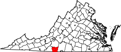
According to the United States Census Bureau, the CDP has a total area of 5.4 square miles (13.9 km2), of which, 5.3 square miles (13.9 km2) of it is land and 0.04 square miles (0.1 km2) of it (0.37%) is water.

Demographics

As of the census [1] of 2000, there were 1,742 people, 678 households, and 549 families residing in the CDP. The population density was 325.4 people per square mile (125.7/km2). There were 715 housing units at an average density of 133.6/sq mi (51.6/km2). The racial makeup of the CDP was 80.31% White, 15.67% African American, 0.17% Native American, 1.78% Asian, 1.15% from other races, and 0.92% from two or more races. Hispanic or Latino of any race were 6.08% of the population.

There were 678 households, out of which 32.3% had children under the age of 18 living with them, 72.6% were married couples living together, 5.8% had a female householder with no husband present, and 18.9% were non-families. 17.1% of all households were made up of individuals, and 7.1% had someone living alone who was 65 years of age or older. The average household size was 2.57 and the average family size was 2.88.

In the CDP, the population was spread out, with 22.8% under the age of 18, 5.3% from 18 to 24, 25.0% from 25 to 44, 33.6% from 45 to 64, and 13.3% who were 65 years of age or older. The median age was 43 years. For every 100 females, there were 94.4 males. For every 100 females age 18 and over, there were 93.8 males.

The median income for a household in the CDP was $58,929, and the median income for a family was $67,431. Males had a median income of $46,146 versus $27,031 for females. The per capita income for the CDP was $36,777. About 2.3% of families and 2.3% of the population were below the poverty line, including 1.8% of those under age 18 and 5.1% of those age 65 or over.

Related Research Articles

Martinsville, Virginia Independent city in Virginia, United States

Martinsville is an independent city near the southern border of the Commonwealth of Virginia. As of the 2010 census, the population was 13,821. It is the county seat of Henry County, although the two are separate jurisdictions. The Bureau of Economic Analysis combines the city of Martinsville with Henry County for statistical purposes.

Henry County, Virginia U.S. county in Virginia

Henry County is a county located in the U.S. state of Virginia. As of the 2010 census, the population was 54,151. The county seat is usually identified as Martinsville; however, the administration building, county courthouse, Henry County Sheriff's Office and its jail are located on Kings Mountain Road in Collinsville.

Manhasset Hills, New York Hamlet and census-designated place in New York, United States

Manhasset Hills is a hamlet and census-designated place (CDP) in Nassau County, New York, United States. The population was 3,592 at the 2010 census. Manhasset Hills is an unincorporated area of the Town of North Hempstead. Neighboring communities include Herricks, North New Hyde Park, and Lake Success.

Russellton, Pennsylvania Census-designated place in Pennsylvania, United States

Russellton is a census-designated place (CDP) in Allegheny County, Pennsylvania, United States. The population was 1,440 at the 2010 census.

Laymantown, Virginia Census-designated place in Virginia, United States

Laymantown is a census-designated place (CDP) in Botetourt County, Virginia, United States. The population was 1,979 at the 2010 census. It is part of the Roanoke Metropolitan Statistical Area.

Fancy Gap, Virginia CDP in Virginia, United States

Fancy Gap is a census-designated place (CDP) in Carroll County, Virginia, United States. The population was 237 at the 2010 census.

Penhook, Virginia Census-designated place in Virginia, United States

Penhook is a census-designated place (CDP) in Franklin County, Virginia, United States. The population was 801 at the 2010 census, up from 726 in 2000. It is part of the Roanoke Metropolitan Statistical Area.

East Highland Park, Virginia Census-designated place in Virginia

East Highland Park is a census-designated place (CDP) in Henrico County, Virginia, in the United States. The population was 14,796 at the 2010 census.

Bassett, Virginia CDP in Virginia, United States

Bassett is a census-designated place (CDP) in Henry County, Virginia, United States. The population was 1,100 at the 2010 census. It is part of the Martinsville Micropolitan Statistical Area. The town was founded along a rail line by the same family that later started Bassett Furniture. Bassett Furniture's headquarters have remained in Bassett, Va., since it began in 1902.

Collinsville, Virginia CDP in Virginia, United States

Collinsville is a census-designated place (CDP) in Henry County, Virginia, United States. The population was 7,335 at the 2010 census, which was down from the 7,777 reported in 2000. It is part of the Martinsville Micropolitan Statistical Area. Collinsville is also where the administration building and county courthouse of Henry County are located.

Fieldale, Virginia CDP in Virginia, United States

Fieldale is a census-designated place (CDP) in Henry County, Virginia, United States. The population was 879 at the 2010 census. It is part of the Martinsville Micropolitan Statistical Area.

Horsepasture, Virginia CDP in Virginia, United States

Horsepasture is a census-designated place (CDP) in Henry County, Virginia, United States. The population was 2,227 at the 2010 census. It is part of the Martinsville Micropolitan Statistical Area.

Laurel Park, Virginia CDP in Virginia, United States

Laurel Park is a census-designated place (CDP) in Henry County, Virginia, United States. The population was 675 at the 2010 census. It is part of the Martinsville Micropolitan Statistical Area.

Oak Level, Virginia CDP in Virginia, United States

Oak Level is a census-designated place (CDP) in Henry County, Virginia, United States. The population was 857 at the 2010 census. It is part of the Martinsville Micropolitan Statistical Area.

Ridgeway, Virginia Town in Virginia, United States

Ridgeway is a town in Henry County, Virginia, United States. The population was 742 at the 2010 census. It is part of the Martinsville Micropolitan Statistical Area. Martinsville Speedway, a NASCAR racetrack, is located between Ridgeway and the Martinsville city limits.

Sandy Level, Virginia Census-designated place in Virginia, United States

Sandy Level is a census-designated place (CDP) in Henry County, Virginia, United States. The population was 484 at the 2010 census, which was a significant decrease from the 689 reported in 2000. It is part of the Martinsville Micropolitan Statistical Area.

Stanleytown, Virginia CDP in Virginia, United States

Stanleytown is a census-designated place (CDP) in Henry County, Virginia, United States. The population was 1,422 at the 2010 census. It is part of the Martinsville Micropolitan Statistical Area.

Villa Heights, Virginia Census-designated place in Virginia, United States

Villa Heights is a census-designated place (CDP) in Henry County, Virginia, United States. The population was 717 at the 2010 census. It is part of the Martinsville Micropolitan Statistical Area.

Rose Hill, Lee County, Virginia Census-designated place in Virginia, United States

Rose Hill is an unincorporated community and census-designated place (CDP) in Lee County, Virginia, United States. The population was 799 at the 2010 census, up from 714 at the 2000 census.

Martinsville, Virginia micropolitan area

The Martinsville Micropolitan Statistical Area is a United States Micropolitan Statistical Area (USA) in Virginia, as defined by the Office of Management and Budget (OMB) as of June, 2003. As of the 2000 census, the μSA had a population of 73,346.

References

  1. 1 2 "U.S. Census website". United States Census Bureau . Retrieved 31 January 2008.
  2. "US Board on Geographic Names". United States Geological Survey. 25 October 2007. Retrieved 31 January 2008.
  3. Chatmoss celebrates half century of club growth, sports, friendships, The Martinsville Bulletin, 16 November 2008
  4. "USDA Watershed Rehabilitation". NRCS.USDA.gov.
  5. Thomas D. Perry (2009). Henry County. Arcadia Publishing. p. 7. ISBN   978-0-7385-6704-4.
  6. Virginia G. Pedigo; Lewis Gravely Pedigo (1977). History of Patrick and Henry Counties, Virginia. Genealogical Publishing Com. p. 155. ISBN   978-0-8063-8010-0.
  7. "US Gazetteer files: 2010, 2000, and 1990". United States Census Bureau. 12 February 2011. Retrieved 23 April 2011.