Dinwiddie County, Virginia | |
|---|---|
 | |
 Flag  Seal | |
 Location within the U.S. state of Virginia | |
| Coordinates: 37°05′N77°38′W / 37.08°N 77.63°W | |
| Country | |
| State | |
| Founded | 1752 |
| Named after | Robert Dinwiddie |
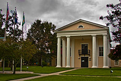
| Seat | Dinwiddie |
| Largest town | McKenney |
| Area | |
• Total | 507 sq mi (1,310 km2) |
| • Land | 504 sq mi (1,310 km2) |
| • Water | 3.5 sq mi (9.1 km2) 0.7% |
| Population (2020) | |
• Total | 27,947 |
| • Density | 55.5/sq mi (21.4/km2) |
| Time zone | UTC−5 (Eastern) |
| • Summer (DST) | UTC−4 (EDT) |
| Congressional district | 4th |
| Website | www |
Dinwiddie County is a largely rural United States county located in the south-central part of the Commonwealth of Virginia. Dinwiddie forms part of the Greater Richmond metropolitan statistical area, and as of the 2020 census, the county's population was 27,947. [1] The county seat is the small town of Dinwiddie, which shares the county’s name. [2]
Contents
- History
- Civil War battles
- Geography
- Adjacent counties
- National protected area
- Major highways
- Demographics
- Racial and ethnic composition
- 2020 census
- 2000 Census
- Government
- Board of Supervisors
- Constitutional officers
- Communities
- Town
- Census-designated places
- Unincorporated communities
- Education
- References
- External links
The county was established in 1752 from part of Prince George County and was named in honor of Robert Dinwiddie, the de facto head of the Virginia colony at the time. Agriculture has historically played an important role in the county's economy. [3] Dinwiddie's close proximity to the city of Petersburg and its railroad lines led to the county hosting six notable Civil War battles.

