A ZIP Code is a postal code used by the United States Postal Service (USPS) in a system it introduced in 1963. The term ZIP is an acronym for Zone Improvement Plan; it was chosen to suggest that the mail travels more efficiently and quickly when senders use the code in the postal address. The basic format consists of five digits. An extended ZIP+4 code was introduced in 1983 which includes the five digits of the ZIP Code, followed by a hyphen and four additional digits that reference a more specific location.

Levels is an unincorporated community in Hampshire County in the U.S. state of West Virginia. According to the 2000 census, the Levels community has a population of 147. It is home to John J. Cornwell Elementary School.

Purgitsville is an unincorporated community in Hampshire County in the U.S. state of West Virginia. According to the 2000 census, the ZCTA for Purgitsville had a population of 813. Purgitsville is located on U.S. Highway 220/West Virginia Route 28 at its intersection with Huffman Road south of Junction. An elementary school, Mill Creek Elementary, was open here until 1993 when it was consolidated with Romney Elementary.
Rio is an unincorporated community in southern Hampshire County in the U.S. state of West Virginia. Rio is located just north of the Hardy County line at the crossroads of Augusta-Ford Hill Road and Delray Road in the North River Valley. According to the 2000 census, the Rio community has a population of 154.
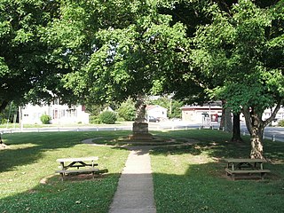
Heathsville is a census-designated place (CDP) in and the county seat of Northumberland County, Virginia, United States. Heathsville is the eastern-most county of the Northern Neck of Virginia, which was the birthplace of three of the first five Presidents of the United States - George Washington, James Madison, and James Monroe. The town itself is the county seat of Northumberland County, and has housed four county courthouses since the first was built in 1663.

Aldie is an unincorporated community located between Chantilly and Middleburg in Loudoun County, Virginia. Aldie's historic heart is the Village of Aldie that is located on the John Mosby Highway in a gap between the Catoctin Mountains and Bull Run Mountains, through which the Little River flows. Aldie traditionally serves as the gateway to Loudoun Valley and beyond.
Seaford is an unincorporated community in York County, Virginia, United States, on the Virginia Peninsula. As of the 2010 Census, the Seaford postal area had a population of 3,669. The zip code for Seaford is 23696.

Woodstock is an unincorporated community which is a suburb of Baltimore, Maryland. The original village of Woodstock is located in Howard County, and also includes portions of Baltimore County and Carroll County.
Smoot is an unincorporated community in western Greenbrier County, West Virginia, United States. It lies south of the interchange of Interstate 64 and U.S. Route 60 northwest of the city of Lewisburg, the county seat of Greenbrier County. Its elevation is 2,480 feet (756 m). Although it is unincorporated, it has a post office, with the ZIP code of 24977.
Sumerco is an unincorporated community in northeastern Lincoln County, West Virginia, United States. It lies along West Virginia Route 214 east of the town of Hamlin, the county seat of Lincoln County. Its elevation is 1,211 feet (369 m). Although it is unincorporated, it has a post office, with the ZIP code of 25567; the population of the ZCTA for ZIP code 25567 was 709 at the 2000 census.
Wana — formerly Wise — is an unincorporated community in northwestern Monongalia County, West Virginia, USA. It lies along West Virginia Route 7 northwest of the city of Morgantown, the county seat of Monongalia County. Its elevation is 1,030 feet (314 m). Although it is unincorporated, it has a post office, with the ZIP code of 26590.
Dallas is an unincorporated community in northeastern Marshall County, West Virginia, United States. It lies along local roads northeast of the city of Moundsville, the county seat of Marshall County, and almost in Pennsylvania. Its elevation is 1,388 feet (423 m). Although it is unincorporated, it has a post office, with the ZIP code of 26036.
Advent is an unincorporated community in southeastern Jackson County, West Virginia, United States. It lies along Advent Road southeast of the city of Ripley, the county seat of Jackson County, and near Jackson County's borders with Kanawha and Roane counties. Its elevation is 791 feet (241 m). Advent had a post office, which closed on December 25, 2010.

Willis is an unincorporated community in southwestern Floyd County, Virginia, United States. It lies along U.S. Route 221 southwest of the town of Floyd, the county seat of Floyd County. It has an elevation of 2,723 feet (830 m). Although Willis is unincorporated, it has a post office, with the ZIP code of 24380.

Covesville is an unincorporated community in Albemarle County, Virginia, United States. Covesville is located 15.7 miles (25.3 km) southwest of Charlottesville, Virginia and has a post office with ZIP code 22931.
Nathalie is an unincorporated community and census-designated place (CDP) in Halifax County, Virginia, United States, in the south-central region of the state. The population as of the 2010 census was 183.
Asbury is an unincorporated community in Greenbrier County, West Virginia, United States. Asbury is located on West Virginia Route 12 northeast of Alderson. Asbury has a post office with ZIP code 24916.

White Marsh is an unincorporated community in Gloucester County, in the U. S. state of Virginia. White Marsh is located on U.S. Route 17 5 miles (8.0 km) south of Gloucester Courthouse. White Marsh has a post office with ZIP code 23183.
Woods Crossroads is an unincorporated community in Gloucester County, in the U. S. state of Virginia. Woods Crossroads is located on U.S. Route 17 and Virginia State Route 14 6.5 miles (10.5 km) northwest of Gloucester Courthouse. Woods Crossroads has a post office with ZIP code 23190.

Jenkins Bridge is an unincorporated community in Accomack County, Virginia, United States. Jenkins Bridge is located on Holdens Creek 3.6 miles (5.8 km) north-northwest of Hallwood. Jenkins Bridge had a post office until January 20, 2007; it still has its own ZIP code, 23399.


