Lancaster County, Virginia

Last updated

Lancaster County
CentralLancasterVA.jpg
Central Lancaster, the county seat, with the county courthouse visible
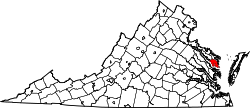
Map of Virginia highlighting Lancaster County.svg
Location within the U.S. state of Virginia
Virginia in United States.svg
Virginia's location within the U.S.
Coordinates: 37°43′N76°25′W / 37.71°N 76.41°W / 37.71; -76.41
CountryFlag of the United States.svg United States
StateFlag of Virginia.svg Virginia
Founded1651
Seat Lancaster
Largest town Kilmarnock
Area
  Total
231 sq mi (600 km2)
  Land133 sq mi (340 km2)
  Water98 sq mi (250 km2)  42.4%
Population
 (2020)
  Total
10,919
  Density47/sq mi (18/km2)
Time zone UTC−5 (Eastern)
  Summer (DST) UTC−4 (EDT)
Congressional district 1st
Website www.lancova.com

Lancaster County is a county located on the Northern Neck in the Commonwealth of Virginia. As of the 2020 census, the population sits at 10,919. [1] Its county seat is Lancaster. [2]

Contents

Located on the Northern Neck near the mouth of the Rappahannock River, Lancaster County is part of the Northern Neck George Washington Birthplace wine-growing region recognized by the United States as an American Viticultural Area.[ citation needed ] Lancaster County is the most densely populated county in the Northern Neck.[ citation needed ] The largest town in Lancaster County is Kilmarnock, Virginia. The county's area code is 804.

History

The historic church of St. Mary's, Whitechapel, in Lancaster County, St. Mary's parish was the birthplace of Mary Ball Washington, mother of George Washington St marys whitechapel.jpg
The historic church of St. Mary's, Whitechapel, in Lancaster County, St. Mary's parish was the birthplace of Mary Ball Washington, mother of George Washington

Lancaster County was established in 1651 from Northumberland and York counties, and large land patents (subject to terms including clearing and settlement) were issued that year. [3] It was home to Robert King Carter in the 18th century, and remaining buildings from that time include Christ Church and St. Mary's, Whitechapel. Other historic attractions open to the public include the Lancaster Courthouse Historic District including the Mary Ball Washington Museum and Library, Belle Isle State Park, and the Village of Morattico Historic District.

Geography

According to the U.S. Census Bureau, the county has a total area of 231 square miles (600 km2), of which 133 square miles (340 km2) is land and 98 square miles (250 km2) (42.4%) is water. [4]

Adjacent counties

Major highways

Demographics

Historical population
CensusPop.Note
1790 5,638
1800 5,375−4.7%
1810 5,5924.0%
1820 5,517−1.3%
1830 4,801−13.0%
1840 4,628−3.6%
1850 4,7081.7%
1860 5,1519.4%
1870 5,3554.0%
1880 6,16015.0%
1890 7,19116.7%
1900 8,94924.4%
1910 9,7529.0%
1920 9,7570.1%
1930 8,896−8.8%
1940 8,786−1.2%
1950 8,640−1.7%
1960 9,1746.2%
1970 9,126−0.5%
1980 10,12911.0%
1990 10,8967.6%
2000 11,5676.2%
2010 11,391−1.5%
2020 10,919−4.1%
U.S. Decennial Census [5]
1790–1960 [6] 1900–1990 [7]
1990–2000 [8] 2010 [9] 2020 [10]

2020 census

Lancaster County, Virginia – Racial and ethnic composition
Note: the US Census treats Hispanic/Latino as an ethnic category. This table excludes Latinos from the racial categories and assigns them to a separate category. Hispanics/Latinos may be of any race.
Race / Ethnicity (NH = Non-Hispanic)Pop 2010 [9] Pop 2020 [10] % 2010% 2020
White alone (NH)7,9257,44169.57%68.15%
Black or African American alone (NH)3,1662,94627.79%26.98%
Native American or Alaska Native alone (NH)16140.14%0.13%
Asian alone (NH)65770.57%0.71%
Pacific Islander alone (NH)010.00%0.01%
Some Other Race alone (NH)5390.04%0.36%
Mixed Race or Multi-Racial (NH)962760.84%2.53%
Hispanic or Latino (any race)1181251.04%1.14%
Total11,39110,919100.00%100.00%

2000 Census

As of the census [11] of 2000, there were 11,567 people, 5,004 households, and 3,412 families residing in the county. The population density was 87 people per square mile (34 people/km2). There were 6,498 housing units at an average density of 49 units per square mile (19 units/km2). The racial makeup of the county was 69.95% White, 28.88% Black or African American, 0.14% Native American, 0.34% Asian, 0.06% Pacific Islander, 0.10% from other races, and 0.54% from two or more races. 0.61% of the population were Hispanic or Latino of any race.

There were 5,004 households, out of which 21.20% had children under the age of 18 living with them, 54.70% were married couples living together, 11.10% had a female householder with no husband present, and 31.80% were non-families. 28.70% of all households were made up of individuals, and 16.80% had someone living alone who was 65 years of age or older. The average household size was 2.23 and the average family size was 2.71.

In the county, the population was spread out, with 19.00% under the age of 18, 5.00% from 18 to 24, 19.60% from 25 to 44, 28.00% from 45 to 64, and 28.50% who were 65 years of age or older. The median age was 50 years. For every 100 females there were 86.80 males. For every 100 females age 18 and over, there were 81.50 males.

Type of workers for this country are: Private wage or salary (72%); Government (15%); and Self-employed (12%). [12] The median income for a household in the county was $33,239, and the median income for a family was $42,957. Males had a median income of $30,592 versus $23,039 for females. The per capita income for the county was $24,663. Approximately 9.90% of families and 12.50% of the population were below the poverty line, including 18.00% of those under age 18 and 11.20% of those age 65 or over.

Economy

The economy in Lancaster County is primarily composed of services industries with education, health care, social service administration, scientific, professional, administrative, and retail work making up about 56% of the workforce. Secondarily, trades such as construction, manufacturing, transportation, warehousing, and utilities make up about 21% of the workforce. [13]

Most businesses in the county are small businesses with 64% of businesses employing 0 to 4 employees. 81% of employers in the county employ fewer than 10 employees. Larger employers (50+ employees) make up just 3% of employers, with the largest among those including health care providers such as the Bon Secours Health System (Rappahannock General Hospital) and Rappahannock Westminster Canterbury—local governments such as the Lancaster County School Board and Lancaster County government—and retail including Walmart. [14]

Lancaster County overall had an unemployment rate of about 2.9%, similar to Virginia's of about 2.5% in September 2023, however, the county's unemployment rate tends to spike in off-season months from January through April due to seasonal employment. [14]

Government

Lancaster County is governed by a five-member board of supervisors. The board meets in the Lancaster County Administration Building at 7 p.m. on the last Thursday of every month. The Administration building is located at 8311 Mary Ball Road in Lancaster, Virginia. [15]

Board of Supervisors

Constitutional officers

Lancaster is represented by Republican Richard Stuart in the Virginia Senate, Republican Hillary Pugh Kent in the Virginia House of Delegates, and Republican Robert J. "Rob" Wittman in the U.S. House of Representatives.

United States presidential election results for Lancaster County, Virginia [16]
Year Republican Democratic Third party(ies)
No.%No.%No.%
1912 8214.04%47982.02%233.94%
1916 5811.11%46188.31%30.57%
1920 13825.27%40473.99%40.73%
1924 9013.47%56484.43%142.10%
1928 52062.28%31537.72%00.00%
1932 27229.34%63968.93%161.73%
1936 32231.76%68967.95%30.30%
1940 31730.60%71168.63%80.77%
1944 39036.76%66662.77%50.47%
1948 45939.10%56047.70%15513.20%
1952 1,22861.49%75337.71%160.80%
1956 1,38070.66%37319.10%20010.24%
1960 1,34059.56%89539.78%150.67%
1964 1,66357.13%1,24542.77%30.10%
1968 1,64044.93%1,13431.07%87624.00%
1972 2,68371.64%1,00926.94%531.42%
1976 2,38158.44%1,58138.81%1122.75%
1980 2,78061.01%1,56734.39%2104.61%
1984 3,41667.72%1,55930.91%691.37%
1988 3,38067.02%1,55130.76%1122.22%
1992 2,84151.39%1,81232.78%87515.83%
1996 2,70955.36%1,84437.69%3406.95%
2000 3,41162.53%1,93735.51%1071.96%
2004 3,72459.78%2,47739.76%290.47%
2008 3,64752.57%3,23546.63%560.81%
2012 3,75353.91%3,14945.24%590.85%
2016 3,52353.02%2,86943.18%2533.81%
2020 3,69751.69%3,36847.09%871.22%
2024 3,86652.86%3,35545.88%921.26%

Communities

Towns

Census-designated places

Outskirts of Lively, in Lancaster County FieldNearLively.jpg
Outskirts of Lively, in Lancaster County

Other unincorporated communities

Points of interest

Lancaster County is home to the historic church of St. Mary's, Whitechapel, founded in 1669. Mary Ball Washington, mother of George Washington, was born in the parish of St. Mary's. Rappahannock General Hospital is in Kilmarnock, it is the only hospital on the Northern Neck. Other attractions are:

See also

References

  1. "Lancaster County, Virginia". United States Census Bureau . Retrieved January 30, 2022.
  2. "Find a County". National Association of Counties. Retrieved June 7, 2011.
  3. Carolyn H. Jett, Lancaster County, Virginia: Where the River Meets the Bay (Mary Ball Washington Museum and Library 2003) p. 39
  4. "US Gazetteer files: 2010, 2000, and 1990". United States Census Bureau. February 12, 2011. Retrieved April 23, 2011.
  5. "Census of Population and Housing from 1790-2000". US Census Bureau . Retrieved January 24, 2022.
  6. "Historical Census Browser". University of Virginia Library. Retrieved January 3, 2014.
  7. "Population of Counties by Decennial Census: 1900 to 1990". United States Census Bureau. Retrieved January 3, 2014.
  8. "Census 2000 PHC-T-4. Ranking Tables for Counties: 1990 and 2000" (PDF). United States Census Bureau. Archived (PDF) from the original on October 9, 2022. Retrieved January 3, 2014.
  9. 1 2 "P2 Hispanic or Latino, and Not Hispanic or Latino by Race – 2010: DEC Redistricting Data (PL 94-171) - Lancaster County, Virginia". United States Census Bureau .
  10. 1 2 "P2 Hispanic or Latino, and Not Hispanic or Latino by Race – 2020: DEC Redistricting Data (PL 94-171) - Lancaster County, Virginia". United States Census Bureau .
  11. "U.S. Census website". United States Census Bureau . Retrieved May 14, 2011.
  12. "Lancaster County, Virginia detailed profile - houses, real estate, cost of living, wages, work, agriculture, ancestries, and more". www.city-data.com. Retrieved April 9, 2018.
  13. "Explore Census Data". data.census.gov. Retrieved June 16, 2025.
  14. 1 2 "Lancaster County 2035 Strategic Plan" (PDF). Lancaster County, Virginia. December 2023. Retrieved June 16, 2025.
  15. www.lancova.com Retrieved 17 May 2014 Archived May 17, 2014, at the Wayback Machine
  16. Leip, David. "Dave Leip's Atlas of U.S. Presidential Elections". uselectionatlas.org. Retrieved December 9, 2020.

37°43′N76°25′W / 37.71°N 76.41°W / 37.71; -76.41