Lexington, Virginia | |
|---|---|
 Main Street, Lexington, Virginia | |
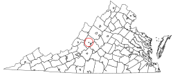 Lexington in the Commonwealth of Virginia | |
 Lexington  Lexington  Lexington | |
| Coordinates: 37°47′2″N79°26′34″W / 37.78389°N 79.44278°W [1] | |
| Country | United States |
| State | Virginia |
| County | None (independent city) |
| Government | |
| • Mayor | Frank W Friedman |
| • City manager | Jim Halasz |
| • Commissioner of Revenue | Karen T. Roundy |
| • Treasurer | Patricia DeLaney |
| • City Attorney | Jeremy Carroll, Esquire |
| Area | |
• Total | 2.53 sq mi (6.54 km2) |
| • Land | 2.50 sq mi (6.47 km2) |
| • Water | 0.027 sq mi (0.07 km2) |
| Elevation | 1,063 ft (324 m) |
| Population (2020) | |
• Total | 7,320 |
| • Density | 2,930/sq mi (1,130/km2) |
| Time zone | UTC−5 (Eastern (EST)) |
| • Summer (DST) | UTC−4 (EDT) |
| ZIP Code | 24450 |
| Area code | 540 |
| FIPS code | 51-45512 [3] |
| GNIS feature ID | 1498506 [1] |
| Website | Lexington, Virginia |
Lexington is an independent city in the Commonwealth of Virginia, United States. At the 2020 census, the population was 7,320. [4] It is the county seat of Rockbridge County, although the two are separate jurisdictions, and is combined with it for statistical purposes by the Bureau of Economic Analysis. [5] Lexington is within the Shenandoah Valley about 57 miles (92 km) east of the West Virginia border and is about 50 miles (80 km) north of Roanoke, Virginia. [6] First settled in 1778, Lexington is best known as the home of the Virginia Military Institute and Washington and Lee University.


