Laurel, Virginia

Last updated

Laurel, Virginia
Laurel District.JPG
VAMap-doton-Laurel.PNG
Location of Laurel, Virginia
Coordinates: 37°38′2″N77°30′24″W / 37.63389°N 77.50667°W / 37.63389; -77.50667
CountryUnited States
State Virginia
County Henrico
Area
  Total
5.4 sq mi (14.1 km2)
  Land5.4 sq mi (14.0 km2)
  Water0.0 sq mi (0.1 km2)
Elevation
243 ft (74 m)
Population
 (2020) [1]
  Total
17,769
  Density3,300/sq mi (1,300/km2)
Time zone UTC−5 (Eastern (EST))
  Summer (DST) UTC−4 (EDT)
ZIP Codes
23075, 23228, 23229, 23231, 23233, 23238, 23242, 23255, 23288, 23294
FIPS code 51-44280 [2]
GNIS feature ID1469155 [3]

Laurel is a census-designated place (CDP) in western Henrico County, Virginia, United States, named after the number of laurel trees in the area. [4] The population was 17,769 at the 2020 United States Census. [1]

Contents

Laurel is the location of the Laurel Skate Park. The bowl was recently filled in with smooth concrete and the vertical ramp removed to make way for safer amenities. [5]

Laurel is the location of the Laurel Industrial School Historic District.

History

Laurel's previous names include Hungary; Hungary Station; Jenningsville, so named because the Jennings family, who were large landholders and have a family gravesite at the site of the historic district; [4] and School. [6] In the 19th century, Laurel was a stop on the Richmond, Fredericksburg and Potomac (RF&P) Railroad. It was a spur line that connected the coalfields in western Henrico with the rail network. During the Civil War, the station was burned. Union Army Colonel Ulric Dahlgren's body was secretly buried there in March 1864; the body was later re-interred to Philadelphia. [7] The RF&P railroad is succeeded by CSX Transportation, which still operates on the same rights-of-way.

The A.A. Harvey General Store was built c.1910 to serve the community. Over the years, the building has undergone several transformations. It went from general store to housing. It then became the Crystal Ice Co. and the Laurel Post Office, where Lillian Merkle was Postmaster[ when? ]. The Post Office was one of only a few in the United States that was privately owned. [4] The building was completely restored in 1991 to its present use as the Laurel Gallery. Robert Bluford, the preservationist, made efforts to ensure that the restored building stayed true to its original style. [7]

Geography

Laurel is located at 37°38′2″N77°30′24″W / 37.63389°N 77.50667°W / 37.63389; -77.50667 (37.634012, 77.506661). [8]

According to the United States Census Bureau, the CDP has a total area of 5.4 square miles (14.1 km2), of which 5.4 square miles (14.0 km2) is land and 0.04 square miles (0.1 km2), or 0.71%, is water. [9]

Demographics

Historical population
CensusPop.Note
1980 10,569
1990 13,01123.1%
2000 14,87514.3%
2010 16,71312.4%
2020 17,7696.3%
U.S. Decennial Census [10]

As of the census [2] of 2000, there were 14,875 people, 6,288 households, and 3,634 families residing in the CDP. The population density was 2,713.6 inhabitants per square mile (1,047.7/km2). There were 6,522 housing units at an average density of 1,189.8 sq mi (3,082 km2). The racial makeup of the CDP was 64.98% White, 24.30% African American, 0.33% Native American, 6.16% Asian, 0.05% Pacific Islander, 2.08% from other races, and 2.08% from two or more races. Hispanic or Latino of any race were 4.15% of the population.

There were 6,288 households, out of which 27.2% had children under the age of 18 living with them, 42.0% were married couples living together, 12.0% had a female householder with no husband present, and 42.2% were non-families. 32.8% of all households were made up of individuals, and 7.1% had someone living alone who was 65 years of age or older. The average household size was 2.24 and the average family size was 2.87.

In the CDP, the population was spread out, with 20.2% under the age of 18, 10.6% from 18 to 24, 38.5% from 25 to 44, 19.6% from 45 to 64, and 11.0% who were 65 years of age or older. The median age was 34 years. For every 100 females, there were 93.4 males. For every 100 females age 18 and over, there were 91.6 males.

The median income for a household in the CDP was $42,128, and the median income for a family was $52,579. Males had a median income of $31,495 versus $30,158 for females. The per capita income for the CDP was $21,893. About 3.8% of families and 5.4% of the population were below the poverty line, including 4.7% of those under age 18 and 2.0% of those age 65 or over.

Related Research Articles

<span class="mw-page-title-main">Gulf Gate Estates, Florida</span> Census-designated place in Florida, United States

Gulf Gate Estates is a census-designated place (CDP) in Sarasota County, Florida, United States. The population was 11,118 at the 2020 census, up from 10,911 at the 2010 census. It is part of the North Port–Bradenton–Sarasota, Florida Metropolitan Statistical Area.

<span class="mw-page-title-main">Richville, Minnesota</span> City in Minnesota, United States

Richville is a city in Otter Tail County, Minnesota, United States. The population was 77 as of the 2020 census.

<span class="mw-page-title-main">Madison Heights, Virginia</span> Census-designated place in Virginia, United States

Madison Heights is a census-designated place (CDP) in Amherst County, Virginia, United States. The population was 10,893 at the 2020 census. It is part of the Lynchburg Metropolitan Statistical Area.

<span class="mw-page-title-main">Bensley, Virginia</span> CDP in Virginia, United States

Bensley is a census-designated place (CDP) in Chesterfield County, Virginia, United States. It is an inner suburb of Richmond, Virginia. The population was 5,971 at the 2020 census. Bensley Community building is inside of Bensley park. The community building is outside of Bensley, setting in walking distance of the CDP. The community is an old village with no active government. The community is over 100 years old. A new police substation in the village is next to the old Bensley Bermuda Rescue Squad, near DuPont Spruance.

<span class="mw-page-title-main">Chesterfield Court House, Virginia</span> Unincorporated community in Virginia, United States

Chesterfield Court House is an unincorporated community and former census-designated place that is the county seat of Chesterfield County, Virginia, United States. It was a census-designated place (CDP) at the 2000 census, but has not been delineated as a CDP since then. The Chesterfield County Courthouse and Courthouse Square are listed in the National Register of Historic Places. The area is also home of the Chesterfield County Government Complex.
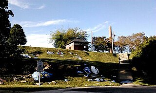
<span class="mw-page-title-main">Ettrick, Virginia</span> CDP in Virginia, United States

Ettrick is a census-designated place (CDP) in Chesterfield County, Virginia, United States. Per the 2020 census, the population was 7,241. The town is home to Virginia State University and the Petersburg Amtrak train station.

<span class="mw-page-title-main">Matoaca, Virginia</span> CDP in Virginia, United States

Matoaca is a census-designated place (CDP) in Chesterfield County, Virginia, United States. The population was 2,725 at the 2020 census. It is named after the Pamunkey princess Matoaka who was better known by her nickname "Pocahontas". It was near the site of an Appomattoc village Matoka or Matoks, which was reputedly her girlhood home, and the palace town of the weroansqua Oppussoquionuske.

<span class="mw-page-title-main">Franconia, Virginia</span> Census-designated place in Virginia, United States

Franconia is a census-designated place (CDP) in Fairfax County, Virginia, United States. The population was 18,943 at the 2020 census.

<span class="mw-page-title-main">Newington, Virginia</span> Census-designated place in Virginia, United States

Newington is a census-designated place (CDP) in Fairfax County, Virginia, United States. As of the 2020 census, the population was 13,223. The population was 12,943 at the 2010 census. The 2010 census showed a significant decrease after half the population was split off to the newly created Newington Forest CDP.

<span class="mw-page-title-main">Chamberlayne, Virginia</span> Census-designated place in Virginia

Chamberlayne is a census-designated place (CDP) in Henrico County, Virginia, United States. The population was 5,581 at the 2020 census.

<span class="mw-page-title-main">Dumbarton, Virginia</span> Census-designated place in Virginia

Dumbarton is a census-designated place (CDP) in Henrico County, Virginia, United States. The population was 7,879 at the 2010 census.

<span class="mw-page-title-main">East Highland Park, Virginia</span> Census-designated place in Virginia

East Highland Park is a census-designated place (CDP) in Henrico County, Virginia, in the United States. The population was 15,131 at the 2020 census.

<span class="mw-page-title-main">Highland Springs, Virginia</span> Census-designated place in Virginia

Highland Springs is a census-designated place (CDP) located in Henrico County, Virginia, United States, 4.3 miles (7 km) east of Richmond. The population was 16,604 at the 2020 census.

<span class="mw-page-title-main">Lakeside, Virginia</span> Census-designated area in Virginia

Lakeside is a census-designated place (CDP) in Henrico County, Virginia, United States. It is an inner suburb of Richmond, Virginia. The population was 12,203 at the 2020 census.

<span class="mw-page-title-main">Montrose, Virginia</span> Census-designated place in Virginia

Montrose is a census-designated place (CDP) in Henrico County, Virginia, United States. The population was 7,909 at the 2020 census.

<span class="mw-page-title-main">Tuckahoe, Virginia</span> Census-designated place in Virginia

Tuckahoe is a census-designated place (CDP) in Henrico County, Virginia, United States. It is an upper middle-class suburb to the west of Richmond. The population of Tuckahoe was 48,049 at the 2020 census. It is named after the area's history as the site of Thomas Randolph's Tuckahoe Plantation which still stands along the James River.
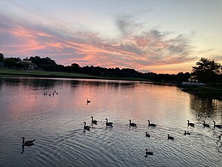
<span class="mw-page-title-main">Wyndham, Virginia</span> Census-designated place in Virginia

Wyndham is a census-designated place (CDP) in Henrico County, Virginia, United States, in the West End area outside of Richmond. The population was 9,785 at the 2010 census. The CDP is named for Wyndham, a planned community there. It is an affluent suburb of Richmond, Virginia.

<span class="mw-page-title-main">Laurel Park, Virginia</span> CDP in Virginia, United States

Laurel Park is a census-designated place (CDP) in Henry County, Virginia, United States. The population was 675 at the 2010 census. It is part of the Martinsville Micropolitan Statistical Area.

<span class="mw-page-title-main">Mallory, West Virginia</span> Census-designated place in West Virginia, United States

Mallory is a census-designated place (CDP) in Logan County, West Virginia, United States. The population was 1,654 at the 2010 census. The CDP contains the unincorporated communities, from west to east, of Huff Junction, Mallory, Davin, Mineral City, Claypool, Combs Addition, and Gillman Bottom.

Hollins is a census-designated place (CDP) in Botetourt and Roanoke County, Virginia, United States. Hollins covers much of the area known locally as "North County". The population was 15,574 at the 2020 census. It is part of the Roanoke Metropolitan Statistical Area. The area is also the home of Hollins University in addition to four properties listed on the National Register of Historic Places: the Black Horse Tavern-Bellvue Hotel and Office, Harshbarger House, the Hollins College Quadrangle, and Old Tombstone.

References

  1. 1 2 "QuickFacts: Laurel CDP, Virginia". United States Census Bureau . Retrieved March 20, 2024.
  2. 1 2 "U.S. Census website". United States Census Bureau . Retrieved January 31, 2008.
  3. "US Board on Geographic Names". United States Geological Survey. October 25, 2007. Retrieved January 31, 2008.
  4. 1 2 3 National Register of Historic Places Inventory-Nomination Form: Lauren Industrial School Historic District (PDF), June 12, 1987
  5. "Laurel Recreation Area & Skate Park - Henrico County, Virginia". henrico.us. Retrieved January 3, 2022.
  6. An Opportunity to Reform: The Laurel Industrial School & History of Juvenile Corrections in Henrico , retrieved January 3, 2022
  7. 1 2 "History of Laurel". laurelgalleryrva.com. Retrieved January 3, 2022.
  8. "US Gazetteer files: 2010, 2000, and 1990". United States Census Bureau. February 12, 2011. Retrieved April 23, 2011.
  9. "Geographic Identifiers: 2010 Demographic Profile Data (G001): Laurel CDP, Virginia". United States Census Bureau . Retrieved August 6, 2012.
  10. "Census of Population and Housing". Census.gov. Retrieved June 4, 2015.