Wyndham, Virginia | |
---|---|
Coordinates: 37°41′51″N77°36′39″W / 37.69750°N 77.61083°W | |
Country | United States |
State | Virginia |
County | Henrico |
Area | |
• Total | 3.6 sq mi (9.4 km2) |
• Land | 3.6 sq mi (9.4 km2) |
• Water | 0.0 sq mi (0.0 km2) |
Elevation | 249 ft (76 m) |
Population (2010) | |
• Total | 9,785 |
• Density | 2,700/sq mi (1,000/km2) |
Time zone | UTC−5 (Eastern (EST)) |
• Summer (DST) | UTC−4 (EDT) |
ZIP code | 23059 [1] |
Area code | 804 |
FIPS code | 51-87960 [2] |
GNIS feature ID | 1852921 [3] |
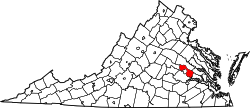
Wyndham is a census-designated place (CDP) in Henrico County, Virginia, United States, in the West End area outside of Richmond. The population was 9,785 at the 2010 census. [4] The CDP is named for Wyndham, a planned community there. [5] It is an affluent suburb of Richmond, Virginia.
Wyndham is located at 37°41′51″N77°36′39″W / 37.69750°N 77.61083°W (37.697475, −77.610871). [6]
According to the United States Census Bureau, the CDP has a total area of 3.6 square miles (9.4 km2), all land.
As of the census [2] of 2000, there were 6,176 people, 2,068 households, and 1,732 families residing in the CDP. The population density was 1,702.0 people per square mile (656.9/km2). There were 2,190 housing units at an average density of 603.5/sq mi (232.9/km2). The racial makeup of the CDP was 91.42% White, 2.66% African American, 0.10% Native American, 4.55% Asian, 0.23% from other races, and 1.05% from two or more races. Hispanic or Latino of any race were 1.41% of the population.
There were 2,068 households, out of which 55.4% had children under the age of 18 living with them, 79.2% were married couples living together, 3.2% had a female householder with no husband present, and 16.2% were non-families. 13.2% of all households were made up of individuals, and 2.0% had someone living alone who was 65 years of age or older. The average household size was 2.99 and the average family size was 3.32.
In the CDP, the population was spread out, with 35.7% under the age of 18, 2.0% from 18 to 24, 39.2% from 25 to 44, 18.7% from 45 to 64, and 4.4% who were 65 years of age or older. The median age was 34 years. For every 100 females, there were 100.0 males. For every 100 females age 18 and over, there were 96.0 males.
The median income for a household in the CDP was $113,723, and the median income for a family was $121,019. Males had a median income of $93,839 versus $44,911 for females. The per capita income for the CDP was $43,195. About 0.8% of families and 0.9% of the population were below the poverty line, including 1.2% of those under age 18 and none of those age 65 or over.
Willow Valley is an unincorporated community and census-designated place (CDP) in Mohave County, Arizona, United States. The population was 1,059 as of the 2020 census.
Russellton is a census-designated place (CDP) in Allegheny County, Pennsylvania, United States. The population was 1,330 at the 2020 census.
Beaverdale is an unincorporated community and census-designated place (CDP) in Cambria County, Pennsylvania, United States. The population was 1,035 at the 2010 census. Prior to that time, the CDP was known as Beaverdale-Lloydell.
Low Moor is a census-designated place (CDP) in Alleghany County, Virginia. The population was 258 at the 2010 census.
Selma is a census-designated place (CDP) in Alleghany County, Virginia, United States. The population was 529 at the 2010 census.
Bellwood is a census-designated place (CDP) in Chesterfield County, Virginia, United States. The population was 6,352 at the 2010 census. The community takes its name from Bellwood, one of the James River Plantations.
Bensley is a census-designated place (CDP) in Chesterfield County, Virginia, United States. It is an inner suburb of Richmond, Virginia. The population was 5,819 at the 2010 census. Bensley Community building is inside of Bensley park. The community building is outside of Bensley, setting in walking distance of the CDP. The community is an old village with no active government. The community is over 100 years old. A new police substation in the village is next to the old Bensley Bermuda Rescue Squad, near DuPont Spruance.
Chesterfield Court House is an unincorporated community and census-designated place that is the county seat of Chesterfield County, Virginia, United States. It was a census-designated place (CDP) at the 2020 census. It was not delineated as a CDP for the 2010 census. The Chesterfield County Courthouse and Courthouse Square are listed in the National Register of Historic Places. The area is also home of the Chesterfield County Government Complex.
Chamberlayne is a census-designated place (CDP) in Henrico County, Virginia, United States. The population was 5,581 at the 2020 census.
Dumbarton is a census-designated place (CDP) in Henrico County, Virginia, United States. The population was 7,879 at the 2010 census.
East Highland Park is a census-designated place (CDP) in Henrico County, Virginia, in the United States. The population was 15,131 at the 2020 census.
Lakeside is a census-designated place (CDP) in Henrico County, Virginia, United States. It is an inner suburb of Richmond, Virginia. The population was 12,203 at the 2020 census.
Laurel is a census-designated place (CDP) in western Henrico County, Virginia, United States. The population was 17,769 at the 2020 United States Census. It is the county seat of Henrico County.
Montrose is a census-designated place (CDP) in Henrico County, Virginia, United States. The population was 7,909 at the 2020 census.
Sudley is a census-designated place (CDP) in Prince William County, Virginia, United States. As of the 2010 census, Sudley comprises what in the 2000 census were the Sudley and West Gate CDPs. Sudley's population including West Gate was 16,203 at the 2010 census, and excluding West Gate was 7,719 at the 2000 census.
Aquia Harbour is a census-designated place (CDP) in Stafford County, Virginia, United States, 13 miles (21 km) north of Fredericksburg. The population was 6,727 at the 2010 census. Aquia Church, erected in 1757 and now a National Historic Landmark, is located west of the community.
Fairlea is a census-designated place (CDP) in Greenbrier County, West Virginia, United States. The population was 1,747 at the 2010 census. Fairlea is the location of the annual West Virginia State Fair, held in August.
Eagle Lake is a census-designated place (CDP) in the town of Dover, Racine County, Wisconsin, United States. The population was 1,251 at the 2020 census.
Hollins is a census-designated place (CDP) in Botetourt and Roanoke County, Virginia, United States. Hollins covers much of the area known locally as "North County". The population was 15,574 at the 2020 census. It is part of the Roanoke Metropolitan Statistical Area. The area is also the home of Hollins University in addition to four properties listed on the National Register of Historic Places: the Black Horse Tavern-Bellvue Hotel and Office, Harshbarger House, the Hollins College Quadrangle, and Old Tombstone.
Dranesville is a census-designated place (CDP) in Fairfax County, Virginia, United States. Dranesville is located on the Leesburg Pike at its intersection with Georgetown Pike. The U.S. Census Bureau defines Dranesville as a census-designated place (CDP) with a population of 11,921 as of 2010. At the 2020 Census the population was 11,785.