Glen Allen, Virginia

Last updated

Glen Allen, Virginia
Glen Allen VA.JPG
Mountain Road in Glen Allen, Virginia, with historical marker in the foreground
VAMap-doton-GlenAllen.PNG
Location of Glen Allen, Virginia
Coordinates: 37°39′36″N77°29′8″W / 37.66000°N 77.48556°W / 37.66000; -77.48556
CountryFlag of the United States.svg  United States
State Flag of Virginia.svg  Virginia
County Flag of Henrico County, Virginia.png Henrico
Area
  Total8.9 sq mi (22.9 km2)
  Land8.8 sq mi (22.9 km2)
  Water0.0 sq mi (0.0 km2)
Elevation
207 ft (63 m)
Population
 (2020)
  Total16,187
  Density1,800/sq mi (710/km2)
Time zone UTC−5 (Eastern (EST))
  Summer (DST) UTC−4 (EDT)
ZIP codes
23058-23060
Area code 804
FIPS code 51-31200
GNIS feature ID1494958 [1]

Glen Allen is a census-designated place (CDP) in Henrico County, Virginia, United States. The population was 16,187 [2] as of the 2020 Census, up from 14,774 at the 2010 census. [3] Areas outside the CDP which use a "Glen Allen" mailing address include residences in neighboring Hanover County. [4]

Contents

History

Called "Mountain Road Crossing" when rail service began in 1836, the settlement which came to be known as Glen Allen took its name from the homestead of a local landowner, Mrs. Benjamin Allen. Its most noted resident was Captain John Cussons, a native Englishman, Confederate scout, author, and entrepreneur. Cussons made his residence here after the Civil War and founded a successful printing company. Later he built a fashionable resort hotel known as Forest Lodge adjacent to the railroad tracks. [5]

The area of Glen Allen used to be mostly rural farmland, but it is now a growing suburb of Richmond.

Geography

According to the United States Census Bureau, the CDP has a total area of 8.86 square miles (22.94 km2), of which 8.79 square miles (22.77 km2) are land and 0.069 square miles (0.18 km2), or 0.76%, are water. [3]

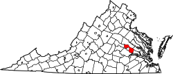
The Glen Allen census-designated place is in northern Henrico County, approximately 11 miles (18 km) north-northwest of downtown Richmond. The CDP is bordered to the north by the Chickahominy River, which forms the Henrico–Hanover County line. The eastern border of the CDP is Interstate 95, from the Chickahominy River south to East Parham Road. The southern border of the CDP follows East Parham Road, U.S. Route 1, Virginia State Route 157 (Mountain Road), Jessie Chavis Drive, North Run, Woodman Road, Blackburn Road, Winston Boulevard, and Indale Road to the CSX railroad line, which it follows south to Hungary Road. The western border of the CDP follows Hungary Spring Road, Old Route 33, Attems Way, and U.S. Route 33 (Staples Mill Road) to Courtney Road, then follows a power line northeast back to the CSX rail line. The border follows the railroad north to County Road 625 (Greenwood Road), then takes Old Washington Highway to the Chickahominy River. [4] Glen Allen uses two postal addresses, ZIP codes 23059 and 23060, which cover neighboring communities as well, including rural areas of Hanover County to the north.

The Glen Allen CDP includes all or portions of the communities of Hunton, Greenwood, Longdale, Holly Glen Estates, Biltmore, and Yellow Tavern. [6]

Demographics

Historical population
CensusPop.Note
1980 6,202
1990 9,01045.3%
2000 12,56239.4%
2010 14,77417.6%
2020 16,1879.6%
Source: U.S. Census Bureau [7]

As of the census [8] of 2020, there were 16,187 people, up from 14,774 at the 2010 Census.The racial makeup of the CDP was 60.4% White, 25.3% African American, 0.0% Native American, 7.5% Asian, 0.0% Pacific Islander, and 2.4% from two or more races. Hispanic or Latino of any race were 6.4% of the population.

The median income for a household in the CDP was $79,401. The per capita income for the CDP was $39,414. About 7% of the population were below the poverty line.

Economy

Appliance maker Hamilton Beach and insurer Markel are based in Glen Allen.

Notable people

Related Research Articles

<span class="mw-page-title-main">New Kent County, Virginia</span> County in Virginia, United States

New Kent County is a county in the south eastern part the Commonwealth of Virginia. As of the 2020 United States Census, its population was 22,945. Its county seat is New Kent.

<span class="mw-page-title-main">Henrico County, Virginia</span> County in Virginia, United States

Henrico County, officially the County of Henrico, is located in the Commonwealth of Virginia in the United States. As of the 2020 census, the population was 334,389 making it the fifth-most populous county in Virginia. Henrico County is included in the Greater Richmond Region. There is no incorporated community within Henrico County; therefore, there is no incorporated county seat either. Laurel, an unincorporated CDP, serves this function.

<span class="mw-page-title-main">Hanover County, Virginia</span> County in Virginia, United States

Hanover County is a county in the Commonwealth of Virginia. As of the 2020 census, the population was 109,979. Its county seat is Hanover Courthouse.

<span class="mw-page-title-main">Charles City County, Virginia</span> County in Virginia, United States

Charles City County is a county located in the U.S. commonwealth of Virginia. The county is situated southeast of Richmond and west of Jamestown. It is bounded on the south by the James River and on the east by the Chickahominy River.

<span class="mw-page-title-main">Ashland, Virginia</span> Town in Virginia, United States

Ashland is a town in Hanover County, Virginia, United States, located 16 miles (26 km) north of Richmond along Interstate 95 and U.S. Route 1. As of the 2020 census it had a population of 7,565, up from 7,225 at the 2010 census.

<span class="mw-page-title-main">Mechanicsville, Virginia</span> Census-designated place in Virginia, United States

Mechanicsville is an unincorporated community and census-designated place (CDP) in Hanover County, Virginia, United States. The population was 39,482 during the 2020 census, up from 36,348 in the 2010 census.

<span class="mw-page-title-main">Highland Springs, Virginia</span> Census-designated place in Virginia

Highland Springs is a census-designated place (CDP) located in Henrico County, Virginia, United States, 4.3 miles (7 km) east of Richmond. The population was 16,604 at the 2020 census.

<span class="mw-page-title-main">Laurel, Virginia</span> Census-designated place in Virginia, United States

Laurel is a census-designated place (CDP) in western Henrico County, Virginia. The population was 16,713 at the 2010 United States Census. It is the county seat of Henrico County.

Short Pump is a census-designated place (CDP) in Henrico County, Virginia, United States. It is a suburb of Richmond, Virginia. The population was 30,626 at the 2020 census.

<span class="mw-page-title-main">Greater Richmond Transit Company</span>

The Greater Richmond Transit Company, known locally as GRTC, is a local government-owned public service company which operates an urban-suburban bus line based in Richmond, Virginia. In 2022, the system had a ridership of 8,739,400, or about 32,800 per weekday as of the third quarter of 2023.

<span class="mw-page-title-main">Greater Richmond Region</span> Metropolitan statistical area in the United States

The Greater Richmond Region, the Richmond metropolitan area or Central Virginia, is a region and metropolitan area in the U.S. state of Virginia, centered on Richmond. The U.S. Office of Management and Budget (OMB) defines the area as the Richmond, VA Metropolitan Statistical Area, a Metropolitan Statistical Area (MSA) used by the U.S. Census Bureau and other entities. The OMB defines the area as comprising 17 county-level jurisdictions, including the independent cities of Richmond, Petersburg, Hopewell, and Colonial Heights. As of 2020, it had a population of 1,314,434, making it the 44th largest MSA in the country.

<span class="mw-page-title-main">West End (Richmond, Virginia)</span> Neighborhood in Richmond, Virginia, United States

The West End is a part of Richmond, Virginia. Definitions of the bounds of the West End vary, it may include only the western part of the city of Richmond or extend as far as western Henrico County. As there is no one municipal organization that represents this specific region, the boundaries are loosely defined as being north of the James River, west of I-195, and south of Broad Street. Historically, the Richmond neighborhoods of the Fan and the Museum District were a part of the West End. A primary conduit through the West End is Interstate 64.

<span class="mw-page-title-main">Virginia State Route 150</span> State highway in Virginia, United States

State Route 150 is a state highway in the U.S. state of Virginia. Known as Chippenham Parkway, the state highway runs 15.19 miles (24.45 km) from Interstate 95 (I-95) and SR 895 in Bensley north to Parham Road and River Road near Tuckahoe in Henrico County. SR 150 is a four- to six-lane circumferential highway that connects the Chesterfield County suburbs of Richmond with western Henrico County and, via SR 895, eastern Henrico County and Richmond International Airport. The highway is a freeway except for a short stretch east of SR 147 in Richmond. SR 150 has junctions with all of the radial highways south of the James River, including I-95, U.S. Route 1, US 301, US 360, US 60, and SR 76.

<span class="mw-page-title-main">Virginia State Route 2</span> North-south state highway in Virginia, US

State Route 2, formerly State Route 50, is a primary state highway in the U.S. state of Virginia. The state highway runs 53.08 miles (85.42 km) from U.S. Route 1 and US 301 in Richmond north to US 1 Business, US 17 Business, and SR 3 Business in Fredericksburg. SR 2 connects Richmond and Fredericksburg via Bowling Green. The state highway runs concurrently with US 301 from Richmond to Bowling Green and with US 17 Business in the Fredericksburg area.

<span class="mw-page-title-main">Virginia Randolph</span> 19th and 20th-century American schoolteacher

Virginia Estelle Randolph was an American educator in Henrico County, Virginia. She was named the United States' first "Jeanes Supervising Industrial Teacher" by her Superintendent of Schools, Jackson Davis, and she led a program funded by the Jeanes Foundation to upgrade vocational training throughout the U.S. South as her career progressed. Her work is widely associated with vocational education. Two schools of the Henrico County Public Schools system were named in her honor and in 2009 Randolph was posthumously honored by the Library of Virginia as one of their "Virginia Women in History" for her career and contributions to education.

<span class="mw-page-title-main">U.S. Route 1 in Virginia</span> Section of United States Numbered Highway in Virginia

U.S. Route 1 (US 1) is a major north–south U.S. Route that serves the East Coast of the United States. In the U.S. state of Virginia, US 1 runs north–south through South Hill, Petersburg, Richmond, Fredericksburg, and Alexandria on its way from North Carolina to the 14th Street bridges into the District of Columbia. It is completely paralleled by Interstate Highways in Virginia—Interstate 85 (I-85) south of Petersburg, I-95 north to Alexandria, and I-395 into the District of Columbia—and now serves mainly local traffic. At its north end, on the approach to the 14th Street bridges, US 1 is concurrent with I-395; the rest of US 1 is on surface roads.

<span class="mw-page-title-main">U.S. Route 33 in Virginia</span> Section of US highway in Virginia

U.S. Route 33 is a part of the U.S. Highway System that runs from Elkhart, Indiana to Richmond, Virginia. In Virginia, the U.S. Highway runs 135.60 miles (218.23 km) from the West Virginia state line near Rawley Springs east to its eastern terminus at SR 33 in Richmond. US 33 is the primary east–west highway of Rockingham County, which lies in the Shenandoah Valley. The highway connects the independent city of Harrisonburg, the town of Elkton, and an entrance to Shenandoah National Park. East of the Blue Ridge Mountains, US 33 connects the Piedmont communities of Stanardsville, Gordonsville, and Louisa. The U.S. Highway is a major suburban and urban route in the Richmond metropolitan area. Within Richmond, US 33 runs concurrently with US 250. SR 33 continues from US 33's eastern terminus as a state-numbered extension of the U.S. Highway that connects Richmond with Virginia's Middle Peninsula.

<span class="mw-page-title-main">Hanover, Virginia</span> Census-designated place in Virginia, United States

Hanover is an unincorporated community and census-designated place (CDP) in Hanover County, Virginia, United States. It is the county seat and is located at the junction of U.S. Route 301 and State Route 54 south of the Pamunkey River. While historically known as Hanover Courthouse, the U.S. Geological Survey, Census Bureau, Postal Service and residents refer to it as "Hanover". The population as of the 2010 census was 252.

<span class="mw-page-title-main">Virginia State Route 271</span> State highway in Virginia, United States

State Route 271 is a primary state highway in the U.S. state of Virginia. Known as Pouncey Tract Road, the state highway runs 7.34 miles (11.81 km) from U.S. Route 250 in Short Pump north to SR 620 and SR 622 in Rockville. A small section of it was first added to the state highway system during 1930, and it gained its current routing and designation by 1940.

Parham Road is a circumferential highway in Henrico County in the U.S. state of Virginia. The highway runs 12.08 miles (19.44 km) from Virginia State Route 150 near Tuckahoe east to U.S. Route 301 and SR 2 in Chamberlayne. Parham Road serves the northwestern suburbs of Richmond, including Tuckahoe, Laurel, and Chamberlayne. The four-lane divided highway intersects all of the major highways that extend northwest and north from the city, including Interstate 64 (I-64) and I-95. Parham Road is county maintained except for the portion that is State Route 73, a connector between US 1 and I-95. The Parham Road name was applied to a small portion of the current route by the early 20th century. SR 73 was constructed in the early 1960s. Most of Parham Road from SR 6 to US 1 was constructed as a new four-lane divided highway by Henrico County in the late 1960s; the existing sections were upgraded at the same time. The highway was extended east to its present terminus in the late 1970s. Parham Road was completed south to its present western terminus in 1990 concurrent with the extension of SR 150 across the James River from the Southside of Richmond to Henrico County.

References

  1. "US Board on Geographic Names". United States Geological Survey. October 25, 2007. Retrieved January 31, 2008.
  2. "Census Quick Facts: Glen Allen VA".
  3. 1 2 "Geographic Identifiers: 2010 Census Summary File 1 (G001): Glen Allen CDP, Virginia". American Factfinder. U.S. Census Bureau. Archived from the original on February 13, 2020. Retrieved March 22, 2018.
  4. 1 2 "TIGERweb: Glen Allen CDP, Virginia". Geography Division, U.S. Census Bureau. Retrieved March 22, 2018.
  5. Rogers, Kyle (2018). "The Idle Hour: The Eccentric Life Of Capt. John Cussons". The UncommonWealth: Voices from the Library of Virginia. Retrieved August 26, 2021.
  6. "Glen Allen, VA". U.S. Geological Survey 7.5-minute topographic map series. ACME Mapper. Retrieved March 22, 2018.
  7. . United States Census Bureau https://www.census.gov.{{cite web}}: Missing or empty |title= (help)
  8. "QuickFacts Glen Allen CDP, Virginia". United States Census Bureau. Retrieved April 5, 2023.
  9. Giambalvo, Emily (August 11, 2018). "D.C. United's youngest player, Chris Durkin, focuses on development in first MLS season". The Washington Post . Retrieved February 23, 2024.
  10. "Glen Allen native Chris Durkin signs with D.C. United" . Richmond Times-Dispatch . June 14, 2016. Retrieved February 23, 2024.
  11. Phillips, Michael (April 14, 2021). "New York rangers sign glen Allen's Zac Jones". Richmond Times-Dispatch . Retrieved February 23, 2024.
  12. Alexander, Chip (May 1, 2015). "NC State catcher adjusts to life behind the plate". The News & Observer . Archived from the original on December 19, 2018. Retrieved February 23, 2024.
  13. "Former Deep Run, U.Va. player expected to join Kickers". Richmond Times-Dispatch . March 23, 2013. Archived from the original on February 23, 2024. Retrieved February 23, 2024.