Warsaw | |
---|---|
Coordinates: 37°57′27″N76°45′30″W / 37.95750°N 76.75833°W | |
Country | United States |
State | Virginia |
County | Richmond |
Government | |
• Type | Council - Manager |
• Mayor | Randall L. Phelps |
• Town Manager | Joseph N. Quesenberry |
• Police Chief | Sean L. Peterson |
Area | |
• Total | 3.05 sq mi (7.91 km2) |
• Land | 3.05 sq mi (7.91 km2) |
• Water | 0.00 sq mi (0.00 km2) |
Elevation | 131 ft (40 m) |
Population (2020) | |
• Total | 1,637 |
• Estimate (2022) [2] | 2,281 |
• Density | 545.66/sq mi (206.95/km2) |
Time zone | UTC−5 (Eastern (EST)) |
• Summer (DST) | UTC−4 (EDT) |
ZIP code | 22572 |
Area code | 804 |
FIPS code | 51-83168 [3] |
GNIS ID | 1500279 [4] |
Website | Town website |
Warsaw is an incorporated town in and the county seat of Richmond County, Virginia, United States. [5] The population was 1,637 at the 2020 census and is estimated to be 2,281 as of 2022.
Prior to English colonization, the area of Warsaw, Virginia was occupied by a group of Rappahannock Native Americans, who would fish on the nearby creeks for shad and herring. [6] By 1667, the Rappahannock people had been forced to sell all their land north of the Rappahannock River to English settlers, including the modern site of Warsaw. [6]
After the division of the Old Rappahannock County in 1692, Richmond County was created. The new county had its seat at Richmond Court House, which was originally along the shores of the Rappahannock River. The site of Richmond Court House was moved inland to modern Warsaw in 1730, and the modern court house was built in 1748. [7] The area was also the home of Robert Wormeley Carter, who represented Richmond County in the Virginia House of Burgesses and the Continental Congress as a supporter of the American Revolution; he owned the historic house of Sabine Hall, located near Richmond Court House. [8] Additionally, the region was subjected to intense British raids during the War of 1812, and many free men of the town were rallied in its defense from the British army. [9] During this time, the area's economy grew reliant on tobacco, as a small group of wealthy planters grew the crop with the labor of indentured settlers and enslaved Africans. [10] [11]
In January 1832, the town's name was changed to Warsaw, after the news of "great uprisings in Old World Warsaw" in 1830 and 1831 reached residents. This change was due to local popular support for the November Uprising in Poland. [12] As with Richmond Court House, a number of other small towns in the United States changed their names to Warsaw at this time, such as Warsaw, Kentucky. [13]
Following the Civil War, the area's newly emancipated freedmen made efforts to secure their own churches and schools. [14] Ultimately, the region's schools and churches would be formally desegregated with the passage of the Civil Rights Act, though all schools in the region would not be fully integrated until the 1970s. [15]
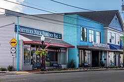
Today, Warsaw is one of many small towns in Virginia's Northern Neck region. The town prides itself on its schools, natural beauty, and quality of life. [16]
Warsaw is located at 37°57′27″N76°45′30″W / 37.95750°N 76.75833°W (37.957617, −76.758302). [17]
According to the United States Census Bureau, the town has a total area of 3.0 square miles (7.9 km2), all of it land.
The climate in this area is characterized by hot, humid summers and generally mild to cool winters. According to the Köppen Climate Classification system, Warsaw has a humid subtropical climate, abbreviated "Cfa" on climate maps. [18]
Climate data for Warsaw, Virginia (1991–2020 normals, extremes 1893–present) | |||||||||||||
---|---|---|---|---|---|---|---|---|---|---|---|---|---|
Month | Jan | Feb | Mar | Apr | May | Jun | Jul | Aug | Sep | Oct | Nov | Dec | Year |
Record high °F (°C) | 82 (28) | 81 (27) | 94 (34) | 97 (36) | 99 (37) | 105 (41) | 106 (41) | 103 (39) | 105 (41) | 100 (38) | 85 (29) | 82 (28) | 106 (41) |
Mean daily maximum °F (°C) | 46.8 (8.2) | 50.4 (10.2) | 58.5 (14.7) | 69.7 (20.9) | 77.1 (25.1) | 84.3 (29.1) | 88.4 (31.3) | 86.4 (30.2) | 80.4 (26.9) | 70.4 (21.3) | 59.5 (15.3) | 50.0 (10.0) | 68.5 (20.3) |
Daily mean °F (°C) | 37.6 (3.1) | 40.3 (4.6) | 47.5 (8.6) | 57.8 (14.3) | 66.2 (19.0) | 73.9 (23.3) | 78.2 (25.7) | 76.2 (24.6) | 70.1 (21.2) | 59.5 (15.3) | 49.3 (9.6) | 41.2 (5.1) | 58.1 (14.5) |
Mean daily minimum °F (°C) | 28.5 (−1.9) | 30.2 (−1.0) | 36.5 (2.5) | 45.8 (7.7) | 55.3 (12.9) | 63.5 (17.5) | 68.1 (20.1) | 66.1 (18.9) | 59.8 (15.4) | 48.6 (9.2) | 39.1 (3.9) | 32.3 (0.2) | 47.8 (8.8) |
Record low °F (°C) | −6 (−21) | −5 (−21) | 5 (−15) | 14 (−10) | 29 (−2) | 38 (3) | 47 (8) | 44 (7) | 30 (−1) | 24 (−4) | 13 (−11) | −3 (−19) | −6 (−21) |
Average precipitation inches (mm) | 3.02 (77) | 2.60 (66) | 3.66 (93) | 3.18 (81) | 3.90 (99) | 4.37 (111) | 4.73 (120) | 5.01 (127) | 4.15 (105) | 3.98 (101) | 3.29 (84) | 3.30 (84) | 45.19 (1,148) |
Average snowfall inches (cm) | 4.4 (11) | 3.3 (8.4) | 1.4 (3.6) | 0.1 (0.25) | 0.0 (0.0) | 0.0 (0.0) | 0.0 (0.0) | 0.0 (0.0) | 0.0 (0.0) | 0.0 (0.0) | 0.1 (0.25) | 2.2 (5.6) | 11.5 (29) |
Average precipitation days (≥ 0.01 in) | 8.9 | 8.1 | 9.3 | 10.4 | 11.3 | 11.0 | 10.4 | 9.6 | 9.0 | 9.3 | 8.4 | 9.1 | 114.8 |
Average snowy days (≥ 0.1 in) | 1.6 | 1.5 | 0.6 | 0.0 | 0.0 | 0.0 | 0.0 | 0.0 | 0.0 | 0.0 | 0.0 | 0.9 | 4.6 |
Source: NOAA [19] [20] |
Race / Ethnicity | Pop 2020 | % 2020 |
---|---|---|
White alone (NH) | 1033 | 74.21% |
Black or African American alone (NH) | 479 | 17.37% |
Native American or Alaska Native alone (NH) | 1 | 0.26% |
Asian alone (NH) | 10 | 1.32% |
Pacific Islander alone (NH) | 0 | 0.00% |
Some Other Race alone (NH) | 1 | 0.00% |
Mixed Race/Multi-Racial (NH) | 44 | 3.42% |
Hispanic or Latino (any race) | 69 | 3.42% |
Total | 1,637 | 100.00% |
Note: the US Census treats Hispanic/Latino as an ethnic category. This table excludes Latinos from the racial categories and assigns them to a separate category. Hispanics/Latinos can be of any race.
Census | Pop. | Note | %± |
---|---|---|---|
1880 | 115 | — | |
1950 | 435 | — | |
1960 | 549 | 26.2% | |
1970 | 511 | −6.9% | |
1980 | 771 | 50.9% | |
1990 | 961 | 24.6% | |
2000 | 1,375 | 43.1% | |
2010 | 1,512 | 10.0% | |
2020 | 1,637 | 8.3% | |
2022 (est.) | 2,281 | [2] | 39.3% |
U.S. Decennial Census [22] |
As of the census [3] of 2000, there were 1,375 people, 445 households, and 233 families living in the town. The population density was 453.0 people per square mile (174.6/km2). There were 468 housing units at an average density of 154.2 per square mile (59.4/km2). The racial makeup of the town was 67.64% White, 29.38% African American, 0.22% Native American, 0.44% Asian, 1.53% from other races, and 0.80% from two or more races. Hispanic or Latino of any race were 4.36% of the population.
There were 445 households, out of which 22.5% had children under the age of 18 living with them, 39.1% were married couples living together, 10.8% had a female householder with no husband present, and 47.6% were non-families. 45.6% of all households were made up of individuals, and 24.3% had someone living alone who was 65 years of age or older. The average household size was 2.01 and the average family size was 2.81.
In the town, the population was spread out, with 13.3% under the age of 18, 9.7% from 18 to 24, 28.1% from 25 to 44, 19.4% from 45 to 64, and 29.5% who were 65 years of age or older. The median age was 44 years. For every 100 females, there were 102.2 males. For every 100 females aged 18 and over, there were 103.8 males.
The median income for a household in the town was $28,971, and the median income for a family was $44,167. Males had a median income of $40,052 versus $23,661 for females. The per capita income for the town was $21,392. About 12.4% of families and 16.8% of the population were below the poverty line, including 20.6% of those under age 18 and 16.4% of those age 65 or over.
Warsaw serves as the hub of Richmond County and provides a wide array of economic opportunities. As of 2017, 40% of the town's employment came from educational, health, and social services. [23] Educationally, the town is home to an elementary and middle school, a high school, a technical school, and a campus of the Rappahannock Community College. [24]
Warsaw is also the location of the Northern Neck Regional Jail, which was completed in 1995. The jail employs 100 people and has a capacity of 460 inmates. Its most recent addition was completed in 2000. [25]
The area also uses its historic importance to promote tourism. [23] Historic sites nearby include Menokin, the former home of Francis Lightfoot Lee, Mount Airy and Sabine Hall. A former plantation estate, Belle Mount, is currently operated as a vineyard and winery within a few miles of Warsaw town limits. In addition to Menokin, Mount Airy, and Sabine Hall, Grove Mount and the Richmond County Courthouse are listed on the National Register of Historic Places. The formerly listed Bladensfield was destroyed by fire in 1996. [26]
Westmoreland County is a county located in the Northern Neck of the Commonwealth of Virginia. As of the 2020 census, the population sits at 18,477. Its county seat is Montross.
Richmond County is a county located on the Northern Neck in the U.S. state of Virginia. As of the 2020 census, the population sits at 8,923. Its county seat is Warsaw. The rural county should not be confused with the large city and state capital Richmond, Virginia. It was formed in 1692 when the first Rappahannock County was divided to form Richmond County and Essex County.
New Kent County is a county in the south eastern part the Commonwealth of Virginia. As of the 2020 United States Census, its population was 22,945. Its county seat is New Kent.
Middlesex County is a county located on the Middle Peninsula in the U.S. state of Virginia. As of the 2020 census, the population was 10,625. Its county seat is Saluda.
King George County is a county located in the Commonwealth of Virginia. As of the 2020 census, the population sits at 26,723. Its county seat is the town of King George.
Fredericksburg is an independent city in Virginia, United States. As of the 2020 census, the population was 27,982. It is 48 miles (77 km) south of Washington, D.C., and 53 miles (85 km) north of Richmond. The Bureau of Economic Analysis of the United States Department of Commerce combines the city of Fredericksburg with neighboring Spotsylvania County for statistical purposes.
Fauquier County is a county in the Commonwealth of Virginia. As of the 2020 census, the population was 72,972. The county seat is Warrenton.
Emporia is an independent city in the Commonwealth of Virginia, surrounded by Greensville County, United States. Emporia and a predecessor town have been the county seat of Greensville County since 1791. As of the 2020 census, the population was 5,766, making it the third-least populous city in Virginia. The Bureau of Economic Analysis combines the city of Emporia with surrounding Greensville County for statistical purposes.
Caroline County is a United States county located in the eastern part of the Commonwealth of Virginia. The northern boundary of the county borders on the Rappahannock River, notably at the historic town of Port Royal. The Caroline county seat is Bowling Green.
Fairfax is a town in Allendale and Hampton counties, South Carolina, United States. The population was 2,025 at the 2010 census, a decline of over one-third of its population of 3,206 from 2000.
Buchanan is a town in Botetourt County, Virginia, United States. The population was 1,196 at the 2020 census. It is part of the Roanoke Metropolitan Statistical Area. It was the western terminus of the James River and Kanawha Canal when construction on the canal ended.
Tappahannock is the oldest town in Essex County, Virginia, United States. The population was 2,375 at the 2010 census, up from 2,068 at the 2000 census. Located on the Rappahannock River, Tappahannock is the county seat of Essex County. Its name comes from an Algonquian language word lappihanne, meaning "Town on the rise and fall of water" or "where the tide ebbs and flows." The Rappahannock is a tidal estuary from above this point and downriver to its mouth on Chesapeake Bay.
White Stone is a town in Lancaster County, Virginia, United States. The population was 380 at the 2020 census. White Stone is one of many small towns located in Virginia's Northern Neck region.
Chatham is a town in Pittsylvania County, Virginia, United States. It is the county seat of Pittsylvania County. Chatham's population was 1,232 at the 2020 census. It is included in the Danville, Virginia Metropolitan Statistical Area. The town was originally called Competition, but the name was changed to Chatham by the Virginia General Assembly on May 1, 1852.
Falmouth is a census-designated place (CDP) in Stafford County, Virginia, United States. Situated on the north bank of the Rappahannock River at the falls, the community is north of and opposite the city of Fredericksburg. Recognized by the U.S. Census Bureau as a census-designated place (CDP), Falmouth's population was 4,956 as of the 2020 census.
Man is a town in Logan County, West Virginia, United States. The population was 772 at the 2020 census. The town is located along the Guyandotte River at the mouth of Buffalo Creek, which was the site of the 1972 Buffalo Creek Flood following a dam collapse. The name of the town reportedly derives from the last syllable of the surname of Ulysses Hinchman, who was a member of the House of Delegates from Logan County between 1866 and 1869.
Eleanor is a town in Putnam County, West Virginia, United States, along the Kanawha River. Its population was 1,548 at the 2020 census. It is part of the Huntington–Ashland metropolitan area. The town, named for Eleanor Roosevelt, was established as a New Deal project in the 1930s like other Franklin D. Roosevelt towns around the nation.
Winnsboro is a city in Franklin and Wood counties in northeastern Texas, United States, north of Tyler. The population was 3,434 at the 2010 census, down from 3,584 at the 2000 census. Settlement of Winnsboro began in the 1850s with a post office established between 1854 and 1855.
The Northern Neck is the northernmost of three peninsulas on the western shore of the Chesapeake Bay in the Commonwealth of Virginia. The Potomac River forms the northern boundary of the peninsula; the Rappahannock River demarcates it on the south. The land between these rivers was formed into Northumberland County in 1648, prior to the creation of Westmoreland County and Lancaster County. The Northern Neck encompasses the following Virginia counties: Lancaster, Northumberland, Richmond, King George and Westmoreland; it had a total population of 50,158 as of the 2020 census.
Menokin, also known as Francis Lightfoot Lee House, was the plantation of Francis Lightfoot Lee near Warsaw, Virginia, built for him by his wife's father, John Tayloe II, of nearby Mount Airy. Lee, a Founding Father, was a signer of the United States Declaration of Independence. Menokin was declared a National Historic Landmark in 1971.