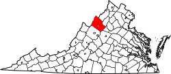
Timberville, Virginia

Last updated

Timberville, Virginia
2016-06-26 18 09 42 View south along Virginia State Route 42 (Main Street) at Rockingham Street in Timberville, Rockingham County, Virginia.jpg
Main Street in Timberville
Timberville in Rockingham County, VA.svg
Location of Timberville within Rockingham County
USA Virginia location map.svg
Red pog.svg
Timberville, Virginia
Location within the state of Virginia
Usa edcp location map.svg
Red pog.svg
Timberville, Virginia
Timberville, Virginia (the United States)
Coordinates: 38°38′3″N78°46′35″W / 38.63417°N 78.77639°W / 38.63417; -78.77639
CountryUnited States
State Virginia
County Rockingham
Incorporated1884
Government
  Type Council-manager government
   Town Manager Austin C. Garber II [1]
   Mayor Donald Delaughty
   Town Council [2]
Council Members
  • Clarence L. Fox (I)
  • Debra J. Jessup (I)
  • Sharon Jones (I)
  • Ned Overton (I)
  • Natalie Sherlock (I)
  • Carl Turner, Jr. (I)
Area
[3]
  Total1.35 sq mi (3.51 km2)
  Land1.34 sq mi (3.46 km2)
  Water0.02 sq mi (0.05 km2)
Elevation
[4]
1,020 ft (310 m)
Population
 (2010)
  Total2,522
  Estimate 
(2019) [5]
2,691
  Density2,014.22/sq mi (777.45/km2)
Time zone UTC−5 (Eastern (EST))
  Summer (DST) UTC−4 (EDT)
ZIP code
22853
Area code 540
FIPS code 51-78736 [6]
GNIS feature ID1500227 [4]
Website www.townoftimberville.com

Timberville is a town in Rockingham County, Virginia, United States. The population was 2,522 at the 2010 census, which was a significant increase from the 1,739 reported in the 2000 census. It is part of the Harrisonburg Metropolitan Statistical Area.

Contents

History

Prior to European colonization, the land upon which Timberville sits was inhabited by Indigenous peoples for thousands of years. The earliest white settlers of Timberville were mostly Pennsylvania Dutch who migrated to the Shenandoah Valley. [7]

Geography

Timberville is located at 38°38′3″N78°46′35″W / 38.63417°N 78.77639°W / 38.63417; -78.77639 (38.634273, 78.776422). [8]

According to the United States Census Bureau, the town has a total area of 0.9 square miles (2.3 km2), all of which is land.

View south along SR 42 in Timberville 2016-06-26 18 14 16 View south along Virginia State Route 42 (Main Street) at McCauley Avenue in Timberville, Rockingham County, Virginia.jpg
View south along SR 42 in Timberville

Transportation

The primary roads providing access to Timberville are Virginia State Route 42 and Virginia State Route 211. SR 42 heads north and south, connecting to Virginia State Route 259 in Broadway to the south. To the north, SR 42 heads mostly through rural areas of southwestern Shenandoah County. SR 211 heads east from Timberville, connecting to Interstate 81 and U.S. Route 211 in New Market.

Demographics

Historical population
CensusPop.Note
1880 112
1900 173
1910 24038.7%
1920 27715.4%
1930 3029.0%
1940 253−16.2%
1950 2717.1%
1960 41252.0%
1970 959132.8%
1980 1,51057.5%
1990 1,5965.7%
2000 1,7399.0%
2010 2,52245.0%
2019 (est.)2,691 [5] 6.7%
U.S. Decennial Census [9]

At the 2000 census 1,739 people, 735 households, and 465 families resided in the town. The population density was 1,968.1 per square mile (763.0/km2). There were 770 housing units at an average density of 871.5 per square mile (337.8/km2). The racial makeup of the town was 97.35% White, 0.17% African American, 0.12% Native American, 0.17% Asian, 1.21% from other races, and 0.98% from two or more races. Hispanic or Latino of any race were 4.31% of the population. 30% of Timberville's residents were German, 11% English, 8% Irish, 3% Mexican, and 2% Dutch. Scotch-Irish, Italians, Russians, Scottish, French, Swiss, Polish, French Canadians and Yugoslavs each constituted 1%. [6] [10]

Of the 735 households 27.5% had children under the age of 18 living with them, 47.8% were married couples living together, 12.0% had a female householder with no husband present, and 36.7% were non-families. 32.4% of households were one person and 17.6% were one person aged 65 or older. The average household size was 2.29 and the average family size was 2.89.

The age distribution was 22.0% under the age of 18, 7.2% from 18 to 24, 27.9% from 25 to 44, 21.6% from 45 to 64, and 21.3% 65 or older. The median age was 40 years. For every 100 females, there were 86.2 males. For every 100 females aged 18 and over, there were 78.0 males.

The median household income was $33,750 and the median family income was $41,417. Males had a median income of $27,230 versus $19,099 for females. The per capita income for the town was $16,450. About 7.2% of families and 10.9% of the population were below the poverty line, including 12.8% of those under age 18 and 17.7% of those age 65 or over.

Related Research Articles

<span class="mw-page-title-main">Waynesboro, Virginia</span> Independent city in Virginia, United States

Waynesboro is an independent city in the Commonwealth of Virginia. It is a principal city of the Staunton-Waynesboro Metropolitan Statistical Area. Waynesboro is located in the Shenandoah Valley and is surrounded by Augusta County. As of the 2020 census, the population was 22,196.

<span class="mw-page-title-main">Shenandoah County, Virginia</span> County in Virginia, United States

Shenandoah County is a county located in the Commonwealth of Virginia. As of the 2020 United States Census, the population was 44,186. Its county seat is Woodstock. It is part of the Shenandoah Valley region of Virginia.

<span class="mw-page-title-main">Page County, Virginia</span> County in Virginia, United States

Page County is located in the Commonwealth of Virginia. As of the 2020 census, the population was 23,709. Its county seat is Luray. Page County was formed in 1831 from Shenandoah and Rockingham counties and was named for John Page, Governor of Virginia from 1802 to 1805.

<span class="mw-page-title-main">Barker, Niagara County, New York</span> Village in New York, United States

Barker is a village in Niagara County, New York. The population was 533 at the time of the 2010 census. The mail ZIP code is 14012. It is part of the Buffalo–Niagara Falls Metropolitan Statistical Area.

<span class="mw-page-title-main">Crimora, Virginia</span> CDP in Virginia, United States

Crimora is a census-designated place (CDP) in Augusta County, Virginia, United States. The population was 2,209 at the 2010 census, a 23% increase from the 1,796 reported in 2000. It is part of the Staunton–Waynesboro Micropolitan Statistical Area.

<span class="mw-page-title-main">Dillwyn, Virginia</span> Town in Virginia, United States

Dillwyn is an incorporated town in Buckingham County, Virginia, in the United States. The population was 447 at the 2010 census.

<span class="mw-page-title-main">Middletown, Virginia</span> Town in Virginia, United States

Middletown is a town in Frederick County, Virginia, United States, in the northern Shenandoah Valley. The population was 1,265 at the 2010 census, up from 1,015 at the 2000 census.

<span class="mw-page-title-main">Stanardsville, Virginia</span> Town in Virginia, United States

Stanardsville is a town in Greene County, Virginia, United States. The population was 349 at the 2020 census, down from 367 at the 2010 census. It is the county seat of Greene County. The name is from Robert Stanard, a benefactor who donated land for public use. It is part of the Charlottesville, Virginia metropolitan area.

<span class="mw-page-title-main">Luray, Virginia</span> Town in the United States

Luray is the county seat of Page County, Virginia, United States, in the Shenandoah Valley in the northern part of the Commonwealth. The population was 4,895 at the 2010 census.

<span class="mw-page-title-main">Stanley, Virginia</span> Town in Virginia, United States

Stanley is a town in Page County, Virginia, United States. The population was 1,723 at the 2023 census.

<span class="mw-page-title-main">Broadway, Virginia</span> Town in Virginia, United States

Broadway is a town in Rockingham County, Virginia, United States. The population was 3,691 at the 2010 census. It is included in the Harrisonburg Metropolitan Statistical Area.

<span class="mw-page-title-main">Dayton, Virginia</span> Town in Virginia, United States

Dayton is a town in Rockingham County, Virginia, United States. The population is 1,530 as of the 2010 census. It is included in the Harrisonburg, Virginia Metropolitan Statistical Area.

<span class="mw-page-title-main">Elkton, Virginia</span> Town in Virginia, United States

Elkton is an incorporated town in Rockingham County, Virginia, United States. It is included in the Harrisonburg Metropolitan Statistical Area. The population was 2,762 at the 2010 census. Elkton was named for the Elk Run stream.

<span class="mw-page-title-main">Mount Crawford, Virginia</span> Town in Virginia, United States

Mount Crawford is a town in Rockingham County, Virginia, United States. It is included in the Harrisonburg Metropolitan Statistical Area, and the town's population was 433 at the 2010 census.

<span class="mw-page-title-main">Edinburg, Virginia</span> Town in Virginia, United States

Edinburg is a town in Shenandoah County, Virginia, United States. The population was 1,041 at the 2010 census.

<span class="mw-page-title-main">New Market, Virginia</span> Town in Virginia, United States

New Market is a town in Shenandoah County, Virginia, United States. Founded as a small crossroads trading town in the Shenandoah Valley, it has a population of 2,155 as of the most recent 2020 U.S. census. The north–south U.S. 11 and the east–west U.S. 211 pass near it and cross Massanutten Mountain at the town's titular gap.

<span class="mw-page-title-main">Strasburg, Virginia</span> Town in Virginia, United States

Strasburg is a town in Shenandoah County, Virginia, United States, which was founded in 1761 by Peter Stover. It is the largest town by population in the county and is known for its grassroots art culture, pottery, antiques, and American Civil War history. The population was 7,083 at the 2020 census.

<span class="mw-page-title-main">Toms Brook, Virginia</span> Town in Virginia, United States

Toms Brook is a town in Shenandoah County, Virginia, United States. The population was 258 at the 2010 census.

<span class="mw-page-title-main">Wardensville, West Virginia</span> Town in West Virginia, United States

Wardensville is a town in Hardy County, West Virginia, United States. The population was 265 at the 2020 census. Originally named Trout Run, Wardensville was chartered in Virginia in 1832 and incorporated in West Virginia in 1879. Wardensville is located west of the Great North Mountain range, which separates it from the Shenandoah Valley. The town lies on the east bank of the Cacapon River at its confluence with Trout Run. The George Washington and Jefferson National Forests border the town to its east and south.

<span class="mw-page-title-main">Grottoes, Virginia</span> Town in Virginia, United States

Grottoes is an incorporated town in Augusta and Rockingham counties in the U.S. state of Virginia. The population was 2,668 at the 2010 census.

References

  1. "Timberville Town Office". www.townoftimberville.com. Retrieved April 28, 2022.
  2. "Timberville Town Council". www.townoftimberville.com. Retrieved April 28, 2022.
  3. "2019 U.S. Gazetteer Files". United States Census Bureau. Retrieved August 7, 2020.
  4. 1 2 U.S. Geological Survey Geographic Names Information System: Timberville, Virginia
  5. 1 2 "Population and Housing Unit Estimates". United States Census Bureau. May 24, 2020. Retrieved May 27, 2020.
  6. 1 2 "U.S. Census website". United States Census Bureau . Retrieved January 31, 2008.
  7. "TOWN OF TIMBERVILLE and TIMBERVILLE GROWTH AREA COMPREHENSIVE PLAN" (PDF). Town of Timberville. Retrieved May 25, 2019.
  8. "US Gazetteer files: 2010, 2000, and 1990". United States Census Bureau. February 12, 2011. Retrieved April 23, 2011.
  9. "Census of Population and Housing". Census.gov. Retrieved June 4, 2015.
  10. "Timberville, VA, Ancestry & Family History". Epodunk.com. Retrieved April 20, 2015.