Port Republic, Virginia

Last updated

Port Republic
Census-designated place
Port Republic CDP in Rockingham County, VA.svg
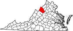
Location of the Port Republic CDP within Rockingham County
USA Virginia location map.svg
Red pog.svg
Port Republic
Location in Virginia
Usa edcp location map.svg
Red pog.svg
Port Republic
Port Republic (the United States)
Coordinates: 38°17′21″N78°48′48″W / 38.28917°N 78.81333°W / 38.28917; -78.81333
CountryFlag of the United States.svg  United States
State Virginia
County Rockingham County
Population
 (1832)
  Total160
FIPS code 51-63896
GNIS feature ID 2807441

Port Republic is a census-designated place in Rockingham County, Virginia, United States. The Battle of Port Republic occurred there in the American Civil War.

History

Port Republic was chartered as a town in 1802, at the confluence of the South River and the North River, which join to form the South Fork of the Shenandoah River. This point was the head of navigation on this branch of the Shenandoah, [1] and influenced the town's commercial and strategic importance. [2]

By 1832 the town had a population of 160 people. Many mills were built there, the first one in 1745, because of the availability of water power, and the proximity to water transportation to the northern Shenandoah Valley and the Potomac River. [3] The Battle of Port Republic in June 1862 during Stonewall Jackson's Shenandoah Valley Campaign in the American Civil War centered on Port Republic.

After the Civil War, Port Republic remained a locus of commerce and industry, with two iron foundries in operation by 1866. [3] Artifacts and documents of the town's founding and history are preserved at a museum in the town. [4]

Bogota, Haugh House, and Port Republic Historic District are listed on the National Register of Historic Places. [5]

James Madison, the first bishop of the Diocese of Virginia of The Episcopal Church in the United States, was born in Port Republic in 1749. Not to be confused with his cousin (also named), James Madison, who became the 4th President of the United States.

Related Research Articles

<span class="mw-page-title-main">Shenandoah County, Virginia</span> County in Virginia, United States

Shenandoah County is a county located in the Commonwealth of Virginia. As of the 2020 United States Census, the population was 44,186. Its county seat is Woodstock. It is part of the Shenandoah Valley region of Virginia.

<span class="mw-page-title-main">Rockingham County, Virginia</span> County in Virginia, United States

Rockingham County is a county located in the U.S. state of Virginia. As of the 2020 census, the population was 83,757. Its county seat is the independent city of Harrisonburg.

<span class="mw-page-title-main">Harrisonburg, Virginia</span> Independent city in Virginia, United States

Harrisonburg is an independent city in the Shenandoah Valley region of the Commonwealth of Virginia in the United States. It is also the county seat of the surrounding Rockingham County, although the two are separate jurisdictions. At the 2020 census, the population was 51,814. The Bureau of Economic Analysis combines the city of Harrisonburg with Rockingham County for statistical purposes into the Harrisonburg, Virginia Metropolitan Statistical Area, which had an estimated population of 126,562 in 2011.

<span class="mw-page-title-main">Elkton, Virginia</span> Town in Virginia, United States

Elkton is an incorporated town in Rockingham County, Virginia, United States. It is included in the Harrisonburg Metropolitan Statistical Area. The population was 2,762 at the 2010 census. Elkton was named for the Elk Run stream.

<span class="mw-page-title-main">Mount Jackson, Virginia</span> Town in Virginia, United States

Mount Jackson is a town in Shenandoah County, Virginia, United States. The population was 1,994 at the 2010 census.

<span class="mw-page-title-main">New Market, Virginia</span> Town in Virginia, United States

New Market is a town in Shenandoah County, Virginia, United States. Founded as a small crossroads trading town in the Shenandoah Valley, it has a population of 2,146 as of the most recent 2010 U.S. census. The north–south U.S. 11 and the east–west U.S. 211 pass near it and cross Massanutten Mountain at the town's titular gap.

<span class="mw-page-title-main">Woodstock, Virginia</span> Town in Virginia, United States

Woodstock is a town and the county seat of Shenandoah County, Virginia, United States. It has a population of 5,212 according to the 2017 census. Woodstock comprises 3.2 square miles of incorporated area of the town, and is located along the "Seven Bends" of the north fork of the Shenandoah River. While some tourism references list Woodstock as the fourth oldest town in Virginia, the area was sparsely settled and perhaps platted in 1752 or shortly thereafter, but the town was actually established by charter in 1761. While there are a number of Virginia towns closer to the eastern seaboard that claim earlier founding dates, Woodstock was one of the first towns west of the Blue Ridge.

<span class="mw-page-title-main">Front Royal, Virginia</span> Town in Virginia, United States

Front Royal is the only incorporated town in Warren County, Virginia, United States. The population was 15,011 at the 2020 census. It is the county seat of Warren County.

<span class="mw-page-title-main">Shenandoah Valley</span> Region of Virginia and West Virginia

The Shenandoah Valley is a geographic valley and cultural region of western Virginia and the Eastern Panhandle of West Virginia in the United States. The valley is bounded to the east by the Blue Ridge Mountains, to the west by the eastern front of the Ridge-and-Valley Appalachians, to the north by the Potomac River and to the south by the James River. The cultural region covers a larger area that includes all of the valley plus the Virginia highlands to the west, and the Roanoke Valley to the south. It is physiographically located within the Ridge and Valley province and is a portion of the Great Appalachian Valley.

<span class="mw-page-title-main">John T. Harris</span> American politician (1823–1899)

John Thomas Harris was a nineteenth-century politician, lawyer and judge from Virginia. He was often referred to after the American Civil War as "Judge Harris", even after his election to Congress. He was the first cousin of John Hill.

<span class="mw-page-title-main">McGaheysville, Virginia</span> Census-designated place in Virginia, United States

McGaheysville is a Census-designated place located in Rockingham County, in the U.S. state of Virginia. It is located along U.S. Route 33 between Penn Laird and Elkton, and sits at the base of the Massanutten.

Jacob Yost was an American politician who served as mayor of Staunton, as well as twice represented Virginia's Shenandoah Valley in the United States House of Representatives, from 1887–1889 and 1897–1899.

<span class="mw-page-title-main">Edward Tiffin Harrison Warren</span>

Edward Tiffin Harrison Warren was a military colonel who commanded a Virginia infantry regiment in the Army of Northern Virginia during the American Civil War. He was killed in the Battle of the Wilderness on May 5, 1864.

<span class="mw-page-title-main">Adam Miller (pioneer)</span> First permanent white settler in the Shenandoah Valley

With residency beginning in 1727, Adam Miller (Mueller) is recognized as the first permanent white settler in the Shenandoah Valley of Virginia, US. Born in 1703 in Schriesheim, Germany, Miller immigrated to America as a young married man, settling in Lancaster County, PA in 1724.

<span class="mw-page-title-main">Cootes Store, Virginia</span> Unincorporated community in Virginia, United States

Cootes Store is an unincorporated community in Rockingham County, Virginia, United States. Located in the Shenandoah Valley, it is situated north of Harrisonburg, south of Bergton, and west of Timberville. The border with West Virginia is nearby, as is the edge of George Washington National Forest. Cootes Store is within a gorge where the North Fork Shenandoah River breaks, at the crossroads of Route 613 and Route 259.

<span class="mw-page-title-main">Linville, Virginia</span> Census-designated place in Virginia, United States

Linville is a Census-designated place located in Rockingham County, in the U.S. state of Virginia. It is located 6 miles north of Harrisonburg, Virginia. It is for the first time listed as CDP for the United States Census 2020. It contains the Linville United Church of Christ.

<span class="mw-page-title-main">New Erection, Virginia</span> Unincorporated community in Virginia, United States

New Erection is an unincorporated community located in Rockingham County, in the U.S. state of Virginia.

Jacob Nicholas Liggett was a Virginia lawyer, Confederate officer, farmer and politician from Virginia.

<span class="mw-page-title-main">Lowry's Artillery</span> Confederate States army unit

Lowry's Artillery, also known as the Centerville Rifles, was a unit of the Confederate States Army, and was organized by Dr. William M. Lowry in Monroe County, Virginia, with approximately 100 men. They were officially mustered into Confederate service on June 8, 1861. Dr. Lowry was elected captain, with George Beirne Chapman as 1st Lt., William V. Young as 2nd Lt., Charles Dunlap as 3rd Lt., John H. Pence as orderly sergeant, A.J. Keadle, 1st. Sgt., J.P. Shanklin, 2nd Sgt., and J.C. Woodson, 3rd Sgt. By the end of the war the unit had enrolled 219 men.

<span class="mw-page-title-main">Shenandoah Germans</span>

The Shenandoah Valley region of Virginia and parts of West Virginia is home to a long-established German-American community dating back to the 17th century. The earliest German settlers to Shenandoah, sometimes known as the Shenandoah Deitsch or the Valley Dutch, were Pennsylvania Dutch migrants who arrived from southeastern Pennsylvania. These German settlers travelled southward along the Great Wagon Road. The Pennsylvania Dutch are the descendants of German, Swiss, and Alsatian Protestants who began settling in Pennsylvania during the 1600s. These German refugees had fled the Rhineland-Palatinate region of southwestern Germany due to religious and political persecution during repeated invasions by French troops. From the colonial period to the early 1900s, people of Germanic heritage formed the social and economic backbone of the Shenandoah Valley. The majority of German settlers in the valley belonged to Anabaptist denominations such as the Mennonites, the Dunkers, and others. Smaller numbers were German Catholics or German Jews. The earliest European settlers of the Shenandoah Valley were the Germans, who mostly settled in the northern portions of the valley, and the Scotch-Irish who mostly settled in the southern portions of the valley. The German language was commonly spoken in Shenandoah until World War I when anti-German sentiment resulted in many German-Americans abandoning their language and customs in order to assimilate into the cultural mainstream.

References

  1. Wayland, J.W. (1912). A History of Rockingham County, Virginia. Ruebush-Elkins Company. p. 421. Retrieved January 12, 2015.
  2. "JMU Public History: Port Republic Study". Archived from the original on September 28, 2004. Retrieved January 12, 2015.
  3. 1 2 Wayland, J.W. (1912). A History of Rockingham County, Virginia. Ruebush-Elkins Company. p. 422. Retrieved January 12, 2015.
  4. "Port Republic Museum | Hours/Directions". portrepublicmuseum.org. Retrieved January 12, 2015.
  5. "National Register Information System". National Register of Historic Places . National Park Service. July 9, 2010.