New Erection, Virginia

Last updated

New Erection
New Erection Virginia 02.jpg
USA Virginia location map.svg
Red pog.svg
New Erection
Location in Virginia
Usa edcp location map.svg
Red pog.svg
New Erection
New Erection (the United States)
Coordinates: 38°28′25″N78°55′39″W / 38.47361°N 78.92750°W / 38.47361; -78.92750
Country United States
State Virginia
County Rockingham County
Elevation
[1]
1,398 ft (426 m)
GNIS feature ID1779334 [1]

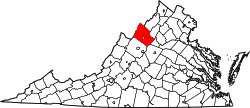
New Erection is an unincorporated community located in Rockingham County, in the U.S. state of Virginia.

The community took its name from a Presbyterian church called "New Erection" because it was re-erected there, having previously been erected in Dayton. [2]

Related Research Articles

<span class="mw-page-title-main">Rockingham County, Virginia</span> County in Virginia, United States

Rockingham County is a county located in the U.S. state of Virginia. As of the 2020 census, the population was 83,757. Its county seat is the independent city of Harrisonburg.

<span class="mw-page-title-main">Rockingham County, North Carolina</span> County in North Carolina, United States

Rockingham County is a county located in the U.S. state of North Carolina. As of the 2020 census, the population was 91,096. Its county seat is Wentworth. The county is known as "North Carolina's North Star."

<span class="mw-page-title-main">Rockingham County, New Hampshire</span> County in New Hampshire, United States

Rockingham County is a county in the U.S. state of New Hampshire. As of the 2020 census, the population was 314,176, making it New Hampshire's second-most populous county. The county seat is Brentwood. Rockingham County is part of the Boston-Cambridge-Newton, MA-NH Metropolitan Statistical Area and the greater Boston-Worcester-Providence, MA-RI-NH-CT Combined Statistical Area. Per the 2020 census, it was New Hampshire's fastest growing county from 2010 to 2020.

<span class="mw-page-title-main">Rockingham, North Carolina</span> City in North Carolina, United States

Rockingham is a city in Richmond County, North Carolina, United States, named after the Marquess of Rockingham. The population was 9,558 at the 2010 census. It is the county seat of Richmond County.

<span class="mw-page-title-main">Dayton, Virginia</span> Town in Virginia, United States

Dayton is a town in Rockingham County, Virginia, United States. The population is 1,530 as of the 2010 census. It is included in the Harrisonburg, Virginia Metropolitan Statistical Area.

<span class="mw-page-title-main">Elkton, Virginia</span> Town in Virginia, United States

Elkton is an incorporated town in Rockingham County, Virginia, United States. It is included in the Harrisonburg Metropolitan Statistical Area. The population was 2,762 at the 2010 census. Elkton was named for the Elk Run stream.

<span class="mw-page-title-main">Shenandoah Valley</span> Region of Virginia and West Virginia

The Shenandoah Valley is a geographic valley and cultural region of western Virginia and the Eastern Panhandle of West Virginia in the United States. The valley is bounded to the east by the Blue Ridge Mountains, to the west by the eastern front of the Ridge-and-Valley Appalachians, to the north by the Potomac River and to the south by the James River. The cultural region covers a larger area that includes all of the valley plus the Virginia highlands to the west, and the Roanoke Valley to the south. It is physiographically located within the Ridge and Valley province and is a portion of the Great Appalachian Valley.

<span class="mw-page-title-main">Dan River</span> River in the U.S. states of North Carolina and Virginia

The Dan River flows 214 miles (344 km) in the U.S. states of North Carolina and Virginia. It rises in Patrick County, Virginia, and crosses the state border into Stokes County, North Carolina. It then flows into Rockingham County. From there it flows back into Virginia through Pittsylvania County before reentering North Carolina near the border between Caswell County and Rockingham County. It flows into northern Caswell County and then back into southern Virginia and finally into Kerr Reservoir on the Roanoke River.

<span class="mw-page-title-main">John F. Lewis</span> American politician

John Francis Lewis was an American planter and politician from Rockingham County, Virginia. He represented Rockingham County as a Whig during the Virginia Secession Convention of 1861 and refused to sign the final document, and twice served as Lieutenant Governor of Virginia following the American Civil War and represented Virginia as a Republican in the United States Senate during the Reconstruction period after the Civil War.

<span class="mw-page-title-main">U.S. Route 33 in Virginia</span> Section of US highway in Virginia

U.S. Route 33 is a part of the U.S. Highway System that runs from Elkhart, Indiana to Richmond, Virginia. In Virginia, the U.S. Highway runs 135.60 miles (218.23 km) from the West Virginia state line near Rawley Springs east to its eastern terminus at SR 33 in Richmond. US 33 is the primary east–west highway of Rockingham County, which lies in the Shenandoah Valley. The highway connects the independent city of Harrisonburg, the town of Elkton, and an entrance to Shenandoah National Park. East of the Blue Ridge Mountains, US 33 connects the Piedmont communities of Stanardsville, Gordonsville, and Louisa. The U.S. Highway is a major suburban and urban route in the Richmond metropolitan area. Within Richmond, US 33 runs concurrently with US 250. SR 33 continues from US 33's eastern terminus as a state-numbered extension of the U.S. Highway that connects Richmond with Virginia's Middle Peninsula.

<span class="mw-page-title-main">Virginia State Route 257</span>

State Route 257 is a primary state highway in the U.S. state of Virginia. The state highway runs 18.04 miles (29.03 km) from SR 902 and SR 924 near Briery Branch east to Interstate 81 (I-81) near Mount Crawford. SR 257 connects I-81 and U.S. Route 11 with Bridgewater and Dayton, between which the highway runs concurrently with SR 42. The state highway also provides access to Bridgewater College and connects Dayton with the western Rockingham County communities of Briery Branch, Ottobine and Montezuma.

<span class="mw-page-title-main">U.S. Route 1 in North Carolina</span>

U.S. Highway 1 (US 1) is a north–south United States Numbered Highway which runs along the East Coast of the U.S. between Key West, Florida, and the U.S.–Canada border near Fort Kent, Maine. In North Carolina, US 1 runs for 174.1 miles (280.2 km) across the central region of the state. The highway enters North Carolina from South Carolina, southwest of Rockingham. US 1 runs northeast, passing through or closely bypassing Southern Pines and Sanford in the Sandhills region. It next passes through Cary, the state capital of Raleigh, and Wake Forest. The highway continues north to Henderson, before leaving the state at the Virginia state line, near Wise. The route is mostly a multilane divided arterial road, with several freeway segments. It serves as a strategic highway, connecting the North Carolina Sandhills and Research Triangle regions northward to the Southside region.

<span class="mw-page-title-main">U.S. Route 220 in North Carolina</span> Highway in North Carolina

U.S. Route 220 is a north–south U.S. highway which travels from Rockingham, North Carolina, to South Waverly, Pennsylvania. In the U.S. state of North Carolina, US 220 travels 123.4 miles (198.6 km) from an intersection with US 1 in Rockingham to the Virginia state line near Price, North Carolina. The highway is an important north–south route in Central North Carolina, connecting Rockingham, Asheboro, Greensboro, and Summerfield. US 220 runs concurrently with Interstate 73 from north of Rockingham to Greensboro, and from Summerfield to Stokesdale; while US 220 runs concurrently with I-74 from Rockingham to Randleman.

For the other town in Virginia named Inglewood, see Inglewood, Rockingham County, Virginia.

Mechanicsville is an unincorporated community in Rockingham County, Virginia, United States. Mechanicsville is 2 miles (3.2 km) north-northwest of Timberville.

Dale Enterprise is an unincorporated community in Rockingham County, Virginia, United States. The name dates to 1872, when it was time to name the village's post office. The place was previously known as Millersville, after the Miller family who ran an early store there. After the Civil War, Mr. J. W. Minnick started a new mercantile “enterprise” at the crossroads of Silver Lake Road and Route 33. Minnick’s store was located near a “dale,” so the chosen name became Dale Enterprise.

Edom is an unincorporated community located in Rockingham County, in the U.S. state of Virginia. It is located along State Route 42 at the crossroads with State Route 721, north of Harrisonburg and southeast of Singers Glen. Linville Creek flows through the village.

Rockingham is an unincorporated community in eastern Ray County, in the U.S. state of Missouri and part of the Kansas City metropolitan area.

<span class="mw-page-title-main">J. J. Webster</span> American politician, farmer, and businessman

James Jefferson Webster Sr. was an American businessman, farmer, and politician. He owned a dairy and tobacco farm, tobacco warehouses, a general store, and co-ran a car dealership in Rockingham County, North Carolina. A Democrat, Webster served as a Rockingham County commissioner for ten years. As a county commissioner, he played a role in the development of North Carolina Highway 135, which was posthumously named after him, and worked on the gubernatorial campaign of W. Kerr Scott.

References

  1. 1 2 U.S. Geological Survey Geographic Names Information System: New Erection, Virginia
  2. Wayland, John Walter (1912). A History of Rockingham County, Virginia. Ruebush-Elkins Company. p.  267.