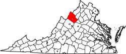
Lilly is an unincorporated community located in Rockingham County, in the U.S. state of Virginia. It is located west of Harrisonburg, Virginia along Route 613, northeast of Clover Hill, near the edge of the George Washington National Forest. [1]
Rockingham County is a county located in the U.S. state of Virginia. As of the 2010 census, the population was 76,314. Its county seat is the independent city of Harrisonburg.
In the United States, a state is a constituent political entity, of which there are currently 50. Bound together in a political union, each state holds governmental jurisdiction over a separate and defined geographic territory and shares its sovereignty with the federal government. Due to this shared sovereignty, Americans are citizens both of the federal republic and of the state in which they reside. State citizenship and residency are flexible, and no government approval is required to move between states, except for persons restricted by certain types of court orders. Four states use the term commonwealth rather than state in their full official names.
Virginia, officially the Commonwealth of Virginia, is a state in the Southeastern and Mid-Atlantic regions of the United States located between the Atlantic Coast and the Appalachian Mountains. Virginia is nicknamed the "Old Dominion" due to its status as the first English colonial possession established in mainland North America and "Mother of Presidents" because eight U.S. presidents were born there, more than any other state. The geography and climate of the Commonwealth are shaped by the Blue Ridge Mountains and the Chesapeake Bay, which provide habitat for much of its flora and fauna. The capital of the Commonwealth is Richmond; Virginia Beach is the most populous city, and Fairfax County is the most populous political subdivision. The Commonwealth's estimated population as of 2018 is over 8.5 million.
Castleman Run Lake Wildlife Management Area is located on 486 acres (197 ha) near in Brooke and Ohio counties near Bethany, West Virginia. The moderate slopes are covered with mixed hardwoods, brushy vegetation, and open fields. The WMA is located about 3 miles south of Bethany on Castleman Run Road.
Doveville is an unincorporated community in Fairfax County, in the U.S. state of Virginia. It lies along Virginia State Highway 236, west of Annandale, east of the independent city of Fairfax and southwest of Merrifield. Immediately to the south is Rutherford and immediately to the north is Mantua. Numerous parks are located nearby, including Long Branch Stream Valley Park to the south, Daniels Run Park to the west and Woodburn Road Park and Accotink Stream Valley Park to the northeast.
Bolar is an unincorporated community in Bath County and Highland County, Virginia, United States. The community is located approximately 14.5 miles (23.3 km) southwest of Monterey, Virginia and 13.4 miles (21.6 km) northeast of Warm Springs, Virginia. Bolar is situated along Bolar Run on Big Valley Road, which roughly follows the county line through the community.
Keezletown is an unincorporated community located in Rockingham County, in the U.S. state of Virginia. It is located northeast of Harrisonburg.
Criders is an unincorporated community located in Rockingham County, in the U.S. state of Virginia. It is located in George Washington National Forest, west of Bergton near the state border with West Virginia.
Cross Keys is an unincorporated community located in Rockingham County, in the U.S. state of Virginia. It is located on State Route 276 south of Harrisonburg.
Hinton is an unincorporated community located in Rockingham County, in the U.S. state of Virginia. It is located northwest of Harrisonburg along U.S. Route 33 and Route 752 near the edge of George Washington National Forest.
Mauzy is an unincorporated community located in Rockingham County, in the U.S. state of Virginia. It is located south of Timberville, just north of Lacey Spring along Route 259, just off Interstate 81.
Mount Clinton is an unincorporated community located in Rockingham County, in the U.S. state of Virginia. It is located northeast of Clover Hill. There are several Mennonite churches in the vicinity, one of which is located along the access road to the west. It is two miles north of Hinton.
Rawley Springs is an unincorporated community located in Rockingham County, in the U.S. state of Virginia. It is located nine miles west of Harrisonburg, north of Clover Hill, along U.S. Route 33, near the George Washington National Forest. It lies on the Dry River and is situated on the southern slope of the North Mountain.
Stemphleytown is an unincorporated community located in Rockingham County, in the U.S. state of Virginia. It is located two miles west of Dayton, along Virginia State Route 257.
Turleytown is an unincorporated community located in Rockingham County, in the U.S. state of Virginia. It is located west of Broadway, along State Route 613. It is believed to be named after Giles Turley who visited it in 1804.
Yankeetown is an unincorporated community located in Rockingham County, in the U.S. state of Virginia. It is located just northwest of Fulks Run in George Washington National Forest, along Virginia State Route 259.
Fort Mitchell is an unincorporated community in Lunenburg County, Virginia.
West Augusta is an unincorporated community in Augusta County, Virginia, United States. West Augusta is located at the intersection of U.S. Route 250 and Virginia State Route 629. The source of the Calfpasture River, which flows through West Augusta, is located near the community to the north.
Liberty is an unincorporated community in Highland County, Virginia, United States. Liberty is located 10.7 miles (17.2 km) southeast of Monterey, Virginia. The community is located in the Cowpasture River valley at the confluence of the Cowpasture River and Shaws Fork.
Mustoe is an unincorporated community in Highland County, Virginia, United States. Mustoe is located 6.9 miles (11.1 km) south-southwest of Monterey, Virginia. The community is situated along U.S. Route 220 on the banks of the Jackson River. According to the National Weather Service, the only tornado on record in Highland County occurred near Mustoe in 1959.
Jahnke is a neighborhood in Richmond, Virginia located in the Southside region of the city. The neighborhood is largely suburban, but lies within the city limits. The zip code for the neighborhood is 23225. Jahnke is named after Jahnke Road which is the main road through the neighborhood. The heart of Jahnke is at the intersection of Jahnke Road and German School Road.
Pleasant Valley is an unincorporated community in Rockingham County, Virginia, United States. Pleasant Valley is located 4.7 miles (7.6 km) south-southeast of Harrisonburg, Virginia.
This Rockingham County, Virginia state location article is a stub. You can help Wikipedia by expanding it. |