Criders, Virginia

Last updated

Criders
USA Virginia location map.svg
Red pog.svg
Criders
Location in Virginia
Usa edcp location map.svg
Red pog.svg
Criders
Criders (the United States)
Coordinates: 38°45′14″N79°1′21″W / 38.75389°N 79.02250°W / 38.75389; -79.02250
CountryFlag of the United States.svg  United States
State Virginia
County Rockingham County
Elevation
491 m (1,612 ft)

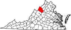
Criders is an unincorporated community located in Rockingham County, in the U.S. state of Virginia. It is located in George Washington National Forest, west of Bergton near the state border with West Virginia. [1]

Related Research Articles

<span class="mw-page-title-main">West Virginia Route 12</span>

West Virginia Route 12 is a north–south route located in the southern portion of the U.S. state of West Virginia. The southern terminus of the route is at U.S. Route 219 in Peterstown, Monroe County, less than 300 yards (270 m) from the Virginia state line. It compromises a portion of the Farm Heritage Road byway between Peterstown and West Virginia Route 122. The northern terminus of the route is at U.S. Route 60 in Alta, Greenbrier County, near Interstate 64 exit 161.

<span class="mw-page-title-main">West Virginia Route 69</span>

West Virginia Route 69 is a north–south state highway located within Wetzel County, West Virginia. The southern terminus of the route is at U.S. Route 250 in Hundred. The northern terminus is at the Pennsylvania state line three miles (5 km) north of Hundred, where WV 69 continues northward as Pennsylvania Route 18.

<span class="mw-page-title-main">West Virginia Route 971</span>

West Virginia Route 971 is a 9.9-mile (15.9 km) north–south state highway in Wyoming County, West Virginia. The route runs from West Virginia Route 97 in Baileysville north to West Virginia Route 10 in Oceana. It runs through mountainous, rural terrain, connecting Baileysville and Oceana to the communities of Clear Fork, Lillydale, and Lillyhaven. WV 971 has been the highest numbered state highway in West Virginia since July 2017, when WV 972 was decommissioned and absorbed by WV 93.

<span class="mw-page-title-main">West Virginia Route 161</span> State highway in West Virginia, United States

West Virginia Route 161 is a north–south state highway located entirely within McDowell County, West Virginia. The southern terminus of the route is at West Virginia Route 16 in Bishop less than 900 feet (270 m) from the Virginia state line. The northern terminus is at U.S. Route 52 in Elkhorn.

<span class="mw-page-title-main">Route 311 (Virginia–West Virginia)</span>

Virginia State Route 311 and West Virginia Route 311 are adjoining state highways in the U.S. states of Virginia and West Virginia. The two state highways together run 58.7 miles (94.5 km) from U.S. Route 11 in Salem, Virginia north to Interstate 64 and U.S. Route 60 near White Sulphur Springs, West Virginia. The two Virginia portions of Route 311 are maintained by the Virginia Department of Transportation, with the exception of the city-maintained portion within Salem. The West Virginia segments are maintained by the West Virginia Division of Highways.

<span class="mw-page-title-main">Holly River State Park</span> State Park in Webster County, West Virginia

Holly River State Park is a state park located in Webster County, West Virginia. Situated on the Left Fork of the Holly River near the town of Hacker Valley, it is the second largest park in the West Virginia state park system with a total of 8,294 acres (3,356 ha). The park features over 42 miles (68 km) of hiking trails, ten vacation cabins, an 88-unit campground, and many recreation and picnic areas.

<span class="mw-page-title-main">Burches Run Wildlife Management Area</span> State Wildlife Management Area in Marshall County, West Virginia

Burches Run Wildlife Management Area, formerly Burches Run Lake WMA, is located on 55 acres (22 ha) near Wheeling in Marshall County, West Virginia. Until 2005 the wildlife management area contained a lake impounded by a dam at risk of failure. The name change occurred after the dam was removed. The terrain climbs gently above Burches Run and is covered by a mature oak-hickory second-growth forest.

Doveville is an unincorporated community in Fairfax County, in the U.S. state of Virginia. It lies along Virginia State Highway 236, west of Annandale, east of the independent city of Fairfax and southwest of Merrifield. Immediately to the south is Rutherford and immediately to the north is Mantua. Numerous parks are located nearby, including Long Branch Stream Valley Park to the south, Daniels Run Park to the west and Woodburn Road Park and Accotink Stream Valley Park to the northeast.

Bergton, formerly Dovesville, is an unincorporated community located in Rockingham County, in the U.S. state of Virginia. It is located in George Washington National Forest, northwest of Timberville and adjacent to Criders near the state border with West Virginia. Bergton is probably best known for its annual community fair.

<span class="mw-page-title-main">Briery Branch, Virginia</span> Unincorporated community in Virginia, United States

Briery Branch is an unincorporated community located in Rockingham County, in the U.S. state of Virginia. It is located west of Ottobine and its trail leads into the George Washington National Forest.

Lilly is an unincorporated community located in Rockingham County, in the U.S. state of Virginia. It is located west of Harrisonburg, Virginia along Route 613, northeast of Clover Hill, near the edge of the George Washington National Forest.

Mount Clinton is an unincorporated community located in Rockingham County, in the U.S. state of Virginia. It is located northeast of Clover Hill. There are several Mennonite churches in the vicinity, one of which is located along the access road to the west. It is two miles north of Hinton.

<span class="mw-page-title-main">Rawley Springs, Virginia</span> Unincorporated community in Virginia, United States

Rawley Springs is an unincorporated community located in Rockingham County, in the U.S. state of Virginia.

Stemphleytown is an unincorporated community located in Rockingham County, in the U.S. state of Virginia.

Turleytown is an unincorporated community located in Rockingham County, in the U.S. state of Virginia.

<span class="mw-page-title-main">Special routes of U.S. Route 19</span>

Several special routes of U.S. Route 19 (US 19) exist. In order from south to north, they are as follows.

<span class="mw-page-title-main">Route 102 (Virginia–West Virginia)</span>

Virginia State Route 102 and West Virginia Route 102 are adjoining state highways in the U.S. states of Virginia and West Virginia. The two state highways together run 11.4 miles (18.3 km) from Center Street in Pocahontas, Virginia east to the Virginia – West Virginia state line between the twin cities of Bluefield, Virginia and Bluefield, West Virginia. Most of Route 102 consists of three sections in Virginia maintained by the Virginia Department of Transportation (VDOT); the two intervening sections in West Virginia are maintained by the West Virginia Division of Highways. In addition to connecting Pocahontas with the two Bluefields, the state highway passes through Nemours, West Virginia and Falls Mills, Virginia and provides access to Bluefield College.

<span class="mw-page-title-main">West Augusta, Virginia</span> Unincorporated community in Virginia, United States

West Augusta is an unincorporated community in Augusta County, Virginia, United States. West Augusta is located at the intersection of U.S. Route 250 and Virginia State Route 629. The source of the Calfpasture River, which flows through West Augusta, is located near the community to the north.

<span class="mw-page-title-main">Laurel Fork (North Fork South Branch Potomac River tributary)</span> River in West Virginia, United States

The Laurel Fork is a 15.7-mile-long (25.3 km) stream in Virginia and West Virginia, United States. The stream flows north from Highland County, Virginia, where its source and the majority of its length is located, to its mouth in Pendleton County, West Virginia. Laurel Fork is a tributary to the North Fork South Branch Potomac River, making it a part of the Potomac River watershed. The area surrounding Laurel Fork is home to several plant and animal species found nowhere else in Virginia, and is a prime example of a northern boreal forest in the state.

References

  1. Google Maps (Map). Google.