Hinton, Virginia

Last updated
Hinton
Unincorporated community
USA Virginia location map.svg
Red pog.svg
Hinton
Location in Virginia
Usa edcp location map.svg
Red pog.svg
Hinton
Hinton (the US)
Coordinates: 38°27′57″N78°58′21″W / 38.46583°N 78.97250°W / 38.46583; -78.97250 Coordinates: 38°27′57″N78°58′21″W / 38.46583°N 78.97250°W / 38.46583; -78.97250
Country Flag of the United States.svg  United States
State Virginia
County Rockingham County

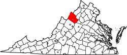
Hinton is an unincorporated community located in Rockingham County, in the U.S. state of Virginia. It is located northwest of Harrisonburg along U.S. Route 33 and Route 752 near the edge of George Washington National Forest. [1]

Rockingham County, Virginia County in the United States

Rockingham County is a county located in the U.S. state of Virginia. As of the 2010 census, the population was 76,314. Its county seat is the independent city of Harrisonburg.

U.S. state constituent political entity of the United States

In the United States, a state is a constituent political entity, of which there are currently 50. Bound together in a political union, each state holds governmental jurisdiction over a separate and defined geographic territory and shares its sovereignty with the federal government. Due to this shared sovereignty, Americans are citizens both of the federal republic and of the state in which they reside. State citizenship and residency are flexible, and no government approval is required to move between states, except for persons restricted by certain types of court orders. Four states use the term commonwealth rather than state in their full official names.

Virginia State of the United States of America

Virginia, officially the Commonwealth of Virginia, is a state in the Southeastern and Mid-Atlantic regions of the United States located between the Atlantic Coast and the Appalachian Mountains. Virginia is nicknamed the "Old Dominion" due to its status as the first English colonial possession established in mainland North America and "Mother of Presidents" because eight U.S. presidents were born there, more than any other state. The geography and climate of the Commonwealth are shaped by the Blue Ridge Mountains and the Chesapeake Bay, which provide habitat for much of its flora and fauna. The capital of the Commonwealth is Richmond; Virginia Beach is the most populous city, and Fairfax County is the most populous political subdivision. The Commonwealth's estimated population as of 2018 is over 8.5 million.

Climate

The climate in this area is characterized by hot, humid summers and generally mild to cool winters. According to the Köppen Climate Classification system, Hinton has a humid subtropical climate, abbreviated "Cfa" on climate maps. [2]

Humid subtropical climate category in the Köppen climate classification system

A humid subtropical climate is a zone of climate characterized by hot and humid summers, and mild winters. These climates normally lie on the southeast side of all continents, generally between latitudes 25° and 40° and are located poleward from adjacent tropical climates. While many subtropical climates tend to be located at or near coastal locations, in some cases they extend inland, most notably in China and the United States, where they exhibit more pronounced seasonal variations and sharper contrasts between summer and winter, as part of a gradient between the more tropical climates of the southern coasts of these countries and the more continental climates of China and the United States’ northern and central regions.

Related Research Articles

Monroe, Virginia Unincorporated community in Virginia, United States

Monroe is an unincorporated community in Amherst County, Virginia, United States. Monroe is located along U.S. Route 29 6.1 miles (9.8 km) north of Lynchburg.

Riverton, West Virginia Unincorporated community in West Virginia, United States

Riverton is an unincorporated community on the North Fork South Branch Potomac River in Pendleton County, West Virginia, USA. Riverton lies along U.S. Highway 33/West Virginia Route 28 in the Monongahela National Forest.

Mathias, West Virginia Unincorporated community in West Virginia, United States

Mathias is an unincorporated community along the Lost River in Hardy County in the U.S. state of West Virginia. Mathias lies off West Virginia Route 259. Before the consolidated school of East Hardy High School at Baker, Mathias had its own educational facility, Mathias School, which served grades Kindergarten through twelfth.

Uneeda, West Virginia Unincorporated community in West Virginia, United States

Uneeda is an unincorporated community on the Pond Fork River in Boone County in the U.S. state of West Virginia. The town lies along West Virginia Route 85.

Woolwine, Virginia Unincorporated community in Virginia, United States

Woolwine is an unincorporated community in northern Patrick County, Virginia, United States. The western terminus of State Route 40 is here, at State Route 8. The community lies in the Rocky Knob American Viticultural Area. Two covered bridges are located in Woolwine: the Jack's Creek Covered Bridge and the more recent Clifford Wood Covered Bridge which is privately owned. They span the Smith River. The Bob White Covered Bridge, which also spanned the Smith River, was destroyed during flooding on September 29, 2015.

Neola, West Virginia Unincorporated community in West Virginia, United States

Neola is an unincorporated community in northeastern Greenbrier County, West Virginia, United States. It lies along West Virginia Route 92 north of the city of White Sulphur Springs. Its elevation is 2,037 feet (621 m).

Copper Hill, Virginia Unincorporated community in Virginia, United States

Copper Hill is an unincorporated community in Floyd County, Virginia, United States.

Lowell, West Virginia Unincorporated community in West Virginia, United States

Lowell is an unincorporated community in Summers County, West Virginia, United States. Lowell is located on the Greenbrier River, east of Hinton and southwest of Alderson. The community was first settled in 1770 and is the oldest community in Summers County.

Paynesville, West Virginia Unincorporated community in West Virginia, United States

Paynesville is an unincorporated community in McDowell County, West Virginia, United States. Paynesville is located along West Virginia Route 83 at the Virginia border. Paynesville has a post office with ZIP code 24873.

Dailey, West Virginia Census-designated place (CDP) in West Virginia, United States

Dailey is a census-designated place (CDP) in Randolph County, West Virginia, United States. Dailey is located on U.S. Route 219 and U.S. Route 250 3 miles (4.8 km) south-southwest of Beverly. Dailey has a post office with ZIP code 26259. As of the 2010 census, its population was 114.

Lorentz, West Virginia Unincorporated community in West Virginia, United States

Lorentz is an unincorporated community in Upshur County, West Virginia, United States. Lorentz is located on U.S. Route 33 and U.S. Route 119 4 miles (6.4 km) west-northwest of Buckhannon. Lorentz has a post office with ZIP code 26229.

Hico, West Virginia Census-designated place in West Virginia, United States

Hico is a census-designated place (CDP) in Fayette County, West Virginia, United States. Hico is located at the junction of U.S. Route 19 and U.S. Route 60 7 miles (11 km) northeast of Fayetteville. Hico has a post office with ZIP code 25854. As of the 2010 census, its population was 272.

Borderland, West Virginia Unincorporated community in West Virginia, United States

Borderland is an unincorporated community in Mingo County, West Virginia, United States. Borderland is located along the Tug Fork and U.S. Routes 52 and 119 3 miles (4.8 km) northwest of Williamson. Borderland had a post office, which opened on March 6, 1905, and closed on June 20, 2009.

Haywood, West Virginia Unincorporated community in West Virginia, United States

Haywood is an unincorporated community in Harrison County, West Virginia, United States. Haywood is located on West Virginia Route 20 0.5 miles (0.80 km) northeast of Lumberport. Haywood has a post office with ZIP code 26366.

Procious, West Virginia Unincorporated community in West Virginia, United States

Procious is an unincorporated community in Clay County, West Virginia, United States. Procious is located on the Elk River and West Virginia Route 4, 7 miles (11 km) west-northwest of Clay. Procious has a post office with ZIP code 25164.

Evington, Virginia Unincorporated community in Virginia, United States

Evington is an unincorporated community in Campbell County, Virginia, United States. Evington is located along Virginia State Route 24, west of U.S. Highway 29, southwest of Lynchburg.

Cross Keys, Virginia Unincorporated community in Virginia, United States

Cross Keys is an unincorporated community located in Rockingham County, in the U.S. state of Virginia. It is located on State Route 276 south of Harrisonburg.

Trevilians, Virginia Unincorporated community in Virginia, United States

Trevilians is an unincorporated community in Louisa County, Virginia, United States. Trevilians is located at the junction of U.S. Route 33 and Virginia State Route 22 4 miles (6.4 km) west-northwest of Louisa. Trevilians has a post office with ZIP code 23170.

West Augusta, Virginia Unincorporated community in Virginia, United States

West Augusta is an unincorporated community in Augusta County, Virginia, United States. West Augusta is located at the intersection of U.S. Route 250 and Virginia State Route 629. The source of the Calfpasture River, which flows through West Augusta, is located near the community to the north.

Elkwood, Virginia Unincorporated community in Virginia, United States

Elkwood is an unincorporated community in Culpeper County, Virginia, United States. Elkwood is located on U.S. Route 15 8.1 miles (13.0 km) east-northeast of Culpeper. Elkwood has a post office with ZIP code 22718.

References