Montezuma, Virginia

Last updated
Montezuma
USA Virginia location map.svg
Red pog.svg
Montezuma
Location in Virginia
Usa edcp location map.svg
Red pog.svg
Montezuma
Montezuma (the United States)
Coordinates: 38°24′33″N78°59′17″W / 38.40917°N 78.98806°W / 38.40917; -78.98806 Coordinates: 38°24′33″N78°59′17″W / 38.40917°N 78.98806°W / 38.40917; -78.98806
CountryFlag of the United States.svg  United States
State Virginia
County Rockingham County

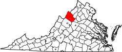
Montezuma is an unincorporated community located in Rockingham County, in the U.S. state of Virginia.

Geography

It is located northwest of Bridgewater. [1]

Rockingham County VA location map.svg
Red pog.svg
Montezuma
Location of Montezuma within the Rockingham County

Related Research Articles

Cortez, Colorado City in Colorado, United States

Cortez is a home rule municipality that is the county seat and the most populous municipality of Montezuma County, Colorado, United States. The city population was 8,766 at the 2020 United States Census.

Montezuma, Indiana Town in Indiana, United States

Montezuma is a town in Reserve Township, Parke County, in the U.S. state of Indiana. The population was 1,022 at the 2010 census. It is located approximately 66 miles west of Indianapolis

Montezuma, Kansas City in Gray County, Kansas

Montezuma is a city in Gray County, Kansas, United States. As of the 2020 census, the population of the city was 975.

Montezuma Creek, Utah Census-designated place in Utah, United States

Montezuma Creek is a census-designated place (CDP) in San Juan County, Utah, United States. The population was 335 at the 2010 census, a decrease from the 2000 figure of 507.

U.S. Route 163 is a 64-mile (103 km) U.S. Highway that runs from US 160 northward to US 191 in the U.S. states of Arizona and Utah. The southernmost 44 miles (71 km) of its length are within the Navajo Nation. The highway forms part of the Trail of the Ancients, a National Scenic Byway. The highway cuts through the heart of Monument Valley and has been featured in numerous movies and commercials.

Sierra Estrella Landform in Maricopa County, Arizona

The Sierra Estrella is a mountain range located southwest of Phoenix, Arizona. Much of the range falls within the Gila River Indian Reservation, but 14,400 acres (5,800 ha) of BLM land is protected as the Sierra Estrella Wilderness.

Montezuma, Costa Rica Place in Puntarenas, Costa Rica

Montezuma is a town in Puntarenas Province, Costa Rica which began as a remote fishing village and has gained popularity since the 1980s among tourists on a budget.

Hesperus Mountain (Colorado) Mountain in Colorado, United States

Hesperus Mountain is the highest summit of the La Plata Mountains range of the Rocky Mountains of North America. The prominent 13,237-foot (4,035 m) thirteener is located in San Juan National Forest, 13.2 miles (21.2 km) northeast by east of the Town of Mancos in Montezuma County, Colorado, United States. The summit of Hesperus Mountain is the highest point in Montezuma County.

The Montezuma Falls, a horsetail waterfall on a minor tributary to the Pieman River, is located on the West Coast Range of Tasmania, Australia.

Miller Peak (Arizona) Mountain in Cochise County, Arizona

Miller Peak, at 9,470 feet (2,886 m), is the second-highest mountain in Cochise County, Arizona. Located approximately 10 miles south of Sierra Vista, Arizona, it is the highest mountain in the Huachuca mountain range and a popular local hiking destination. The Miller Peak Wilderness encompasses 20,190 acres and is managed by the Coronado National Forest. This is also the most southerly peak and land area to rise above 9,000 feet in the continental United States. The area was affected by the 2011 Monument fire and most of the pine trees seen in older photographs were burned and destroyed. Scrub oak are beginning to replace the areas that were previously covered by pine.

Virginia State Route 257

State Route 257 is a primary state highway in the U.S. state of Virginia. The state highway runs 18.04 miles (29.03 km) from SR 902 and SR 924 near Briery Branch east to Interstate 81 (I-81) near Mount Crawford. SR 257 connects I-81 and U.S. Route 11 with Bridgewater and Dayton, between which the highway runs concurrently with SR 42. The state highway also provides access to Bridgewater College and connects Dayton with the western Rockingham County communities of Briery Branch, Ottobine and Montezuma.

State Route 162 (SR-162) is a state highway located in San Juan County, Utah, United States. It begins at US-191 east of Bluff. It then follows the former alignment of SR-163 to Montezuma Creek. There, it intersects UT-262 at its southern terminus. Afterwards, it follows SR-262's former alignment past Aneth to the Colorado state line. Colorado State Highway 41 takes over in the Centennial State, ending at a junction with US-160 6 miles east of the Four Corners Monument.

Montezuma's treasure is a legendary buried treasure said to be located in the Casa Grande ruins or elsewhere in the southwest United States and Mexico. The legend is one of many treasure stories in American folklore. Thomas Penfield wrote, "There is not the slimmest thread of reality in this story which is common throughout Mexico and the southwestern United States. There are some puzzling aspects but the story, nevertheless, adds up to pure legend."

Ohio State Route 703 Highway in Ohio

State Route 703 (SR 703) is a state highway in western Ohio. Its western terminus is in Montezuma at SR 219, and its eastern terminus is in St. Marys at an intersection with SR 29, SR 66, and the southern terminus of SR 116 in St. Marys. The route is mainly an east–west highway along the shores of Grand Lake St. Marys, although the section between Celina and Montezuma travels in a more north-south fashion.

Fort McDowell, Arizona Unincorporated community in Arizona, United States

Fort McDowell is an unincorporated community in Maricopa County, Arizona, United States. Fort McDowell is 23 miles northeast of Phoenix. Fort McDowell has a post office with ZIP code 85264.

Montezuma, California

Montezuma is a former hamlet and township in Solano County, California, located in the California Delta region of the state; the township, which embraced the hamlet, and several other places, such as Bird's Landing—which still exists—included portions of the Montezuma Hills. The name Montezuma was used in multiple places within Solano County by Mormon settlers during the period from 1847–50.

Sedona Sky Academy is a private therapeutic boarding school for adolescent girls, in Lake Montezuma, Arizona, United States. Sedona Sky Academy is located on the previous site of Copper Canyon Academy, which was established by Tammy Behrmann and her brother Darren Prince in 1998. They sold it to Aspen Education Group in 2002. In 2006, Aspen was acquired by CRC Health Group, Inc.

Clyde River (New York)

The Clyde River is a main tributary which feeds the Seneca River in Seneca County, New York, United States. It begins at the hamlet of Lyons in nearby Wayne County and meanders for approximately 27 miles from west to east before emptying into the Seneca River in the town of Tyre at Montezuma National Wildlife Refuge. Much of the original river has been channeled through to form part of the Erie Canal. A number of tributaries feed the Clyde River along its route.

State Route 225 is a 17.1 miles (27.5 km) long north-south secondary state highway located in West Tennessee. It connects Hornsby with Henderson.

References

  1. Google Maps (Map). Google.