Mauzy, Virginia

Last updated
Mauzy
USA Virginia location map.svg
Red pog.svg
Mauzy
Location in Virginia
Usa edcp location map.svg
Red pog.svg
Mauzy
Mauzy (the United States)
Coordinates: 38°34′8″N78°45′8″W / 38.56889°N 78.75222°W / 38.56889; -78.75222 Coordinates: 38°34′8″N78°45′8″W / 38.56889°N 78.75222°W / 38.56889; -78.75222
CountryFlag of the United States.svg  United States
State Virginia
County Rockingham County

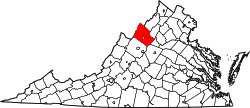
Mauzy is an unincorporated community located in Rockingham County, in the U.S. state of Virginia. It is located south of Timberville, just north of Lacey Spring along Route 259, just off Interstate 81. [1]

Related Research Articles

The National Football Conference – Eastern Division or NFC East is one of the four divisions of the National Football Conference (NFC) in the National Football League (NFL). It currently has four members: the Dallas Cowboys, the New York Giants, the Philadelphia Eagles, and the Washington Redskins.

Highway 20 is a major road intended for travel by the public between Highway 11 Lumsden to Highway 3 at Birch Hills. Saskatchewan's main roadways are located in the central/southern geographical land area of rolling prairie and grass land in a western Canadian prairie province. This highway is one which runs south to north and is located just east of Saskatoon and just north of Regina. At the northern extremity near Lanigan, the highway helps to service the PCS Lanigan potash mining operation. Down south, the highway is popular for tourists heading out to the Qu'Appelle Valley and resorts and beaches of Last Mountain Lake.

Highway 55 is a paved, undivided provincial highway in the Canadian province of Saskatchewan. It runs from Alberta Highway 55 the Alberta border, west of Pierceland, to Highway 9, near Mountain Cabin. Highway 55 is 652 km long. It forms part of the interprovincial Northern Woods and Water Route.

Kandla, Estonia Village in Saare County, Estonia

Kandla is a village in Saaremaa Parish, Saare County in western Estonia. It is located 21.4 kilometres (13.3 mi) by road northwest of Kuressaare, just to the northwest of Jõempa.

Holmeson, New Jersey Unincorporated community in New Jersey, United States

Holmeson is an unincorporated community located within Millstone Township in Monmouth County, New Jersey, United States. As it is located along County Route 537 through which the Monmouth–Ocean county line runs down the center, portions of the community are also located in Jackson Township. Owing to its location near Interstate 195 and Six Flags Great Adventure, the community is mostly made up of gas stations, restaurants, and small businesses though the Jackson Premium Outlets occupies land just south of the community.

Monte Caseros Airport airport in Argentina

Monte Caseros Airport is an airport serving Monte Caseros, a town in the Corrientes Province of Argentina. Monte Caseros is 8 kilometres (5.0 mi) south of the triple border between Argentina, Brazil, and Uruguay.

Torrence Avenue is a north–south street in the South Side of Chicago, as well as its southern suburbs. It marks 2628 East in the Chicago address system, being located slightly more than 3 14 miles (5.2 km) east of State Street. The road runs north from Richton Road in Crete to Steger Road at the Will–Cook county line in Sauk Village. From there, its northern segment begins just west of here. Torrence Avenue continues north, intersecting Interstate 80 (I-80) and I-94 in Lansing. From here, the road goes north until ending just south of 95th Street. The road carries Illinois Route 83 (IL 83) from Glenwood Dyer Road in Lynwood to Sibley Boulevard in Calumet City, as well as carrying US 6 from the Kingery Expressway to 159th Street.

El Mirador Airport, is an airport just southeast of Puerto Varas, a city in the Los Lagos Region of Chile. Puerto Varas is on the southwest shore of Llanquihue Lake.

New Canton, New Jersey Unincorporated community in New Jersey, United States

New Canton is an unincorporated community located along the border of Robbinsville Township in Mercer County and Upper Freehold Township in Monmouth County, New Jersey, United States. The area was once known as Cabbagetown and has been settled since the 18th century. The settlement is located at the intersection of Old York Road and New Canton-Stone Tavern Road just north of Interstate 195's interchange 8. The Upper Freehold side of the area contains farmland and new housing developments while the Robbinsville side features new commercial warehouse buildings including an Amazon.com Fulfillment Center opened in July 2014.

Parkside, Trenton, New Jersey Unincorporated community in New Jersey, United States

Parkside is a neighborhood located within the city of Trenton in Mercer County, New Jersey, United States. Parkside is just southwest of Cadwalader Park.

Paulas Corner, New Jersey Unincorporated community in New Jersey, United States

Paulas Corner or Paulas Corners is an unincorporated community located within East Brunswick Township in Middlesex County, New Jersey, United States. It is located at the intersection of Church Lane and Fresh Ponds Road in the southwestern portion of the township and consists of homes, some small farms, and forest land. The county-owned Tamarack Golf Course is located just northeast of the intersection.

Spotswood Manor, New Jersey Unincorporated community in New Jersey, United States

Spotswood Manor is an unincorporated community located within Monroe Township in Middlesex County, New Jersey, United States. The settlement is located just south of the borough of Spotswood, most of them consist of small homes, though businesses and strip malls line Spotswood-Englishtown Road, the main road through the area.

Freewood Acres, New Jersey Unincorporated community in New Jersey, United States

Freewood Acres is an unincorporated community located within Howell Township in Monmouth County, New Jersey, United States. The area is made up of mostly single-story homes arranged along a street grid in the northern reaches of the Pine Barrens. U.S. Route 9 runs through the center of the community just north of its interchange with Interstate 195. The Land O'Pines Elementary School and Manasquan Reservoir County Park exist to the east of the community.

Land of Pines, New Jersey Unincorporated community in New Jersey, United States

Land of Pines is an unincorporated community located within Howell Township in Monmouth County, New Jersey, United States. The area consists of single-family home developments with some businesses located along U.S. Route 9, a divided highway that runs through the center of the community. It is located in the northernmost extents of the Pine Barrens and is just south of Interstate 195.

Macedonia, New Jersey Unincorporated community in New Jersey, United States

Macedonia is an unincorporated community located within Tinton Falls in Monmouth County, New Jersey, United States. The settlement, found in the center of Tinton Falls, is located near the interchange complex between the Garden State Parkway, New Jersey Route 18, New Jersey Route 36, and Wayside Road. The main residential section of the community is located just north of Route 18 and consists of smaller single-family houses, churches, a fire department, and a park. On the south side of Route 18, an asphalt production plant and Naval Weapons Station Earle make up the landscape.

Pullentown, New Jersey Unincorporated community in New Jersey, United States

Pullentown is an unincorporated community located within Upper Freehold Township in Monmouth County, New Jersey, United States. The settlement is located along County Route 526 east of Allentown and just west of its intersection with Sharon Station Road. The area contains mostly farmland with some homes and small businesses located along the road.

Wyckoff Mills, New Jersey Unincorporated community in New Jersey, United States

Wyckoff Mills is an unincorporated community located within Howell Township in Monmouth County, New Jersey, United States. The settlement is centered about the intersection of Wyckoff Mills Road and Strickland Road, just east of U.S. Route 9 in the western sector of the township.

R279 road (Ireland) regional road in Ireland

The R279 road is a regional road in Ireland linking Cliffoney and Mullaghmore in County Sligo. The 19th century Classiebawn Castle is located on this road just before entering Mullaghmore. The entire road is part of the Wild Atlantic Way, which continues around Mullaghmore Head after the end of the R279.

References

  1. Google Maps (Map). Google.