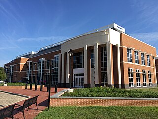
Hanover County is a county in the Commonwealth of Virginia. As of the 2010 census, the population was 106,374. Its county seat is Hanover Courthouse.

Rockingham County is a county located in the U.S. state of North Carolina. As of the 2010 census, the population was 93,643. Its county seat is Wentworth. The county is known as "North Carolina's North Star."
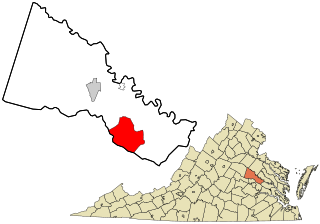
Mechanicsville is an unincorporated area and census-designated place (CDP) in Hanover County, Virginia, United States. The population was 36,348 during the 2010 census, up from 30,464 at the 2000 census.
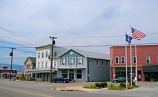
Elkton is an incorporated town in Rockingham County, Virginia, United States. It is included in the Harrisonburg Metropolitan Statistical Area. The population was 2,762 at the 2010 census. Elkton was named for the Elk Run stream.
Mechanicsville is the name of several localities in North America:
Mechanicsville is the name of four places in the Commonwealth of Virginia in the United States of America:

Mechanicsburg, also known as Mechanicsville, is an unincorporated community in Hampshire County, West Virginia, in the United States. It is located on the Northwestern Turnpike west of Romney at Mill Creek Gap. Mechanicsburg is the site of "The Burg", used as a headquarters by both armies during the American Civil War. Along Fox Hollow Road lies the 19th-century Fox's Hollow Baptist Church and the old Mechanicsburg School.
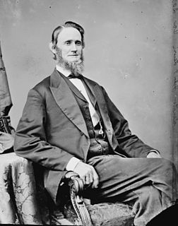
John Francis Lewis was an American planter and politician from Rockingham County, Virginia. He served two terms as the ninth and 14th Lieutenant Governor of Virginia and represented Virginia as a Republican in the United States Senate during the Reconstruction period after the Civil War.

Cold Harbor National Cemetery is a United States National Cemetery in Mechanicsville, Hanover County, Virginia. It encompasses 1.4 acres (5,700 m2), and as of the end of 2005, had 2,110 interments. Administered by the United States Department of Veterans Affairs, it is managed by the Hampton National Cemetery.

St. Mary's County Public Schools is a school district that serves St. Mary's County, Maryland, USA, at the confluence of the Potomac River, Patuxent River, and Chesapeake Bay. The area is a mixture of rural and suburban communities. Many of the families are employed by NAS Patuxent River, government contractors, St. Mary's College of Maryland, county government, and others involved in the traditional agriculture and water related businesses. It has an approximate enrollment of almost 17,000 students. SMCPS operates 17 elementary schools, 4 middle schools, 4 high schools, an Alternative Learning Center, and a Vocational Training Center, serving students in Grades Pre-K through 12th grade. The school system is overseen by the Maryland State Department of Education.
The Capital District consist of schools located East and Northeast of the James River in the Greater Richmond Region.

Deep Run Ponds Natural Area Preserve is a 706-acre (2.86 km2) Natural Area Preserve in Rockingham County, Virginia. The preserve contains one of the largest remaining systems of Shenandoah Valley sinkhole ponds in Virginia. Such ponds are found in Rockingham and Augusta counties; their water levels fluctuate throughout the year. The preserve's eight sinkhole ponds support a variety of rare plant and animal life; two ponds support the rare Virginia sneezeweed, while others contain black-fruited spikerush, northern St. John's-wort, Buxbaum's sedge, and northern bog clubmoss.
The 7th Virginia Cavalry also known as Ashby's Cavalry was a Confederate cavalry regiment raised in the spring of 1861 by Colonel Angus William McDonald The regiment was composed primarily of men from the counties of the Shenandoah Valley as well as from the counties of Fauquier and Loudoun. Two companies contained men from the border counties of Maryland.
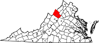
This is a list of the National Register of Historic Places listings in Rockingham County, Virginia.

Mechanicsville is an unincorporated community in Loudoun County, Virginia, United States. Mechanicsville is located on Virginia Route 9 2 miles (3.2 km) northwest of Hillsboro.

Mechanicsville is an unincorporated community in Rockbridge County, Virginia, United States. Mechanicsville is 3 miles (4.8 km) southwest of Buena Vista.

Cootes Store is an unincorporated community in Rockingham County, Virginia, United States. Located in the Shenandoah Valley, it is situated north of Harrisonburg, south of Bergton, and west of Timberville. The border with West Virginia is nearby, as is the edge of George Washington National Forest. Cootes Store is within a gorge where the North Fork Shenandoah River breaks, at the crossroads of Route 613 and Route 259.
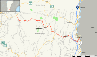
Vermont Route 121 (VT 121) is a state highway in the U.S. state of Vermont. The highway runs 21.439 miles (34.503 km) from VT 11 in Londonderry east to U.S. Route 5 in the incorporated village of Bellows Falls in the town of Rockingham. VT 121 follows the Saxtons River in northern Windham County. The highway has a pair of gravel sections in the towns of Windham and Grafton.
Hanover County Public Schools is a school district headquartered in Ashland, Virginia. It serves Hanover County.


