Rockingham County is a county located in the U.S. state of Virginia. As of the 2020 census, the population was 83,757. Its county seat is the independent city of Harrisonburg.

Camp Hill is a town in Tallapoosa County, Alabama, United States. It was incorporated in 1895. At the 2010 census the population was 1,014, down from 1,273 in 2000. Camp Hill is the home to Southern Preparatory Academy.

Santa Ynez is a census-designated place (CDP) in the Santa Ynez Valley of Santa Barbara County, California.

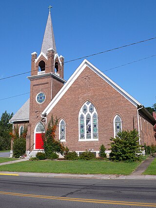
Harrisonburg is a village in and the parish seat of Catahoula Parish, Louisiana, United States. The population was 348 as of the 2010 census, down from 746 in 2000.

Westernport is a town in Allegany County, Maryland, United States, along the Georges Creek Valley. It is part of the Cumberland, MD-WV Metropolitan Statistical Area. The population was 1,888 at the 2010 census.

Frazer Township is a township in Allegheny County, Pennsylvania, United States. The population was 1,164 at the 2020 census. The Pittsburgh Mills shopping mall complex is located in the township.

Allardt is a city in Fentress County, Tennessee, United States. The population was 555 at the 2020 census. The current mayor Ms. Patricia (Pat) Brown Clark was elected in 2018. According to the city charter, there are three city council board members, currently Chris Crabtree, Thomas Potter, and Michael Wiley.

Stanardsville is a town in Greene County, Virginia, United States. The population was 349 at the 2020 census, down from 367 at the 2010 census. It is the county seat of Greene County. The name is from Robert Stanard, a benefactor who donated land for public use. It is part of the Charlottesville, Virginia metropolitan area.

Halifax is a town in Halifax County, Virginia, United States, along the Banister River. The population was 1,309 at the 2010 census. It is the county seat of Halifax County.
Dayton is a town in Rockingham County, Virginia, United States. The population is 1,530 as of the 2010 census. It is included in the Harrisonburg, Virginia Metropolitan Statistical Area.
Elkton is an incorporated town in Rockingham County, Virginia, United States. It is included in the Harrisonburg Metropolitan Statistical Area. The population was 2,762 at the 2010 census. Elkton was named for the Elk Run stream.

Mount Crawford is a town in Rockingham County, Virginia, United States. It is included in the Harrisonburg Metropolitan Statistical Area, and the town's population was 433 at the 2010 census.

Timberville is a town in Rockingham County, Virginia, United States. The population was 2,522 at the 2010 census, which was a significant increase from the 1,739 reported in the 2000 census. It is part of the Harrisonburg Metropolitan Statistical Area.
New Market is a town in Shenandoah County, Virginia, United States. Founded as a small crossroads trading town in the Shenandoah Valley, it has a population of 2,155 as of the most recent 2020 U.S. census. The north–south U.S. 11 and the east–west U.S. 211 pass near it and cross Massanutten Mountain at the town's titular gap.
Toms Brook is a town in Shenandoah County, Virginia, United States. The population was 258 at the 2010 census.

Bayard is a town in Grant County, West Virginia, United States. The population was 200 at the 2020 census. Bayard was incorporated in 1893 and named in honor of Thomas F. Bayard, Jr., who later became a United States senator from Delaware (1923–1929). Bayard was founded on the West Virginia Central and Pittsburgh Railroad as a coal mining community. Coal mining has remained the town's chief industry.
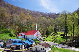
Kermit is a town in Mingo County, West Virginia, United States. The population was 406 at the 2010 census. Kermit is located along the Tug Fork, opposite Warfield, Kentucky. The Norfolk Southern Railway's Kenova District runs through town.

Grottoes is an incorporated town in Augusta and Rockingham counties in the U.S. state of Virginia. The population was 2,668 at the 2010 census.

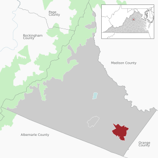
Gordonsville is a town in Orange County in the Commonwealth of Virginia in the United States. Located about 19 miles northeast of Charlottesville and 65 miles northwest of Richmond, the population was 1,402 at the 2020 census.
Ruckersville is a census-designated place (CDP) in Greene County, Virginia, United States, located in a rural area north of Charlottesville. The population as of the 2020 estimate was 1,321, a 17.7% increase from the 2010 census with 1,141. The community lies amidst hills, mountain views, trees, and farmland. It is located at the intersection of two major highways, north–south U.S. Route 29 and east–west U.S. Route 33. It was founded in 1732, by the same family that established Ruckersville, Georgia.