Alberta, Virginia

Last updated

Alberta, Virginia
VAMap-doton-Alberta.png
Location of Alberta, Virginia
Coordinates: 36°51′49″N77°52′53″W / 36.86361°N 77.88139°W / 36.86361; -77.88139
Country United States
State Virginia
County Brunswick
Area
[1]
  Total2.15 sq mi (5.56 km2)
  Land2.13 sq mi (5.53 km2)
  Water0.01 sq mi (0.03 km2)
Elevation
397 ft (121 m)
Population
 (2020)
  Total302
  Density126.52/sq mi (48.85/km2)
Time zone UTC-5 (Eastern (EST))
  Summer (DST) UTC-4 (EDT)
ZIP code
23821
Area code 434
FIPS code 51-00724 [2]
GNIS feature ID1498398 [3]
Website www.albertava.com

Alberta is a town in Brunswick County, Virginia, United States. The population was 302 at the 2020 census. [4] It is home to the Christanna Campus of Southside Virginia Community College.

Contents

History

For much of the 20th century, Alberta marked the junction of two railroad mainlines. The Richmond, Petersburg and Carolina Railroad from Petersburg, Virginia to Ridgeway Junction (today Norlina, North Carolina) was completed in 1900, at which point it was merged into the Seaboard Air Line (SAL). [5] By 1914, the population of Alberta was estimate by the railroad to be somewhere around 100. [6] The Seaboard line (dubbed the "S-line" after later mergers) continued to operate into the 1980s, and today Alberta is along the abandoned portion of the CSX Norlina Subdivision. The Virginian Railway opened in 1907 from Norfolk to Victoria, Virginia, passing through Alberta (with through-service from the coalfields of Appalachia starting in 1909). The Virginian continued in use until it was gradually abandoned following a merger with Norfolk and Western in the later half of the 20th century.

Hobson's Choice and Rocky Run Methodist Church are listed on the National Register of Historic Places. [7]

Geography

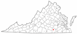
Alberta is located in north-central Brunswick County along U.S. Route 1. Interstate 85 passes south of the original portion of the town, with access from Exit 28. The town limits extend southwest along Route 1 and I-85 to Virginia State Route 46 and Southside Virginia Community College, with access from I-85 to VA 46 from Exit 27. Via I-85 it is 40 miles (64 km) northeast to Petersburg and 16 miles (26 km) southwest to South Hill.

According to the United States Census Bureau, Alberta has a total area of 2.15 square miles (5.56 km2), of which 2.14 square miles (5.53 km2) is land and 0.01 square miles (0.03 km2), or 0.61%, is water. [8]

Demographics

Historical population
CensusPop.Note
1930 328
1940 41626.8%
1950 4303.4%
1960 4300.0%
1970 4668.4%
1980 394−15.5%
1990 337−14.5%
2000 306−9.2%
2010 298−2.6%
2020 3021.3%
U.S. Decennial Census [9]

At the 2000 census there were 306 people, 128 households, and 86 families living in the town. The population density was 278.3 people per square mile (107.4/km2). There were 158 housing units at an average density of 143.7 per square mile (55.5/km2). The racial makeup of the town was 59.80% White, 39.54% African American, 0.33% Asian, 0.33% from other races. Hispanic or Latino of any race were 0.33%. [2]

Of the 128 households 26.6% had children under the age of 18 living with them, 44.5% were married couples living together, 20.3% had a female householder with no husband present, and 32.8% were non-families. 29.7% of households were one person and 14.1% were one person aged 65 or older. The average household size was 2.39 and the average family size was 2.93.

The age distribution was 26.8% under the age of 18, 5.2% from 18 to 24, 27.1% from 25 to 44, 24.2% from 45 to 64, and 16.7% 65 or older. The median age was 39 years. For every 100 females, there were 86.6 males. For every 100 females age 18 and over, there were 75.0 males.

The median household income was $27,361 and the median family income was $31,875. Males had a median income of $27,250 versus $20,833 for females. The per capita income for the town was $14,607. About 10.8% of families and 16.3% of the population were below the poverty line, including 21.1% of those under the age of eighteen and 14.5% of those sixty five or over.

Notable People

Related Research Articles

<span class="mw-page-title-main">Nottoway County, Virginia</span> County in Virginia, United States

Nottoway County is a county located in the Commonwealth of Virginia. As of the 2020 census, the population was 15,642. Its county seat is Nottoway. It is situated south of the James River, thus making it a part of the Southside Virginia Region.

<span class="mw-page-title-main">Dinwiddie County, Virginia</span> County in Virginia, United States

Dinwiddie County is a county located in the Commonwealth of Virginia. As of the 2020 census, the population was 27,947. Its county seat is Dinwiddie.

<span class="mw-page-title-main">Ashford, Alabama</span> Town in Alabama, United States

Ashford is a town in Houston County, Alabama, United States. It is part of the Dothan, Alabama Metropolitan Statistical Area. The town was incorporated in June 1891. For most of its history, it was a center for naval stores production, pulpwood harvesting, and cotton agriculture. The population was 2,148 at the 2010 census, up from 1,853 at the 2000 census.

<span class="mw-page-title-main">Wildwood, Florida</span> City in Florida, United States

Wildwood is a city in Sumter County, Florida, United States. The population was 15,730 at the 2020 census.

<span class="mw-page-title-main">Weldon, North Carolina</span> Town in North Carolina, United States

Weldon is a town in Halifax County, North Carolina, United States. The population was 1,655 at the 2010 census. It is part of the Roanoke Rapids, North Carolina Micropolitan Statistical Area.

<span class="mw-page-title-main">Seaboard, North Carolina</span> Town in North Carolina, United States

Seaboard is a township in Northampton County, North Carolina, United States, created as a company town by the Seaboard and Roanoke Railroad, approximately 10 miles northeast of Weldon in the mid-1840s as a place for railroad employees to live.

<span class="mw-page-title-main">Ellenboro, North Carolina</span> Town in North Carolina, United States

Ellenboro is a town in Rutherford County, North Carolina, United States. The population was 873 at the 2010 census.

<span class="mw-page-title-main">Indian Trail, North Carolina</span> Town in North Carolina, United States

Indian Trail is a suburban town in Union County, North Carolina, United States. A part of the Charlotte metropolitan area, Indian Trail has grown rapidly in the 21st century, going from 1,942 residents in 1990 to 39,997 in 2020.

<span class="mw-page-title-main">Norlina, North Carolina</span> Town in North Carolina, United States

Norlina is a town in Warren County, North Carolina, United States. The population was 1,118 at the 2010 census.

<span class="mw-page-title-main">Appomattox, Virginia</span> Town in Virginia

Appomattox is a town in Appomattox County, Virginia, United States. The population was 1,733 at the 2010 census. It is the county seat of Appomattox County.

<span class="mw-page-title-main">Keysville, Virginia</span> Town in Virginia, United States

Keysville is a town in Charlotte County, Virginia, United States. The population was 832 at the 2010 census. One of two branches of Southside Virginia Community College is in Keysville. The surrounding area has tobacco and mixed farming.

<span class="mw-page-title-main">Chester, Virginia</span> CDP in Virginia, United States

Chester is a census-designated place (CDP) in Chesterfield County, Virginia, United States. Per the 2020 census, the population was 23,414.

<span class="mw-page-title-main">McKenney, Virginia</span> Town in Virginia, United States

McKenney is an incorporated town in Dinwiddie County, Virginia, United States. The population was 483 at the 2010 census.

<span class="mw-page-title-main">Burkeville, Virginia</span> Town in Virginia, United States

Burkeville is an incorporated town in Nottoway County, Virginia, United States. The population was 432 at the 2010 census. The source of the town name is disputed. The town is located at the crossroads of U.S. routes 360 and 460.

<span class="mw-page-title-main">Crewe, Virginia</span> Town in Virginia, United States

Crewe is a town in Nottoway County, Virginia, United States. The population was 2,262 at the 2020 census.

<span class="mw-page-title-main">Stony Creek, Virginia</span> Town in Virginia, United States

Stony Creek is a town in Sussex County, Virginia, United States. The population was 198 at the 2010 census.

<span class="mw-page-title-main">Durbin, West Virginia</span> Town in West Virginia, United States

Durbin is a town in Pocahontas County, West Virginia, United States. The population was 235 at the 2020 census.

<span class="mw-page-title-main">Pamplin City, Virginia</span> Town in Virginia, United States

Pamplin City is a town in Appomattox and Prince Edward counties in the U.S. state of Virginia. The population was 138 at the 2020 United States census.

<span class="mw-page-title-main">Brodnax, Virginia</span> Town in Virginia, United States

Brodnax is a town in Brunswick and Mecklenburg counties in the U.S. state of Virginia. The population was 298 at the 2010 census.

<span class="mw-page-title-main">Jarratt, Virginia</span> Town in Virginia, United States

Jarratt is a town in Greensville and Sussex counties in the U.S. state of Virginia. The population was 652 at the 2020 census. In 1848, Jarratt was a stop on the Petersburg Railroad. Jaratt was incorporated in 1938.

References

  1. "2019 U.S. Gazetteer Files". United States Census Bureau. Retrieved August 7, 2020.
  2. 1 2 "U.S. Census website". United States Census Bureau . Retrieved January 31, 2008.
  3. "US Board on Geographic Names". United States Geological Survey. October 25, 2007. Retrieved January 31, 2008.
  4. "Alberta town, Virginia". 2020 United States Census. April 1, 2020. Retrieved April 23, 2024.
  5. Griffin, William E. Jr.; Dixon, Thomas W. Jr. (2010). Virginia Railroads: Railroading in the Old Dominion. Forest, Virginia: TLC Publishing Inc. pp. 79–87. ISBN   9780939487974.
  6. Freight Traffic Department, Seaboard Air Line Railway (1914). Seaboard Air Line Railway Shippers Guide (1914 ed.). New York City: Wynkoop Hallenbeck Crawford Company. p. 161. Retrieved July 6, 2021.
  7. "National Register Information System". National Register of Historic Places . National Park Service. July 9, 2010.
  8. "Geographic Identifiers: 2010 Demographic Profile Data (G001): Alberta town, Virginia". U.S. Census Bureau, American Factfinder. Archived from the original on February 12, 2020. Retrieved May 1, 2014.
  9. "Census of Population and Housing". Census.gov. Retrieved June 4, 2015.