Clarke County, Virginia

Last updated

Clarke County
County
Old Clarke County Courthouse VA1.jpg
Old Clarke County Courthouse and Confederate monument
Flag of Clarke County, Virginia.png
Seal of Clarke County, Virginia.png
Map of Virginia highlighting Clarke County.svg
Location within the U.S. state of Virginia
Virginia in United States.svg
Virginia's location within the U.S.
Coordinates: 39°07′N78°00′W / 39.12°N 78°W / 39.12; -78
CountryFlag of the United States.svg United States
StateFlag of Virginia.svg  Virginia
Founded1836
Named for George Rogers Clark
Seat Berryville
Largest townBerryville
Area
  Total
178 sq mi (460 km2)
  Land176 sq mi (460 km2)
  Water2.2 sq mi (6 km2)  1.2%
Population
 (2020)
  Total
14,783
  Density83/sq mi (32/km2)
Time zone UTC−5 (Eastern)
  Summer (DST) UTC−4 (EDT)
Congressional district 6th
Website clarkecounty.gov

Clarke County is a county in the Commonwealth of Virginia. As of the 2020 census, the population was 14,783. [1] Its county seat is Berryville. [2] Clarke County is included in the Washington-Arlington-Alexandria, DC-VA-MD-WV Metropolitan Statistical Area.

Contents

History

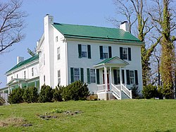
The first settlement of the Virginia Colony in the future Clarke County was in 1736 by Thomas Fairfax, 6th Lord Fairfax of Cameron who built a home, Greenway Court, on part of his 5 million acres (20,000 km2) property, near what is now the village of White Post. White Post was named for the large signpost pointing the way to Lord Fairfax's home.

As it lay just west of the Blue Ridge border demarcated under Governor Spotswood at Albany in 1722, the area was claimed along with the rest of the Shenandoah Valley by the Six Nations Iroquois (who had overrun it during the later Beaver Wars in around 1672), until the Treaty of Lancaster in 1744, when it was purchased from them by Governor Gooch.

Many of the early settlers of what became Clarke County were children of Tidewater planters, who settled on large land grants from Lord Fairfax. Two thirds of the county was settled by the plantation group, and the plantation lifestyle thrived until the Civil War. County status came in 1836, when it was divided off from Frederick County. Clarke County was known for its large crops of wheat.

During the American Civil War, John S. Mosby, "the Gray Ghost" of the Confederacy, raided General Philip Sheridan's supply train in the summer of 1864, in Berryville. The Battle of Cool Spring was fought in Clarke County on July 17 and 18, 1864, followed by the Battle of Berryville on September 3, 1864.

In 1881 was founded the Bank of Clarke County, a still-functional regional bank with headquarters in Berryville. [3]

Early in the 20th century, the future Virginia politician Harry F. Byrd Sr. and his wife established their first home near Berryville, where he undertook extensive agricultural activity growing peaches and apples. Byrd became a state senator in the upper house of the Virginia General Assembly, served a term as a Governor of Virginia, and was a United States senator for over 30 years. He headed the powerful Byrd Organization, which dominated state politics between the mid-1920s and the 1960s.

In 1996, Forrest Pritchard revitalized Smithfield Farm by starting a grass-fed, sustainable livestock operation. Renamed 'Smith Meadows', it is currently one of the oldest fully grass-finished farms in the United States, and its story was chronicled in the New York Times bestseller Gaining Ground.

Historic buildings and structures

Geography

Clarke County, Virginia.svg
Clarke

According to the U.S. Census Bureau, the county has a total area of 178 square miles (460 km2), of which 176 square miles (460 km2) is land and 2.2 square miles (5.7 km2) (1.2%) is water. [4] It is the third-smallest county in Virginia by total area.

Adjacent counties

Government

Board of Supervisors

Constitutional officers

Clarke County is represented by Republican Timmy French in the Virginia Senate, Republican Delores Riley Oates in the Virginia House of Delegates, and Republican Ben Cline in the U.S. House of Representatives.

United States presidential election results for Clarke County, Virginia [5]
Year Republican Democratic Third party(ies)
No.%No.%No.%
2024 5,64157.33%3,99340.58%2052.08%
2020 5,19255.61%3,92041.98%2252.41%
2016 4,66156.75%3,05137.15%5016.10%
2012 4,29655.35%3,23941.73%2272.92%
2008 3,84051.68%3,45746.52%1341.80%
2004 3,74157.51%2,69941.49%651.00%
2000 2,88354.56%2,16640.99%2354.45%
1996 2,20148.17%1,90641.72%46210.11%
1992 1,99442.90%1,81138.96%84318.14%
1988 2,50262.24%1,47836.77%401.00%
1984 2,52967.21%1,21532.29%190.50%
1980 1,87657.44%1,15635.39%2347.16%
1976 1,44051.54%1,27645.67%782.79%
1972 1,81669.13%71527.22%963.65%
1968 1,12742.62%76829.05%74928.33%
1964 1,06848.41%1,13651.50%20.09%
1960 80446.31%92353.17%90.52%
1956 78548.91%72545.17%955.92%
1952 80952.88%71646.80%50.33%
1948 38433.16%48241.62%29225.22%
1944 41533.58%81666.02%50.40%
1940 33324.13%1,04375.58%40.29%
1936 19817.35%94082.38%30.26%
1932 12412.74%84186.43%80.82%
1928 24825.10%74074.90%00.00%
1924 769.76%68788.19%162.05%
1920 15415.78%77479.30%484.92%
1916 497.66%59092.19%10.16%
1912 396.19%57691.43%152.38%

Demographics

Historical population
CensusPop.Note
1840 6,353
1850 7,35215.7%
1860 7,146−2.8%
1870 6,670−6.7%
1880 7,68215.2%
1890 8,0715.1%
1900 7,927−1.8%
1910 7,468−5.8%
1920 7,165−4.1%
1930 7,1670.0%
1940 7,159−0.1%
1950 7,074−1.2%
1960 7,94212.3%
1970 8,1022.0%
1980 9,96523.0%
1990 12,10121.4%
2000 12,6524.6%
2010 14,03410.9%
2020 14,7835.3%
U.S. Decennial Census [6]
1790–1960 [7] 1900–1990 [8]
1990–2000 [9] 2010 [10] 2020 [11]

2020 census

Clarke County, Virginia – Racial and ethnic composition
Note: the US Census treats Hispanic/Latino as an ethnic category. This table excludes Latinos from the racial categories and assigns them to a separate category. Hispanics/Latinos may be of any race.
Race / Ethnicity (NH = Non-Hispanic)Pop 2010 [10] Pop 2020 [11] % 2010% 2020
White alone (NH)12,38712,30988.26%83.26%
Black or African American alone (NH)7425645.29%3.82%
Native American or Alaska Native alone (NH)35330.25%0.22%
Asian alone (NH)1212100.86%1.42%
Pacific Islander alone (NH)5150.04%0.10%
Some Other Race alone (NH)15890.11%0.60%
Mixed Race or Multi-Racial (NH)2396761.70%4.57%
Hispanic or Latino (any race)4908873.49%6.00%
Total14,03414,783100.00%100.00%

2000 Census

As of the census [12] of 2000, there were 12,652 people, 4,942 households, and 3,513 families residing in the county. The population density was 72 inhabitants per square mile (28/km2). There were 5,388 housing units at an average density of 30 units per square mile (12 units/km2). The racial makeup of the county was 91.15% White, 6.73% Black or African American, 0.19% Native American, 0.49% Asian, 0.03% Pacific Islander, 0.55% from other races, and 0.85% from two or more races. 1.46% of the population was Hispanic or Latino of any race.

By 2005 90.1% of Clarke County's population was non-Hispanic whites. 6.3% were African-American. 0.2% Native American. 0.6% Asian. 2.6% were Latino.

There were 4,942 households, out of which 29.40% had children under the age of 18 living with them, 58.20% were married couples living together, 8.90% had a female householder with no husband present, and 28.90% were non-families. 24.10% of all households were made up of individuals, and 9.90% had someone living alone who was 65 years of age or older. The average household size was 2.50 and the average family size was 2.97.

In the county, the population was spread out, with 23.40% under the age of 18, 5.80% from 18 to 24, 29.10% from 25 to 44, 27.10% from 45 to 64, and 14.60% who were 65 years of age or older. The median age was 41 years. For every 100 females, there were 98.00 males. For every 100 females age 18 and over, there were 96.60 males.

The median income for a household in the county was $51,601, and the median income for a family was $59,750. Males had a median income of $40,254 versus $30,165 for females. The per capita income for the county was $24,844. About 4.20% of families and 6.60% of the population were below the poverty line, including 7.10% of those under age 18 and 11.10% of those age 65 or over.

Transportation

US 340 near Berryville in Clarke County 2019-08-16 17 39 00 View north along U.S. Route 340 (Lord Fairfax Highway) from the overpass for Virginia State Route 7 (Harry Byrd Highway-Berryville Bypass) in Stringtown, Clarke County, Virginia.jpg
US 340 near Berryville in Clarke County

Major highways

The Norfolk Southern Railway's H-Line runs the perimeter of Clarke County.

Service

Communities

Towns

Census-designated place

Other unincorporated communities

See also

Related Research Articles

<span class="mw-page-title-main">Frederick County, Virginia</span> County in Virginia, United States

Frederick County is located in the Commonwealth of Virginia. As of the 2020 census, the population was 91,419. Its county seat is Winchester. The county was formed in 1743 by the splitting of Orange County. It is Virginia's northernmost county. Frederick County is included in the Winchester, VA-WV Metropolitan Statistical Area, which is also included in the Washington-Baltimore-Northern Virginia, DC-MD-VA-WV-PA Combined Statistical Area.

<span class="mw-page-title-main">Houston County, Alabama</span> County in Alabama, United States

Houston County is a county located in the southeastern corner of the U.S. state of Alabama. As of the 2020 census the population was 107,202. Its county seat is Dothan, which is located on the border and partially in adjacent Henry County.

<span class="mw-page-title-main">Richmond County, Virginia</span> County in Virginia, United States

Richmond County is a county located on the Northern Neck in the U.S. state of Virginia. As of the 2020 census, the population sits at 8,923. Its county seat is Warsaw. The rural county should not be confused with the large city and state capital Richmond, Virginia. It was formed in 1692 when the first Rappahannock County was divided to form Richmond County and Essex County.

<span class="mw-page-title-main">Mecklenburg County, Virginia</span> County in Virginia, United States

Mecklenburg County is a county in the Commonwealth of Virginia. As of the 2020 census, the population was 30,319. Its county seat is Boydton.

<span class="mw-page-title-main">Lancaster County, Virginia</span> County in Virginia, United States

Lancaster County is a county located on the Northern Neck in the Commonwealth of Virginia. As of the 2020 census, the population sits at 10,919. Its county seat is Lancaster.

<span class="mw-page-title-main">Culpeper County, Virginia</span> County in Virginia, United States

Culpeper County is a county located along the borderlands of the northern and central region of the Commonwealth of Virginia. As of the 2020 United States Census, the population was 52,552. Its county seat and only incorporated community is Culpeper.

<span class="mw-page-title-main">Treasure Island, Florida</span> City in Florida, United States of America

Treasure Island is a city in Pinellas County, Florida, United States. It is situated on a barrier island in the Gulf of Mexico. As of the 2020 census, the city population was 6,584.

Berryville is a town in Henderson County, Texas, United States. The population was 824 at the 2020 census, down from 975 at the 2010 census.

<span class="mw-page-title-main">Berryville, Virginia</span> Town in Virginia

Berryville is an incorporated town in and the county seat of Clarke County, Virginia, United States. The population was 4,574 at the 2020 census, up from 4,185 at the 2010 census.

<span class="mw-page-title-main">Boyce, Virginia</span> Town in Virginia

Boyce is a small incorporated town in Clarke County, Virginia, United States. The population was 749 at the 2020 census, up from 589 at the 2010 census.

<span class="mw-page-title-main">Dunn Loring, Virginia</span> Census-designated place in Virginia

Dunn Loring is a census-designated place (CDP) in Fairfax County, Virginia, United States. The population was 9,464 as of the 2020 census. This suburban area is bordered by Merrifield to the south, Vienna to the west, Tysons to the north, and Idylwood to the east. Dunn Loring is located within the Washington metropolitan area.

<span class="mw-page-title-main">Fort Hunt, Virginia</span> Census-designated place in Virginia, United States

Fort Hunt is a census-designated place (CDP) in Fairfax County, Virginia, United States. The area is named after Fort Hunt, which was built on the bank of the Potomac River in 1897 to defend Washington, D.C. from naval attack and is now a public park. The area is also notable for its high population of senior citizens and for being one of the first suburbs in wealthy Fairfax County. The population was 17,231 at the 2020 census.

<span class="mw-page-title-main">Great Falls, Virginia</span> Census-designated place in Virginia, United States

Great Falls is a census-designated place in Fairfax County, Virginia, United States. The population at the 2020 census was 15,953.

<span class="mw-page-title-main">Merrifield, Virginia</span> Census-designated place in Virginia, United States

Merrifield is a census-designated place (CDP) in Fairfax County, Virginia, United States. The population was 20,488 at the 2020 census.

<span class="mw-page-title-main">Mount Vernon, Virginia</span> Census-designated place in Virginia, United States

Mount Vernon is a census-designated place (CDP) and unincorporated community in Fairfax County, Virginia, United States. The population was 12,914 at the 2020 census. Primarily due to its historical significance and natural recreation and beauty, the Mount Vernon area receives over one million tourists each year.

<span class="mw-page-title-main">Newington, Virginia</span> Census-designated place in Virginia, United States

Newington is a census-designated place (CDP) in Fairfax County, Virginia, United States. As of the 2020 census, the population was 13,223. The population was 12,943 at the 2010 census. The 2010 census showed a significant decrease after half the population was split off to the newly created Newington Forest CDP.

<span class="mw-page-title-main">Fairfax Station, Virginia</span> Census-designated place in Virginia, United States

Fairfax Station is a census-designated place (CDP) in Fairfax County, Virginia, United States. The population was 12,420 at the 2020 census. Located in Northern Virginia, its center is located 22 miles (35 km) southwest of Washington, D.C.

<span class="mw-page-title-main">Dranesville, Virginia</span> Census-designated place in Virginia, United States

Dranesville is a census-designated place (CDP) in Fairfax County, Virginia, United States. Dranesville is located on the Leesburg Pike at its intersection with Georgetown Pike. The U.S. Census Bureau defines Dranesville as a census-designated place (CDP) with a population of 11,921 as of 2010. At the 2020 Census the population was 11,785.

<span class="mw-page-title-main">Floris, Virginia</span> Census-designated place in Virginia, United States

Floris is a census-designated place (CDP) located within the Oak Hill area of Fairfax County, Virginia, United States. The population at the 2020 census was 8,341.

<span class="mw-page-title-main">McNair, Virginia</span> Census-designated place in Virginia, United States

McNair is a census-designated place located in the Oak Hill section of Fairfax County, Virginia, United States. It is directly to the east of Washington Dulles International Airport. The population as of the 2020 census was 21,598. Much of the population resides in the McNair Farms planned community. The community has a school called McNair Elementary.

References

  1. "Clarke County, Virginia". United States Census Bureau . Retrieved January 30, 2022.
  2. "Find a County". National Association of Counties. Archived from the original on May 31, 2011. Retrieved June 7, 2011.
  3. "History of Bank of Clarke County". Archived from the original on February 3, 2017. Retrieved March 10, 2017.
  4. "US Gazetteer files: 2010, 2000, and 1990". United States Census Bureau. February 12, 2011. Retrieved April 23, 2011.
  5. David Leip. "Dave Leip's Atlas of U.S. Presidential Elections". Uselectionatlas.org. Retrieved December 8, 2020.
  6. "Census of Population and Housing from 1790-2000". US Census Bureau . Retrieved January 24, 2022.
  7. "Historical Census Browser". University of Virginia Library. Archived from the original on December 26, 2013. Retrieved January 1, 2014.
  8. "Population of Counties by Decennial Census: 1900 to 1990". United States Census Bureau. Archived from the original on December 15, 2013. Retrieved January 1, 2014.
  9. "Census 2000 PHC-T-4. Ranking Tables for Counties: 1990 and 2000" (PDF). United States Census Bureau. Archived (PDF) from the original on December 18, 2014. Retrieved January 1, 2014.
  10. 1 2 "P2 Hispanic or Latino, and Not Hispanic or Latino by Race – 2010: DEC Redistricting Data (PL 94-171) - Clarke County, Virginia". United States Census Bureau .
  11. 1 2 "P2 Hispanic or Latino, and Not Hispanic or Latino by Race – 2020: DEC Redistricting Data (PL 94-171) - Clarke County, Virginia". United States Census Bureau .
  12. "U.S. Census website". United States Census Bureau . Retrieved May 14, 2011.

39°07′N78°00′W / 39.12°N 78.00°W / 39.12; -78.00