Millwood, Virginia | |
|---|---|
 The Burwell-Morgan Mill in September 2005 [2] | |
 Millwood Location within the state of Virginia  Millwood Millwood (Virginia)  Millwood Millwood (the United States) | |
| Coordinates: 39°4′10″N78°2′16″W / 39.06944°N 78.03778°W | |
| Country | |
| State | |
| County | Clarke |
| Time zone | UTC−5 (Eastern (EST)) |
| • Summer (DST) | UTC−4 (EDT) |
| ZIP code | 22646 [3] |
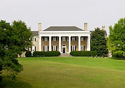
Millwood is an unincorporated community located in Clarke County, Virginia, United States. Millwood is the home of many of Clarke County's most historic sites including the Burwell-Morgan Mill (1785), Carter Hall (1792), the Greenway Historic District, Long Branch (1811), Old Chapel (1790), and the River House. Project HOPE is based at Carter Hall.