Albemarle County, Virginia

Last updated

Albemarle County
Albemarle County Office Building.jpg
The Albemarle County Office Building
Flag of Albemarle County.gif
Albemarlecountyseal.png
Map of Virginia highlighting Albemarle County.svg
Location within the U.S. state of Virginia
Virginia in United States.svg
Virginia's location within the U.S.
Coordinates: 38°02′N78°34′W / 38.03°N 78.56°W / 38.03; -78.56
CountryFlag of the United States.svg United States
StateFlag of Virginia.svg  Virginia
Founded1744
Named for Willem Anne van Keppel, 2nd Earl of Albemarle [1]
Seat Charlottesville
Largest town Scottsville
Area
  Total726 sq mi (1,880 km2)
  Land721 sq mi (1,870 km2)
  Water5 sq mi (10 km2)  0.7%
Population
 (2020)
  Total112,395
  Density155/sq mi (60/km2)
Time zone UTC−5 (Eastern)
  Summer (DST) UTC−4 (EDT)
Congressional districts 5th, 7th
Website www.albemarle.org

Albemarle County is a county located in the Piedmont region of the Commonwealth of Virginia. Its county seat is Charlottesville, which is an independent city and enclave entirely surrounded by the county. [2] Albemarle County is part of the Charlottesville Metropolitan Statistical Area. As of the 2020 census, the population was 112,395. [3]

Contents

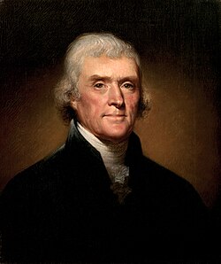
Albemarle County was created in 1744 from the western portion of Goochland County, though portions of Albemarle were later carved out to create other counties. Albemarle County was named in honor of Willem Anne van Keppel, 2nd Earl of Albemarle. Its most famous inhabitant was Thomas Jefferson, who built his estate home, Monticello, in the county.

History

Thomas Jefferson lived most of his life in Albemarle County Thomas Jefferson by Rembrandt Peale, 1800.jpg
Thomas Jefferson lived most of his life in Albemarle County

At the time of European encounter, the inhabitants of the area that became Albemarle County were a Siouan-speaking tribe called the Saponi. [4] In 1744, the Virginia General Assembly created Albemarle County from the western portion of Goochland County. [5] The county was named in honor of Willem Anne van Keppel, 2nd Earl of Albemarle and titular Governor of Virginia at the time. [6] The large county was partitioned in 1761, forming Buckingham and Amherst counties, at which time the county seat was moved from the formerly central Scottsville to a piece of newly central land, christened Charlottesville. [6] In 1777, Albemarle County was divided and Fluvanna County established, finalizing the boundaries of modern Albemarle County.

Albemarle County is well known for its association with President and Founding Father Thomas Jefferson, who was born in the county at Shadwell, though it was then part of Goochland County. [7] However, his home of Monticello is located in the county. [8] When the American Revolutionary War started in 1775, Jefferson was made colonel of the Albemarle Militia.

During the Civil War, the Battle of Rio Hill was a skirmish in which Union cavalry raided a Confederate camp in Albemarle County, Virginia.

Until the Civil War, the majority of Albemarle County's population consisted of enslaved African Americans. [9]

Geography

According to the U.S. Census Bureau, the county has a total area of 726 square miles (1,880 km2), of which 721 square miles (1,870 km2) is land and 5 square miles (13 km2) (0.7%) is water. [10]

Waterways

The Rivanna River's south fork forms in Albemarle County and was historically important for transportation. The south fork flows in-between Darden Towe Park and Pen Park. Boat ramp access is available at Darden Towe Park. The James River acts as a natural border between Albemarle and Buckingham Counties.

Major highways

I-64 in Albemarle County 2019-06-25 12 38 39 View west along Interstate 64 from the overpass for Virginia State Route 691 (Greenwood Road) in Greenwood, Albemarle County, Virginia.jpg
I-64 in Albemarle County

Protected areas

Albemarle's western border with Augusta and Rockingham Counties is located within the Shenandoah National Park.

Adjacent counties

Albemarle County borders 8 other counties, more than any other county in Virginia.

Parks and recreation

[11]

Demographics

Historical population
CensusPop.Note
1790 12,585
1800 16,43930.6%
1810 18,26811.1%
1820 19,7508.1%
1830 22,61814.5%
1840 22,294−1.4%
1850 25,80015.7%
1860 26,6253.2%
1870 27,5443.5%
1880 32,61818.4%
1890 32,379−0.7%
1900 28,473−12.1%
1910 29,8714.9%
1920 26,005−12.9%
1930 26,9813.8%
1940 24,652−8.6%
1950 26,6628.2%
1960 30,96916.2%
1970 37,78022.0%
1980 55,78347.7%
1990 68,04022.0%
2000 79,23616.5%
2010 98,97024.9%
2020 112,39513.6%
U.S. Decennial Census [12]
1790–1960 [13] 1900–1990 [14]
1990–2000 [15] 2010 [16] 2020 [17]

2020 census

Albemarle County, Virginia – Racial and ethnic composition
Note: the US Census treats Hispanic/Latino as an ethnic category. This table excludes Latinos from the racial categories and assigns them to a separate category. Hispanics/Latinos may be of any race.
Race / Ethnicity (NH = Non-Hispanic)Pop 2010 [16] Pop 2020 [17] % 2010% 2020
White alone (NH)77,13080,33577.93%71.48%
Black or African American alone (NH)9,4879,7939.59%8.71%
Native American or Alaska Native alone (NH)150960.15%0.09%
Asian alone (NH)4,5978,1864.64%7.28%
Pacific Islander alone (NH)42440.04%0.04%
Some Other Race alone (NH)1736040.17%0.54%
Mixed Race or Multi-Racial (NH)1,9744,8841.99%4.35%
Hispanic or Latino (any race)5,4178,4535.47%7.52%
Total98,970112,395100.00%100.00%

2010 Census

The largest self-reported ancestry groups in Albemarle County are English 16.3%, German 16.0%, Irish 12.7%, "American" 11.4% and Italian 5.2%. [18]

As of the census [19] of 2010, there were 98,970 people, 38,157 households, and 24,578 families residing in the county. The population density was 137 people per square mile (53 people/km2). There were 42,122 housing units at an average density of 58 units per square mile (22 units/km2). The racial makeup of the county was 80.6% White, 9.7% Black or African American, 0.3% Native American, 4.7% Asian, 0.1% Pacific Islander, 2.3% from other races, and 2.4% from two or more races. 5.5% of the population were Hispanic or Latino of any race.

There were 38,157 households, out of which 28.2% had children under the age of 18 living with them, 51.4% were married couples living together, 9.6% had a female householder with no husband present, and 35.6% were non-families. 28.0% of all households were made up of individuals, and 25.9% had someone living alone who was 65 years of age or older. The average household size was 2.41 and the average family size was 2.96.

In the county, the population was spread out, with 21.5% under the age of 18, 12.3% from 18 to 24, 24.7% from 25 to 44, 27.2% from 45 to 64, and 14.3% who were 65 years of age or older. The median age was 38.2 years. For every 100 females there were 92.69 males. For every 100 females aged 18 and over, there were 89.59 males.

22% of Albemarle residents have a graduate or professional degree, compared with 10% nationwide.

The median income for a household in the county was $63,001, and the median income for a family was $98,934. Males had a median income of $55,530 versus $52,211 for females. The per capita income for the county was $36,718. About 3.8% of families and 10.4% of the population were below the poverty line, including 8.0% of those under age 18 and 2.4% of those age 65 or over.

Economy

35% of people working in Albemarle live in the county, while 65% commute in. 19% of those commuting in live in Charlottesville, while the remainder live in the surrounding counties. 26,800 people commute out of Albemarle for work. 48% of which commute to Charlottesville, making up 51% of Charlottesville's in-commuters. In 2022, Albemarle had a 2.7% unemployment rate, compared with a national rate of 3.6%. [20]

The top 10 employers as of Q4 2022 were: [20]

  1. University of Virginia
  2. Sentara Healthcare
  3. U.S. Department of Defense
  4. County of Albemarle
  5. Crutchfield Corporation
  6. Walmart
  7. Piedmont Virginia Community College
  8. Northrop Grumman Corporation
  9. Boar's Head Inn
  10. Atlantic Coast Athletic Club

Government

Albemarle is governed by an elected six-member Board of Supervisors. Management of the county is vested in a Board-appointed County Executive. [21]

Board of Supervisors of Albemarle County [22]
NamePartyFirst electionDistrict
 Jim Andrews (chair)Dem2021Samuel Miller
 Diantha McKeelDem2013Jack Jouett
 Mike PruittDem2023Scottsville
 Ned GallawayDem2017Rio
 Ann MallekDem2007White Hall
 Bea LaPisto-KirtleyDem2019Rivanna

There are also several elected Constitutional Officers:

The nonpartisan School Board is also elected. Its members are: [26]

Emergency services

Earlysville Volunteer Fire Company Engine 45 at the Independence Day Parade. Earlysville Volunteer Fire Department Truck.jpg
Earlysville Volunteer Fire Company Engine 45 at the Independence Day Parade.
Crozet Volunteer Fire Department Engine 52 truck during the same parade. Crozet Volunteer Fire Company Truck.jpg
Crozet Volunteer Fire Department Engine 52 truck during the same parade.

Albemarle County has two branches of law enforcement, the Albemarle County Police Department, which handles criminal matters and is directed by the appointed police chief, Colonel Sean Reeves. [27] The second branch is the Albemarle County Sheriff's Office, which handles civil service in the county, and they are directed by the elected Sheriff Chan Bryant. [28]

Albemarle County Fire Rescue (ACFR) provides essential emergency services to the residents and visitors of Albemarle County including, fire suppression, emergency medical treatment, and transport, technical rescue, water rescue, and hazardous materials mitigation. In addition, the department provides a wide array of non-emergency services such as investigations, business inspections, burn permits, child safety seat inspections, smoke detector installations, public education, and emergency management.

Services are provided through a combination of career staff, nine volunteer fire and rescue agencies, and regional partners. Fire and rescue stations are placed strategically throughout the county to ensure proper coverage:

Fire stations

  • East Rivanna Volunteer Fire Company – Station 2 – (combination career/volunteer)
  • North Garden Volunteer Fire Company – Station 3 – (combination career/volunteer)
  • Earlysville Volunteer Fire Company – Station 4 – (combination career/volunteer)
  • Crozet Volunteer Fire Department – Station 5 – (combination career/volunteer)
  • Stony Point Volunteer Fire Company – Station 6 – (combination career/volunteer)
  • Scottsville Volunteer Fire Department – Station 7 – (volunteer)
  • Seminole Trail Volunteer Fire Department – Station 8 – (combination career/volunteer)
  • Charlottesville–Albemarle Airport Department of Public Safety – Station 9 – (career)
  • Monticello Fire Rescue – Station 11 – (career)
  • Hollymead Fire Rescue – Station 12 – (career)
  • Ivy Fire Rescue – Station 15 – (career)
  • Pantops Fire Rescue – Station 16 – (career)

[29] [30]

Rescue squads

[29]

  1. Combination career/volunteer – stations supplemented by career staff Monday - Friday, 6 AM - 6 PM. Volunteers operate these stations weeknights from 6 PM - 6 AM as well as weekends and holidays
  2. Volunteer – stations that operate with an all-volunteer, 24/7 team.
  3. Career – stations that operate with an all-career, 24/7 shift that work three distinct schedules

Law enforcement

The Albemarle County Sheriff's Office (ACSO) and the Albemarle County Police Department (ACPD) provide law enforcement services in the county.

The ACSO was created in 1745 when Joseph Thompson was appointed as the first sheriff. Then in 1895, citizens started electing sheriffs for 4-year terms. Lucian Watts was the first elected sheriff. [31] As of 2022 the sheriff is Chan Bryant, the county's first woman sheriff. [32]

The ACPD was created in 1983. Prior to 1983, local county governments could create a police force by a simple vote held by their respective board of supervisors. In February 1983 the Virginia General Assembly restricted the authority of county governments to create police forces without a voter referendum. The law did not go into effect until July 1983: On May 11, 1983, before the law took effect, the Albemarle County Board of Supervisors passed an ordinance creating the Albemarle County Police Department. That original ordinance provided for a police chief and five full time officers. [33] George W. Bailey was the first chief of police. [31] As of 2022 the chief of police is Sean Reeves. The ACPD currently has 140 sworn officers, 23 civilian employees, and 3 animal control officers. [34]

Representation & elections

Albemarle is represented by Republican Bryce Reeves and Democrat Creigh Deeds in the Virginia State Senate; Republicans Chris Runion, Rob Bell, and Matt Fariss and Democrat Sally L. Hudson represent the county in the Virginia House of Delegates. Republican Bob Good represents most of the county in the U.S. House of Representatives. Democrat Abigail Spanberger represents a small sliver in the most Northwest portion of Albemarle County.

For much of the second half of the 20th century, Albemarle County was heavily Republican, like most of this part of Virginia. However, the Republican edge narrowed significantly in the 1990s, in part due to the influence of the University of Virginia. In 2004, John Kerry carried it by two points, becoming the first Democrat to win the county since 1948. It swung hard to Barack Obama in 2008, and since then has become one of the few Democratic bastions in central Virginia, though it is not as overwhelmingly Democratic as Charlottesville.

United States presidential election results for Albemarle County, Virginia [35] [36]
Year Republican Democratic Third party
No.%No.%No.%
2020 20,80432.18%42,46665.68%1,3872.15%
2016 19,25933.95%33,34558.78%4,1227.27%
2012 23,29743.22%29,75755.20%8531.58%
2008 20,57640.36%29,79258.43%6161.21%
2004 21,18948.46%22,08850.51%4491.03%
2000 18,29149.64%16,25544.12%2,3006.24%
1996 15,24348.81%14,08945.12%1,8966.07%
1992 13,89443.69%13,88643.66%4,02412.65%
1988 15,11758.70%10,36340.24%2731.06%
1984 14,45564.16%7,98235.43%930.41%
1980 10,42453.23%7,29337.24%1,8659.52%
1976 9,08454.62%7,31043.95%2381.43%
1972 8,44765.22%4,30333.23%2011.55%
1968 4,51253.45%2,25526.71%1,67419.83%
1964 3,25151.48%3,06248.49%20.03%
1960 3,13559.47%2,10239.87%350.66%
1956 2,50857.18%1,41232.19%46610.62%
1952 2,52360.32%1,64239.25%180.43%
1948 98440.28%1,17848.22%28111.50%
1944 96435.69%1,72563.87%120.44%
1940 80432.71%1,64867.05%60.24%
1936 63525.74%1,82573.98%70.28%
1932 50820.39%1,94978.24%341.36%
1928 84635.00%1,57165.00%00.00%
1924 36620.31%1,38376.75%532.94%
1920 54125.42%1,58774.58%00.00%
1916 22313.95%1,37686.05%00.00%
1912 1449.58%1,21580.84%1449.58%
1908 38027.03%99971.05%271.92%
1904 30922.18%1,06976.74%151.08%
1900 1,67440.78%2,41158.73%200.49%
1896 1,91841.50%2,62856.86%761.64%
1892 1,79539.18%2,75760.18%290.63%
1888 2,16645.58%2,57354.15%130.27%
1884 2,58746.80%2,94153.20%00.00%
1880 1,64440.31%2,43259.64%20.05%

Education

The Albemarle County Public School System operates public education in the county. It provides education to nearly 14,000 students including preschool through high school. The Albemarle County Public School System's mission is to "establish a community of learners and learning, through relationships, relevance and rigor, one student at a time." [37] ACPS provides 25 school facilities [37] which include Community Lab School, a charter school that is located in the City of Charlottesville, Albemarle High School, Western Albemarle High School, and Monticello High School. [38] The School Board and the Superintendent, Matthew Haas, work closely together in operating the Albemarle County Public School System.

Many private schools in Albemarle serve the county and students from surrounding areas. These include:

Some students attend several private schools in the City of Charlottesville.

Jefferson-Madison Regional Library is the regional library system that provides services to the citizens of Albemarle.

Communities

The city of Charlottesville is enclaved within Albemarle County. Under Virginia law in effect since 1871, all municipalities in the state incorporated as cities are legally and politically independent of any county.

(Population according to the 2020 United States Census)

Municipalities in Albemarle County.svg

Towns

  1. Scottsville, the original county seat (524)
    (also in Fluvanna County)

Census-designated places

  1. Afton (313) new in 2020
    (also in Nelson County)
  2. Crozet (9,224)
  3. Earlysville (1,153) new in 2020
  4. Esmont (491)
  5. Free Union (187)
  6. Hollymead (8,601)
  7. Ivy (917)
  8. Keswick (321) new in 2020
  9. North Garden (461) new in 2020
  10. Pantops (4,682)
  11. Piney Mountain (1,880)
  12. Rio (2.076) new in 2020
  13. Rivanna (east county) (2,174)
  14. University of Virginia (7.704)

Unincorporated Communities

Many of these unincorporated areas have Charlottesville addresses.

Notable people

United States President and Governor of Virginia Thomas Jefferson's home, Monticello, is located in Albemarle County. Monticellofromgardens.jpg
United States President and Governor of Virginia Thomas Jefferson's home, Monticello, is located in Albemarle County.
United States President and Governor of Virginia James Monroe's home, Ash Lawn-Highland, is located in Albemarle County. AshLawnHighland.jpg
United States President and Governor of Virginia James Monroe's home, Ash Lawn-Highland, is located in Albemarle County.

See also

Related Research Articles

<span class="mw-page-title-main">Frederick County, Maryland</span> County in Maryland, United States

Frederick County is located in Maryland, United States. As of the 2020 U.S. census, the population was 271,717. The county seat is Frederick.

<span class="mw-page-title-main">Greene County, Virginia</span> County in Virginia, United States

Greene County is a county in Virginia in the eastern United States. As of the 2020 census, the population was 20,552. Its county seat is Stanardsville.

<span class="mw-page-title-main">Spotsylvania County, Virginia</span> County in Virginia, United States

Spotsylvania County is a county in the U.S. state of Virginia. As of the July 2021 estimate, the population was 145,300. Its county seat is Spotsylvania Courthouse.

<span class="mw-page-title-main">Henrico County, Virginia</span> County in Virginia, United States

Henrico County, officially the County of Henrico, is located in the Commonwealth of Virginia in the United States. As of the 2020 census, the population was 334,389 making it the fifth-most populous county in Virginia. Henrico County is included in the Greater Richmond Region. There is no incorporated community within Henrico County; therefore, there is no incorporated county seat either. Laurel, an unincorporated CDP, serves this function.

<span class="mw-page-title-main">Fluvanna County, Virginia</span> County in Virginia, United States

Fluvanna County is a county located in the Piedmont region of the Commonwealth of Virginia, United States. As of the 2020 census, the population was 27,249. Its county seat is Palmyra, while the most populous community is the census designated place of Lake Monticello.

<span class="mw-page-title-main">Charlottesville, Virginia</span> Independent city in Virginia, United States

Charlottesville, colloquially known as C'ville, is an independent city in Virginia, United States. It is the seat of government of Albemarle County, which surrounds the city, though the two are separate legal entities. It is named after Queen Charlotte. At the 2020 census, the population of the city was 46,553. The Bureau of Economic Analysis combines the City of Charlottesville with Albemarle County for statistical purposes, bringing its population to approximately 160,000. Charlottesville is the heart of the Charlottesville metropolitan area, which includes Albemarle, Buckingham, Fluvanna, Greene, and Nelson counties.

<span class="mw-page-title-main">Buckingham County, Virginia</span> County in Virginia, United States

Buckingham County is a rural United States county located in the Commonwealth of Virginia, and containing the geographic center of the state. Buckingham County is part of the Piedmont region of Virginia, and the county seat is Buckingham.

<span class="mw-page-title-main">Botetourt County, Virginia</span> County in Virginia, United States

Botetourt County is a US county that lies in the Roanoke Region of Virginia. Located in the mountainous portion of the state, the county is bordered by two major ranges, the Blue Ridge Mountains and the Appalachian Mountains.

<span class="mw-page-title-main">Lake Monticello, Virginia</span> Census-designated place in Virginia, United States

Lake Monticello, a private gated community, is a census-designated place (CDP) in Fluvanna County, Virginia, United States. The population was 10,126 at the 2020 census. The community is centered on a lake of the same name, which is formed by a dam on a short tributary of the nearby Rivanna River. Lake Monticello is part of the Charlottesville Metropolitan Statistical Area. Lake Monticello was developed in the 1960s as a summer vacation home community but quickly evolved into a bedroom community of Charlottesville, and to a smaller extent of Richmond. It also has a sizable retirement age population.

<span class="mw-page-title-main">Purcellville, Virginia</span> Small Town in Virginia

Purcellville is a town in Loudoun County, Virginia. The population was 8,929 according to the 2020 Census. Purcellville is the major population center for Western Loudoun and the Loudoun Valley. Many of the older structures remaining in Purcellville reflect the Victorian architecture popular during the early twentieth century.

<span class="mw-page-title-main">Scottsville, Virginia</span> Town in Virginia, United States

Scottsville is a town in Albemarle and Fluvanna counties in the U.S. state of Virginia. The population was 566 at the 2010 census. It is part of the Charlottesville Metropolitan Statistical Area.

Randolph Jefferson was the younger brother of Thomas Jefferson, the only male sibling to survive infancy. He was a planter and owner of the Snowden plantation that he inherited from his father. He served the local militia for about ten years, making captain of the local militia in 1794. He also served during the Revolutionary War.

<span class="mw-page-title-main">Wilson Cary Nicholas</span> American politician

Wilson Cary Nicholas was an American politician who served in the U.S. Senate from 1799 to 1804 and was the 19th Governor of Virginia from 1814 to 1816.

The Charlottesville Metropolitan Statistical Area is a Metropolitan Statistical Area (MSA) in the Piedmont region of the Commonwealth of Virginia as defined by the Office of Management and Budget (OMB). The combined population is: 201,559, 218,615, and 235,232.

<span class="mw-page-title-main">Keswick, Virginia</span> Unincorporated community in Virginia, United States

Keswick is a census-designated place in Albemarle County, Virginia, United States, about six miles east of Charlottesville.

<span class="mw-page-title-main">Virginia State Route 20</span> State highway in central Virginia, US

State Route 20 is a primary state highway in the U.S. state of Virginia. The state highway runs 89.79 miles (144.50 km) from U.S. Route 15 in Dillwyn north to SR 3 in Wilderness. SR 20 is a C-shaped route that connects Charlottesville with Farmville in Southside Virginia. The state highway also links Charlottesville to Fredericksburg by way of Orange County, within which SR 20 is the main east–west highway and intersects US 15 again in the county seat of Orange.

<span class="mw-page-title-main">Virginia State Route 53</span> State highway in central Virginia, US

State Route 53 is a primary state highway in the U.S. state of Virginia. Known as Thomas Jefferson Parkway, the state highway runs 18.32 miles (29.48 km) from SR 20 near Charlottesville east to U.S. Route 15 in Palmyra. SR 53 connects the county seats of Albemarle and Fluvanna counties. The state highway also provides access to the community of Lake Monticello and Monticello, the estate of Thomas Jefferson. The route of SR 53 became a state highway in 1930; the highway receives its present designation in 1947.

<span class="mw-page-title-main">Shack Mountain</span> Historic house in Virginia, United States

Shack Mountain is a house near Charlottesville, Virginia, that is a tribute to Thomas Jefferson's architectural style. It was designed by and for Fiske Kimball (1881-1955), an architectural historian who was the founder of the University of Virginia School of Architecture, and who is credited with restoring respect for Jefferson's architectural ability. The house derives its name from the Shackelford family, who owned and settled the property in the 18th century.

<span class="mw-page-title-main">Scottsville Historic District</span> Historic district in Virginia, United States

Scottsville Historic District is a national historic district located at Scottsville, Albemarle County and Fluvanna County, Virginia. The district encompasses 153 contributing buildings, 1 contributing site, and 4 contributing structures in the town of Scottsville. The district includes commercial, residential, religious, factory and warehouse buildings in a variety of popular architectural styles including Federal, Georgian, Greek Revival, Gothic Revival, Italianate, Queen Anne, Prairie, Colonial Revival, and Craftsman. Notable buildings include Scottsville High School (1920), Riverview (1817), Chester (1847), Belle Haven, Oakwood, Herndon House (1800), The Tavern (mid-1700s), Scottsville Presbyterian Church (1832), Disciples Church (1846), Coleman's Store (1914), and the Fore House (1732). Located in the district and separately listed are Cliffside and Mount Walla.

References

  1. "County Overview". County of Albemarle. Archived from the original on December 19, 2008. Retrieved November 14, 2008.
  2. "Find a County". National Association of Counties. Archived from the original on May 31, 2011. Retrieved June 7, 2011.
  3. "Albemarle County, Virginia". United States Census Bureau . Retrieved January 30, 2022.
  4. Swanton, John R. (1952), The Indian Tribes of North America, Smithsonian Institution, p. 72, ISBN   0-8063-1730-2, OCLC   52230544
  5. Pawlett, Nathaniel (1976). "An Index to Roads Shown in the Albemarle County Surveyors Books 1744-1853" (PDF). Charlottesville, Virginia: Virginia Highway & Transportation Research Council. Archived (PDF) from the original on October 30, 2008. Retrieved October 11, 2008.{{cite journal}}: Cite journal requires |journal= (help)
  6. 1 2 Atkins, Ace (March 27, 2007). "A county by any other name?". C-Ville Weekly. Portico Publications. Archived from the original on July 8, 2011. Retrieved October 11, 2008.
  7. Henry Stephens Randall, The Life of Thomas Jefferson
  8. "Albemarle County". Commonwealth of Virginia. Archived from the original on December 8, 2006. Retrieved October 11, 2008. Albemarle County is widely recognized as rich in history and beauty. Among its historic attractions are Monticello, home to President Thomas Jefferson...
  9. "Enslaved Population in Virginia". Encyclopedia Virginia. Retrieved August 20, 2018.
  10. "US Gazetteer files: 2010, 2000, and 1990". United States Census Bureau. February 12, 2011. Retrieved April 23, 2011.
  11. "Parks". Albemarle County, VA. Retrieved January 26, 2023.
  12. "Census of Population and Housing from 1790-2000". US Census Bureau . Retrieved January 24, 2022.
  13. "Historical Census Browser". University of Virginia Library. Retrieved December 31, 2013.
  14. "Population of Counties by Decennial Census: 1900 to 1990". United States Census Bureau. Retrieved December 31, 2013.
  15. "Census 2000 PHC-T-4. Ranking Tables for Counties: 1990 and 2000" (PDF). United States Census Bureau. Archived (PDF) from the original on October 9, 2022. Retrieved December 31, 2013.
  16. 1 2 "P2 Hispanic or Latino, and Not Hispanic or Latino by Race - 2010: DEC Redistricting Data (PL 94-171) - Albemarle County, Virginia". United States Census Bureau .
  17. 1 2 "P2 Hispanic or Latino, and Not Hispanic or Latino by Race - 2020: DEC Redistricting Data (PL 94-171) - Albemarle County, Virginia". United States Census Bureau .
  18. "U.S. Census website". United States Census Bureau . Retrieved March 19, 2015.
  19. "U.S. Census website". United States Census Bureau . Retrieved May 14, 2011.
  20. 1 2 Local Area Profiles Archived November 27, 2020, at the Wayback Machine virginiaworks.com
  21. "County Executive". County of Albemarle, VA. Retrieved June 21, 2015.
  22. "Board Members". Albemarle County, VA. Retrieved January 26, 2023.
  23. "Circuit Court Clerk's Office". Albemarle County, VA.
  24. "Staff". Albemarle County, VA. Retrieved August 6, 2021.
  25. "Albemarle County Sheriff's Office". Albemarle County Sheriff's Office. Retrieved August 6, 2021.
  26. "School Board Members". Albemarle County School District. Retrieved August 6, 2021.
  27. "Albemarle County Police Department". Albemarle County, VA. Retrieved January 26, 2023.
  28. "Albemarle County Sheriff's Office". Albemarle County Sheriff's Office. Retrieved January 26, 2023.
  29. 1 2 "Station Information". Albemarle County, VA. Retrieved August 17, 2018.
  30. "Public Safety". Charlottesville-Albemarle Airport. Retrieved January 5, 2024.
  31. 1 2 "Albemarle County Sheriff's Office - History". Archived from the original on June 27, 2009. Retrieved August 27, 2009.
  32. "Bryant sworn in as Albemarle County Sheriff". CBS19 News. Retrieved October 25, 2022.
  33. "Error". lfweb.albemarle.org. Retrieved May 20, 2023.
  34. "Albemarle County Police Department - Who are we" . Retrieved May 20, 2023.
  35. Leip, David. "Dave Leip's Atlas of U.S. Presidential Elections". uselectionatlas.org. Retrieved August 17, 2018.
  36. "Our Campaigns - U.S. President" . Retrieved January 22, 2021.
  37. 1 2 "Division Fact Sheet". Albemarle County Public Schools. Retrieved November 7, 2017.
  38. "Our Schools". Albemarle County Public Schools. Retrieved November 7, 2017.
  39. 1 2 3 4 5 6 7 8 9 10 11 12 13 14 15 Who Was Who in America, Historical Volume, 1607-1896. Chicago: Marquis Who's Who. 1963.
  40. National Register of Historic Places Inventory Nomination Form: Mirador (Boundary Increase) (Report). Commonwealth of Virginia, Department of Historic Resources. April 7, 2003.
  41. "Inside The New York Times Book Review: John Grisham on 'The Whistler'". The New York Times. November 4, 2016. ISSN   0362-4331 . Retrieved November 7, 2017.
  42. Healy, Patrick. "Grisham's 'Time to Kill' Coming to Broadway". ArtsBeat. Retrieved November 7, 2017.
  43. Obituary of Claude Hampton Hall (1922-2001), Bryan-College Station, Texas, Eagle, April 4, 2001

Further reading

38°02′N78°34′W / 38.03°N 78.56°W / 38.03; -78.56