Page County | |
---|---|
Coordinates: 38°37′N78°29′W / 38.61°N 78.48°W | |
Country | United States |
State | Virginia |
Founded | 1831 |
Named for | John Page |
Seat | Luray |
Largest town | Luray |
Area | |
• Total | 314 sq mi (810 km2) |
• Land | 311 sq mi (810 km2) |
• Water | 3.2 sq mi (8 km2) 1.0% |
Population (2020) | |
• Total | 23,709 |
• Density | 76/sq mi (29/km2) |
Time zone | UTC−5 (Eastern) |
• Summer (DST) | UTC−4 (EDT) |
ZIP Codes | 22650, 22827, 22835, 22849, 22851 |
Area code | 540, 826 |
Congressional district | 6th |
Website | www |
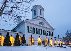
Page County is located in the Commonwealth of Virginia. As of the 2020 census, the population was 23,709. [1] Its county seat is Luray. [2] Page County was formed in 1831 from Shenandoah and Rockingham counties and was named for John Page, Governor of Virginia from 1802 to 1805.
According to the U.S. Census Bureau, the county has a total area of 314 square miles (810 km2), of which 311 square miles (810 km2) is land and 3.2 square miles (8.3 km2) (1.0%) is water. [3] The highest point in Page County is Hawksbill Mountain, which is located along the border with Madison County within Shenandoah National Park.
Census | Pop. | Note | %± |
---|---|---|---|
1840 | 6,194 | — | |
1850 | 7,600 | 22.7% | |
1860 | 8,109 | 6.7% | |
1870 | 8,462 | 4.4% | |
1880 | 9,965 | 17.8% | |
1890 | 13,092 | 31.4% | |
1900 | 13,794 | 5.4% | |
1910 | 14,147 | 2.6% | |
1920 | 14,770 | 4.4% | |
1930 | 14,852 | 0.6% | |
1940 | 14,863 | 0.1% | |
1950 | 15,152 | 1.9% | |
1960 | 15,572 | 2.8% | |
1970 | 16,581 | 6.5% | |
1980 | 19,401 | 17.0% | |
1990 | 21,690 | 11.8% | |
2000 | 23,177 | 6.9% | |
2010 | 24,042 | 3.7% | |
2020 | 23,709 | −1.4% | |
U.S. Decennial Census [4] 1790–1960 [5] 1900–1990 [6] 1990–2000 [7] 2010 [8] 2020 [9] |
Race / Ethnicity | Pop 2010 [8] | Pop 2020 [9] | % 2010 | % 2020 |
---|---|---|---|---|
White alone (NH) | 22,871 | 21,870 | 95.13% | 92.24% |
Black or African American alone (NH) | 456 | 436 | 1.90% | 1.84% |
Native American or Alaska Native alone (NH) | 37 | 49 | 0.15% | 0.21% |
Asian alone (NH) | 71 | 115 | 0.30% | 0.49% |
Pacific Islander alone (NH) | 7 | 8 | 0.03% | 0.03% |
Some Other Race alone (NH) | 6 | 40 | 0.02% | 0.17% |
Mixed Race/Multi-Racial (NH) | 221 | 694 | 0.92% | 2.93% |
Hispanic or Latino (any race) | 373 | 497 | 1.55% | 2.10% |
Total | 24,042 | 23,709 | 100.00% | 100.00% |
Note: the US Census treats Hispanic/Latino as an ethnic category. This table excludes Latinos from the racial categories and assigns them to a separate category. Hispanics/Latinos can be of any race.
As of the census [10] of 2000, there were 23,177 people, 9,305 households, and 6,634 families residing in the county. The population density was 74 people per square mile (29 people/km2). There were 10,557 housing units at an average density of 34 units per square mile (13 units/km2). The racial makeup of the county was 96.65% White, 2.61% Black or African American, 0.15% Native American, 0.24% Asian, 0.03% Pacific Islander, 0.48% from other races, and 0.68% from two or more races. 1.08% of the population were Hispanic or Latino of any race.
There were 9,305 households, out of which 29.60% had children under the age of 18 living with them, 55.80% were married couples living together, 10.50% had a female householder with no husband present, and 28.70% were non-families. 24.40% of all households were made up of individuals, and 11.10% had someone living alone who was 65 years of age or older. The average household size was 2.46 and the average family size was 2.91.
In the county, the population was spread out, with 23.00% under the age of 18, 7.70% from 18 to 24, 28.30% from 25 to 44, 25.30% from 45 to 64, and 15.70% who were 65 years of age or older. The median age was 39 years. For every 100 females there were 96.20 males. For every 100 females age 18 and over, there were 94.40 males.
The median income for a household in the county was $33,359, and the median income for a family was $39,005. Males had a median income of $27,199 versus $19,821 for females. The per capita income for the county was $16,321. About 10.10% of families and 12.50% of the population were below the poverty line, including 16.00% of those under age 18 and 14.70% of those age 65 or over.
Page County has a total of 8 public schools: 4 elementary schools, 2 middle schools and 2 high schools. [11]
High Schools | Middle Schools | Elementary Schools |
---|---|---|
Luray | Luray | Luray |
Springfield | ||
Page County | Page County | Shenandoah |
Stanley |
In addition to the public schools, Page County has a Technical Center with programs in:
Laurel Ridge Community College's Luray-Page County Center is located in Luray, which provides college and workforce development classes. Jenkins Hall features more than 13,000 square feet of educational space, including classrooms, science and health labs, a trades lab, student commons, and administrative offices.
The college in Luray is a satellite site for a physical therapy assistant degree program, plus phlebotomy, medical office assistant, HVAC, and heavy equipment operator classes. [13]
Students can earn an Associate Degree in many different subjects, or can take general education classes to transfer into a four-year university.
Since 1940, Page County has been a stronghold for the Republican Party in presidential elections.
The Page County Board of Supervisors has six members, one from each voting district and one at-large chairman.
Name | Party | District | |
---|---|---|---|
Keith Weakley, Chairman | Rep | At-Large | |
D. Keith Guzy Jr. | Rep | District 1 - West Luray | |
Allen Louderback | Rep | District 2 - East Luray | |
Ryan Cubbage | Rep | District 3 - Marksville | |
Vacant | TBD | District 4 - Newport | |
Jeff Vaughan | Rep | District 5 - Shenandoah | |
Year | Republican | Democratic | Third party(ies) | |||
---|---|---|---|---|---|---|
No. | % | No. | % | No. | % | |
2024 | 10,123 | 76.39% | 2,976 | 22.46% | 152 | 1.15% |
2020 | 9,345 | 74.68% | 3,007 | 24.03% | 162 | 1.29% |
2016 | 7,831 | 72.91% | 2,514 | 23.41% | 395 | 3.68% |
2012 | 6,344 | 62.03% | 3,724 | 36.41% | 160 | 1.56% |
2008 | 6,041 | 58.15% | 4,235 | 40.76% | 113 | 1.09% |
2004 | 6,221 | 64.78% | 3,324 | 34.61% | 58 | 0.60% |
2000 | 5,089 | 63.64% | 2,726 | 34.09% | 181 | 2.26% |
1996 | 3,876 | 51.83% | 2,868 | 38.35% | 735 | 9.83% |
1992 | 4,203 | 49.68% | 3,010 | 35.58% | 1,247 | 14.74% |
1988 | 5,013 | 66.18% | 2,499 | 32.99% | 63 | 0.83% |
1984 | 5,021 | 66.78% | 2,437 | 32.41% | 61 | 0.81% |
1980 | 4,297 | 60.20% | 2,607 | 36.52% | 234 | 3.28% |
1976 | 3,780 | 51.52% | 3,401 | 46.35% | 156 | 2.13% |
1972 | 4,326 | 72.34% | 1,585 | 26.51% | 69 | 1.15% |
1968 | 3,667 | 53.93% | 2,125 | 31.25% | 1,008 | 14.82% |
1964 | 2,804 | 51.74% | 2,606 | 48.09% | 9 | 0.17% |
1960 | 2,708 | 62.53% | 1,608 | 37.13% | 15 | 0.35% |
1956 | 2,372 | 62.73% | 1,358 | 35.92% | 51 | 1.35% |
1952 | 2,649 | 64.59% | 1,441 | 35.14% | 11 | 0.27% |
1948 | 2,236 | 55.14% | 1,611 | 39.73% | 208 | 5.13% |
1944 | 2,574 | 60.79% | 1,653 | 39.04% | 7 | 0.17% |
1940 | 1,630 | 50.36% | 1,596 | 49.30% | 11 | 0.34% |
1936 | 1,551 | 45.00% | 1,888 | 54.77% | 8 | 0.23% |
1932 | 1,261 | 39.93% | 1,851 | 58.61% | 46 | 1.46% |
1928 | 1,580 | 60.65% | 1,025 | 39.35% | 0 | 0.00% |
1924 | 885 | 43.02% | 1,015 | 49.34% | 157 | 7.63% |
1920 | 1,126 | 56.81% | 846 | 42.68% | 10 | 0.50% |
1916 | 613 | 41.50% | 842 | 57.01% | 22 | 1.49% |
1912 | 340 | 27.94% | 703 | 57.76% | 174 | 14.30% |
Frederick County is located in the Commonwealth of Virginia. As of the 2020 census, the population was 91,419. Its county seat is Winchester. The county was formed in 1743 by the splitting of Orange County. It is Virginia's northernmost county. Frederick County is included in the Winchester, VA-WV Metropolitan Statistical Area, which is also included in the Washington-Baltimore-Northern Virginia, DC-MD-VA-WV-PA Combined Statistical Area.
Greene County is a county in Virginia in the eastern United States. As of the 2020 census, the population was 20,552. Its county seat is Stanardsville.
Warren County is a U.S. county located in the Commonwealth of Virginia. The 2020 census places Warren County within the Washington-Arlington-Alexandria, DC-VA-MD-WV Metropolitan Statistical Area with a population of 40,727. The county was established in 1836. The county seat is Front Royal.
Shenandoah County is a county located in the Commonwealth of Virginia. As of the 2020 United States Census, the population was 44,186. Its county seat is Woodstock. It is part of the Shenandoah Valley region of Virginia.
Rockingham County is a county located in the U.S. state of Virginia. As of the 2020 census, the population was 83,757. Its county seat is the independent city of Harrisonburg.
Richmond County is a county located on the Northern Neck in the U.S. state of Virginia. As of the 2020 census, the population sits at 8,923. Its county seat is Warsaw. The rural county should not be confused with the large city and state capital Richmond, Virginia. It was formed in 1692 when the first Rappahannock County was divided to form Richmond County and Essex County.
Madison County is a county located in the Commonwealth of Virginia. As of the 2020 census, the population was 13,837. Its county seat is Madison.
Dickenson County is a county located in the Commonwealth of Virginia. As of the 2020 census, the population was 14,124. Its county seat is Clintwood.
Clarke County is a county in the Commonwealth of Virginia. As of the 2020 census, the population was 14,783. Its county seat is Berryville. Clarke County is included in the Washington-Arlington-Alexandria, DC-VA-MD-WV Metropolitan Statistical Area.
Page County is a county located in the U.S. state of Iowa. As of the 2020 census, the population was 15,211. The county seat is Clarinda. The county is named in honor of Captain John Page of the 4th U.S. Infantry, who was mortally wounded in the Battle of Palo Alto.
Luray is a city in Russell County, Kansas, United States. As of the 2020 census, the population of the city was 166.
West Laurel is an unincorporated area and census-designated place (CDP) in Prince George's County, Maryland, United States. Per the 2020 census, the population was 4,428.
Laureles is a census-designated place (CDP) in Cameron County, Texas, United States. The population was 4,111 at the 2020 census. It is part of the Brownsville–Harlingen Metropolitan Statistical Area. Laureles is an area between Los Fresnos and San Benito.
Laurel Park is a census-designated place (CDP) in Henry County, Virginia, United States. The population was 675 at the 2010 census. It is part of the Martinsville Micropolitan Statistical Area.
Luray is the county seat of Page County, Virginia, United States, in the Shenandoah Valley in the northern part of the Commonwealth. The population was 4,831 at the 2020 census.
Stanley is a town in Page County, Virginia, United States. The population was 1,723 at the 2023 census.
Edinburg is a town in Shenandoah County, Virginia, United States. The population was 1,041 at the 2010 census.
New Market is a town in Shenandoah County, Virginia, United States. Founded as a small crossroads trading town in the Shenandoah Valley, it has a population of 2,155 as of the most recent 2020 U.S. census. The north–south U.S. 11 and the east–west U.S. 211 pass near it and cross Massanutten Mountain at the town's titular gap.
Bolivar is a town in Jefferson County, West Virginia, United States. The population was 1,072 at the 2020 census. The town is named for South American revolutionary leader Simón Bolívar. Located in West Virginia's Eastern Panhandle, it is part of the northwestern fringes of the Washington metropolitan area.
Laurel Hill is a census-designated place in Fairfax County, Virginia, United States. The population at the 2020 census was 8,307. Formerly part of the Lorton CDP, it comprises most of what was formerly the Lorton Reformatory grounds, which were purchased by Fairfax County in 2002 following the prison's closing and redeveloped as a new suburban community. The name "Laurel Hill" was adopted from Laurel Hill House, an 18th-century structure which had served as the residence of the Superintendent of the Reformatory, and originally was the home of Revolutionary War patriot William Lindsay.