Manassas Park, Virginia

Last updated

Manassas Park, Virginia
City of Manassas Park
Manassas Park.jpg
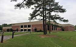
Manassas Park community center
Flag of Manassas Park, Virginia.png
Seal of Manassas Park, Virginia.png
Logo of Manassas Park, Virginia.svg
Map showing Manassas Park city, Virginia.png
Location of Manassas Park in Virginia
Manassas Park-Location.svg
Manassas Park in Virginia
USA Virginia Northern location map.svg
Red pog.svg
Manassas Park
USA Virginia location map.svg
Red pog.svg
Manassas Park
Usa edcp location map.svg
Red pog.svg
Manassas Park
Coordinates: 38°46′19″N77°27′09″W / 38.77194°N 77.45250°W / 38.77194; -77.45250
Country United States
State Virginia
Pre-incorporation County Flag of Prince William County, Virginia.svg Prince William County (None after Incorporation - Independent city)
Incorporated1975
Named for Manassas, Virginia
Government
   Mayor Alanna Mensing
Area
[1]
  Total
3.03 sq mi (7.86 km2)
  Land3.03 sq mi (7.86 km2)
  Water0.00 sq mi (0.00 km2)
Population
 (2020)
  Total
17,219
  Density5,682.84/sq mi (2,194.16/km2)
Time zone UTC-5
  Summer (DST) UTC-4
Zip Code
20111
FIPS code 51-48968 [2]
GNIS feature ID1495894 [3]
Website City of Manassas Park

Manassas Park is an independent city in the U.S. state of Virginia. As of the 2020 census, the population was 17,219. [4] Manassas Park is bordered by the city of Manassas and Prince William County. Manassas Park is a part of the Washington-Arlington-Alexandria, DC-VA-MD-WV Metropolitan Statistical Area.

Contents

History

During the American Civil War, the Manassas Park area was used as a campsite by the Confederate States Army during both the First and Second Battles of Bull Run.

Manassas Park was created as a subdivision of Prince William County, with the first houses being constructed in 1955. In 1957, Manassas Park was incorporated as a town. Approximately 600 acres of land was annexed by the town of Manassas Park in 1974, and the town was incorporated as a city independent from the county the next year in 1975. Since then, it has been Virginia's newest city. [5]

Geography

Manassas Park is located at 38°46′19″N77°27′09″W / 38.77194°N 77.45250°W / 38.77194; -77.45250 (38.771944, -77.45250). It is roughly dumbbell-shaped and lies to the south of Bull Run. It is longest NW–SE along Manassas Drive, and is bisected by Virginia State Route 28 at its narrowest section.

According to the United States Census Bureau, the city has a total area of 2.5 square miles (6.5 km2), all of it land. [6]

Adjacent county / Independent city

Demographics

Historical population
CensusPop.Note
1960 5,342
1970 6,84428.1%
1980 6,524−4.7%
1990 6,7343.2%
2000 10,29052.8%
2010 14,27338.7%
2020 17,21920.6%
U.S. Decennial Census [7]
1790-1960 [8] 1900-1990 [9]
1990-2000 [10] 2010-2020 [11]

2020 census

Manassas Park city, Virginia – Racial and Ethnic Composition
(NH = Non-Hispanic)
Note: the US Census treats Hispanic/Latino as an ethnic category. This table excludes Latinos from the racial categories and assigns them to a separate category. Hispanics/Latinos may be of any race.
Race / EthnicityPop 2010 [12] Pop 2020 [11] % 2010% 2020
White alone (NH)6,0704,70642.53%27.33%
Black or African American alone (NH)1,7842,07612.50%12.06%
Native American or Alaska Native alone (NH)31270.22%0.16%
Asian alone (NH)1,2611,8278.83%10.61%
Pacific Islander alone (NH)17130.12%0.08%
Some Other Race alone (NH)481330.34%0.77%
Mixed Race/Multi-Racial (NH)4176382.92%3.71%
Hispanic or Latino (any race)4,6457,79932.54%45.29%
Total14,27317,219100.00%100.00%

2000 census

At the 2000 census there were 10,290 people, 3,254 households and 2,557 families in the city. The population density was 4,129.0 inhabitants per square mile (1,594.2/km2). There were 3,365 housing units at an average density of 1,350.3 per square mile (521.4/km2). The racial makeup of the city was 72.79% White, 11.17% African American, 0.44% Native American, 4.06% Asian, 0.07% Pacific Islander, 8.14% from other races, and 3.33% from two or more races. Hispanic or Latino of any race were 15.00%. [13]

Of the 3,254 households 45.4% had children under the age of 18 living with them, 59.9% were married couples living together, 12.1% had a female householder with no husband present, and 21.4% were non-families. 14.4% of households were one person and 2.6% were one person aged 65 or older. The average household size was 3.16 and the average family size was 3.47.

The age distribution was 31.0% under the age of 18, 8.7% from 18 to 24, 40.1% from 25 to 44, 15.9% from 45 to 64, and 4.3% 65 or older. The median age was 30 years. For every 100 females, there were 103.8 males. For every 100 females age 18 and over, there were 103.0 males.

The median household income was $60,794 and the median family income was $61,075. Males had a median income of $38,643 versus $30,942 for females. The per capita income for the city was $21,048. About 4.7% of families and 5.2% of the population were below the poverty line, including 5.8% of those under age 18 and 11.2% of those age 65 or over.

In June 2021, U.S. News & World Report ranked Manassas Park with the fifth best life expectancy in the United States at 92.5 years old. [14]

Education

The city is served by Manassas Park City Schools, with a total of 4 schools: Cougar Elementary, Manassas Park Elementary, Manassas Park Middle, and Manassas Park High School. There are also Private Schools.

Transportation

Route 28 entering Manassas Park 2016-10-11 14 25 03 View north along Virginia State Route 28 (Centreville Road) at Conner Drive, entering Manassas Park, Virginia from Buckhall, Prince William County, Virginia.jpg
Route 28 entering Manassas Park

Virginia State Route 28 is the main highway serving the city. From Manassas Park, SR 28 extends north to Interstate 66 and south to Virginia State Route 234, providing connections to major cities through the region.

Virginia State Route 213 follows Manassas Drive, serving as a main roadway within Manassas Park. However, the route designation is unsigned.

The city is home to Manassas Park station located on the Manassas Line of the Virginia Railway Express.

Government

Manassas Park has supported every Democratic nominee since 2008. It voted for every Republican nominee between 1980 and 2004 while voting for the Democratic nominee in 1976, which was the first election held under independent city status.

United States presidential election results for Manassas Park, Virginia [15]
Year Republican Democratic Third party(ies)
No.%No.%No.%
2024 2,31438.59%3,50658.46%1772.95%
2020 1,97932.51%3,99265.58%1161.91%
2016 1,73333.12%3,20461.24%2955.64%
2012 1,69936.49%2,87961.83%781.68%
2008 1,63439.47%2,46359.49%431.04%
2004 1,80754.23%1,49844.96%270.81%
2000 1,46056.59%1,04840.62%722.79%
1996 91649.84%74840.70%1749.47%
1992 79246.05%56732.97%36120.99%
1988 99368.67%43430.01%191.31%
1984 97571.96%37527.68%50.37%
1980 72958.13%44735.65%786.22%
1976 44437.34%70959.63%363.03%

Notable people

References

  1. "2019 U.S. Gazetteer Files". United States Census Bureau. Retrieved August 7, 2020.
  2. "U.S. Census website". United States Census Bureau . Retrieved January 31, 2008.
  3. "US Board on Geographic Names". United States Geological Survey. October 25, 2007. Retrieved January 31, 2008.
  4. "Manassas Park city, Manassas Park city, Virginia". United States Census Bureau . Retrieved January 30, 2022.
  5. "Overview and History". Manassas Park. Retrieved June 6, 2022.
  6. "US Gazetteer files: 2010, 2000, and 1990". United States Census Bureau. February 12, 2011. Retrieved April 23, 2011.
  7. "Census of Population and Housing from 1790". US Census Bureau . Retrieved January 24, 2022.
  8. "Historical Census Browser". University of Virginia Library. Retrieved January 6, 2014.
  9. "Population of Counties by Decennial Census: 1900 to 1990". United States Census Bureau. Retrieved January 6, 2014.
  10. "Census 2000 PHC-T-4. Ranking Tables for Counties: 1990 and 2000" (PDF). United States Census Bureau. Archived (PDF) from the original on October 9, 2022. Retrieved January 6, 2014.
  11. 1 2 "P2 HISPANIC OR LATINO, AND NOT HISPANIC OR LATINO BY RACE - 2020: DEC Redistricting Data (PL 94-171) - Manassas Park city, Virginia". United States Census Bureau .
  12. "P2 HISPANIC OR LATINO, AND NOT HISPANIC OR LATINO BY RACE - 2010: DEC Redistricting Data (PL 94-171) - Manassas Park city, Virginia". United States Census Bureau .
  13. "U.S. Census website". United States Census Bureau . Retrieved May 14, 2011.
  14. Cirruzzo, Chelsea (June 30, 2021). "The 25 Counties With the Longest Life Expectancy". U.S. News & World Report. Retrieved July 1, 2021.
  15. David Leip. "Dave Leip's Atlas of U.S. Presidential Elections". Uselectionatlas.org. Retrieved December 8, 2020.