Lovingston, Virginia

Last updated
Lovingston, Virginia
Lovingston.JPG
Front Street in Lovingston
Coordinates: 37°45′46″N78°52′15″W / 37.76278°N 78.87083°W / 37.76278; -78.87083 Coordinates: 37°45′46″N78°52′15″W / 37.76278°N 78.87083°W / 37.76278; -78.87083
Country United States
State Virginia
County Nelson County, Virginia
Founded1809
Area
  Total4.03 sq mi (10.44 km2)
  Land4.03 sq mi (10.44 km2)
  Water0 sq mi (0 km2)
Elevation
817 ft (249 m)
Population
 (2010)
  Total520
  Density129.03/sq mi (49.81/km2)
Time zone UTC-5 (EST)
  Summer (DST) UTC-4 (EDT)
ZIP code
22949
Area code 434
FIPS code 51-47224
GNIS feature ID1498508

Lovingston is a census-designated place (CDP) in and the county seat of Nelson County, Virginia, United States. [1] The population as of the 2010 Census was 520. [2] Its ZIP Code is 22949. It was among the communities severely affected by flash flooding from Hurricane Camille in 1969. [3]

Contents

Lovingston is part of the Charlottesville Metropolitan Statistical Area.

The Lovingston High School, Lovingston Historic District, and the Nelson County Courthouse are listed on the National Register of Historic Places. [4]

History

The town was formed in 1807 and has been the county seat of Nelson County since 1809 when the courthouse was built in the center of town. The original 30-acre parcel of land on which the town sits was given by the Loving family, a very influential family over the years of the town's history. The town is dominated by the courthouse in the center of town with a grid pattern of streets surrounding it. Front, Second and Spring streets (which is now Route 29) run in a north–south direction while Main and Pleasant streets run in an east–west direction. The layout of the town was designed by George W. Varnum and the original design is still present today with very few alterations.

Courthouse Square

The courthouse is a significant marker of Lovingston's history as a courthouse town. It was the first public building built after the town's formation in 1807, and expansions have enabled it to remain in use to the present. Notable buildings in the square include the Whitehead Law office, the First Clerk's office, and the original jail that was based on a design from Thomas Jefferson.

Along Court Street were several taverns and hotels where people would gather to dine and rest on court days. Court days were a weekly event that would bring people from all over the county. The entire square would be filled with court attendees and their families picnicking and socializing.

The courthouse was designed by Shelton Crosthwait and is derived from the English town hall plan featuring a two-story temple front with a ground floor arcaded piazza. This design bridges the gap between colonial courthouse design and the Jeffersonian temple form.

Hurricane Camille

Damage from Hurricane Camille on the outskirts of Lovingston Lovingston Damages (7797544338).jpg
Damage from Hurricane Camille on the outskirts of Lovingston

The hurricane of 1969 was a profound event that has had a lasting impact on Lovingston. Dr. Robert H. Simpson at the National Hurricane Center called Hurricane Camille "the greatest recorded storm ever to hit a heavily populated area of the Western hemisphere." Thirty-three inches of measured rain fell in a short period of five hours in town, the day prior five inches in a half-hour and 153 Virginians were killed, three of whom lived in Lovingston, and some still missing. Many buildings were destroyed (207) and 70 more were damaged. The town was sited to avoid heavy flooding; however, the surrounding areas were more severely damaged, including the communities of Massie's Mill, Roseland, Bryant, and many others. Lovingston served as the center of rescue and recovery operations after the storm. 185 miles of road were severely damaged or lost in the flood.

The 153 Nelson County residents lost to Hurricane Camille have been commemorated in a number of ways over the years. In the Courthouse Square stands a monument honoring the 153 Nelson County residents who died in the tragedy.

Historic District

The town has been recognized on the Virginia Landmarks Register and the National Register of Historic Places since 2005 with 134 contributing buildings and sites within 225-acre designated historic area. Architectural styles present include Federal, Greek Revival, Gothic Revival, Italianate, Colonial Revival, Dutch Colonial Revival, Craftsman, and Modern Movements, as well as commercial and governmental buildings.
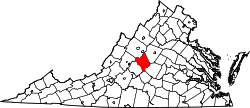
Geography

Lovingston is located in Nelson County in the center of the Commonwealth of Virginia along U.S. 29 just west of Peebles Mountain. The village has a total area of 4.03 square miles (10.44 km2), all of it land.

Lovingston is 147 miles (237 km) from Washington, D.C. and 102 miles (164 km) from Richmond.

Climate

Lovingston has a four-season humid subtropical climate, with all months being well-watered, though the period from May to September is the wettest. Winters are somewhat cool, with a January average of 34.5 °F (1.4 °C). Spring and autumn provide transitions of reasonable length. Summers are hot and humid, with July averaging 75.6 °F(24.2 °C). Snowfall is highly variable from year to year but is normally light and does not remain on the ground for long, averaging 17.1 inches (43.4 cm).

Demographics

As of the 2010 census, there were 520 people, 231 households, and 114 families residing in the town. There were 262 housing units. The racial makeup of the city was 72.5% White, 19.6% Black or African American, 0.6% Native American, 1.3% Asian, 1.2% from other races, and 4.8% from two or more races. 2.7% of the population were Hispanics or Latinos of any race.

Of the 231 households, 21.6% had children under the age of 18 living with them, 14.2% were married couples living together, 14.7% had a female householder with no husband present, and 50.6% were non-families. 46.8% of all households were made up of individuals, and 37.2% had someone living alone who was 65 years of age or older.

The age distribution was 16.5% under the age of 18 and 20.4% who were 65 years of age or older. The median age was 53.5 years.

The median income for a household in the city was $26,964, and the median income for a family was $70,486. The per capita income for the city was $22,411. About 6% of the population was below the poverty line.

Government

Lovingston became an independent town in 1871 and was de-incorporated in 1938. It has been the second seat of Nelson County since its formation in 1807 when Colleen was the original seat of Government for what is Amherst County also which Nelson County split away from. Lovingston has been home to the courthouse since its construction in 1809. Lovingston sits in the 59th District of the Virginia House of Delegates, represented by Republican Matt Fariss and the 25th District of the Senate of Virginia, represented by Democrat Creigh Deeds. Federally, Lovingston is part of Virginia's 5th congressional district, represented by Republican Bob Good, elected in 2020.

Points of interest

Kilmartin's Pharmacy

The white building at 622 Front Street was established as a livery and inn for travelers on the Stage Road in the early 1800s. The lower section has been altered to accommodate for retail space in the 1930s, but there were once stables where guests would keep their horses on the street level. During the American Civil War, the Inn was occupied by Confederate Soldiers and used as a hospital for soldiers wounded in nearby battles. The apartments on the second level have been home to several individual tenants and families, to present day, including the pastors of Lovingstons's four Baptist churches and their families during the early 1900s. The property is best known as the home to the local pharmacy, which was opened by Dr. E.B. Rowan in 1932 and was later managed by Dr. Joseph Kilmartin. Doctor Kilmartin's Pharmacy was a popular place for residents of Lovingston to spend time as it boasted some of the best milk shakes in Nelson County. Dr. Kilmartin retired in 1971, but the drug store remained open until 1980.

The Orchard House

The Orchard House was built in 1874 as the second home of Judge John D. Horsley, who served at the Courthouse. His son Thomas (Thos for short) M. Horsley took up residence here, making a successful orchard business named Village View that overlooked Lovingston. After Thomas' untimely death, his sorrowful widow let the orchard fall into ruin. Suddenly she rolled up her sleeves and rescued it, eventually remarrying. The Orchard was operable until 1962. It is now a central Virginia bed and breakfast.

The Mountain Cove Vineyard

The vineyard owned by AI Weed, who was the second president of the Virginia Winery Association, was founded in 1973. It sits on 600 acres outside the historic district of Lovingston. Robert Lee Camden owned the property from 1910 to 1935. The land was used for the apple, corn, tobacco, and cattle businesses. The original buildings in the vineyard were built around 1860 and are still in use for storage. Clarence T. Wright, nephew of R. L. Camden and a local mail carrier, inherited the property in 1935 and died in 1968.

Nelson Hall

Lovingston was once home to Nelson County's only movie theater, Nelson Hall, which was moved to Front Street from the nearby Oak Ridge estate in the 1920s. Manager J. H. McClellan bought the theater in 1945, and added a brick lobby with upstairs apartment to the front of the original two-story wooden structure shortly after. The theater seats 300 on the first level, and 99 in a balcony accessed by a separate entrance on the south side; during segregation, African American patrons could sit in the balcony only.

At its peak, the theater showed one movie on weeknights, two on Saturday nights, and a matinée and two evening shows on Sunday. On Thursday nights, the film was preceded by a live stage show, often local musicians or travelling Vaudeville shows. McClellan managed the theater until 1970, and Nelson Hall closed in 1973. The building has since been intermittently used as a performance space and church.

Bright Hope Baptist Church

Bright Hope Baptist Church is Lovingston's most historic African-American landmark. Located on a prominent site overlooking the village from the west, the church and a school (no longer standing) were built by the American Missionary Association around 1870 to serve the freedmen and women of Nelson County. The church cemetery has over 100 marked graves in the kept area.

Notable residents

A small number of celebrities were born in or near Lovingston. These individuals have helped put Lovingston on the map.

Related Research Articles

<span class="mw-page-title-main">Nelson County, Virginia</span> County in Virginia, United States

Nelson County is a county located in the Commonwealth of Virginia, in the United States. As of the 2020 census, the population was 14,775. Its county seat is Lovingston. Nelson County is part of the Charlottesville, VA, Metropolitan Statistical Area.

<span class="mw-page-title-main">Lawrenceville, Virginia</span> Town in Virginia, United States

Lawrenceville is a town in Brunswick County, Virginia, United States. Per the 2020 census, the population was 1,014. Located by the Meherrin River, it is the county seat of Brunswick County. In colonial times, Lieutenant Governor Alexander Spotswood had a stockade built nearby, called Fort Christanna, where converted Native American allies were housed and educated.

<span class="mw-page-title-main">Independence, Virginia</span> Town in Virginia, United States

Independence is a town in Southwestern Virginia's Grayson County, with a population of 1,001 as of the 2020 census. As the Grayson County Seat, it is located 71 miles from Winston-Salem, North Carolina, the closest city with a population over 50,000, and is situated on Virginia's Crooked Road, a heritage trail celebrating the musical heritage of Western and Southwest Virginia.

<span class="mw-page-title-main">Courtland, Virginia</span> Town in Virginia, United States

Courtland is an incorporated town in Southampton County, Virginia, United States. It is the county seat of Southampton County.

<span class="mw-page-title-main">Franklin, West Virginia</span> Town in West Virginia, United States

Franklin is a town in Pendleton County, West Virginia, United States. The population was 486 at the 2020 census. It is the county seat of Pendleton County. Franklin was established in 1794 and named for Francis Evick, an early settler.

<span class="mw-page-title-main">Court House, Arlington, Virginia</span> Neighborhood in Arlington, Virginia

Court House, also known as Courthouse, is a transit-oriented neighborhood in Arlington County, Virginia. It is centered around the Court House station on the Orange Line and the Silver Line of the Washington Metro.

<span class="mw-page-title-main">Virginia State Route 56</span> State highway in Virginia, United States

State Route 56 is a primary state highway in the U.S. state of Virginia. The state highway runs 60.87 miles (97.96 km) from U.S. Route 11 at Steeles Tavern east to US 60 near Buckingham. SR 56 is the main east–west highway of Nelson County. The state highway connects the county seat of Lovingston with Buckingham to the east and the Blue Ridge Mountains and the Shenandoah Valley to the west.

<span class="mw-page-title-main">Bristol County Courthouse Complex</span> United States historic place

The Bristol County Courthouse Complex Historic District contains three historic buildings located along Court Street in Taunton, Massachusetts, including the Bristol County Superior Courthouse, the Bristol County Registry of Deeds and the former First District Courthouse. The city's Korean War and World War II Memorials are also located on the lawn in front of the superior courthouse. The Bristol County Courthouse Complex directly abuts the Taunton Green Historic District, the City's central square.

<span class="mw-page-title-main">DeKalb County Courthouse (Illinois)</span> Local government building in the United States

The DeKalb County Courthouse is located in the county seat of DeKalb County, Illinois, U.S., the city of Sycamore. The Classical Revival structure sits on a square facing Illinois Route 64 as it passes through the city. The current courthouse was constructed in 1905 amid controversy over where the courthouse and thus, ultimately, the county seat would be located. The current building is the third structure to bear the name "DeKalb County Courthouse." DeKalb County's Courthouse still serves as the county's primary judicial center and is a contributing property to the Sycamore Historic District. The district joined the National Register of Historic Places in 1978. As the county's primary courthouse for over 100 years, the site has been host to many trials, including prominent murder cases.

<span class="mw-page-title-main">Ogle County Courthouse</span> Local government building in the United States

The Ogle County Courthouse is a National Register of Historic Places listing in the Ogle County, Illinois, county seat of Oregon. The building stands on a public square in the city's downtown commercial district. The current structure was completed in 1891 and was preceded by two other buildings, one of which was destroyed by a group of outlaws. Following the destruction of the courthouse, the county was without a judicial building for a period during the 1840s. The Ogle County Courthouse was designed by Chicago architect George O. Garnsey in the Romanesque Revival style of architecture. The ridged roof is dominated by its wooden cupola which stands out at a distance.

<span class="mw-page-title-main">Colleen, Virginia</span>

Colleen is an unincorporated community in Nelson County, Virginia, United States. It was originally named Cabellsville. From 1761, Colleen was the first seat of government of the original Amherst County, when the county court first met at Henry Key's home near this central location in the newly-formed county and ordered William Cabell to survey the line dividing it from the former Albemarle County. The new courthouse was erected on Lunsford Lomax's land by March 1762. In 1807, Virginia's legislature formed Nelson County, so the county seat had to be relocated. The Amherst County judges met at New Glasgow and ordered a new courthouse built nearby. That frame courthouse was finished in 1810 and replaced by the current courthouse in 1870. Meanwhile, the Nelson County seat was transferred to Lovingston, and a courthouse built in 1809.

<span class="mw-page-title-main">Lovingston High School</span> United States historic place

Lovingston High School is a historical school located at Lovingston, Nelson County, Virginia. It is a one-story Colonial Revival-style building that opened in 1931 and originally served grades one through eleven. It consists of a one-and-one-half-story main block with one-story wings. Behind the main block is the central auditorium with a stage and seven flanking classrooms. Later additions to the rear include four additional classrooms, built about 1945, and a kitchen, built 1951.

<span class="mw-page-title-main">Nelson County Courthouse</span> United States historic place

Nelson County Courthouse is a historic courthouse located at Lovingston, Nelson County, Virginia within the Lovingston Historic District. The original building opened in 1810. It is a rectangular, two-story stuccoed brick structure, with two additions: one of ten feet attached to the rear of the original structure and the other is a large lateral wing across the rear of the first addition. Both of these additions were constructed in 1940. The original structure was partially remodeled in 1968. It contains one large courtroom with a spectator gallery towards the rear. It was the first public building to be built after Nelson County's organization in 1807.

<span class="mw-page-title-main">Lovingston Historic District</span> Historic district in Virginia, United States

The Lovingston Historic District is a national historic district located in Lovingston, Virginia, USA. It is a 224.8-acre (0.910 km2) historic district which includes the entirety of the 1809 and 1823 plats as well as the continued growth through the early-to-mid-20th-century. The cohesive village contains a diverse collection of building types and architectural styles that reflect the town's growth and development as the seat of Nelson County from its inception to the present. It consists of 105 properties with 176 total resources, including the Nelson County Courthouse listed separately on the National Register of Historic Places, forty-nine single dwellings, twenty-four commercial structures, six multiple dwellings, twenty-five sheds, three churches, five tavern/hotels, eleven offices, a theater, a cooper shop, a packing shed, a post office, a bank, a cemetery and two statues.

<span class="mw-page-title-main">Crown Point Courthouse Square Historic District</span> Historic district in Indiana, United States

Crown Point Courthouse Square Historic District is a historic district in Crown Point, Indiana, that dates back to 1873. It was listed on the National Register of Historic Places in 2004. Its boundaries were changed in 2005, and it was increased in 2007 to include a Moderne architecture building at 208 Main Street. The late nineteenth- and early twentieth-century commercial and public buildings represent a period of economic and political growth. The Lake County Courthouse stands in the center of the district. Designed by architect John C. Cochrane in 1878, this brick building is a combination of Romanesque Revival and Classical styles. Enlarged in 1909 with the addition of north and south wings, designed by Beers and Beers. Continued growth in the county required second enlargement in 1928. This local landmark was placed in the National Register of Historic Places in 1973.

<span class="mw-page-title-main">Orleans County Courthouse Historic District</span> Historic district in New York, United States

The Orleans County Courthouse Historic District is one of two located in downtown Albion, New York, United States. Centered on Courthouse Square, it includes many significant buildings in the village, such as its post office and churches from seven different denominations, one of which is the tallest structure in the county. Many buildings are the work of local architect William V.N. Barlow, with contributions from Solon Spencer Beman and Andrew Jackson Warner. They run the range of architectural styles from the era in which the district developed, from Federal to Colonial Revival.

<span class="mw-page-title-main">Okeechobee County Courthouse</span> Building in Florida, United States

The Okeechobee County Courthouse, built in 1926, is an historic courthouse building located at 304 Northwest Second Street in Okeechobee, Florida. It was designed by architect George Gaynor Hyde of Miami in what has been variously called the Southern Colonial Revival or Mediterranean Revival style of architecture. Due to the collapse of the Florida Land Boom during its construction, its central dome was never built. After the 1928 Okeechobee hurricane, its hallways were used as a temporary morgue. An open breezeway was planned and built through the center front of the first floor but was later enclosed; the winding stairways to the second floor courtroom still remain.

<span class="mw-page-title-main">Valparaiso Downtown Commercial District</span> Historic district in Indiana, United States

Valparaiso has retained an active downtown. It remains a mix of government, retail and business center, with a mixed residential and service area. Numerous economic changes have not changed the basic character, historic courthouse area. The historic district retains the distinctive turn-of-the-19th-century architecture, supporting numerous small specialty shops, shaded sidewalks, and a people friendly environment. The Downtown District, is anchored on the Porter County Courthouse. It includes 14-blocks surrounding the square, bounded on the north by Jefferson Street, on the east by Morgan Street, on the south by Monroe Street, and on the west by Napoleon Street.

<span class="mw-page-title-main">Downtown Morgantown Historic District</span> Historic district in West Virginia, United States

The Downtown Morgantown Historic District is a federally designated historic district in Morgantown, Monongalia County, West Virginia. The district, encompassing approximately 75 acres, has 122 contributing buildings and 2 contributing sites including commercial and public buildings, residences, and churches. The district has been listed on the National Register of Historic Places since May 2, 1996. Ten of the contributing buildings are listed separately on the National Register of Historic Places. Significant structures located within the historic district are the Monongalia County Courthouse, the Metropolitan Theater, and the Old Morgantown Post Office.

<span class="mw-page-title-main">Lamoille County Courthouse</span> United States historic place

The Lamoille County Courthouse is located at 154 Main Street in Hyde Park, the shire town of Lamoille County, Vermont. Built in 1912 to a design by Burlington architect Zachary Taylor Austin (1850–1910), it is a good example of Romanesque and Colonial Revival architecture. It was listed on the National Register of Historic Places in 1996.

References

  1. "Find a County". National Association of Counties. Retrieved 2011-06-07.
  2. Virginia Trend Report 2: State and Complete Places (Sub-state 2010 Census Data). Missouri Census Data Center. Accessed 2011-06-08.
  3. Garnett P. Williams and Harold P. Guy. Erosional and Depositional Aspects of Hurricane Camille in Virginia, 1969. United States Government Printing Office, 1973, pp. 1.
  4. "National Register Information System". National Register of Historic Places . National Park Service. July 9, 2010.