Arrington, Virginia

Last updated

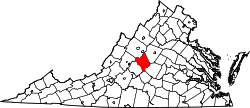
Arrington is a census-designated place (CDP) in Nelson County, Virginia, United States. The population as of the 2010 Census was 708.

Mitchell's Brick House Tavern was listed on the National Register of Historic Places in 2006. [1]

Climate

The climate in this area is characterized by hot, humid summers and generally mild to cool winters. According to the Köppen Climate Classification system, Arrington has a humid subtropical climate, abbreviated "Cfa" on climate maps. [2]

Related Research Articles

<span class="mw-page-title-main">Hallwood, Virginia</span> Town in Virginia, United States

Hallwood is a town in Accomack County, Virginia, in the United States. As of the 2010 census, the town population was 206.

<span class="mw-page-title-main">Painter, Virginia</span> Town in Virginia, United States

Painter is a town in Accomack County, Virginia, United States. The population was recorded at 229 at the 2010 census.

<span class="mw-page-title-main">Appomattox, Virginia</span> Town in Virginia

Appomattox is a town in Appomattox County, Virginia, United States. The population was 1,733 at the 2010 census. It is the county seat of Appomattox County.

<span class="mw-page-title-main">Brookneal, Virginia</span> Town in Virginia, United States

Brookneal is an incorporated town in Campbell County, Virginia, United States. The population was 1,112 as of the 2010 census. It is part of the Lynchburg Metropolitan Statistical Area.

<span class="mw-page-title-main">Halifax, Virginia</span> Town in Virginia, United States

Halifax is a town in Halifax County, Virginia, United States, along the Banister River. The population was 1,309 at the 2010 census. It is the county seat of Halifax County.

<span class="mw-page-title-main">Cheriton, Virginia</span> Town in Virginia, United States

Cheriton is a town in Northampton County, Virginia, United States. The population was 487 at the 2010 census.

<span class="mw-page-title-main">Broadway, Virginia</span> Town in Virginia, United States

Broadway is a town in Rockingham County, Virginia, United States. The population was 3,691 at the 2010 census. It is included in the Harrisonburg Metropolitan Statistical Area.

<span class="mw-page-title-main">Dayton, Virginia</span> Town in Virginia, United States

Dayton is a town in Rockingham County, Virginia, United States. The population is 1,530 as of the 2010 census. It is included in the Harrisonburg, Virginia Metropolitan Statistical Area.

<span class="mw-page-title-main">New Market, Virginia</span> Town in Virginia, United States

New Market is a town in Shenandoah County, Virginia, United States. Founded as a small crossroads trading town in the Shenandoah Valley, it has a population of 2,146 as of the most recent 2010 U.S. census. The north–south U.S. 11 and the east–west U.S. 211 pass near it and cross Massanutten Mountain at the town's titular gap.

<span class="mw-page-title-main">Toms Brook, Virginia</span> Town in Virginia, United States

Toms Brook is a town in Shenandoah County, Virginia, United States. The population was 258 at the 2010 census.

<span class="mw-page-title-main">Clarksville, Virginia</span> Town in Virginia, United States

Clarksville is a town in Mecklenburg county in the U.S. state of Virginia, near the southern border of the commonwealth. The population was 1,139 at the 2010 census. Since the town has numerous buildings of the 18th-, 19th-, and early 20th-century architecture, the downtown area of Clarksville has been designated a Historic District on the National Register of Historic Places and Virginia's Historic Register. Clarksville claims the title of Virginia's only Lakeside town. Nearby the town of Clarksville is Occoneechee State Park.

<span class="mw-page-title-main">Nottoway, Virginia</span>

Nottoway, or Nottoway Court House, is a census-designated place (CDP) in and the county seat of Nottoway County, Virginia, United States. The population as of the 2010 Census was 84.

<span class="mw-page-title-main">Nellysford, Virginia</span>

Nellysford is a census-designated place (CDP) in Nelson County, Virginia, United States. The population as of the 2010 Census was 1,076. It is home to the Wintergreen golf course at Stoney Creek. Its zip code is 22958.

Lafayette is a census-designated place (CDP) between the cities of Roanoke and Christiansburg in eastern Montgomery County, southwest Virginia, United States. The population as of the 2010 Census was 449. It is located adjacent to Elliston, at the confluence of the North and South Forks of the Roanoke River.

<span class="mw-page-title-main">Randolph, Virginia</span> Unincorporated community in Virginia, United States

Randolph, formerly called Roanoke and Talcott, is a small unincorporated community in Charlotte County, Virginia, United States, near the Staunton River. Its elevation is 354 feet. The community is the home of Staunton River Battlefield State Park.

<span class="mw-page-title-main">Madison Mills, Virginia</span> Unincorporated community in Virginia, United States

Madison Mills is an unincorporated community located in Madison County, Virginia, United States. It is located at the intersection of U.S. Route 15 and Virginia State Route 230.

Shipman is a census-designated place (CDP) in Nelson County, Virginia, United States. The population as of the 2010 Census was 507.

<span class="mw-page-title-main">Wintergreen, Virginia</span>

Wintergreen is a census-designated place (CDP) in Augusta and Nelson counties, Virginia, United States, located near Wintergreen Resort. The population as of the 2010 Census was 165.

Fine Creek Mills is an unincorporated community in Powhatan County, in the U.S. state of Virginia.

<span class="mw-page-title-main">Skipwith, Virginia</span> Unincorporated community in Virginia, United States

Skipwith is an unincorporated community in old Bluestone Township, Mecklenburg County, Virginia, United States. It is located between Chase City and Clarksville, west-northwest of the county seat at Boydton. The community was named for local members of the Skipwith family, related to colonial Virginia Skipwith families which began arriving from English baronial estates in the 1650s. The surname Skipwith is derived from Old English "sceap" (sheep) and Old Norse "vath". One ancient Skipwith coat of arms is blazoned "Argent, three bars Gules, in chief a greyhound courant Sable."

References

  1. "National Register Information System". National Register of Historic Places . National Park Service. July 9, 2010.
  2. Climate Summary for Arrington, Virginia

37°41′03″N78°54′04″W / 37.68417°N 78.90111°W / 37.68417; -78.90111