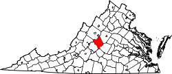
Shady Lane, Virginia

Last updated

Shady Lane is an unincorporated community in Nelson County, Virginia, United States.

Nelson County, Virginia county in Virginia, United States of America

Nelson County is a county located in the Commonwealth of Virginia. As of the 2010 census, the population was 15,020. Its county seat is Lovingston.

Virginia State of the United States of America

Virginia, officially the Commonwealth of Virginia, is a state in the Southeastern and Mid-Atlantic regions of the United States located between the Atlantic Coast and the Appalachian Mountains. Virginia is nicknamed the "Old Dominion" due to its status as the first English colonial possession established in mainland North America and "Mother of Presidents" because eight U.S. presidents were born there, more than any other state. The geography and climate of the Commonwealth are shaped by the Blue Ridge Mountains and the Chesapeake Bay, which provide habitat for much of its flora and fauna. The capital of the Commonwealth is Richmond; Virginia Beach is the most populous city, and Fairfax County is the most populous political subdivision. The Commonwealth's estimated population as of 2017 is over 8.4 million.

United States federal republic in North America

The United States of America (USA), commonly known as the United States or America, is a country composed of 50 states, a federal district, five major self-governing territories, and various possessions. At 3.8 million square miles, the United States is the world's third or fourth largest country by total area and is slightly smaller than the entire continent of Europe's 3.9 million square miles. With a population of over 327 million people, the U.S. is the third most populous country. The capital is Washington, D.C., and the largest city by population is New York City. Forty-eight states and the capital's federal district are contiguous in North America between Canada and Mexico. The State of Alaska is in the northwest corner of North America, bordered by Canada to the east and across the Bering Strait from Russia to the west. The State of Hawaii is an archipelago in the mid-Pacific Ocean. The U.S. territories are scattered about the Pacific Ocean and the Caribbean Sea, stretching across nine official time zones. The extremely diverse geography, climate, and wildlife of the United States make it one of the world's 17 megadiverse countries.

Related Research Articles

Abárzuza is a town and municipality located in the province and autonomous community of Navarre, northern Spain.

Karapınar District in Turkey

Karapınar is a town and district of Konya Province in the Central Anatolia region of Turkey. According to 2000 census, population of the district is 55,734 of which 35,285 live in the town of Karapınar. Volcanic Karapınar Field is located nearby.

South Branch Piscataquog River river in the United States of America

The South Branch of the Piscataquog River is a 20.5-mile-long (33.0 km) river located in southern New Hampshire in the United States. It is a tributary of the Piscataquog River, part of the Merrimack River watershed.

Safford Unified School District

The Safford Unified School District is the school district that serves the City of Safford, Arizona and some minor outlying areas.

Warnock, Ohio human settlement in United States of America

Warnock is an unincorporated community in northern Smith Township, Belmont County, Ohio, United States. Although it is unincorporated, it has a post office, with the ZIP code of 43967. It lies along State Route 9.

Warwick Township is a civil township in Benson County, North Dakota, United States. As of the 2000 census, its population was 78.

Midway, Alameda County, California Unincorporated community in California, United States

Midway is an unincorporated community in Alameda County, California, 6 miles (9.7 km) south-southeast of Altamont. It lies at an elevation of 358 feet. A post office operated in Midway from 1870 to 1918.

Mariemont, California Unincorporated community in California, United States

Mariemont is an unincorporated community in El Dorado County, California. It lies at an elevation of 1158 feet.

Elk Grove, Humboldt County, California Former settlement in California, United States

Elk Grove is a former settlement in Humboldt County, California. It was located 6 miles (9.7 km) north-northeast of Orick, at an elevation of 151 feet. It still appeared on maps as of 1947.

Thunder Lake, Alberta

Thunder Lake is a hamlet in central Alberta within the County of Barrhead No. 11. It is located on the eastern shore of Thunder Lake, just south of Thunder Lake Provincial Park, and is about 5 kilometres (3.1 mi) west of Highway 18 and approximately 21 kilometres (13 mi) west of Barrhead.

Lodore is an unincorporated community located in Amelia County, in the U.S. state of Virginia.

Kosino-Ukhtomsky District District in Moscow, Russia

Kosino-Ukhtomsky District is an administrative district (raion) of Eastern Administrative Okrug, and one of the 125 raions of Moscow, Russia.

Raymond is an unincorporated community in Coweta County, Georgia, United States. It uses the mailing addresses of nearby Sharpsburg and Newnan.

Witch Creek, a populated locale in San Diego County, California between Ramona and Santa Ysabel. Named for Witch Creek that flows through the area.

Collier Mill is an unincorporated community in Lee County, Virginia, in the United States.

Artic is an unincorporated community in Grays Harbor County, in the U.S. state of Washington.

Fincastle is an unincorporated community in Brown County, in the U.S. state of Ohio.

Gaztambide (Madrid) Ward of Madrid in Madrid, Spain

Gaztambide is a ward (barrio) of Madrid belonging to the district of Chamberí.

Depew is an unincorporated community in northwest Douglas County, in the U.S. state of Missouri. The community was located just north of Missouri Route 14 about two miles southwest of Dogwood.

Shiloh Township, Iredell County, North Carolina Township in North Carolina, United States

Shiloh Township is a township in Iredell County, North Carolina, United States.

References

Coordinates: 37°42′53″N79°01′21″W / 37.71472°N 79.02250°W / 37.71472; -79.02250

Geographic coordinate system Coordinate system

A geographic coordinate system is a coordinate system that enables every location on Earth to be specified by a set of numbers, letters or symbols. The coordinates are often chosen such that one of the numbers represents a vertical position and two or three of the numbers represent a horizontal position; alternatively, a geographic position may be expressed in a combined three-dimensional Cartesian vector. A common choice of coordinates is latitude, longitude and elevation. To specify a location on a plane requires a map projection.