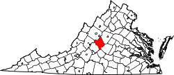
Red Apple Orchard is an unincorporated community in Nelson County, Virginia, United States.
Nelson County is a county located in the Commonwealth of Virginia. As of the 2010 census, the population was 15,020. Its county seat is Lovingston.
Virginia, officially the Commonwealth of Virginia, is a state in the Southeastern and Mid-Atlantic regions of the United States located between the Atlantic Coast and the Appalachian Mountains. The geography and climate of the Commonwealth are shaped by the Blue Ridge Mountains and the Chesapeake Bay, which provide habitat for much of its flora and fauna. The capital of the Commonwealth is Richmond; Virginia Beach is the most populous city, and Fairfax County is the most populous political subdivision. The Commonwealth's estimated population as of 2018 is over 8.5 million.
The United States of America (USA), commonly known as the United States or America, is a country comprising 50 states, a federal district, five major self-governing territories, and various possessions. At 3.8 million square miles, the United States is the world's third or fourth largest country by total area and is slightly smaller than the entire continent of Europe's 3.9 million square miles. With a population of over 327 million people, the U.S. is the third most populous country. The capital is Washington, D.C., and the largest city by population is New York City. Forty-eight states and the capital's federal district are contiguous in North America between Canada and Mexico. The State of Alaska is in the northwest corner of North America, bordered by Canada to the east and across the Bering Strait from Russia to the west. The State of Hawaii is an archipelago in the mid-Pacific Ocean. The U.S. territories are scattered about the Pacific Ocean and the Caribbean Sea, stretching across nine official time zones. The extremely diverse geography, climate, and wildlife of the United States make it one of the world's 17 megadiverse countries.
Bagley Township is a civil township of Otsego County in the U.S. state of Michigan. The population was 5,838 at the 2000 census.
Childwickbury Manor is a manor house in Hertfordshire, England, between St Albans and Harpenden.
Friesland Ridge is a ridge on Livingston Island in the South Shetlands, part of the Tangra Mountains. The summit, Mount Friesland, which rises to 1,700 metres (5,600 ft), is the northwesternmost of the ridge’s six main peaks. Its elevation was estimated at 1,684 metres (5,525 ft) by a 1995/96 Bulgarian survey; the present figure was produced by a 2003 Australian GPS survey, and closely matched by the Bulgarian survey Tangra 2004/05.
Mercey Hot Springs is an unincorporated community in the Little Panoche Valley of Fresno County, central California, about 60 miles (97 km) west-southwest of Fresno. It is a resort along South Fork Little Panoche Creek and the Little Panoche Road located at the western edge of Fresno County.
Greenwood is a township in Gombak constituency in Selangor, Malaysia. It is located halfway between Batu Caves and Gombak town. Greenwood is sandwiched between the MRR2's interchanges with DUKE
Moussakuy is a town in the Sanaba Department of Banwa Province in western Burkina Faso. As of 2005 it had a population of 1,139.
Trębaczew is a village in the administrative district of Gmina Sadkowice, within Rawa County, Łódź Voivodeship, in central Poland. It lies approximately 6 kilometres (4 mi) south-east of Sadkowice, 25 km (16 mi) east of Rawa Mazowiecka, and 78 km (48 mi) east of the regional capital Łódź.
Kolczyn is a village in the administrative district of Gmina Gozdowo, within Sierpc County, Masovian Voivodeship, in east-central Poland.
Grand Dakar is a commune d'arrondissement of the city of Dakar, Senegal.
Obrzynowo is a village in the administrative district of Gmina Prabuty, within Kwidzyn County, Pomeranian Voivodeship, in northern Poland. It lies approximately 5 kilometres (3 mi) north-east of Prabuty, 23 km (14 mi) east of Kwidzyn, and 78 km (48 mi) south-east of the regional capital Gdańsk.
Lubkowo is a village in the administrative district of Gmina Krokowa, within Puck County, Pomeranian Voivodeship, in northern Poland. It lies approximately 6 kilometres (4 mi) west of Krokowa, 24 km (15 mi) west of Puck, and 59 km (37 mi) north-west of the regional capital Gdańsk.
Semiostrovskiy Reid is a strait, located at 68°46′44″N37°24′35″E, separating islands Sem Ostrovov and Kola Peninsula, Russia.
Edmiston is an unincorporated community in Fresno County, California. It is located 9 miles (14 km) east-southeast of Clovis, at an elevation of 407 feet.
Millicent is an unincorporated community in southern Alberta within the County of Newell, located 15 kilometres (9.3 mi) northeast of Highway 1, 17 kilometres (11 mi) northeast of Brooks.
Rawlings is an unincorporated community located in Brunswick County, in the U.S. state of Virginia. The population for Rawlings,VA was 456 at the 2000 census. Rawlings is home of Lake Phoenix, a scuba park and family campground close to Davis Travel Center.
Toril is a municipality in the province of Cáceres and autonomous community of Extremadura, Spain. The municipality covers an area of 149.76 square kilometres (57.82 sq mi) and as of 2014 had a population of 176 people.
Little Britain is a census-designated place located in Little Britain Township in Lancaster County, Pennsylvania, USA. It is located along Pennsylvania Route 272 in far southern Lancaster County. At the 2010 census, the population was 372.
Hopeville is an unincorporated community in Brownsville Township, Union County, in the U.S. state of Indiana.
Highets Corner is an unincorporated community in Washington Township, Owen County, in the U.S. state of Indiana.
Coordinates: 37°42′15″N78°46′44″W / 37.70417°N 78.77889°W
A geographic coordinate system is a coordinate system that enables every location on Earth to be specified by a set of numbers, letters or symbols. The coordinates are often chosen such that one of the numbers represents a vertical position and two or three of the numbers represent a horizontal position; alternatively, a geographic position may be expressed in a combined three-dimensional Cartesian vector. A common choice of coordinates is latitude, longitude and elevation. To specify a location on a plane requires a map projection.
This Nelson County, Virginia state location article is a stub. You can help Wikipedia by expanding it. |