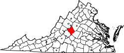
Tyro is an unincorporated community in Nelson County, Virginia, United States. It was among the communities severely affected by flash flooding from Hurricane Camille in 1969. [1]
It was named from the English word tyro, which also means "beginner" or "novice". [2] [3]
Pharsalia and the Tyro Mill are listed on the National Register of Historic Places. [4]
Nelson County is a county located in the Commonwealth of Virginia, in the United States. As of the 2020 census, the population was 14,775. Its county seat is Lovingston. Nelson County is part of the Charlottesville, VA, Metropolitan Statistical Area.
Buena Vista is an independent city located in the Blue Ridge Mountains region of Virginia in the United States. As of the 2020 census, the population was 6,641. The Bureau of Economic Analysis combines the independent cities of Buena Vista and Lexington, along with surrounding Rockbridge County, for statistical purposes.
Jackson County is a county located in the U.S. state of Mississippi. As of the 2020 census, the population was 143,252, making it the fifth-most populous county in Mississippi. Its county seat is Pascagoula. The county was named for Andrew Jackson, general in the United States Army and afterward President of the United States. Jackson County is included in the Pascagoula, MS Metropolitan Statistical Area. It is located at the southeastern tip of the state. The county has sandy soil and is in the Piney Woods area. It borders the state of Alabama on its east side. The county was severely damaged by both Hurricane Camille in August 1969 and Hurricane Katrina on August 29, 2005, which caused catastrophic effects.
Tyro is a city in Montgomery County, Kansas, United States. As of the 2020 census, the population of the city was 177.
Glasgow is a town in Rockbridge County, Virginia, United States, at the confluence of the James and Maury Rivers. The population was 1,052 at the 2020 census.
Hurricane Camille was a powerful, deadly and destructive tropical cyclone which became the second most intense on record to strike the United States and is one of the four Category 5 hurricanes to make landfall in the U.S.
Schuyler is a census-designated place (CDP) in Nelson County, Virginia,, close to Scottsville and Charlottesville, Virginia. The population as of the 2010 U.S. D inecennial Census was 298.
Lovingston is a census-designated place (CDP) in and the county seat of Nelson County, Virginia, United States. The population, as of the 2010 Census, was 520. Its ZIP Code is 22949. It was among the communities severely affected by flash flooding from Hurricane Camille in 1969.
Falling Spring is an unincorporated community in Alleghany County, Virginia, United States. The name also applies to Falling Spring Falls, a cascade of water nestled in the Alleghany Highlands. The property of the falls and surrounding acreage was granted in 1780 to Thomas Massie by Thomas Jefferson, then governor of Virginia. Jefferson makes explicit reference to the cascade in his Notes on the State of Virginia in the following terms: "The only remarkable cascade in this country is that of the Falling Springs in Augusta (...) it falls over 200 feet into the valley below.
Bryant is an unincorporated community in Nelson County, Virginia, United States. It was among the communities severely affected by flash flooding from Hurricane Camille in 1969.
Massies Mill is an unincorporated community in Nelson County, Virginia, United States. It is located on State Route 56 adjacent to the headwaters of the Tye River. The head of the Virginia Blue Ridge Railway, a now-defunct short line railroad, was once located at Massies Mill.
Montebello is an unincorporated community in Nelson County, Virginia, United States. It was among the communities severely affected by flash flooding from Hurricane Camille in 1969.
Norwood is an unincorporated community in Nelson County, Virginia, United States. It was among the communities severely affected by flash flooding from Hurricane Camille in 1969.
Rockfish is an unincorporated community in Nelson County, Virginia, United States.
Roseland is an unincorporated community in Nelson County, Virginia, United States. It was among the communities severely affected by flash flooding from Hurricane Camille in 1969.
Woods Mill is an unincorporated community in Nelson County, Virginia, United States. It was among the communities severely affected by flash flooding from Hurricane Camille in 1969.
Maidens is a small unincorporated community in Goochland County, Virginia, United States. Sited on the north side of the James River, it is currently located at the junction of U.S. Route 522, State Route 6, and State Route 634.
The Tye River is a 35.4-mile-long (57.0 km) tributary of the James River in central Virginia in the United States. Originating on the eastern slope of the Blue Ridge Mountains in Nelson County, and fed by the Piney and Buffalo rivers, by way of the James River it is part of the watershed of the Chesapeake Bay.
Millboro is an unincorporated community and census designated place in Bath County, Virginia, in the United States.
Millboro Springs is an unincorporated community in Bath County, Virginia, in the United States.
37°49′18″N79°00′17″W / 37.82167°N 79.00472°W