Stanardsville, Virginia

Last updated
Stanardsville
2016-06-27 10 48 56 View west along U.S. Route 33 Business (Old Spotswood Trail) at Ford Avenue in Stanardsville, Greene County, Virginia.jpg
Central Stanardsville
Seal of Stanardsville, Virginia.png
Karte Stanardsville in Greene County, VA.svgPage CountyRockingham CountyOrange CountyMadison CountyStanardsvilleTwin LakesRuckersville
Karte
Location of Stanardsville within the Greene County
USA Virginia location map.svg
Red pog.svg
Stanardsville
Location in Virginia
Usa edcp location map.svg
Red pog.svg
Stanardsville
Stanardsville (the United States)
Coordinates: 38°17′49″N78°26′22″W / 38.29694°N 78.43944°W / 38.29694; -78.43944
CountryFlag of the United States.svg United States
StateFlag of Virginia.svg  Virginia
County Greene
Government
   Mayor Gary Ernest Lowe [1]
Area
[2]
  Total0.36 sq mi (0.93 km2)
  Land0.36 sq mi (0.93 km2)
  Water0.00 sq mi (0.00 km2)
Elevation
663 ft (202 m)
Population
 (2020)
  Total349
  Estimate 
(2019) [3]
386
  Density1,081.23/sq mi (417.11/km2)
Time zone UTC−5 (Eastern (EST))
  Summer (DST) UTC−4 (EDT)
ZIP code
22973
Area code 434
FIPS code 51-75008 [4]
GNIS feature ID1500151 [5]
Website www.stanardsville.org

Stanardsville is a town in Greene County, Virginia, United States. The population was 349 at the 2020 census, [6] down from 367 at the 2010 census. It is the county seat of Greene County. [7] The name is from Robert Stanard, a benefactor who donated land for public use. It is part of the Charlottesville Metropolitan Statistical Area.

Contents

History

Lafayette Inn, historical landmark on Main St. Lafayette Inn.jpg
Lafayette Inn, historical landmark on Main St.

Stanardsville is named for Stanard family, landholders who surveyed the first lots for the town in 1794. [8] In 1838, Greene County was created from land previously contained within Orange County and Stanardsville was selected as the county seat. [9]

The Greene County Courthouse, Beadles House, Octonia Stone, Powell–McMullan House, and Stanardsville Historic District are listed on the National Register of Historic Places. [10]

Geography

Stanardsville is located in central Greene County at 38°17′49″N78°26′22″W / 38.29694°N 78.43944°W / 38.29694; -78.43944 (38.296852, -78.439367), [11] at the eastern foot of the Blue Ridge Mountains.

According to the United States Census Bureau, Stanardsville has a total area of 0.3 square miles (0.9 km2), all of it land. [6]

View west along US 33 Bus at SR 230 in Stanardsville 2018-10-10 15 37 46 View west along U.S. Route 33 Business (Old Spotswood Trail) at Virginia State Route 230 (Madison Road) in Stanardsville, Greene County, Virginia.jpg
View west along US 33 Bus at SR 230 in Stanardsville

Transportation

The main highways directly serving Stanardsville are U.S. Route 33 Business and Virginia State Route 230. US 33 Bus is the old alignment of U.S. Route 33, which now bypasses the town just to the south. US 33 extends eastward to Richmond and westward to Skyline Drive and beyond to Harrisonburg. SR 230 extends northeast, providing connections to Madison, and beyond to Washington, D.C. via U.S. Route 29.

Demographics

Historical population
CensusPop.Note
1930 229
1940 212−7.4%
1950 182−14.2%
1960 28355.5%
1970 2964.6%
1980 284−4.1%
1990 257−9.5%
2000 47685.2%
2010 367−22.9%
2020 349−4.9%
U.S. Decennial Census [12]

As of the census [4] of 2000, there were 476 people, 183 households, and 116 families residing in the town. The population density was 1,361.0 people per square mile (525.1/km2). There were 196 housing units at an average density of 560.4 per square mile (216.2/km2). The racial makeup of the town was 88.87% White, 8.61% African American, 0.21% Native American, 1.05% from other races, and 1.26% from two or more races. Hispanic or Latino of any race were 0.84% of the population.

There were 183 households, out of which 31.1% had children under the age of 18 living with them, 34.4% were married couples living together, 21.9% had a female householder with no husband present, and 36.6% were non-families. 34.4% of all households were made up of individuals, and 14.2% had someone living alone who was 65 years of age or older. The average household size was 2.21 and the average family size was 2.73.

In the town, the population was spread out, with 23.3% under the age of 18, 6.9% from 18 to 24, 22.5% from 25 to 44, 17.9% from 45 to 64, and 29.4% who were 65 years of age or older. The median age was 41 years. For every 100 females there were 74.4 males. For every 100 females aged 18 and over, there were 65.2 males.

The median income for a household in the town was $24,643, and the median income for a family was $33,750. Males had a median income of $24,583 versus $18,889 for females. The per capita income for the town was $21,317. About 14.3% of families and 15.1% of the population were below the poverty line, including 24.5% of those under age 18 and 11.4% of those age 65 or over.

Related Research Articles

<span class="mw-page-title-main">Greene County, Virginia</span> County in Virginia, United States

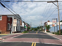
Greene County is a county in Virginia in the eastern United States. As of the 2020 census, the population was 20,552. Its county seat is Stanardsville.

<span class="mw-page-title-main">Siloam, Georgia</span> Town in Georgia, United States

Siloam is a town in Greene County, Georgia, United States. The population was 282 at the 2010 census, down from 331 in 2000.

<span class="mw-page-title-main">Hillsboro, Maryland</span> Town in Maryland

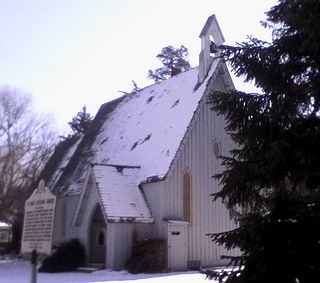
Hillsboro is a town in Caroline County, Maryland, United States. The population was 161 at the 2010 United States Census. Daffin House and St. Paul's Episcopal Church were listed on the National Register of Historic Places in 1975.

<span class="mw-page-title-main">Hallwood, Virginia</span> Town in Virginia, United States

Hallwood is a town in Accomack County, Virginia, in the United States. As of the 2010 census, the town population was 206.

<span class="mw-page-title-main">Dillwyn, Virginia</span> Town in Virginia, United States

Dillwyn is an incorporated town in Buckingham County, Virginia, in the United States. The population was 447 at the 2010 census.

<span class="mw-page-title-main">Remington, Virginia</span> Town in Virginia, United States

Remington is a small incorporated town in Fauquier County, Virginia, United States. The population was 598 at the 2010 census. It is near the highways, U.S. Route 15, U.S. Route 17, U.S. Route 29, and Virginia State Route 28. Remington is less than a mile northeast of the Culpeper County line.

<span class="mw-page-title-main">Halifax, Virginia</span> Town in Virginia, United States

Halifax is a town in Halifax County, Virginia, United States, along the Banister River. The population was 1,309 at the 2010 census. It is the county seat of Halifax County.

<span class="mw-page-title-main">Stanley, Virginia</span> Town in Virginia, United States

Stanley is a town in Page County, Virginia, United States. The population was 1,689 at the 2010 census.

<span class="mw-page-title-main">Broadway, Virginia</span> Town in Virginia, United States

Broadway is a town in Rockingham County, Virginia, United States. The population was 3,691 at the 2010 census. It is included in the Harrisonburg Metropolitan Statistical Area.

<span class="mw-page-title-main">Dayton, Virginia</span> Town in Virginia, United States

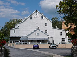
Dayton is a town in Rockingham County, Virginia, United States. The population is 1,530 as of the 2010 census. It is included in the Harrisonburg, Virginia Metropolitan Statistical Area.

<span class="mw-page-title-main">Mount Crawford, Virginia</span> Town in Virginia, United States

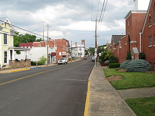
Mount Crawford is a town in Rockingham County, Virginia, United States. It is included in the Harrisonburg Metropolitan Statistical Area, and the town's population was 433 at the 2010 census.

<span class="mw-page-title-main">Edinburg, Virginia</span> Town in Virginia, United States

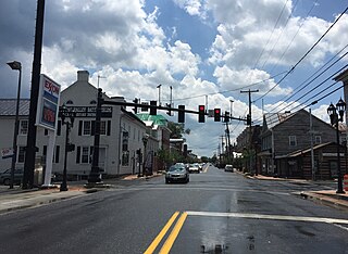
Edinburg is a town in Shenandoah County, Virginia, United States. The population was 1,041 at the 2010 census.

<span class="mw-page-title-main">Toms Brook, Virginia</span> Town in Virginia, United States

Toms Brook is a town in Shenandoah County, Virginia, United States. The population was 258 at the 2010 census.

<span class="mw-page-title-main">Petersburg, West Virginia</span> City in West Virginia, United States

Petersburg is a city in Grant County, West Virginia, United States. The population was 2,251 at the 2020 census. It is the county seat of Grant County.
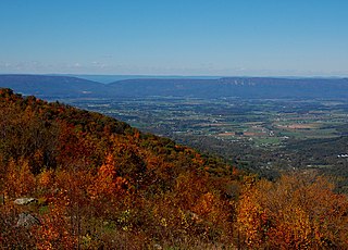
<span class="mw-page-title-main">Capon Bridge, West Virginia</span> Town in West Virginia, United States

Capon Bridge is a town in eastern Hampshire County, West Virginia, United States, along the Northwestern Turnpike, approximately 20 miles (32 km) west of Winchester, Virginia. The population was 418 at the 2020 census. Originally known as "Glencoe", Capon Bridge was incorporated in 1902 by the Hampshire County Circuit Court. It is named because of the construction of the bridge over the Cacapon River at that place, the name of the river being derived from the Shawnee Cape-cape-de-hon, meaning "river of medicine water".

<span class="mw-page-title-main">Alum Creek, West Virginia</span> Census-designated place in West Virginia, United States

Alum Creek is a census-designated place (CDP) in Kanawha and Lincoln counties along the Coal River in the U.S. state of West Virginia. It includes the unincorporated communities of Alum Creek, Forks of Coal, and Priestley. The CDP had a population of 1,749 at the 2010 census, down from 1,839 at the 2000 census.

<span class="mw-page-title-main">Harman, West Virginia</span> Town in West Virginia, United States

Harman is a town in Randolph County, West Virginia, United States. The population was 96 at the 2020 census.

<span class="mw-page-title-main">Grottoes, Virginia</span> Town in Virginia, United States

Grottoes is an incorporated town in Augusta and Rockingham counties in the U.S. state of Virginia. The population was 2,668 at the 2010 census.

<span class="mw-page-title-main">Gordonsville, Virginia</span> Town in Virginia, United States

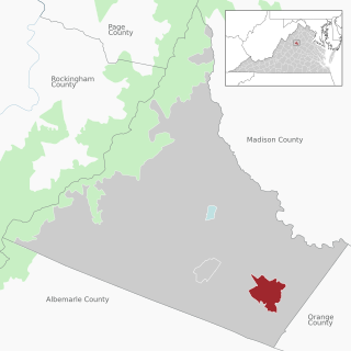
Gordonsville is a town in Orange County in the Commonwealth of Virginia in the United States. Located about 19 miles northeast of Charlottesville and 65 miles northwest of Richmond, the population was 1,496 at the 2010 census.

<span class="mw-page-title-main">Ruckersville, Virginia</span> Census-designated place in Virginia, United States

Ruckersville is a census-designated place (CDP) in Greene County, Virginia, United States, located in a rural area north of Charlottesville. The population as of the 2020 estimate was 1,321, a 17.7% increase from the 2010 census with 1,141. The community lies amidst hills, mountain views, trees, and farmland. It is located at the intersection of two major highways, north–south U.S. Route 29 and east–west U.S. Route 33. It was founded in 1732, by the same family that established Ruckersville, Georgia.

References

  1. "Virginia Elections Database - Gary Ernest Lowe". Virginia Elections Database. Retrieved 2022-04-28.
  2. "2019 U.S. Gazetteer Files". United States Census Bureau. Retrieved August 7, 2020.
  3. "Population and Housing Unit Estimates". United States Census Bureau. May 24, 2020. Retrieved May 27, 2020.
  4. 1 2 "U.S. Census website". United States Census Bureau . Retrieved 2008-01-31.
  5. "US Board on Geographic Names". United States Geological Survey. 2007-10-25. Retrieved 2008-01-31.
  6. 1 2 "Geographic Identifiers: 2010 Demographic Profile Data (G001): Stanardsville town, Virginia". U.S. Census Bureau, American Factfinder. Retrieved March 29, 2017.[ dead link ]
  7. "Find a County". National Association of Counties. Retrieved 2011-06-07.
  8. "About Stanardsville". Town of Stanardsville.
  9. Peters, John O.; Peters, Margaret T. (1995). Virginia's Historic Courthouses. Charlottesville, VA: University Press of Virginia. p. 71. ISBN   0-8139-1604-6.
  10. "National Register Information System". National Register of Historic Places . National Park Service. July 9, 2010.
  11. "US Gazetteer files: 2010, 2000, and 1990". United States Census Bureau. 2011-02-12. Retrieved 2011-04-23.
  12. "Census of Population and Housing". Census.gov. Retrieved June 4, 2015.

Further reading