La Crosse, Virginia

Last updated
La Crosse, Virginia
La Crosse, Virginia Skyline.jpg
VAMap-doton-LaCrosse.PNG
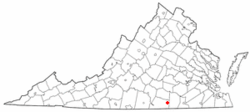
Location of La Crosse, Virginia
Coordinates: 36°41′50″N78°5′32″W / 36.69722°N 78.09222°W / 36.69722; -78.09222
Country United States
State Virginia
County Mecklenburg
Area
[1]
  Total1.22 sq mi (3.17 km2)
  Land1.22 sq mi (3.17 km2)
  Water0.00 sq mi (0.00 km2)
Elevation
476 ft (145 m)
Population
 (2010)
  Total604
  Estimate 
(2019) [2]
575
  Density470.16/sq mi (181.58/km2)
Time zone UTC-5 (Eastern (EST))
  Summer (DST) UTC-4 (EDT)
ZIP code
23950
Area code 434
FIPS code 51-43176 [3]
GNIS feature ID1495802 [4]
Website Official Website

La Crosse is a town in Mecklenburg County, Virginia, United States. Its name is derived from the fact that it was a place where railroads once crossed, and there is still a caboose in the center of the town. La Crosse is adjacent to the neighboring town South Hill.

Contents

The town's population was 604 at the 2010 census.

History

Antique caboose in Centennial Park Antique Caboose at La Crosse, Virginia.jpg
Antique caboose in Centennial Park

Before 1890, La Crosse was known as Piney Pond. [5] The La Crosse Hotel and O.H.P. Tanner House are listed on the National Register of Historic Places. [6] [7] La Crosse was a stop on the Atlantic and Danville Railway. The Virginia General Assembly chartered the People's Warehouse Company in 1902 in La Crosse. The company was formed for selling tobacco. [8] Today, the Tobacco Heritage Trail runs through the town on the old Atlantic and Danville Railway. [9]

Geography

La Crosse is located at 36°41′50″N78°5′32″W / 36.69722°N 78.09222°W / 36.69722; -78.09222 (36.697177, -78.092322). [10]

According to the United States Census Bureau, the town has a total area of 1.2 square miles (3.0 km²), all land.

Demographics

Historical population
CensusPop.Note
1910 281
1920 32013.9%
1930 42733.4%
1940 52422.7%
1950 67528.8%
1960 7267.6%
1970 674−7.2%
1980 7348.9%
1990 549−25.2%
2000 61812.6%
2010 604−2.3%
2019 (est.)575 [2] −4.8%
U.S. Decennial Census [11]

At the 2000 census there were 618 people, 263 households, and 160 families living in the town. The population density was 532.4 people per square mile (205.7/km²). There were 314 housing units at an average density of 270.5 per square mile (104.5/km²). The racial makeup of the town was 54.85% White, 43.20% African American, 0.32% Native American, 0.16% Asian, 0.49% from other races, and 0.97% from two or more races. Hispanic or Latino of any race were 2.91%. [3]

Of the 263 households 27.4% had children under the age of 18 living with them, 35.7% were married couples living together, 21.7% had a female householder with no husband present, and 38.8% were non-families. 34.2% of households were one person and 18.3% were one person aged 65 or older. The average household size was 2.29 and the average family size was 2.90.

The age distribution was 22.3% under the age of 18, 9.2% from 18 to 24, 27.0% from 25 to 44, 23.5% from 45 to 64, and 18.0% 65 or older. The median age was 40 years. For every 100 females there were 79.7 males. For every 100 females aged 18 and over, there were 80.5 males.

The median household income was $24,643 and the median family income was $31,771. Males had a median income of $23,611 versus $17,813 for females. The per capita income for the town was $13,532. About 9.8% of families and 16.0% of the population were below the poverty line, including 24.1% of those under age 18 and 19.1% of those age 65 or over.

Related Research Articles

<span class="mw-page-title-main">La Crosse, Indiana</span> Town in Indiana, United States

La Crosse is a town in LaPorte County, Indiana, United States. The population was 551 at the 2010 census. It is included in the Michigan City, Indiana-La Porte, Indiana Metropolitan Statistical Area.

<span class="mw-page-title-main">Stanardsville, Virginia</span> Town in Virginia, United States

Stanardsville is a town in Greene County, Virginia, United States. The population was 349 at the 2020 census, down from 367 at the 2010 census. It is the county seat of Greene County. The name is from Robert Stanard, a benefactor who donated land for public use. It is part of the Charlottesville Metropolitan Statistical Area.

<span class="mw-page-title-main">Halifax, Virginia</span> Town in Virginia, United States

Halifax is a town in Halifax County, Virginia, United States, along the Banister River. The population was 1,309 at the 2010 census. It is the county seat of Halifax County.

<span class="mw-page-title-main">South Boston, Virginia</span> Town in Virginia, United States

South Boston, formerly Boyd's Ferry, is a town in Halifax County, Virginia, United States. The population was 8,142 at the 2010 census, down from 8,491 at the 2000 census. It is the most populous town in Halifax County.

<span class="mw-page-title-main">Virgilina, Virginia</span> Town in Virginia, United States

Virgilina is a town in Halifax County, Virginia, United States. The population was 154 at the 2010 census. Virgilina was once a copper mining town. It was a stop on the Atlantic and Danville Railway as recently as the 1950s. It is named "Virgilina" because it is located on the Virginia and North Carolina border.

<span class="mw-page-title-main">Kenbridge, Virginia</span> Town in Virginia, United States

Kenbridge is a town in Lunenburg County, Virginia, United States. The population was 1,257 at the 2010 census. It is in a tobacco farming area. The area is home to noted folk artist Eldridge Bagley. The town is home to the Lunenburg Girls’ Softball league, Lunenburg Lightning Football and Cheerleading league and the United Futbol Soccer league. There are many quaint shops and boutiques and many family owned businesses. Home to Kenbridge Elementary School. Visit www.kenbridgeva.net for information.

<span class="mw-page-title-main">Chase City, Virginia</span> Town in Virginia, United States

Chase City is a town in Mecklenburg County, Virginia, United States. Chase City was incorporated in 1873 and named for Salmon P. Chase, United States Chief Justice and Lincoln's Secretary of the Treasury. The population was 2,351 at the 2010 census. Tobacco and other crops are grown nearby.

<span class="mw-page-title-main">South Hill, Virginia</span> Town in Virginia, United States

South Hill is a town in Mecklenburg County, Virginia, United States. The population was 4,650 at the 2010 census. Located on major Interstate and U.S. highways, it has a full-service hospital, a tobacco market, and several hotels. South Hill has a close relationship with the neighboring town of La Crosse. Lake Gaston, a large reservoir popular with boaters and fishermen, is a short distance to the southwest.

<span class="mw-page-title-main">Burkeville, Virginia</span> Town in Virginia, United States

Burkeville is an incorporated town in Nottoway County, Virginia, United States. The population was 432 at the 2010 census. The source of the town name is disputed. The town is located at the crossroads of U.S. routes 360 and 460.

<span class="mw-page-title-main">Gretna, Virginia</span> Town in Virginia, United States

Gretna is a town in Pittsylvania County, Virginia, United States. The population was 1,267 at the 2010 census. It is part of the Danville Metropolitan Statistical Area.

<span class="mw-page-title-main">Hurt, Virginia</span> Town in Virginia, United States

Hurt is a town in Pittsylvania County, Virginia, United States. Population was 1,269 at the 2020 census. It is included in the Danville, Virginia Metropolitan Statistical Area.

<span class="mw-page-title-main">Mount Crawford, Virginia</span> Town in Virginia, United States

Mount Crawford is a town in Rockingham County, Virginia, United States. It is included in the Harrisonburg Metropolitan Statistical Area, and the town's population was 433 at the 2010 census.

<span class="mw-page-title-main">Cleveland, Virginia</span> Town in Virginia, United States

Cleveland is a town in central Russell County, Virginia, United States. The population was 128 at the 2010 census.

<span class="mw-page-title-main">Nickelsville, Virginia</span> Town in Virginia, United States

Nickelsville is a town in Scott County, Virginia. The population was 383 at the 2010 census. It is part of the Metropolitan Statistical Area, which is a component of the Johnson City-Kingsport-Bristol, TN-VA Combined Statistical Area – commonly known as the "Tri-Cities" region.

<span class="mw-page-title-main">Capron, Virginia</span> Town in Virginia, United States

Capron is a town in Southampton County, Virginia, United States. The population was 167 at the 2000 census.

<span class="mw-page-title-main">Stony Creek, Virginia</span> Town in Virginia, United States

Stony Creek is a town in Sussex County, Virginia, United States. The population was 198 at the 2010 census.

<span class="mw-page-title-main">La Crosse, Washington</span> Town in Washington, United States

La Crosse is a rural small town in Whitman County, Washington, United States. The population was 313 at the 2010 census.

<span class="mw-page-title-main">Danville, West Virginia</span> Town in West Virginia, United States

Danville is a town in Boone County, West Virginia, United States. The population was 660 at the 2020 census. Danville was incorporated in 1911 and named for Dan Rock, the town's first postmaster. Danville was formerly known as Newport and Red House.

<span class="mw-page-title-main">Grottoes, Virginia</span> Town in Virginia, United States

Grottoes is an incorporated town in Augusta and Rockingham counties in the U.S. state of Virginia. The population was 2,668 at the 2010 census.

<span class="mw-page-title-main">Brodnax, Virginia</span> Town in Virginia, United States

Brodnax is a town in Brunswick and Mecklenburg counties in the U.S. state of Virginia. The population was 298 at the 2010 census.

References

  1. "2019 U.S. Gazetteer Files". United States Census Bureau. Retrieved August 7, 2020.
  2. 1 2 "Population and Housing Unit Estimates". United States Census Bureau. May 24, 2020. Retrieved May 27, 2020.
  3. 1 2 "U.S. Census website". United States Census Bureau . Retrieved 2008-01-31.
  4. "US Board on Geographic Names". United States Geological Survey. 2007-10-25. Retrieved 2008-01-31.
  5. "Town of La Crosse, Virginia". www.townoflacrosse.org. Retrieved 2019-02-08.
  6. "National Register Information System". National Register of Historic Places . National Park Service. July 9, 2010.
  7. "National Register of Historic Places Listings". Weekly List of Actions Taken on Properties: 8/22/11 through 8/26/11. National Park Service. 2011-09-02.
  8. Virginia (1902). Acts Passed at a General Assembly of the Commonwealth of Virginia. p. 331.
  9. Joe Tennis (28 October 2014). Virginia Rail Trails: Crossing the Commonwealth. Arcadia Publishing Incorporated. pp. 73–74. ISBN   978-1-62585-186-4.
  10. "US Gazetteer files: 2010, 2000, and 1990". United States Census Bureau. 2011-02-12. Retrieved 2011-04-23.
  11. "Census of Population and Housing". Census.gov. Retrieved June 4, 2015.