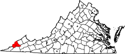
St. Paul, Virginia

Last updated

St. Paul
St. Paul National Bank building.jpg
St. Paul National Bank building
VAMap-doton-StPaul.PNG
Location of St. Paul, Virginia
Coordinates: 36°54′20″N82°18′37″W / 36.90556°N 82.31028°W / 36.90556; -82.31028
Country United States
State Virginia
Counties Wise, Russell
Area
[1]
  Total1.42 sq mi (3.69 km2)
  Land1.38 sq mi (3.58 km2)
  Water0.04 sq mi (0.11 km2)
Elevation
1,503 ft (458 m)
Population
 (2010)
  Total970
  Estimate 
(2019) [2]
851
  Density616.22/sq mi (237.85/km2)
Time zone UTC−5 (Eastern (EST))
  Summer (DST) UTC−4 (EDT)
FIPS code 51-69936 [3]
GNIS feature ID1473855 [4]
Website

St. Paul is a town in Russell and Wise counties in the U.S. state of Virginia. The population was 970 at the 2010 census. Virginia City Hybrid Energy Center, which powers 150,000 homes, is located in St. Paul.

Contents

History

The St. Paul Historic District and Virginia City Church are listed on the National Register of Historic Places. [5] [6] Incorporated in 1911, St. Paul became a bi- county town located in the Appalachian Mountains of Wise and Russell County, Virginia. [7] St. Paul, Virginia is a town that sits along the Clinch River. Along with having trails that go along the Clinch River they have a trail that leads to an old French settlement settled in 1791. This trail is called the Sugar Hill trail. [8]

St. Paul has several historical events that take place in the town. One of these Historical events is the Santa Train. The Santa Train goes from Eastern Kentucky, Southwest Virginia, and ends in Kingsport Tennessee. The Santa Train makes 14 stops along the way while Santa Clause throws out gifts to children. [9]

Geography

According to the United States Census Bureau, the town has a total area of 1.0 square miles (2.6 km2), of which, 1.0 square miles (2.5 km2) of it is land and 0.04 square miles (0.1 km2) of it (3.92%) is water.

Demographics

Historical population
CensusPop.Note
1920 574
1930 71624.7%
1940 7464.2%
1950 1,01435.9%
1960 1,15614.0%
1970 948−18.0%
1980 9732.6%
1990 1,0073.5%
2000 1,000−0.7%
2010 970−3.0%
2019 (est.)851 [2] −12.3%
U.S. Decennial Census [10]

As of the census [3] of 2000, there were 1,000 people, 464 households, and 302 families living in the town. The population density was 1,023.2 people per square mile (394.0/km2). There were 496 housing units at an average density of 507.5 per square mile (195.4/km2). The racial makeup of the town was 95.70% White, 1.80% African American, 0.60% Native American, 0.50% Asian, 0.10% from other races, and 1.30% from two or more races. Hispanic or Latino of any race were 0.50% of the population.

There were 464 households, out of which 28.7% had children under the age of 18 living with them, 48.5% were married couples living together, 12.3% had a female householder with no husband present, and 34.9% were non-families. 33.4% of all households were made up of individuals, and 17.7% had someone living alone who was 65 years of age or older. The average household size was 2.16 and the average family size was 2.72.

In the town, the population was spread out, with 21.6% under the age of 18, 9.7% from 18 to 24, 24.1% from 25 to 44, 25.0% from 45 to 64, and 19.6% who were 65 years of age or older. The median age was 42 years. For every 100 females, there were 82.8 males. For every 100 females aged 18 and over, there were 81.1 males.

The median income for a household in the town was $24,833, and the median income for a family was $39,125. Males had a median income of $31,563 versus $25,313 for females. The per capita income for the town was $17,735. About 15.1% of families and 19.3% of the population were below the poverty line, including 27.4% of those under age 18 and 15.2% of those age 65 or over.

Education

St. Paul is home to one public school, St. Paul Elementary School. The school features unique programs such as the Wetlands Estonoa Project.

Attractions

Natural and outdoor recreation

Historical

Festivals and celebrations

Periodical

St. Paul is home to an online newspaper, the Clinch Valley Times .

Notable people

Boogie2988 (YouTube personality)

Related Research Articles

<span class="mw-page-title-main">Wise County, Virginia</span> County in Virginia, United States

Wise County is a county located in the U.S. state of Virginia. The county was formed in 1856 from Lee, Scott, and Russell Counties and named for Henry A. Wise, who was the Governor of Virginia at the time.

<span class="mw-page-title-main">Otero County, Colorado</span> County in Colorado, United States

Otero County is a county located in the U.S. state of Colorado. As of the 2020 census, the population was 18,690. The county seat is La Junta. The county was named for Miguel Antonio Otero, one of the founders of the town of La Junta and a member of a prominent Hispanic family.

<span class="mw-page-title-main">East Dundee, Illinois</span> Village in Illinois, United States

East Dundee is a village in Kane County with a small section in Cook County. The population was 3,152 at the 2020 census.

<span class="mw-page-title-main">Council Grove, Kansas</span> City in Morris County, Kansas

Council Grove is a city and county seat in Morris County, Kansas, United States. As of the 2020 census, the population of the city was 2,140. It was named after an agreement between American settlers and the Osage Nation allowing settlers' wagon trains to pass westward through the area on the Santa Fe Trail. Pioneers gathered at a grove of trees so that wagons could band together for their trip west.

<span class="mw-page-title-main">Gramercy, Louisiana</span> Town in Louisiana, United States

Gramercy is a town in the U.S. state of Louisiana, in St. James Parish. It is part of the New Orleans Metropolitan Area. The population was 3,613 at the time of the 2010 U.S. census and 3,188 according to the 2020 population estimates program.

<span class="mw-page-title-main">Sugar Hill, New Hampshire</span> Town in New Hampshire, United States

Sugar Hill is a town in Grafton County, New Hampshire, United States. The population was 647 at the 2020 census, an increase over the figure of 563 tabulated in 2010. The town overlooks the White Mountain National Forest, with views of the Presidential, Franconia, Kinsman and Dalton ranges. Sugar Hill was incorporated as a town in 1962, the most recent in New Hampshire.

<span class="mw-page-title-main">Cortlandt, New York</span> Town in New York, United States

Cortlandt is a town in Westchester County, New York, United States, located at the northwestern edge of the county, at the eastern terminus of the Bear Mountain Bridge. The town includes the villages of Buchanan and Croton-on-Hudson.

<span class="mw-page-title-main">Gate City, Virginia</span> Town in Virginia, United States

Gate City is a town in Scott County, Virginia, United States. The population was 2,034 at the 2010 census. It is the seat of Scott County.

<span class="mw-page-title-main">Cedar Bluff, Virginia</span> Town in Virginia, United States

Cedar Bluff is a town in Tazewell County, Virginia, United States. The population was 1,139 at the 2010 census. It is part of the Bluefield, WV-VA micropolitan area, which has a population of 107,578.

<span class="mw-page-title-main">Tazewell, Virginia</span> Town in Virginia, United States

Tazewell is a town in Tazewell County, Virginia, United States. The population was 4,627 at the 2010 census. It is part of the Bluefield, WV-VA micropolitan area, which has a population of 107,578. It is the county seat of Tazewell County.

<span class="mw-page-title-main">Coeburn, Virginia</span> Town in Virginia, United States

Coeburn is a town in Wise County, Virginia, United States, along the Guest River. The population was 2,139 at the 2010 census.

<span class="mw-page-title-main">Sand Fork, West Virginia</span> Town in West Virginia, United States

Sand Fork is a town in Gilmer County, West Virginia, United States. The population was 182 at the 2020 census. It is located along the Little Kanawha River, at the mouth of the Sand Fork.

<span class="mw-page-title-main">Bolivar, West Virginia</span> Town in West Virginia, United States

Bolivar is a town in Jefferson County, West Virginia, United States. The population was 1,072 at the 2020 census. The town is named for South American revolutionary leader Simón Bolívar. Located in West Virginia's Eastern Panhandle, it is part of the northwestern fringes of the Washington metropolitan area.

<span class="mw-page-title-main">Bramwell, West Virginia</span> Town in West Virginia, United States

Bramwell is a town in Mercer County, West Virginia, United States, along the Bluestone River. The population was 277 at the 2020 census. It is part of the Bluefield, WV-VA micropolitan area which has a population of 107,578.

<span class="mw-page-title-main">St. Marys, West Virginia</span> City in West Virginia, United States

St. Marys is a city and the county seat of Pleasants County, West Virginia, United States. The population was 1,847 at the 2020 census. It is part of the Parkersburg–Vienna metropolitan area. St. Marys was established in 1849 by Alexander Creel, who is said to have had a vision of Mary while passing the townsite by boat on the Ohio River.

<span class="mw-page-title-main">Cairo, West Virginia</span> Town in West Virginia, United States

Cairo is a town in Ritchie County, West Virginia, United States, along West Virginia Route 31, the North Fork of the Hughes River, and the North Bend Rail Trail. The population was 174 at the 2020 census.

<span class="mw-page-title-main">Davis, West Virginia</span> Town in West Virginia, United States

Davis is a town in Tucker County, West Virginia, United States, situated along the Blackwater River. The population was 595 at the 2020 census.

<span class="mw-page-title-main">Laona, Wisconsin</span> Town in Wisconsin, United States

Laona is a town in Forest County, Wisconsin, United States. The population was 1,212 at the 2010 census. The census-designated place of Laona is located in the town. The unincorporated community of Blackwell Junction is also located partially in the town.

<span class="mw-page-title-main">Pamplin City, Virginia</span> Town in Virginia, United States

Pamplin City is a town in Appomattox and Prince Edward counties in the U.S. state of Virginia. The population was 219 at the 2010 census.

<span class="mw-page-title-main">Brodnax, Virginia</span> Town in Virginia, United States

Brodnax is a town in Brunswick and Mecklenburg counties in the U.S. state of Virginia. The population was 298 at the 2010 census.

References

  1. "2019 U.S. Gazetteer Files". United States Census Bureau. Retrieved August 7, 2020.
  2. 1 2 "Population and Housing Unit Estimates". United States Census Bureau. May 24, 2020. Retrieved May 27, 2020.
  3. 1 2 "U.S. Census website". United States Census Bureau . Retrieved January 31, 2008.
  4. "US Board on Geographic Names". United States Geological Survey. October 25, 2007. Retrieved January 31, 2008.
  5. "National Register Information System". National Register of Historic Places . National Park Service. July 9, 2010.
  6. "National Register of Historic Places Listings". Weekly List of Actions Taken on Properties: 6/06/11 through 6/10/11. National Park Service. June 17, 2011.
  7. "Government | Town of St. Paul Virginia". stpaulva.org. Retrieved November 7, 2023.
  8. Editor, Mountain Peeks (December 15, 2015). "St. Paul's Sugar Hill: A Story of Biological Diversity, Pioneer History, Murder, and Nature Trails". Mountain Peeks Magazine. Retrieved November 7, 2023.{{cite web}}: |last= has generic name (help)
  9. "The rain did not stop the Santa Train from rolling through St. Paul, Va". WJHL | Tri-Cities News & Weather. November 23, 2019. Retrieved November 7, 2023.
  10. "Census of Population and Housing". Census.gov. Retrieved June 4, 2015.