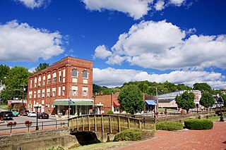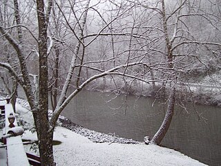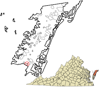
Coeburn is a coal town in Wise County, Virginia, United States, along the Guest River. The population was 2,139 at the 2010 census.
A census-designated place (CDP) is a concentration of population defined by the United States Census Bureau for statistical purposes only.
Bethel is a census-designated place (CDP) in Kitsap County, Washington, United States. Located a few miles south of the city of Port Orchard, Bethel is a wooded residential area. Most residents commute to Port Orchard or nearby cities. It was first designated a place by the Census Bureau in the 2010 census, at which time its population was 3,713. By the 2020 census, the population increased to 4,073.

Kapowsin is a census-designated place located approximately 25 miles southeast of Tacoma in Pierce County, Washington, United States. The 2020 Census placed the population at 249.
Browns Point is a census-designated place (CDP) in Pierce County, Washington, United States, bordered by Tacoma on the east and Puget Sound on all other sides. The population was 1,198 at the 2010 census. The Tacoma neighborhood immediately adjacent to Browns Point is also referred to locally as "Browns Point".
The following is a set–index article, providing a list of lists, for the cities, towns and villages within the jurisdictional United States. It is divided, alphabetically, according to the state, territory, or district name in which they are located.

Rocky Gap is an unincorporated community and census designated place (CDP) that is located in Bland County in the U.S. state of Virginia. In the year of 2016, there was an estimate that there were a total of 511 people living in Rocky Gap. Rocky Gap has one zip code (24366).

Tasley is a census-designated place (CDP) in Accomack County, Virginia, United States. It was first listed as a CDP in 2010. Per the 2020 census, the population was 222.

Earlysville is an unincorporated community and census-designated place in Albemarle County, Virginia, United States, roughly 9 miles (14 km) north of Charlottesville. It was first listed as a CDP in the 2020 census with a population of 1,153.

Greenbackville is a census-designated place (CDP) 4.5 miles (5 km) south of Stockton, Maryland in Accomack County, Virginia, located just south of the Maryland state line. Per the 2020 census, the population was 173.

Austinville is an unincorporated community and census-designated place (CDP) on the New River in southern Wythe County, Virginia, United States. It was first listed as a CDP in the 2020 census with a population of 119. New River Trail State Park runs through Austinville, and Shot Tower Historical State Park is located nearby. The town is the birthplace of Stephen F. Austin, for whose family it is named.

Modest Town is a census-designated place (CDP) in Accomack County, Virginia, United States. Per the 2020 census, the population was 120.

Savage Town is a census-designated place (CDP) in Accomack County, Virginia, United States. Per the 2020 census, the population was 72.
Founded in 1886, Weems is an unincorporated community and census-designated place (CDP) in Lancaster County in the U. S. state of Virginia. It was first drawn as a CDP prior to the 2020 census.
Peach Creek is an unincorporated community and census-designated place (CDP) in Logan County, West Virginia, United States. Peach Creek is located on the east bank of the Guyandotte River across from West Logan. Peach Creek has a post office with ZIP code 25639. The community was first listed as a CDP prior to the 2020 census.
Osaka is a Census-designated place and coal town located in Wise County, Virginia, United States, served by a branch line of the Appalachia to Stonega railroad that ran along Mud Lick Creek to Roda, which was built in 1896 by Interstate Railroads.
Dunbar is an unincorporated community, census-designated place, and coal town located in Wise County, Virginia, United States. It was first listed as a CDP in the 2020 United States census with a population of 79.
Shadow Lake is a census-designated place (CDP) in King County, Washington, United States. The population was 2,262 at the 2010 census.
Schooner Bay is a census-designated place (CDP) in Accomack County, Virginia, United States. It was first listed as a CDP in 2010. As of the 2020 census, it had a population of 97.
Big Stone Gap East is an unincorporated area and census-designated place (CDP) in Wise County, Virginia, United States. It was first listed as a CDP in the 2020 census with a population of 687.


