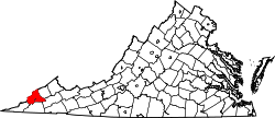
East Stone Gap, Virginia

Last updated

East Stone Gap, Virginia
East-Stone-Gap-va.jpg
East Stone Gap Road (SR 613)
USA Virginia location map.svg
Red pog.svg
East Stone Gap, Virginia
Usa edcp location map.svg
Red pog.svg
East Stone Gap, Virginia
Coordinates: 36°52′00″N82°44′33″W / 36.86667°N 82.74250°W / 36.86667; -82.74250
Country United States
State Virginia
County Wise
Elevation
1,539 ft (469 m)
Population
 (2020)
  Total537
Time zone UTC-5 (Eastern (EST))
  Summer (DST) UTC-4 (EDT)
ZIP code
24246
Area code 276
GNIS feature ID1494214 [1]

East Stone Gap is an unincorporated community and census-designated place in Wise County, Virginia, United States. East Stone Gap is an eastern suburb of Big Stone Gap; U.S. Route 23 separates the two settlements. It was first listed as a CDP in the 2020 census with a population of 537. [2] East Stone Gap has a post office with ZIP code 24246. [3] [4]

Related Research Articles

<span class="mw-page-title-main">ZIP Code</span> Numeric postal code used in the United States and its territories

A ZIP Code is a system of postal codes used by the United States Postal Service (USPS). The term ZIP was chosen to suggest that the mail travels more efficiently and quickly when senders use the code in the postal address.

<span class="mw-page-title-main">Howard, Ohio</span> Census-designated place in Ohio, United States

Howard is a census-designated place (CDP) in southern Howard Township, Knox County, Ohio, United States. As of the 2020 census it had a population of 246. The United States Postal Service has assigned Howard the ZIP Code 43028. The community lies along U.S. Route 36.

<span class="mw-page-title-main">Tornado, West Virginia</span> Census-designated place in West Virginia, United States

Tornado, also called Upper Falls, is a census-designated place (CDP) in Kanawha County, West Virginia, United States.

<span class="mw-page-title-main">Sterling, Virginia</span> Census-designated place in Virginia

Sterling, Virginia, refers most specifically to a census-designated place (CDP) in Loudoun County, Virginia, United States. The population of the CDP as of the 2020 United States Census was 30,337 The CDP boundaries are confined to a relatively small area between Virginia State Route 28 on the west and Virginia State Route 7 on the northeast, excluding areas near SR 606 and the Dulles Town Center.

<span class="mw-page-title-main">Aldie, Virginia</span> Unincorporated community in Virginia, United States

Aldie is an unincorporated community and census-designated place (CDP) located between Chantilly and Middleburg in Loudoun County, Virginia, United States. The historic village of Aldie is located on the John Mosby Highway in a gap between the Catoctin Mountains and Bull Run Mountains, through which the Little River flows. Aldie traditionally serves as the gateway to the Loudoun Valley and beyond.

<span class="mw-page-title-main">Swoope, Virginia</span> Unincorporated community in Virginia, United States

Swoope is an unincorporated community in Augusta County, Virginia. Swoope is located on State Routes 703 and 860 7.4 miles (11.9 km) west of Staunton. Swoope has a post office with ZIP code 24479, which opened on March 6, 1838. Polyface Farm, a sustainable farm run by Joel Salatin, is also near Swoope. Students in the area go to Beverley Manor Elementary School, Churchville Elementary School, attend Beverley Manor Middle School, and Buffalo Gap High School.

<span class="mw-page-title-main">Weston, Colorado</span> Census Designated Place in Colorado, United States

Weston is an unincorporated town, a post office, and a census-designated place (CDP) located in and governed by Las Animas County, Colorado, United States. The Weston post office has the ZIP Code 81091. At the United States Census 2020, the population of the Weston CDP was 53.

Colcord is an unincorporated community in Raleigh County, West Virginia, United States. Colcord is 5.5 miles (8.9 km) east-southeast of Whitesville. Colcord had a post office, which closed on November 30, 2002. The community was named after the proprietor of the Colcord Coal Company.

Yolyn is an unincorporated community in Logan County, West Virginia, United States. Yolyn is 7 miles (11 km) east-southeast of Logan. Yolyn had a post office, which closed on March 3, 2007.

<span class="mw-page-title-main">Amherstdale, West Virginia</span> Census-designated place in West Virginia, United States

Amherstdale is a census-designated place (CDP) in Logan County, West Virginia, United States, situated along Buffalo Creek. The CDP includes the unincorporated communities of Amherstdale, Becco, Fanco, and Braeholm. The CDP population was 350 as of the 2010 census.

Chauncey is a census-designated place (CDP) in Logan County, West Virginia, United States. Chauncey is located along West Virginia Route 44 and Island Creek, 5.5 miles (8.9 km) south of Logan. Chauncey had a post office, which opened on August 23, 1913, and closed on June 27, 2009. As of the 2010 census, its population is 283.

Earling is an unincorporated community and census-designated place (CDP) in Logan County, West Virginia, United States. It was first listed as a CDP prior to the 2020 census. The Earling post office closed on July 1, 1989. The town now shares ZIP Code 25632 with Lyburn and Taplin.

Eggleston is an unincorporated community and census-designated place in Giles County, Virginia, United States. Eggleston is located along the New River, 2.5 miles (4.0 km) south-southeast of Pembroke. It was first listed as a CDP in the 2020 census with a population of 143.

Elkwood is an unincorporated community in Culpeper County, Virginia, United States. Elkwood is located on U.S. Route 15 8.1 miles (13.0 km) east-northeast of Culpeper. Elkwood has a post office with ZIP code 22718.

<span class="mw-page-title-main">Lignum, Virginia</span> Unincorporated community in Virginia, United States

Lignum is an unincorporated community in Culpeper County, Virginia, United States. Lignum is located on Virginia State Route 3 10 miles (16 km) east-southeast of Culpeper. Lignum has a post office with ZIP code 22726, which opened on November 14, 1877.

Doran is an unincorporated community and census-designated place in Tazewell County, Virginia, United States. Doran is located along the Clinch River, U.S. Route 460 and Virginia State Route 67 between Richlands and Raven. Doran has a post office with ZIP code 24612. The community was named for Joseph I. Doran, who was the general counsel for the Norfolk and Western Railway. It was first listed as a CDP in the 2020 census with a population of 113.

Lowry is an unincorporated community in eastern Bedford County, Virginia, United States. The community is located along State Route 715 and is 5.2 miles (8.4 km) east-northeast of Bedford. It is part of the Lynchburg Metropolitan Statistical Area.

Sycamore is an unincorporated community in Talladega County, Alabama, United States, located near Alabama State Route 21, 6.1 miles (9.8 km) north-northeast of Sylacauga. Sycamore has a post office with ZIP code 35149. Sycamore was originally called Sycamore Grove, and was named for the sycamore trees which grew at the site. The post office was established in 1876.

Newtonville is an unincorporated community and census-designated place (CDP) in Buena Vista Township in Atlantic County, in the U.S. state of New Jersey. Newtonville is located on a Conrail line 4.7 miles (7.6 km) east-northeast of Buena. Newtonville has a post office with ZIP Code 08346.

<span class="mw-page-title-main">La Joya, New Mexico</span> Census-designated place in New Mexico, United States

La Joya is a census-designated place in Socorro County, New Mexico, United States. The community is located on the east bank of the Rio Grande, 20 miles (32 km) north of Socorro. Its population was 82 as of the 2010 census. La Joya has a post office with ZIP code 87028, which opened on February 28, 1883.

References

  1. "East Stone Gap". Geographic Names Information System . United States Geological Survey, United States Department of the Interior.
  2. "East Stone Gap, Virginia". United States Census Bureau . Retrieved September 16, 2022.
  3. United States Postal Service (2012). "USPS - Look Up a ZIP Code" . Retrieved February 15, 2012.
  4. "Postmaster Finder - Post Offices by ZIP Code". United States Postal Service. Archived from the original on October 17, 2020. Retrieved December 22, 2012.