Troutville, Virginia

Last updated
Troutville, Virginia
MillCreekBaptistTroutvilleVirginia.jpg
Mill Creek Baptist Church
Logo of Troutville, Virginia.png
VAMap-doton-Troutville.PNG
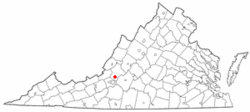
Location of Troutville, Virginia
Coordinates: 37°24′55″N79°52′37″W / 37.41528°N 79.87694°W / 37.41528; -79.87694
Country United States
State Virginia
County Botetourt
Area
[1]
  Total0.69 sq mi (1.79 km2)
  Land0.69 sq mi (1.79 km2)
  Water0.00 sq mi (0.00 km2)
Elevation
1,391 ft (424 m)
Population
 (2020)
  Total458
  Density663.77/sq mi (255.87/km2)
Time zone UTC-5 (Eastern (EST))
  Summer (DST) UTC-4 (EDT)
ZIP code
24175
Area code 540
FIPS code 51-79472 [2]
GNIS feature ID1493720 [3]
Website https://townoftroutville-va.gov/

Troutville is a town in Botetourt County, Virginia, United States. The population was 458 at the 2020 census. The town is located along the U.S. Route 11 between Cloverdale and Buchanan. It is part of the Roanoke Metropolitan Statistical Area.

Contents

History

The railroad reached this location in 1881, and a station was built, but the area had no name. As three nearby houses were occupied by the brothers John, Jim, and Jorge Trout, the area was called Troutsville. It became an important shipping center in the 1890s. In 1895, Troutsville was a thriving town with an active shipping point, farming, canneries, packing houses and factories. The name of the town was later changed to Troutville. The town was chartered on June 4, 1956.

Adrian Cronauer died in a Troutville nursing home.

The Thomas D. Kinzie House and Bryan McDonald Jr. House are listed on the National Register of Historic Places. [4] [5]

Geography

Troutville is located at 37°24′55″N79°52′37″W / 37.415406°N 79.876967°W / 37.415406; -79.876967 (37.415406, -79.876967 [6]

According to the United States Census Bureau, the town has a total area of 0.9 square mile (2.3 km2), all land.

In 2018, Troutville leaders discussed a boundary line adjustment to add 2,600 acres to the town limits, seven times its current size. [7]

Demographics

Historical population
CensusPop.Note
1960 524
1970 522−0.4%
1980 496−5.0%
1990 455−8.3%
2000 432−5.1%
2010 431−0.2%
2020 4586.3%
U.S. Decennial Census [8]

2020 census

As of the census of 2020, there were 458 people residing in the town. There were 244 housing units. The racial makeup of the town was 93.9% White, 0.2% African American or Black, 0.0% American Indian, 0.4% Asian, 0.0% Pacific Islander, 0.2% from other races, and 5.2% from two or more races. Hispanic or Latino of any race were 2.0% of the population.

2010 census

As of the census [2] of 2010, there were 431 people, 194 households, and 126 families living in the town. The population density was 478.9 people per square mile (187.4/km2). There were 226 housing units at an average density of 251.1 per square mile (98.3/km2). The racial makeup of the town was 94.9% White, 1.2% African American, 0.2% Native American, 0.2% Asian, 0.9% from other races, and 2.6% from two or more races. Hispanic or Latino of any race were 2.6% of the population.

There were 194 households, out of which 25.8% had children under the age of 18 living with them, 49.5% were married couples living together, 12.4% had a female householder with no husband present, and 35.1% were non-families. 29.4% of all households were made up of individuals, and 8.8% had someone living alone who was 65 years of age or older. The average household size was 2.22 and the average family size was 2.74.

In the town, the population was spread out, with 21.3% under the age of 18, 7.6% from 18 to 24, 24.6% from 25 to 44, 26.9% from 45 to 64, and 19.7% who were 65 years of age or older. The median age was 41.8 years. For every 100 females there were 103.3 males. For every 100 females aged 18 and over, there were 98.2 males.

The median income for a household in the town was $55,341, and the median income for a family was $56,379. Males had a median income of $50,917 versus $34,250 for females. The per capita income for the town was $24,630. About 5.0% of families and 5.2% of the population were below the poverty line, including 16.0% of those under age 18 and none of those age 65 or over.

Parks and recreation

The Appalachian Trail Crossing U.S. Route 11 in Troutville, Virginia. AppalachianTrailTroutvilleVirginia.jpg
The Appalachian Trail Crossing U.S. Route 11 in Troutville, Virginia.

The Appalachian Trail crosses U.S. Route 11, just south of the town limits. Troutville has been named an Appalachian Trail Community by the Appalachian Trail Conservancy.

U.S. Bicycle Route 76 traverses through the town following Valley Road, U.S. Route 11, and Stoney Battery Road.

The town maintains one park, known as Troutville Town Park. The park features several shelters, a quarter-mile paved walking trail, playground equipment, tennis and basketball courts. A Norfolk Southern caboose is also displayed at the park. The park is regularly used by hikers that come off the Appalachian Trail and cyclists from the U.S. Bicycle Route 76 and hosts a number of annual events and festivals.

Government

Troutville operates a Mayor–council form of government. Troutville Town Council is composed of a mayor and six council members who are elected at-large.

The United States Postal Service operates the Troutville Post Office within the town.

Law enforcement is provided by the Botetourt County Sheriff's Office. Fire protection is provided by the Troutville Volunteer Fire Department, which operates a fire station within the CDP. Emergency medical services are provided by the Botetourt County Department of Fire and EMS, which operates an ambulance out of the Troutville fire station.

Education

Troutville is served by Botetourt County Public Schools. Public school students residing in Troutville are zoned to attend Troutville Elementary School, Read Mountain Middle School, and Lord Botetourt High School.

The closest higher education institutions are located in Hollins and Roanoke.

Infrastructure

The Town operates its own water system, while the Western Virginia Water Authority maintains the Town's sanitary sewer system.

Transportation

Airports

The Roanoke-Blacksburg Regional Airport is the closest airport with commercial service to the town.

Roads

Rail

The Norfolk Southern operated Roanoke Subdivision runs through the town. The closest passenger rail service is located in Roanoke.

Related Research Articles

<span class="mw-page-title-main">Clifton Forge, Virginia</span> Town in Virginia, United States

Clifton Forge is a town in Alleghany County, Virginia, United States which is part of the greater Roanoke Region. The population was 3,555 at the 2020 census. The Jackson River flows through the town, which as a result was once known as Jackson's River Station.

<span class="mw-page-title-main">Botetourt County, Virginia</span> County in Virginia, United States

Botetourt County is a US county that lies in the Roanoke Region of the Commonwealth of Virginia. Located in the mountainous portion of the state, the county is bordered by two major ranges, the Blue Ridge Mountains and the Appalachian Mountains.

<span class="mw-page-title-main">Weldon, North Carolina</span> Town in North Carolina, United States

Weldon is a town in Halifax County, North Carolina, United States. The population was 1,655 at the 2010 census. It is part of the Roanoke Rapids, North Carolina Micropolitan Statistical Area.

<span class="mw-page-title-main">Etna, Pennsylvania</span> Borough in Pennsylvania, United States

Etna is a borough in Allegheny County, Pennsylvania, United States, located across the Allegheny River from Pittsburgh. The population was 3,437 at the 2020 census. It is a suburb of the Pittsburgh metropolitan area.

<span class="mw-page-title-main">Everett, Pennsylvania</span> Borough in Pennsylvania, United States

Everett is a borough in Bedford County, Pennsylvania, United States. The population was 1,765 at the 2020 census.

<span class="mw-page-title-main">Iron Gate, Virginia</span> Town in Virginia, United States

Iron Gate is a town in eastern Alleghany County, Virginia, United States. The population was 324 at the 2020 census. The town is located along U.S. Route 220, near Clifton Forge.

<span class="mw-page-title-main">Blue Ridge, Virginia</span> Census-designated place in Virginia, United States

Blue Ridge is a census-designated place (CDP) in southern Botetourt County, Virginia, United States. The population was 3,185 at the 2020 census. The CDP is located along U.S. Route 460. It is part of the Roanoke Metropolitan Statistical Area.

<span class="mw-page-title-main">Buchanan, Virginia</span> Town in Virginia, United States

Buchanan is a town in Botetourt County, Virginia, United States. The population was 1,196 at the 2020 census. It is part of the Roanoke Metropolitan Statistical Area. It was the western terminus of the James River and Kanawha Canal when construction on the canal ended.

Cloverdale is a census-designated place (CDP) in southern Botetourt County, Virginia, United States. The population was 3,410 at the 2020 census. The community is located along State Route 654. It is part of the Roanoke Metropolitan Statistical Area.

Daleville is a census-designated place (CDP) in southern Botetourt County, Virginia, United States. The population was 3,070 at the 2020 census. The CDP is located along U.S. Route 220. It is part of the Roanoke Metropolitan Statistical Area.

<span class="mw-page-title-main">Fincastle, Virginia</span> Town in Virginia, United States

Fincastle is a town in Botetourt County, Virginia, United States. The population was 755 at the 2020 census. It is the county seat of Botetourt County.

Laymantown is a census-designated place (CDP) in southern Botetourt County, Virginia, United States. The population was 1,867 at the 2020 census. The community is located along State Route 658. It is part of the Roanoke Metropolitan Statistical Area.

North Shore is a census-designated place (CDP) in Franklin County, Virginia, United States. The community lies along State Route 616. It is part of the Roanoke Metropolitan Statistical Area.

<span class="mw-page-title-main">Rocky Mount, Virginia</span> Town in Virginia, United States

Rocky Mount is a town in and the county seat of Franklin County, Virginia, United States. The town is part of the Roanoke Metropolitan Statistical Area, and had a population of 4,903 as of the 2020 census. It is located in the Roanoke Region of Virginia.

<span class="mw-page-title-main">Vinton, Virginia</span> Town in Virginia, United States

Vinton is a town in eastern Roanoke County, Virginia, United States. The population was 8,059 at the 2020 census. Vinton is part of the Roanoke Metropolitan Statistical Area and the Roanoke Region of Virginia.

<span class="mw-page-title-main">Damascus, Virginia</span> Town in Virginia, United States

Damascus is a small town in Washington County, Virginia. The population was 814 at the 2010 census. It is part of the Kingsport–Bristol (TN)–Bristol (VA) Metropolitan Statistical Area, which is a component of the Johnson City–Kingsport–Bristol, TN-VA Combined Statistical Area.

<span class="mw-page-title-main">Bolivar, West Virginia</span> Town in West Virginia, United States

Bolivar is a town in Jefferson County, West Virginia, United States. The population was 1,072 at the 2020 census. The town is named for South American revolutionary leader Simón Bolívar. Located in West Virginia's Eastern Panhandle, it is part of the northwestern fringes of the Washington metropolitan area.

Hollins is a census-designated place (CDP) in Botetourt and Roanoke County, Virginia, United States. Hollins covers much of the area known locally as "North County". The population was 15,574 at the 2020 census. It is part of the Roanoke Metropolitan Statistical Area. The area is also the home of Hollins University in addition to four properties listed on the National Register of Historic Places: the Black Horse Tavern-Bellvue Hotel and Office, Harshbarger House, the Hollins College Quadrangle, and Old Tombstone.

<span class="mw-page-title-main">Roanoke metropolitan area</span> Metropolitan area in Virginia, United States

The Roanoke Metropolitan Statistical Area is a Metropolitan Statistical Area (MSA) in Virginia as defined by the United States Office of Management and Budget (OMB). The Roanoke MSA is sometimes referred to as the Roanoke Valley, even though the Roanoke MSA occupies a larger area than the Roanoke Valley. It is geographically similar to the area known as the Roanoke Region of Virginia, but while the latter includes Alleghany County, the former does not. As of the 2020 census, the MSA had a population of 315,251.

Glen Wilton is a census-designated place (CDP) in northern Botetourt County, Virginia, United States. The population was 129 at the 2020 census. The CDP is located along the James River, between Eagle Rock and Iron Gate. It is part of the Roanoke Metropolitan Statistical Area.

References

  1. "2019 U.S. Gazetteer Files". United States Census Bureau. Retrieved August 7, 2020.
  2. 1 2 "U.S. Census website". United States Census Bureau . Retrieved 2011-05-14.
  3. "Troutville". Geographic Names Information System . United States Geological Survey, United States Department of the Interior.
  4. "National Register Information System". National Register of Historic Places . National Park Service. July 9, 2010.
  5. "National Register of Historic Places Listings". Weekly List of Actions Taken on Properties: 8/22/11 through 8/26/11. National Park Service. 2011-09-02.
  6. "US Gazetteer files: 2010, 2000, and 1990". United States Census Bureau. 2011-02-12. Retrieved 2011-04-23.
  7. "Troutville considers expanding town by thousands of acres". WDBJ. 2018-07-19. Retrieved 2018-07-19.
  8. "Census of Population and Housing". Census.gov. Retrieved June 4, 2015.