Victoria, Virginia

Last updated

Victoria, Virginia
Town
5th Street - panoramio.jpg
Street scene in Victoria
VAMap-doton-Victoria.PNG
Location of Victoria, Virginia
Coordinates: 36°59′36″N78°13′30″W / 36.99333°N 78.22500°W / 36.99333; -78.22500
CountryUnited States
State Virginia
County Lunenburg
Named for Queen Victoria
Government
  MayorAllen D. Smith (Since 2020)
  Town ManagerRodney Newton
Area
[1]
  Total2.85 sq mi (7.38 km2)
  Land2.82 sq mi (7.29 km2)
  Water0.03 sq mi (0.09 km2)
Elevation
587 ft (179 m)
Population
 (2010)
  Total1,725
  Estimate 
(2019) [2]
1,626
  Density577.41/sq mi (222.92/km2)
Time zone UTC−5 (Eastern (EST))
  Summer (DST) UTC−4 (EDT)
ZIP code
23974
Area code 434
FIPS code 51-81024 [3]
GNIS feature ID1496356 [4]
Website www.victoriava.net

Victoria is an incorporated town in Lunenburg County, Virginia, United States. The population was 1,725 at the 2010 census, which was down from the 1,821 reported in 2000.

Contents

History

Lunenburg County in the Southside region was established on May 1, 1746, in Great Britain's Virginia Colony from Brunswick County. The county is named for the former Duchy of Brunswick-Lunenburg in Germany, because one of the titles also carried by Britain's Hanoverian kings was Duke of Brunswick-Lunenburg.

After statehood, Virginia grew as part of the original 13 United States. Beginning in 1816, the Virginia Board of Public Works began providing engineering and financial assistance to internal improvements around the state in transportation which continued during most of the 19th century. However, Lunenburg County had been largely passed by as canals, turnpikes, and railroads were built across much of Virginia. At the beginning of the 20th century, the area which was to become Victoria was mostly farmland (primarily cultivating tobacco) and woodlands.

Born as a railroad town

This aerial shot of Victoria was taken in 1954 looking west. It shows the turntable and roundhouse in the lower left, and the passenger station and Norfolk division offices to the right of the tracks Victoria Air 1954 SMALL.png
This aerial shot of Victoria was taken in 1954 looking west. It shows the turntable and roundhouse in the lower left, and the passenger station and Norfolk division offices to the right of the tracks

Victoria was founded in 1906 as a planned community on what had been largely undeveloped land during the construction of the Tidewater Railway. This was a new east–west railroad chartered in 1904 with its right of way quietly secured in 1904 and 1905, so as to not alert the competition regarding plans to transport coal originated by its sister Deepwater Railway operating in southern West Virginia. The Tidewater Railway was chartered to cross Virginia from the West Virginia border near Glen Lyn, Virginia in Giles County by way of Roanoke and Suffolk to port at Sewell's Point on Hampton Roads near Norfolk, Virginia. Both railroads were planned and built by the team of mining manager and civil engineer William Nelson Page and industrialist and financier Henry Huttleston Rogers, and added a third Hampton Roads coal exporting railhead to the existing Chesapeake and Ohio Railway (with coal piers at Newport News) and the Norfolk and Western Railway's similar facilities at Norfolk's Lambert's Point.

Queen Victoria of the United Kingdom was a favorite of Henry Rogers, and the new town was named in her honor. Victoria was the midpoint of the VGN's Norfolk Division, which extended from Sewell's Point to Roanoke. Designated to be a "division point" on the railroad (specifically a location for crew changes and servicing of the steam locomotives), Victoria became the location of a large equipment maintenance operation with roundhouse, turntable, coaling and water facilities for servicing steam locomotives, and a large yard.

According to author H. Reid in his 1961 book The Virginian Railway, investors recalled the rapid growth of Roanoke between 1882 and 1884, which had been nicknamed the "Magic City" when the Norfolk and Western (N&W) had established major facilities at the former bucolic location which had been earlier known as Big Lick. Comparisons were made when speculating about Victoria's future potential. They could also look to nearby Crewe on the N&W (about 20 miles away from Victoria) to see what a substantial volume of activity and employment a division point on a steam railroad could bring. Predictably, land sales at Victoria were brisk, and buildings (and jobs) soon followed.

In 1907, as they began nearing completion, the Tidewater and Deepwater Railways were combined to form the Virginian Railway (VGN). In March, the Tidewater Railway was formally rechartered by the Virginia State Corporation Commission as "The Virginian Railway Company" and William Nelson Page was elected president on April 15, 1907, at the first new board meeting in Norfolk. On April 22, the Deepwater Railway was acquired, formalizing the marriage of the two roads. Passenger service from Victoria to Norfolk began on June 17, 1907. The trip from Victoria took 12 hours, and operated once daily in each direction except Sundays, according to the first schedules published in the Norfolk Virginian-Pilot newspaper.

That first summer and fall, in conjunction with the Norfolk and Southern Railway (a regional predecessor of the 21st century Norfolk Southern System), service was offered to the Jamestown Exposition being held in Norfolk County that same summer. At the Exposition, VGN president Page served as Chief of International Jury of Awards, Mines and Metallurgy. United States President Theodore Roosevelt, attending the Jamestown Exposition, was one of the VGN's earliest passengers, according to author Reid.

Adjacent to the Jamestown Exposition site on Hampton Roads at Sewell's Point, a new coal pier was being built. Completion of the entire railroad took 2 additional years. The low gradient VGN was considered an engineering marvel of the time when it was completed in 1909. Soon, coal and other commodities began rolling through Victoria. The new Norfolk Division offices of the railroad were on located on a second floor which was added to the original Victoria passenger station a short time later.

The Virginia General Assembly granted a charter and incorporated the Town of Victoria on March 11, 1916.

Bechelbronn and Victoria High School are listed on the National Register of Historic Places. [5]

End of steam, mergers, abandonment

Victoria's importance as a rail point declined sharply in the 1950s when the change to diesel-electric locomotives greatly reduced the labor and facilities needed. The last Virginian passenger train served Victoria in January 1956. VGN steam operations ended completely in June 1957. Then, on December 1, 1959, the Virginian Railway merged with the larger Norfolk and Western Railway. Under combined operations, the through coal traffic was shifted from Victoria to the bigger road's main line through Crewe, Virginia, within commuting distance for N&W's Victoria-based employees. Local customers on the former VGN line through Victoria and nearby Kenbridge were few, and the portion of the line through Victoria and Kenbridge was eventually abandoned in the 1980s. All tracks and virtually all structures were removed, and a portion of the land donated to the community by N&W.

Much like many other communities all across the United States, the end of steam railroading and the era of mergers and consolidation in the second half of the 20th century reduced rail-oriented employment opportunities and had a generally negative impact upon Victoria and the surrounding area. However, the community and Lunenburg County proved resilient, and by the late 1990s, transportation employment represented only a minimal portion of the area's economy.

One of the biggest industries in Victoria is the prison industry. Located two miles from the center of town, the Lunenburg Correctional Center provides employment for many people living in and around Victoria.

Remembering Victoria's rail heritage

Early in the 21st century, work was begun to develop a rail heritage park and obtain a caboose to help present the town's rail heritage. After several years of work, one of the last C-10 cabooses built in-house by VGN employees at the company's massive shops complex in Princeton, West Virginia in the 1950s was located.

Rail preservationist, historian, and photographer Kenneth Miller of Roanoke had purchased Caboose 342 in the 1980s, and working with his father, had carefully restored it over a period of years. Miller, a long-time VGN fan, agreed to let Victoria have what is considered by many to be the finest extant VGN caboose for the new rail heritage park.

To prepare an appropriate display area for Caboose 342, a short stretch of roadbed was prepared, ballasted, and ties and rail were laid by volunteers in Victoria. The initials "H.H.R." and "W.N.P." were engraved as a lasting tribute to the founders of the Virginian Railway, industrialist and financier Henry Huttleston Rogers and coal mining manager and civil engineer William Nelson Page.

Virginian Railway restored and fully equipped caboose # 342 placed on static display in the town of Victoria VGN Caboose 342 at Victoria Virginia August 2004.jpg
Virginian Railway restored and fully equipped caboose # 342 placed on static display in the town of Victoria

Late in 2004, Norfolk Southern carefully transported Caboose 342 from Roanoke to the NS rail yard at Crewe, Virginia by rail. From there, it traveled overland by truck and was placed on the new rails at Victoria on December 22, 2004. In Victoria, it has been placed on display fully equipped, and has become a popular attraction for school groups and retired railroaders alike.

Geography

Victoria is located at 36°59′36″N78°13′30″W / 36.99333°N 78.22500°W / 36.99333; -78.22500 (36.993365, 78.224891). [6]

According to the United States Census Bureau, the town has a total area of 2.9 square miles (7.4 km2), of which, 2.8 square miles (7.3 km2) of it is land and 0.04 square miles (0.1 km2) of it (1.05%) is water.

Demographics

Historical population
CensusPop.Note
1910 682
1920 1,445111.9%
1930 1,5688.5%
1940 1,555−0.8%
1950 1,6073.3%
1960 1,7378.1%
1970 1,408−18.9%
1980 2,00442.3%
1990 1,830−8.7%
2000 1,821−0.5%
2010 1,725−5.3%
2019 (est.)1,626 [2] −5.7%
U.S. Decennial Census [7]

As of the census [3] of 2000, there were 1,821 people, 803 households, and 517 families residing in the town. The population density was 644.6 people per square mile (248.4/km2). There were 903 housing units at an average density of 319.6 per square mile (123.2/km2). The racial makeup of the town was 76.22% White, 21.47% African American, 0.16% Native American, 0.05% Asian, 0.38% from other races, and 1.70% from two or more races. Hispanic or Latino of any race were 1.37% of the population.

There were 803 households, out of which 26.3% had children under the age of 18 living with them, 45.1% were married couples living together, 15.2% had a female householder with no husband present, and 35.6% were non-families. 33.0% of all households were made up of individuals, and 18.4% had someone living alone who was 65 years of age or older. The average household size was 2.27 and the average family size was 2.85.

In the town, the population was spread out, with 22.8% under the age of 18, 7.9% from 18 to 24, 22.9% from 25 to 44, 25.3% from 45 to 64, and 21.0% who were 65 years of age or older. The median age was 42 years. For every 100 females, there were 85.6 males. For every 100 females aged 18 and over, there were 80.4 males.

The median income for a household in the town was $24,694, and the median income for a family was $32,311. Males had a median income of $26,797 versus $17,054 for females. The per capita income for the town was $13,693. About 18.6% of families and 24.6% of the population were below the poverty line, including 38.9% of those under age 18 and 18.2% of those age 65 or over.

Related Research Articles

<span class="mw-page-title-main">Brookneal, Virginia</span> Town in Virginia, United States

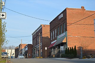
Brookneal is an incorporated town in Campbell County, Virginia, United States. The population was 1,090 as of the 2020 census. It is part of the Lynchburg Metropolitan Statistical Area.

<span class="mw-page-title-main">Princeton, West Virginia</span> City in West Virginia, United States

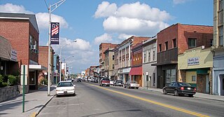
Princeton is a city in and the county seat of Mercer County, West Virginia, United States. The population was 5,872 at the 2020 census. It is part of the Bluefield micropolitan area. The city hosts the Princeton WhistlePigs baseball club of the Appalachian League.

<span class="mw-page-title-main">Mullens, West Virginia</span> City in West Virginia, United States

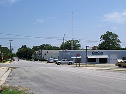
Mullens is a city in Wyoming County, West Virginia. The population was 1,475 at the time of the 2020 census.

<span class="mw-page-title-main">Jamestown Exposition</span> United States historic place

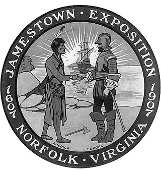
The Jamestown Exposition, also known as the Jamestown Ter-Centennial Exposition of 1907, was one of the many world's fairs and expositions that were popular in the United States in the early part of the 20th century. Commemorating the 300th anniversary of the founding of Jamestown in the Virginia Colony, it was held from April 26 to December 1, 1907, at Sewell's Point on Hampton Roads, in Norfolk, Virginia. It celebrated the first permanent English settlement in the present United States. In 1975, the 20 remaining exposition buildings were included on the National Register of Historic Places as a national historic district.

<span class="mw-page-title-main">Henry Huttleston Rogers</span> American businessman (1840–1909)

Henry Huttleston Rogers was an American industrialist and financier. He made his fortune in the oil refining business, becoming a leader at Standard Oil. He also played a major role in numerous corporations and business enterprises in the gas industry, copper, and railroads. He became a close friend of Mark Twain.

<span class="mw-page-title-main">Virginian Railway</span> Defunct American railroad

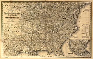
The Virginian Railway was a Class I railroad located in Virginia and West Virginia in the United States. The VGN was created to transport high quality "smokeless" bituminous coal from southern West Virginia to port at Hampton Roads.

<span class="mw-page-title-main">Norfolk and Western Railway</span> Former US Class I railroad (1838–1982)

The Norfolk and Western Railway, commonly called the N&W, was a US class I railroad, formed by more than 200 railroad mergers between 1838 and 1982. It was headquartered in Roanoke, Virginia, for most of its existence. Its motto was "Precision Transportation"; it had a variety of nicknames, including "King Coal" and "British Railway of America". In 1986, N&W merged with Southern Railway to form today's Norfolk Southern Railway.

<span class="mw-page-title-main">Sewell's Point</span> Landform in Norfolk, Virginia, U.S.

Sewells Point is a peninsula of land in the independent city of Norfolk, Virginia in the United States, located at the mouth of the salt-water port of Hampton Roads. Sewells Point is bordered by water on three sides, with Willoughby Bay to the north, Hampton Roads to the west, and the Lafayette River to the south. It is the site of Naval Station Norfolk.

<span class="mw-page-title-main">William Nelson Page</span> American civil engineer and industrialist

William Nelson Page was an American civil engineer and industrialist. He was active in the Virginias following the U.S. Civil War. Page was widely known as a metallurgical expert by other industry leaders and investors as well as state and federal authorities.

The Tidewater Railway, also known as the Tidewater Railway Company, was formed in 1904 as an intrastate railroad in Virginia, in the United States, by William N. Page, a civil engineer and entrepreneur, and his silent partner, millionaire industrialist Henry Huttleston Rogers of Standard Oil fame. It was put together with the intention of creating an outlet to Hampton Roads, where coal mined along their older West Virginia short-line railroad, the Deepwater Railway, could be exported. In 1906, Thomas Davis Ranson served as vice president.

<span class="mw-page-title-main">Frederick J. Kimball</span> American civil engineer (1844–1903)

Frederick James Kimball was a civil engineer. He was an early president of the Norfolk and Western Railway and helped develop the Pocahontas coalfields in Virginia and West Virginia.

<span class="mw-page-title-main">Norfolk and Petersburg Railroad</span>

The Norfolk and Petersburg Railroad was built between Norfolk and Petersburg, Virginia and was completed by 1858. The line was 85 miles (137 km) of 5 ft track gauge.

Page is a census-designated place (CDP) and coal town in Fayette County, West Virginia, United States. As of the 2010 census, its population was 224. It was named for William Nelson Page (1854-1932), a civil engineer and industrialist who lived in nearby Ansted, where he managed Gauley Mountain Coal Company and many iron, coal, and railroad enterprises.

<span class="mw-page-title-main">Atlantic, Mississippi and Ohio Railroad</span> American railroad

Atlantic, Mississippi and Ohio Railroad (AM&O) was formed in 1870 in Virginia from three east–west railroads which traversed across the southern portion of the state. Organized and led by former Confederate general William Mahone (1826-1895), the 428-mile (689 km) line linked Norfolk with Bristol, Virginia by way of Suffolk, Petersburg, Lynchburg, and Salem. The AM&O was promoted as a trade link to the west, and further expansion was envisioned with the goal of increasing Virginia's Ohio Valley and Mississippi Valley commerce. It was heavily backed by investors from England and Scotland.

Harold A. Reid (1925–1992), also known by the pen name H. Reid, was an American writer, photographer, and historian. Reid's photographs of steam locomotives, captured the last days of steam motive power on America's Class I railroads, notably on the Virginian Railway, and ending with the Norfolk and Western in 1960, the last major U.S. railroad to convert from steam.

<span class="mw-page-title-main">Roanoke Shops</span> Railway workshops in Roanoke, Virginia

The Roanoke Shops is a railroad workshop and maintenance facility in Roanoke, Virginia. Between 1884 and 1953, the shops produced 447 steam locomotives, all for the Norfolk and Western Railway (N&W). The Roanoke Shops built the N&W's famous Big Three class steam locomotives; the 4-8-4 class J, the 2-6-6-4 class A, and the 2-8-8-2 class Y6. In late 1953, the Shops built their final steam locomotive, making it last standard gauge steam locomotive built for revenue service in the United States. In 2020, N&W's successor, Norfolk Southern abandoned the Shops and Genesis Rail Services acquired the property in July 2023.

<span class="mw-page-title-main">Virginia Creeper Trail</span>

The Virginia Creeper Trail is a 35-mile (56 km) multi-purpose rail trail. Located in southwestern Virginia, the trail runs from Abingdon to Whitetop, Virginia, near Mount Rogers National Recreation Area and the North Carolina state line.

<span class="mw-page-title-main">Virginia State Route 49</span> State highway in southern Virginia, US

State Route 49 is a primary state highway in the U.S. state of Virginia. The state highway runs 69.01 miles (111.06 km) from the North Carolina state line in Virgilina, Virginia in Halifax County, where the highway continues south as North Carolina Highway 49, north to U.S. Route 360 near Burkeville in Nottoway County. SR 49 passes through Southside Virginia, connecting Virgilina and Burkeville with Clarksville and Chase City in Mecklenburg County, Victoria in Lunenburg County, and Crewe in Nottoway County. Via US 360, the state highway connects Richmond with the John H. Kerr Reservoir.

<span class="mw-page-title-main">Tidewater and Western Railroad</span>

The Farmville and Powhatan Railroad went bankrupt in 1905 and became the Tidewater and Western Railroad. The line survived until 1917 when it was pulled up and sent to France for the World War I effort. The Tidewater and Western Railroad carried freight and passengers along a route from Farmville, Virginia to Bermuda Hundred. The Tidewater and Western Railroad continued to have Western Union Telegraphs run along the rails. These connected to telegraphs on the Atlantic Coast Line along the East Coast of the US and to Europe.

The Princeton–Deepwater District is a rail line in West Virginia that connects Deep Water, West Virginia, on the Kanawha River southwards to Princeton, West Virginia, and beyond to rail lines leading to Virginia. It is known for its rugged terrain and opportunities for rail photography.

References

  1. "2019 U.S. Gazetteer Files". United States Census Bureau. Retrieved August 7, 2020.
  2. 1 2 "Population and Housing Unit Estimates". United States Census Bureau. May 24, 2020. Retrieved May 27, 2020.
  3. 1 2 "U.S. Census website". United States Census Bureau . Retrieved January 31, 2008.
  4. "US Board on Geographic Names". United States Geological Survey. October 25, 2007. Retrieved January 31, 2008.
  5. "National Register Information System". National Register of Historic Places . National Park Service. July 9, 2010.
  6. "US Gazetteer files: 2010, 2000, and 1990". United States Census Bureau. February 12, 2011. Retrieved April 23, 2011.
  7. "Census of Population and Housing". Census.gov. Retrieved June 4, 2015.

Further reading

Periodical, business, and on-line publications