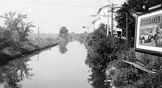
The Illinois and Michigan Canal connected the Great Lakes to the Mississippi River and the Gulf of Mexico. In Illinois, it ran 96 miles (154 km) from the Chicago River in Bridgeport, Chicago to the Illinois River at LaSalle-Peru. The canal crossed the Chicago Portage, and helped establish Chicago as the transportation hub of the United States, before the railroad era. It was opened in 1848. Its function was partially replaced by the wider and deeper Chicago Sanitary and Ship Canal in 1900, and it ceased transportation operations with the completion of the Illinois Waterway in 1933.

A trail is usually a path, track or unpaved lane or road. In the United Kingdom and the Republic of Ireland, path or footpath is the preferred term for a walking trail. The term is also applied in North America to routes along rivers, and sometimes to highways. In the US, the term was historically used for a route into or through wild territory used by emigrants. In the USA "trace" is a synonym for trail, as in Natchez Trace. Some trails are single use and can be used only for walking, cycling, horse riding, snowshoeing and cross-country skiing; others, as in the case of a bridleway in the UK, are multi-use, and can be used by walkers, cyclists and equestrians. There are also unpaved trails used by dirt bikes and other off-road vehicles, and in some places, like the Alps, trails are used for moving cattle and other livestock.

The Trans Canada Trail, officially named The Great Trail between September 2016 and June 2021, is a cross-Canada system of greenways, waterways, and roadways that stretches from the Atlantic to the Pacific to the Arctic oceans. The trail extends over 24,000 kilometres ; it is now the longest recreational, multi-use trail network in the world. The idea for the trail began in 1992, shortly after the Canada 125 celebrations. Since then it has been supported by donations from individuals, corporations, foundations, and all levels of government.

The Boundary Waters Canoe Area Wilderness is a 1,090,000-acre (4,400 km2) wilderness area within the Superior National Forest in northeastern part of the US state of Minnesota under the administration of the U.S. Forest Service. A mixture of forests, glacial lakes, and streams, the BWCAW's preservation as a primitive wilderness began in the 1900s and culminated in the Boundary Waters Canoe Area Wilderness Act of 1978. It is a popular destination for canoeing, hiking, and fishing, and is one of the most visited wildernesses in the United States.

The freedom to roam, or "everyman's right", is the general public's right to access certain public or privately owned land, lakes, and rivers for recreation and exercise. The right is sometimes called the right of public access to the wilderness or the "right to roam".

The Mattawa River is a river in central Ontario, Canada. It flows east from Trout Lake east of North Bay and enters the Ottawa River at the town of Mattawa. Counting from the head of Trout Lake, it is 76 km in length. The river's name comes from the Algonquin word for "meeting of waterways".

Voyageurs National Park is an American national park in northern Minnesota near the city of International Falls established in 1975. The park's name commemorates the voyageurs—French-Canadian fur traders who were the first European settlers to frequently travel through the area. Notable for its outstanding water resources, the park is popular with canoeists, kayakers, other boaters, and fishermen. The Kabetogama Peninsula, which lies entirely within the park and makes up most of its land area, is accessible only by boat. To the east of the park lies the Boundary Waters Canoe Area Wilderness.

Boating is the leisurely activity of travelling by boat, or the recreational use of a boat whether powerboats, sailboats, or man-powered vessels, focused on the travel itself, as well as sports activities, such as fishing or waterskiing. It is a popular activity, and there are millions of boaters worldwide.

A body of water, such as a river, canal or lake, is navigable if it is deep, wide and calm enough for a water vessel to pass safely. Such a navigable water is called a waterway, and is preferably with few obstructions against direct traverse that needed avoiding, such as rocks, reefs or trees. Bridges built over waterways must have sufficient clearance. High flow speed may make a channel unnavigable due to risk of ship collisions. Waters may be unnavigable because of ice, particularly in winter or high-latitude regions. Navigability also depends on context: a small river may be navigable by smaller craft such as a motorboat or a kayak, but unnavigable by a larger freighter or cruise ship. Shallow rivers may be made navigable by the installation of locks that regulate flow and increase upstream water level, or by dredging that deepens parts of the stream bed.

Curecanti National Recreation Area(Pronounced or .) is a National Park Service unit located on the Gunnison River in western Colorado. Established in 1965, Curecanti National Recreation Area is responsible for developing and managing recreational facilities on three reservoirs, Blue Mesa Reservoir, Morrow Point Reservoir and Crystal Reservoir, constructed on the upper Gunnison River in the 1960s by the U.S. Bureau of Reclamation to better utilize the vital waters of the Colorado River and its major tributaries. A popular destination for boating and fishing, Curecanti offers visitors two marinas, traditional and group campgrounds, hiking trails, boat launches, and boat-in campsites. The state's premiere lake trout and Kokanee salmon fisheries, Curecanti is a popular destination for boating and fishing, and is also a popular area for ice-fishing in the winter months.
The Chicago Portage was an ancient portage that connected the Great Lakes waterway system with the Mississippi River waterway system. Connecting these two great water trails meant easy access from the mouth of the St Lawrence River on the Atlantic Ocean to the Rocky Mountains, and the Gulf of Mexico. The approximately six-mile link had been used by Native Americans for thousands of years during the Pre-Columbian era for travel and trade.

A greenway is usually a shared-use path along a strip of undeveloped land, in an urban or rural area, set aside for recreational use or environmental protection. Greenways are frequently created out of disused railways, canal towpaths, utility or similar rights of way, or derelict industrial land. Greenways also can also be linear parks, and can serve as wildlife corridors. The path's surface may be paved and often serves multiple users: walkers, runners, bicyclists, skaters and hikers. A characteristic of greenways, as defined by the European Greenways Association, is "ease of passage": that is that they have "either low or zero gradient", so that they can be used by all "types of users, including mobility impaired people".

The Division of Boating and Waterways (DBW) was established in 1957 upon enactment of legislation supported by the boating community. That legislation established a state boating agency dedicated to all aspects of recreational boating and a special fund to fund the division’s activities. The division receives no General Fund support.

Nautical tourism, also called water tourism, is tourism that combines sailing and boating with vacation and holiday activities. It can be travelling from port to port in a cruise ship, or joining boat-centered events such as regattas or landing a small boat for lunch or other day recreation at specially prepared day boat-landings. It is a form of tourism that is generally more popular in the summertime.
The Tip of The Thumb Heritage Water Trails is a nonprofit citizens organization working with the Huron County Parks to establish and maintain a water trail along Michigan's Lake Huron's shoreline. It is dependent on public support for its existence and growth. The Water Trail, which is best utilized via sea kayaks by people who have had proper sea kayaking instruction, consists of camp sites and rest areas spaced out along the shore. The trail is still being developed, so there are several large sections with no public landing sites.

Right of way is "the legal right, established by usage or grant, to pass along a specific route through grounds or property belonging to another", or "a path or thoroughfare subject to such a right". A similar right of access also exists on land held by a government, lands that are typically called public land, state land, or Crown land. When one person owns a piece of land that is bordered on all sides by lands owned by others, an easement may exist, or be created so as to initiate a right of way through the bordering land.
The Imperial River is a river in southwest Florida in the United States. It is fed by the Kehl Canal and marshland at 26°22′16″N81°41′23″W, just east of the city limits of Bonita Springs in unincorporated southwest Lee County. It is approximately 9.3 miles (15.0 km) long, from its headwaters just east of I-75 in the Flint Pen Strand, through downtown Bonita Springs and to its mouth at the north end of Fishtrap Bay, near the southern end of Estero Bay. It was originally named Surveyors Creek before the city was developed. The river is part of The Great Calusa Blueway.

This is a list of trails and greenways in Detroit.
The Ohio River Water Trail navigates the counties of Allegheny, Beaver, Columbiana, and Hancock in the states of Ohio, Pennsylvania, and West Virginia. The trail is under the stewardship of the Ohio River Trail Council. The water trail or blueway geographically extends from the Three Rivers Water Trail in Pittsburgh, Pennsylvania, to Newell, West Virginia, and East Liverpool, Ohio. The 69-mile Ohio River Water Trail (ORWT) includes 13 miles of the Ohio River along the Three Rivers Water Trail from "The Point" in Pittsburgh at milepost zero downstream to the Dashields Lock and Dam at milepost 13, 33 miles of the Ohio River from Dashields Dam at milepost 13, downstream to Newell at milepost 46.0, 16 miles of the Little Beaver Creek to Beaver Creek State Park, three miles of the Beaver River to the Townsend (Fallston) Dam, and four miles of the Raccoon Creek.

Ford Lake is a fresh water artificial reservoir located in Washtenaw County in the U.S. state of Michigan. The lake was created from the construction of Ford Lake Dam along the Huron River in the early 1930s. The lake is named after business magnate Henry Ford.


