Pittsylvania County | |
---|---|
Coordinates: 36°49′N79°24′W / 36.82°N 79.4°W | |
Country | United States |
State | Virginia |
Founded | 1767 |
Named for | William Pitt |
Seat | Chatham |
Largest town | Chatham |
Area | |
• Total | 978 sq mi (2,530 km2) |
• Land | 969 sq mi (2,510 km2) |
• Water | 9 sq mi (20 km2) 0.9% |
Population (2020) | |
• Total | 60,501 |
• Density | 62/sq mi (24/km2) |
Time zone | UTC−5 (Eastern) |
• Summer (DST) | UTC−4 (EDT) |
Congressional district | 5th |
Website | www |
Pittsylvania County is a county located in the Commonwealth of Virginia. As of the 2020 United States Census, the population was 60,501. [1] Chatham is the county seat.
Pittsylvania County is included in the Danville, VA Micropolitan Statistical Area. [2]
The largest undeveloped uranium deposit in the United States (7th largest in the world) is located in Pittsylvania County. [3] (see Uranium mining in Virginia .)
Originally "Pittsylvania" was a name suggested for an unrealized British colony to be located primarily in what is now West Virginia. Pittsylvania County would not have been within this proposed colony, which subsequently was named Vandalia.
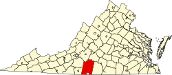
Pittsylvania County was formed in 1767 with territory annexed from Halifax County. It was named for William Pitt, 1st Earl of Chatham, who served as Prime Minister of Great Britain from 1766 to 1768, and who opposed some harsh colonial policies of the period.
In 1777 the western part of Pittsylvania County was partitioned off to became Patrick Henry County.
Maud Clement's History of Pittsylvania County notes the following: "Despite the settlers' intentions, towns failed to develop for two reasons: the generally low level of economic activity in the area and the competition from plantation settlements already providing the kind of marketing and purchasing services typically offered by a town. Plantation settlements along the rivers, particularly at ferrying points, became commercial centers. The most important for early Pittsylvania was that of Sam Pannill, a Scots-Irishman, who at the end of the eighteenth century, while still a young man, set up a plantation town at Green Hill on the north side of the Staunton River in Campbell County. (Clement 15)
"Its economy was tobacco-dominated and reliant on a growing slave labor force. It was a county without towns or a commercial center. Plantation villages on the major river thoroughfares were the only centers of trade, until the emergence of Danville. (Clement 23)"
The city of Danville's history up through the antebellum period overall is an expression of the relationship between the town and the planters who influenced its development.
According to the United States Census Bureau, the county has a total area of 978 square miles (2,530 km2), of which 969 square miles (2,510 km2) is land and 9 square miles (23 km2) (0.9%) is water. [4] It is the largest county in Virginia by land area and second-largest by total area. The county is bounded on the north by the Roanoke River (this stretch of the river is known as the Staunton River), bisected by the Banister River running eastward through the center, and is drained on the south by the Dan River, flowing eastward. [5]
The county is divided into seven districts:
In Virginia:
In North Carolina:
Census | Pop. | Note | %± |
---|---|---|---|
1790 | 11,579 | — | |
1800 | 12,697 | 9.7% | |
1810 | 17,172 | 35.2% | |
1820 | 21,323 | 24.2% | |
1830 | 26,034 | 22.1% | |
1840 | 26,398 | 1.4% | |
1850 | 28,796 | 9.1% | |
1860 | 32,104 | 11.5% | |
1870 | 31,343 | −2.4% | |
1880 | 52,589 | 67.8% | |
1890 | 59,941 | 14.0% | |
1900 | 46,894 | −21.8% | |
1910 | 50,709 | 8.1% | |
1920 | 56,493 | 11.4% | |
1930 | 61,424 | 8.7% | |
1940 | 61,697 | 0.4% | |
1950 | 66,096 | 7.1% | |
1960 | 58,296 | −11.8% | |
1970 | 58,789 | 0.8% | |
1980 | 66,147 | 12.5% | |
1990 | 55,655 | −15.9% | |
2000 | 61,745 | 10.9% | |
2010 | 63,506 | 2.9% | |
2020 | 60,501 | −4.7% | |
US Decennial Census [6] 1790-1960 [7] 1900-1990 [8] 1990-2000 [9] 2010 [10] 2020 [11] |
Race / Ethnicity | Pop 2010 [10] | Pop 2020 [11] | % 2010 | % 2020 |
---|---|---|---|---|
White alone (NH) | 47,250 | 44,277 | 74.40% | 73.18% |
Black or African American alone (NH) | 13,963 | 12,354 | 21.99% | 20.42% |
Native American or Alaska Native alone (NH) | 124 | 93 | 0.20% | 0.15% |
Asian alone (NH) | 176 | 289 | 0.28% | 0.48% |
Pacific Islander alone (NH) | 17 | 17 | 0.03% | 0.03% |
Some Other Race alone (NH) | 42 | 128 | 0.07% | 0.21% |
Mixed Race/Multi-Racial (NH) | 602 | 1,631 | 0.95% | 2.70% |
Hispanic or Latino (any race) | 1,332 | 1,712 | 2.10% | 2.83% |
Total | 63,506 | 60,501 | 100.00% | 100.00% |
Note: the US Census treats Hispanic/Latino as an ethnic category. This table excludes Latinos from the racial categories and assigns them to a separate category. Hispanics/Latinos can be of any race.
According to the 2010 United States Census, there are 60,949 people, and 26,687 households in the county. The population density was 65.5 people per square mile (25.3 people/km2). There were 31,656 housing units at an average density of 32 units per square mile (12 units/km2). The racial makeup of the county was 76.20% White, 21.50% Black or African American, 0.30% Native American, 0.50% Asian, 0.37% from other races, and 1.40% from two or more races. 2.70% of the population were Hispanic or Latino of any race.
There were 26,687 households, out of which 30.40% had children under the age of 18 living with them. The average household size was 2.28 and the average family size was 2.93.
The median income for a household in the county was $44,356. The per capita income for the county was $23,597. About 12.60% of the population were below the poverty line.
Pittsylvania County is governed by an elected seven-member Board of Supervisors. Management of the county is vested in a Board-appointed County Administrator.
Name | Party | First Election | District | |
---|---|---|---|---|
Ken Bowman | Rep | 2023 | Chatham-Blairs | |
Darrell Dalton (Chair) | Ind | 2021 | Callands-Gretna | |
Robert M. Tucker Jr. (Vice Chair) | Ind | 2022 | Banister | |
Eddie Hite | Ind | 2023 | Dan River | |
Tim Dudley | Rep | 2019 | Staunton River | |
William 'Vic' Ingram | Ind | 2019 | Tunstall | |
Murray Whittle | Ind | 2023 | Westover | |
There are also five elected Constitutional Officers:
Year | Republican | Democratic | Third party | |||
---|---|---|---|---|---|---|
No. | % | No. | % | No. | % | |
2020 | 23,751 | 69.39% | 10,115 | 29.55% | 361 | 1.05% |
2016 | 21,554 | 68.21% | 9,199 | 29.11% | 845 | 2.67% |
2012 | 19,263 | 62.78% | 10,858 | 35.39% | 560 | 1.83% |
2008 | 18,730 | 61.55% | 11,415 | 37.51% | 288 | 0.95% |
2004 | 17,673 | 64.46% | 9,274 | 33.83% | 470 | 1.71% |
2000 | 15,760 | 64.98% | 7,834 | 32.30% | 661 | 2.73% |
1996 | 12,127 | 55.85% | 7,681 | 35.37% | 1,906 | 8.78% |
1992 | 11,467 | 52.38% | 7,675 | 35.06% | 2,752 | 12.57% |
1988 | 12,229 | 63.69% | 6,612 | 34.44% | 360 | 1.87% |
1984 | 15,743 | 66.08% | 7,791 | 32.70% | 290 | 1.22% |
1980 | 12,022 | 59.28% | 7,653 | 37.74% | 605 | 2.98% |
1976 | 9,173 | 51.21% | 7,929 | 44.26% | 811 | 4.53% |
1972 | 12,108 | 72.34% | 4,429 | 26.46% | 200 | 1.19% |
1968 | 5,096 | 25.62% | 5,427 | 27.29% | 9,367 | 47.09% |
1964 | 7,120 | 57.54% | 5,228 | 42.25% | 25 | 0.20% |
1960 | 3,788 | 47.62% | 4,089 | 51.41% | 77 | 0.97% |
1956 | 2,870 | 36.82% | 4,136 | 53.07% | 788 | 10.11% |
1952 | 2,893 | 41.93% | 3,976 | 57.62% | 31 | 0.45% |
1948 | 1,164 | 20.54% | 3,149 | 55.58% | 1,353 | 23.88% |
1944 | 1,224 | 25.91% | 3,492 | 73.92% | 8 | 0.17% |
1940 | 728 | 16.34% | 3,710 | 83.28% | 17 | 0.38% |
1936 | 556 | 13.07% | 3,694 | 86.82% | 5 | 0.12% |
1932 | 656 | 17.08% | 3,124 | 81.35% | 60 | 1.56% |
1928 | 2,598 | 60.62% | 1,688 | 39.38% | 0 | 0.00% |
1924 | 880 | 24.75% | 2,563 | 72.08% | 113 | 3.18% |
1920 | 1,162 | 29.83% | 2,715 | 69.69% | 19 | 0.49% |
1916 | 801 | 28.08% | 2,012 | 70.52% | 40 | 1.40% |
1912 | 527 | 21.72% | 1,558 | 64.22% | 341 | 14.06% |
Patrick County is a county located on the central southern border of the Commonwealth of Virginia. As of the 2020 census, the county's population was 17,608. Its county seat is Stuart. It is located within both the rolling hills and valleys of the Piedmont Region and the more mountainous regions of Southwest Virginia.
Henry County is a county located in the U.S. state of Virginia. As of the 2020 census, the population was 50,948. The county seat is usually identified as Martinsville; however, the administration building, county courthouse, and Henry County Sheriff's Office are located on Kings Mountain Road in Collinsville.The Henry County Adult Detention Center is located on DuPont Road in Martinsville.
Halifax County is a county located in the Commonwealth of Virginia. As of the 2020 census, the population was 34,022. Its county seat is Halifax.
Franklin County is located in the Blue Ridge foothills of the Commonwealth of Virginia. As of the 2020 census, the population was 54,477. Its county seat is Rocky Mount. Franklin County is part of the Roanoke Metropolitan Statistical Area and is located in the Roanoke Region of Virginia. The Roanoke River forms its northeast boundary with Bedford County.
Clarke County is a county in the Commonwealth of Virginia. As of the 2020 census, the population was 14,783. Its county seat is Berryville. Clarke County is included in the Washington-Arlington-Alexandria, DC-VA-MD-WV Metropolitan Statistical Area.
Charlotte County is a United States county located in the south central part of the Commonwealth of Virginia. Its county seat is the town of Charlotte Court House. As of the 2020 census, the county population was 11,529. Charlotte County is predominantly rural with a population density of only 26.5 persons per square mile.
Campbell County is a United States county situated in the south central part of the Commonwealth of Virginia. Located in the Piedmont region of Virginia, Campbell borders the Blue Ridge Mountains. The county seat is Rustburg.
Augusta County is a county in the Shenandoah Valley on the western edge of the Commonwealth of Virginia in the United States. The second-largest county of Virginia by total area, it completely surrounds the independent cities of Staunton and Waynesboro. Its county seat is Staunton, but most of the administrative services have offices in neighboring Verona.
Appomattox County is a United States county located in the Piedmont region and near the center of the Commonwealth of Virginia. The county is part of the Lynchburg, VA Metropolitan Statistical Area, and its county seat is the town of Appomattox.
Amelia County is a county located just southwest of Richmond in the Commonwealth of Virginia, United States. The county is located in Central Virginia and is included in the Greater Richmond Region. Its county seat is Amelia Court House.
Brookneal is an incorporated town in Campbell County, Virginia, United States. The population was 1,090 as of the 2020 census. It is part of the Lynchburg Metropolitan Statistical Area.
South Boston, formerly Boyd's Ferry, is a town in Halifax County, Virginia, United States. The population was 8,142 at the 2010 census, down from 8,491 at the 2000 census. It is the most populous town in Halifax County.
Chatham is a town in Pittsylvania County, Virginia, United States. It is the county seat of Pittsylvania County. Chatham's population was 1,232 at the 2020 census. It is included in the Danville, Virginia Metropolitan Statistical Area. The town was originally called Competition, but the name was changed to Chatham by the Virginia General Assembly on May 1, 1852.
Gretna is a town in Pittsylvania County, Virginia, United States. The population was 1,267 at the 2010 census. It is part of the Danville Metropolitan Statistical Area.
Hurt is a town in Pittsylvania County, Virginia, United States. Population was 1,269 at the 2020 census. It is included in the Danville, Virginia Metropolitan Statistical Area.
Tazewell County is a county located in the southwestern portion of the U.S. state of Virginia. As of the 2020 census, the population was 40,429. Its county seat is Tazewell.
Surry County is a county in the Commonwealth of Virginia. As of the 2020 census, the population was 6,561.
State Route 57 is a primary state highway in the U.S. state of Virginia. The state highway runs 88.70 miles (142.75 km) from SR 8 near Woolwine east to SR 360 near Halifax. SR 57 connects the independent city of Martinsville with Chatham and Halifax, the county seats of Pittsylvania and Halifax counties, respectively. The state highway also connects the city to Fairy Stone State Park.
State Route 360 is a primary state highway in the U.S. state of Virginia. The state highway runs 41.77 miles (67.22 km) from U.S. Route 360, US 58 Business, and SR 293 in Danville east to US 360 and SR 344 near Scottsburg. SR 360 is the old alignment of US 360 through Danville, eastern Pittsylvania County, and Halifax County, including the latter's county seat of Halifax, before the U.S. Highway was moved to its present course mostly concurrent with US 58 via South Boston.
King William County is a county located in the U.S. state of Virginia. As of the 2020 census, the population was 17,810. Its county seat is King William.