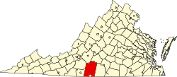
Whitmell is an unincorporated community in Pittsylvania County, in the U.S. state of Virginia. It is the location of the now-closed historic Whitmell Farm-Life School named for Whitmell P. Tunstall, a lawyer and state legislator.
It was originally named Chestnut Grove. An 1855 gazetteer listed the village as having "3 stores, several tobacco factories, and about 100 inhabitants". [1]
Pittsylvania County is a county located in the Commonwealth of Virginia. As of the 2010 census, the population was 63,506. Chatham is the county seat.
Buchanan is a town in Botetourt County, Virginia, United States. The population was 1,178 at the 2010 census. It is part of the Roanoke Metropolitan Statistical Area. It was the western terminus of the James River and Kanawha Canal when construction on the canal ended.
Bowling Green is an incorporated town in Caroline County, Virginia, United States. The population was 1,111 at the 2010 census.
Berryville is an incorporated town in and the county seat of Clarke County, Virginia, United States. The population was 4,185 at the 2010 census, up from 2,963 at the 2000 census.
Burkeville is a town in Nottoway County, Virginia, United States. The population was 432 at the 2010 census. The source of the town name is disputed. The town is located on the crossroads of U.S. Routes 360 and 460.
Bull Run is a census-designated place (CDP) in Prince William County, Virginia. The population was 14,983 at the 2010 census.
Chattaroy is a census-designated place (CDP) in Mingo County, West Virginia, United States. The population was 756 at the 2010 census.
Reedsville is a town in Preston County, West Virginia, United States. The population was 593 at the 2010 census.
Buckland is an unincorporated community in Prince William County, Virginia.
Churchville is a census-designated place (CDP) in the western part of Augusta County, Virginia, United States. The population as of the 2010 Census was 194. Churchville is part of the Staunton–Waynesboro Micropolitan Statistical Area.
Wilderness Road State Park is a state park located in southwestern Virginia, near Cumberland Gap and Ewing, VA. It consists of about 310 acres (1.3 km2) around the former Wilderness Road. Within it stand the Karlan Mansion and a replica of the original Martin's Station fort.
Rome is an unincorporated community along the Ohio River in southeastern Tobin Township, Perry County, in the U.S. state of Indiana.
Amsterdam is an unincorporated community in Botetourt County, Virginia, United States.
Daggers Springs is an unincorporated community in Botetourt County, Virginia, United States.
Cartersville is an unincorporated community in Cumberland County, in the U.S. state of Virginia.
Laurel Grove, Pittsylvania County is an unincorporated community in Pittsylvania County, in the U.S. state of Virginia that once included a post office.
Curdsville is an unincorporated community in Buckingham County, in the U.S. state of Virginia.
Broad Run is a 38.0-mile-long (61.2 km) tributary of the Occoquan River in the U.S. state of Virginia. It rises in Fauquier County and passes through Thoroughfare Gap. A gazetteer from the mid-nineteenth century described it as a small stream, a valuable mill stream.
Pleasant Mount or Mount Pleasant is an unincorporated community in Miller County, in the U.S. state of Missouri. The historic community was located along the current Missouri Route FF on a hilltop approximately one-half mile north of the railroad line. The current community of Mount Pleasant or Mt Pleasant is just south of U.S. Route 54, about three miles northeast of Eldon at 38°22′05″N92°31′25″W.
Twomile Creek is a stream in Oregon County in the Ozarks of southern Missouri. It is a tributary of the Warm Fork Spring River.
Coordinates: 36°42′08″N79°31′25″W / 36.70222°N 79.52361°W