Shockoe, Virginia

Last updated

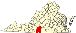
Shockoe is an unincorporated community in Pittsylvania County, in the U.S. state of Virginia. [1]

Pittsylvania County, Virginia county in Virginia, United States

Pittsylvania County is a county located in the Commonwealth of Virginia. As of the 2010 census, the population was 63,506. Its county seat is Chatham.

U.S. state constituent political entity sharing sovereignty as the United States of America

In the United States, a state is a constituent political entity, of which there are currently 50. Bound together in a political union, each state holds governmental jurisdiction over a separate and defined geographic territory and shares its sovereignty with the federal government. Due to this shared sovereignty, Americans are citizens both of the federal republic and of the state in which they reside. State citizenship and residency are flexible, and no government approval is required to move between states, except for persons restricted by certain types of court orders. Four states use the term commonwealth rather than state in their full official names.

Virginia State of the United States of America

Virginia, officially the Commonwealth of Virginia, is a state in the Southeastern and Mid-Atlantic regions of the United States located between the Atlantic Coast and the Appalachian Mountains. Virginia is nicknamed the "Old Dominion" due to its status as the first English colonial possession established in mainland North America and "Mother of Presidents" because eight U.S. presidents were born there, more than any other state. The geography and climate of the Commonwealth are shaped by the Blue Ridge Mountains and the Chesapeake Bay, which provide habitat for much of its flora and fauna. The capital of the Commonwealth is Richmond; Virginia Beach is the most populous city, and Fairfax County is the most populous political subdivision. The Commonwealth's estimated population as of 2017 is over 8.4 million.

Related Research Articles

Applewold, Pennsylvania Borough in Pennsylvania, United States

Applewold is a borough in Armstrong County, Pennsylvania, United States. The population was 310 at the 2010 census.

Wanica District District in Suriname

Wanica is a district of Suriname, in the northeast. Wanica's capital city is Lelydorp. Wanica has a population of 118,222 and an area of 443 km². Following neighbouring Paramaribo, Wanica is the second most populated and urbanised district of Suriname. Two thirds of the country's population live in these two districts.

<i>Wave Organ</i>

The Wave Organ is a sculpture constructed on the shore of San Francisco Bay in May 1986 by the Exploratorium.

Blue River Black Spruce Provincial Park is a provincial park in British Columbia, Canada.

Nebraska Methodist College of Nursing and Allied Health is a private Methodist college in Omaha, Nebraska that focuses on degrees in healthcare.

West Branch (New Hampshire) river in eastern New Hampshire, United States

The West Branch is a 5.5-mile (8.9 km) long river located in eastern New Hampshire in the United States. It is the northern tributary of Ossipee Lake, part of the Saco River watershed leading to the Atlantic Ocean.

Colerain, Ohio human settlement in United States of America

Colerain is an unincorporated community in eastern Colerain Township, Belmont County, Ohio, United States. Although it is unincorporated, it has a post office, with the ZIP code of 43916. It lies along U.S. Route 250.

Kinard is an unincorporated community in southwestern Calhoun County, Florida, United States. The main roads through Kinard are State Road 73 and County Road 392.

West Berlin, New Jersey Unincorporated community in New Jersey, United States

West Berlin is an unincorporated community located within Berlin Township in Camden County, New Jersey, United States. The area is served as United States Postal Service ZIP code 08091.

Crutchfield Crossroads, North Carolina Unincorporated community in North Carolina, United States

Crutchfield Crossroads is an unincorporated community in northwestern Chatham County, North Carolina north of the town of Siler City. Crutchfield Crossroads is commonly defined as the area in and around the rural intersection of Silk Hope-Liberty Road. and Siler City- Snow Camp Road. At the intersection of the two roads, there are some stores, but other than that the entire community is agricultural. Children living in this area attend schools in Silk Hope and Siler City.

Melvin, California Former Unincorporated community in California, United States

Melvin is a former unincorporated community in Fresno County, California, now incorporated into Clovis. It lies at an elevation of 358 feet.

Elberta, New York, also known as Elberta Corners, is a hamlet in the town of Wilson in Niagara County, New York, United States. It is located at the intersection of Braley and Randall Roads.

Dwaarkill is a populated place in Ulster County, New York. The name was collected by the United States Geological Survey between 1976 and 1980 and entered into the Geographic Names Information System on January 23, 1980.

Featherstone is an unincorporated community in Prince William County, in the U.S. state of Virginia.

Rockaway is an unincorporated community in Fluvanna County, in the U.S. state of Virginia.

West Lawn Cemetery Graveyard in Canton, Ohio

West Lawn Cemetery is in Canton, Ohio adjacent to the McKinley National Memorial. It was the original resting place of William McKinley until his memorial was built, and has graves of other notable Cantonians.

Upper Shockoe Valley is a neighborhood in Richmond, Virginia that straddles alongside Interstate 95. The name is given based on the Shockoe River Valley created within the boundaries of the neighborhood.

Wild Cherry is an unincorporated community in southwest Fulton County, Arkansas, United States. It is located along Arkansas Highway 223, just north of the Fulton-Izard county line. Wild Cherry Road runs north from the community. It is approximately six miles east of the eastern shore of Norfork Lake and about 11 miles north of Calico Rock. The elevation is 850 feet.

Durbin is an unincorporated community in Cass County, in the U.S. state of North Dakota.

Reedsburg is an unincorporated community in Wayne County, in the U.S. state of Ohio.

References

  1. "GNIS Detail - Shockoe". geonames.usgs.gov. Retrieved December 20, 2010.

Coordinates: 36°48′31″N79°15′50″W / 36.80861°N 79.26389°W / 36.80861; -79.26389

Geographic coordinate system Coordinate system

A geographic coordinate system is a coordinate system that enables every location on Earth to be specified by a set of numbers, letters or symbols. The coordinates are often chosen such that one of the numbers represents a vertical position and two or three of the numbers represent a horizontal position; alternatively, a geographic position may be expressed in a combined three-dimensional Cartesian vector. A common choice of coordinates is latitude, longitude and elevation. To specify a location on a plane requires a map projection.