West Fork, Virginia

Last updated

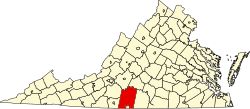
West Fork is an unincorporated community in Pittsylvania County, in the U.S. state of Virginia.

Pittsylvania County, Virginia County in the United States

Pittsylvania County is a county located in the Commonwealth of Virginia. As of the 2010 census, the population was 63,506. Its county seat is Chatham.

U.S. state constituent political entity of the United States

In the United States, a state is a constituent political entity, of which there are currently 50. Bound together in a political union, each state holds governmental jurisdiction over a separate and defined geographic territory and shares its sovereignty with the federal government. Due to this shared sovereignty, Americans are citizens both of the federal republic and of the state in which they reside. State citizenship and residency are flexible, and no government approval is required to move between states, except for persons restricted by certain types of court orders. Four states use the term commonwealth rather than state in their full official names.

Virginia State of the United States of America

Virginia, officially the Commonwealth of Virginia, is a state in the Southeastern and Mid-Atlantic regions of the United States located between the Atlantic Coast and the Appalachian Mountains. Virginia is nicknamed the "Old Dominion" due to its status as the first English colonial possession established in mainland North America and "Mother of Presidents" because eight U.S. presidents were born there, more than any other state. The geography and climate of the Commonwealth are shaped by the Blue Ridge Mountains and the Chesapeake Bay, which provide habitat for much of its flora and fauna. The capital of the Commonwealth is Richmond; Virginia Beach is the most populous city, and Fairfax County is the most populous political subdivision. The Commonwealth's estimated population as of 2018 is over 8.5 million.

Related Research Articles

Garrett County, Maryland County in the United States

Garrett County (gərɛt) is the westernmost county of the U.S. state of Maryland. As of the 2010 census, the population was 30,097, making it the third-least populous county in Maryland. Its county seat is Oakland. The county was named for John Work Garrett (1820–1884), president of the Baltimore and Ohio Railroad. Created from Allegany County, Maryland in 1872, it was the last Maryland county to be formed.

Lunice Creek is a 7.3-mile-long (11.7 km) tributary of the South Branch Potomac River, belonging to the Potomac River and Chesapeake Bay watersheds. The creek is located in Grant County, West Virginia. Lunice Creek is created by its North and South Forks and empties into the South Branch at Petersburg.

Kettle Creek is a 7.3-mile-long (11.7 km) tributary stream of the South Fork South Branch Potomac River in Hardy and Pendleton counties in West Virginia's Eastern Panhandle. Kettle Creek rises on Mitchell Knob and flows north along the eastern flanks of Sweedlin Hill through Sweedlin Valley in the George Washington National Forest.

Mill Creek is a 5.3-mile-long (8.5 km) tributary stream of the North Fork South Branch Potomac River in Pendleton County, West Virginia. Mill Creek rises on the western flanks of North Fork Mountain and from there, flows north through Germany Valley. Its confluence with the North Fork lies at Hinkle Gap between Germany and Harman Knobs.

Mayo River (Dan River tributary) river in the United States of America

The Mayo River is a tributary of the Dan River, which in turn is a tributary of the Roanoke River. All three rivers flow through the U.S. states of Virginia and North Carolina. It is named for Major William Mayo.

Maintop Mountain mountain in United States of America

Maintop Mountain is a mountain in Nelson County, Virginia. The mountain is a peak on a spur off the main Blue Ridge Mountains, about 2 miles (3 km) east of Elk Pond Mountain, and about 3.5 miles (5.5 km) west of The Priest. The mountain is located in the George Washington National Forest.

Fondo, California Unincorporated community in California, United States

Fondo is an unincorporated community in Imperial County, California. It is located on the Southern Pacific Railroad 6.5 miles (10 km) west of Calipatria, at an elevation of 203 feet below sea level.

Buffalo River (Virginia) river in United States of America

The Buffalo River is a 31.5-mile-long (50.7 km) tributary of the Tye River in the U.S. state of Virginia. It is part of the James River watershed.

Pancoastburg, Ohio Census-designated place in Ohio, United States

Pancoastburg is an unincorporated community and census-designated place (CDP) in Madison Township, Fayette County, Ohio, United States. It is located at 39°37′28″N83°15′56″W, along Ohio State Route 207, about 6 miles (10 km) south of Mount Sterling. As of the 2010 census the population of Pancoastburg was 87.

Ajax is an unincorporated community in Pittsylvania County, in the U.S. state of Virginia.

Brosville is an unincorporated community in Pittsylvania County, in the U.S. state of Virginia.

Dry Fork, Pittsylvania County, Virginia human settlement in Virginia, United States of America

Dry Fork is an unincorporated community in Pittsylvania County, in the U.S. state of Virginia.

Hinesville is an unincorporated community in Pittsylvania County, in the U.S. state of Virginia.

Laniers Mill is an unincorporated community in Pittsylvania County, in the U.S. state of Virginia.

Olde Hunting Hills is an unincorporated community in Pittsylvania County, in the U.S. state of Virginia.

Sutherlin is an unincorporated community in Pittsylvania County, in the U.S. state of Virginia.

Turkey Fork is an unincorporated community in Pittsylvania County, in the U.S. state of Virginia.

Devils Fork was an unincorporated community located in both Wyoming County and Raleigh County, West Virginia. Part of it was renamed Stephenson, West Virginia. The area's coal mines and a portion of its community resided in the vicinity of Amigo, West Virginia in Raleigh County, West Virginia.

Bickett Knob is a summit in Monroe County, West Virginia, in the United States. With an elevation of 3,327 feet (1,014 m), Bickett Knob is the 231st highest summit in the state of West Virginia.

Beaverdam is an unincorporated community in Ripley County, in the U.S. state of Missouri.

References

Coordinates: 36°37′28″N79°37′51″W / 36.62444°N 79.63083°W / 36.62444; -79.63083

Geographic coordinate system Coordinate system

A geographic coordinate system is a coordinate system that enables every location on Earth to be specified by a set of numbers, letters or symbols. The coordinates are often chosen such that one of the numbers represents a vertical position and two or three of the numbers represent a horizontal position; alternatively, a geographic position may be expressed in a combined three-dimensional Cartesian vector. A common choice of coordinates is latitude, longitude and elevation. To specify a location on a plane requires a map projection.