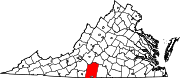
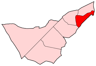
Sandy Level is a census-designated place (CDP) in Henry County, Virginia, United States. The population was 484 at the 2010 census, which was a significant decrease from the 689 reported in 2000. It is part of the Martinsville Micropolitan Statistical Area.

The Muskoka River is a river in the Muskoka District of Ontario, Canada.
Abárzuza is a town and municipality located in the province and autonomous community of Navarre, northern Spain.
Lunice Creek is a 7.3-mile-long (11.7 km) tributary of the South Branch Potomac River, belonging to the Potomac River and Chesapeake Bay watersheds. The creek is located in Grant County, West Virginia. Lunice Creek is created by its North and South Forks and empties into the South Branch at Petersburg.

The Quaboag River is a 25.7-mile-long (41.4 km) river in Massachusetts that heads at Quaboag Pond in Brookfield at an elevation of 594 feet (181 m) above sea level. It flows west to the village of Three Rivers, Massachusetts, at an elevation of 290 feet (88 m).

Rysa Little is an uninhabited island in the Orkney archipelago in Scotland. It is approximately 32 hectares in area, and rises to 20 metres above sea level.
Helena is a hamlet in the Town of Brasher in St. Lawrence County, New York, United States.

The Hagerstown Police Department is a full-service, 24/7 law enforcement agency serving a diverse population of 40,612 in 11.79 square miles (30.5 km2) within the municipality of Hagerstown, Maryland, county seat of Washington County. Hagerstown closely borders Pennsylvania, West Virginia and Virginia. United States.
The Tom Tellez Track at Carl Lewis International Complex, also known as simply Tom Tellez Track or Carl Lewis International Complex, is home to the Houston Cougars outdoor track & field teams. The facility is named after Tom Tellez and Carl Lewis, two of the most notable individuals to have been associated with the program.
Musket Island Marine Provincial Park is a provincial park in British Columbia, Canada, located on the west side of Nelson Island, at the mouth of Jervis Inlet and near Earl's Cove in the Sunshine Coast region.
Nicholson Island is an alluvial island in the Allegheny River in South Buffalo Township, Armstrong County in the U.S. state of Pennsylvania. The island is situated across from Bethel Township.
The Devonian Scherr Formation is a mapped bedrock unit in Pennsylvania, Maryland, Virginia and West Virginia.
Sorrell is an unincorporated community in Caroline County, in the U.S. state of Virginia.
Fox Hollow is an unincorporated community in Pittsylvania County, in the U.S. state of Virginia.
Oak Hill is an unincorporated community in Pittsylvania County, in the U.S. state of Virginia.
Oak Hills is an unincorporated community in Pittsylvania County, in the U.S. state of Virginia.
Oak Ridge, Pittsylvania County is an unincorporated community in Pittsylvania County, Virginia. It is known as the location of the holiday home of former British prime minister Gordon Brown.
Los Cármenes is a ward (barrio) of Madrid belonging to the district of Latina.
Otter Creek is a stream in Cooper and Morgan Counties in the U.S. state of Missouri. It is a tributary of the Lamine River.
Blackjack Hollow is a valley in McDonald County in the U.S. state of Missouri.