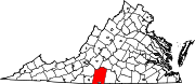
South Boston, formerly Boyd's Ferry, is a town in Halifax County, Virginia, United States. The population was 8,142 at the 2010 census, down from 8,491 at the 2000 census. It is the most populous town in Halifax County.
The Banister River is a tributary of the Dan River, about 65 mi (105 km) long, in southern Virginia in the United States. Via the Dan, it is part of the watershed of the Roanoke River, which flows to the Atlantic Ocean. It rises on Brier Mountain in western Pittsylvania County and flows generally eastwardly into Halifax County, past the town of Halifax. It joins the Dan River 6 mi (9.7 km) east of the town of South Boston.
Coal Landing is an unincorporated community in Stafford County, in the U.S. state of Virginia.
Berry Hill is an unincorporated community in Pittsylvania County, in the U.S. state of Virginia. It is the site of an eponymous plantation Berry Hill that was added to the National Register of Historic Places in 1980.
Beverly Heights is an unincorporated community in Pittsylvania County, in the U.S. state of Virginia.
Brosville is an unincorporated community in Pittsylvania County, in the U.S. state of Virginia.
Callahans Hills is an unincorporated community in Pittsylvania County, in the U.S. state of Virginia.
Cedar Hill is an unincorporated community in Pittsylvania County, in the U.S. state of Virginia.
Coles Hill is an unincorporated community in Pittsylvania County, in the U.S. state of Virginia. It is the site of the largest uranium deposit in the U.S.; however a 1982 Virginia ban on uranium mining has kept its resources from being used commercially. The lode is the subject of an ongoing controversy about possible extraction. In October 2015, a federal judge will decide whether to lift the state ban. Lower courts ruled in favor of the state's ban, however in October 2018 the case is scheduled to be heard by the Supreme Court.
Flint Hill, Pittsylvania County is an unincorporated community in Pittsylvania County, in the U.S. state of Virginia.
Java is an unincorporated community in Pittsylvania County, in the U.S. state of Virginia. Like many such 'communities', Java has no focal point beyond a US Post Office alongside the local (volunteer) fire department building. The 'community' extends east a mile or so into Halifax County. Java contains no manufacturing operations beyond one commercial saw mill which—like local tobacco farms—is a significant employer in the area. That mill and others have increasingly been supplied by logging operations that have, potentially, been creating more farmable land through their clear-cutting practices. A downside to this clearcutting has been a loss of natural habitat for the native wildlife, including deer and bear.
Mountain Hill is an unincorporated community in Pittsylvania County, in the U.S. state of Virginia.
Oak Hill is an unincorporated community in Pittsylvania County, in the U.S. state of Virginia.
Oak Hills is an unincorporated community in Pittsylvania County, in the U.S. state of Virginia.
Olde Hunting Hills is an unincorporated community in Pittsylvania County, in the U.S. state of Virginia.
Surry Hills is an unincorporated community in Pittsylvania County, in the U.S. state of Virginia.
Smith or Smiths Turnout is an unincorporated community in southern York County, South Carolina located south of Rock Hill and northwest of Edgemoor near the Chester County line. The elevation of Smith is 531 feet.
Millard is an unincorporated community in Dickenson County, Virginia, in the United States.
Paces is an unincorporated community in Halifax County, Virginia.

Turbeville is an unincorporated community in Halifax County, Virginia, United States. It lies at an elevation of 535 feet.