Related Research Articles

Sussex County is a rural county located in the Commonwealth of Virginia. As of the 2010 census, the population was 12,087. Its county seat is Sussex. It was formed in 1754 from Surry County. The county is named after the county of Sussex, England.

Eldora Township is one of fifteen townships in Surry County, North Carolina. The township had a population of 3,541 according to the 2000 census.

Mount Airy Township is one of fifteen townships in Surry County, North Carolina, United States. The township had a population of 24,828 according to the 2000 census.
White Sulphur Springs is a small unincorporated community in Surry County, North Carolina on the outskirts of the city of Mount Airy near the Virginia state line. The community sits on the Ararat River and once served as a popular late-nineteenth century resort. The community's name comes from the White Sulphur Springs Hotel that once stood here.

Boones Hill is a small unincorporated community in the Mount Airy Township of northern Surry County, North Carolina, on the outskirts of the city of Mount Airy near Bannertown. The community is centered on the intersection of Business U.S. Highway 52 and U.S. Highway 52 Bypass south of Bannertown. Local lore is that Daniel Boone camped on this hill.
Pine Hill is a small unincorporated community in the Eldora Township of Surry County, North Carolina. The community is centered on the intersection of Eldora Road/Quaker Church Road and North Carolina Highway 268. Prominent landmarks in the community include the Pine Hill Friends Meeting and cemetery.
Long Hill is a small unincorporated community in the Long Hill Township of Surry County, North Carolina. The community is centered on the intersection of Longhill Road, Ararat Road and Old U.S. Highway 52.

Gargatha is a census-designated place (CDP) in Accomack County, Virginia, United States. The population as of the 2010 Census was 381.
Fine Creek Mills is an unincorporated community in Powhatan County, in the U.S. state of Virginia.
Callahans Hills is an unincorporated community in Pittsylvania County, in the U.S. state of Virginia.
Cedar Hill is an unincorporated community in Pittsylvania County, in the U.S. state of Virginia.
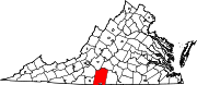
Coles Hill is an unincorporated community in Pittsylvania County, in the U.S. state of Virginia. It is the site of the largest uranium deposit in the U.S.; however a 1982 Virginia ban on uranium mining has kept its resources from being used commercially. The lode is the subject of an ongoing controversy about possible extraction. In October 2015, a federal judge will decide whether to lift the state ban. Lower courts ruled in favor of the state's ban, however in October 2018 the case was scheduled to be heard by the Supreme Court. The Supreme Court upheld Virginia's ban on uranium mining in Virginia Uranium, Inc. v. Warren.
Flint Hill, Pittsylvania County is an unincorporated community in Pittsylvania County, in the U.S. state of Virginia.
Halifax Hills is an unincorporated community in Pittsylvania County, in the U.S. state of Virginia.
Mountain Hill is an unincorporated community in Pittsylvania County, in the U.S. state of Virginia.
Oak Hill is an unincorporated community in Pittsylvania County, in the U.S. state of Virginia.
Oak Hills is an unincorporated community in Pittsylvania County, in the U.S. state of Virginia.
Olde Hunting Hills is an unincorporated community in Pittsylvania County, in the U.S. state of Virginia.
Beech Hill is an unincorporated community in Macon County, in the U.S. state of Tennessee.
Socrates Mountain is a summit in Pendleton County, West Virginia, in the United States. With an elevation of 3,386 feet (1,032 m), Socrates Mountain is the 219th highest summit in the state of West Virginia.
References
Coordinates: 36°35′53″N79°28′16″W / 36.59806°N 79.47111°W
| | This Pittsylvania County, Virginia state location article is a stub. You can help Wikipedia by expanding it. |