Cedar Forest, Virginia

Last updated

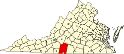
Cedar Forest is an unincorporated community in Pittsylvania County, in the U.S. state of Virginia.

Related Research Articles

<span class="mw-page-title-main">Pittsylvania County, Virginia</span> County in Virginia, United States

Pittsylvania County is a county located in the Commonwealth of Virginia. As of the 2020 United States Census, the population was 60,501. Chatham is the county seat.

<span class="mw-page-title-main">Altavista, Virginia</span> Town in Virginia, United States

Altavista is an incorporated town in Campbell County, Virginia, United States. The population was 3,378 at the 2020 census. It is part of the Lynchburg Metropolitan Statistical Area.

<span class="mw-page-title-main">Cedar Bluff, Virginia</span> Town in Virginia, United States

Cedar Bluff is a town in Tazewell County, Virginia, United States. The population was 1,139 at the 2010 census. It is part of the Bluefield, WV-VA micropolitan area, which has a population of 107,578.

<span class="mw-page-title-main">Boxerwood Gardens</span>

Boxerwood Nature Center and Woodland Garden is a 15-acre (6.1 ha) arboretum featuring both native and unusual plant specimens, located within a larger preserve at 963 Ross Road near Lexington in Rockbridge County, Virginia, United States in the Shenandoah Valley. Established as a private garden in 1952, it was listed on the National Register of Historic Places in 2015.

Droop Mountain is a small mountain in the Allegheny Mountains on the border of Greenbrier and Pocahontas counties in southeastern West Virginia. It was the scene of one of West Virginia's most important battles during the American Civil War—the Battle of Droop Mountain.

Maintop Mountain is a mountain in Nelson County, Virginia. The mountain is a peak on a spur off the main Blue Ridge Mountains, about 2 miles (3 km) east of Elk Pond Mountain, and about 3.5 miles (5.5 km) west of The Priest. The mountain is located in the George Washington National Forest.

Fort Carpenter, Alleghany County, Virginia, was built about 1755-1756 by Joseph Carpenter, who migrated from the Province of New York to "the big bend" of the Jackson River on the Virginia frontier about 1745-1746. It was actually a fortified house, or blockhouse. Located on a low bluff near the mouth of Carpenter Creek, it was later known as Cedar Hill. Logs and stones from the original structure were used in the later dwelling now on the site. A young George Washington visited the string of frontier forts during the French and Indian War in 1756, inspecting Fort Young on the north side of the Jackson River, and Fort Carpenter, described as a fortified house, on the south side. In 1856, Joseph Hannah Carpenter graduated from the Virginia Military Institute as a civil engineer, and later went on to serve as an artillery cadet under the command of Stonewall Jackson.

Cedar Fork is an unincorporated community in Caroline County, in the U.S. state of Virginia.

Liberty Fork is an unincorporated community in Caroline County, in the U.S. state of Virginia.

Brights is an unincorporated community in Pittsylvania County, in the U.S. state of Virginia.

Cedar Hill is an unincorporated community in Pittsylvania County, in the U.S. state of Virginia.

Grit is an unincorporated community in Pittsylvania County, in the U.S. state of Virginia.

Hill Grove is an unincorporated community in Pittsylvania County, in the U.S. state of Virginia.

Level Run is an unincorporated community in Pittsylvania County, in the U.S. state of Virginia.

Straightstone is an unincorporated community in Pittsylvania County, in the U.S. state of Virginia.

Sycamore is an unincorporated community in Pittsylvania County, in the U.S. state of Virginia.

Cedar Run is a 37.5-mile-long (60.4 km) tributary of the Occoquan River in the U.S. state of Virginia.

Patronville is an unincorporated community in Ohio Township, Spencer County, in the U.S. state of Indiana.

Boydsville is an unincorporated community in western Callaway County, in the U.S. state of Missouri. The community is in the Mark Twain National Forest 1.5 miles east of Cedar Creek and Fulton is approximately eight miles to the east-northeast.

Coal Creek is a stream in eastern Iron County, Utah, United States.

References

37°02′48″N79°06′38″W / 37.04667°N 79.11056°W / 37.04667; -79.11056